

Surf Forecasts:

How big are the waves at Futami today (03 Aug):
- Afternoon surf: Afternoon surf (03 Aug, local time) - 4.5ft (1.3m), 16s period with E swell.
- Evening surf: Evening surf (03 Aug, local time) - 4.5ft (1.4m), 16s period with E swell.
The current surf forecast for Futami at 8PM is: 1.4m 16s primary swell from a East direction and 0.1m 7s secondary swell from a Northwest direction (forecast issued at 02:00pm August 03). An open ocean swell of 0.3m 7s is not directed at the surf break. The wind direction is predicted to be cross-offshore and the swell rating is 2.
| Time (JST) & Date | Wave Height | Wave Period |
|---|---|---|
| Morning (03 Aug) | - | - |
| Afternoon (03 Aug) | 4.5ft (1.3m) | 16s |
| Evening (03 Aug) | 4.5ft (1.4m) | 16s |
Table - waves today at Futami. (Swell directed towards the surf break)
Short Range ForecastLight rain (total 8mm), mostly falling on Tue afternoon. Warm (max 31°C on Mon afternoon, min 27°C on Mon night). Winds increasing (light winds from the NE on Mon night, strong winds from the N by Thu morning). | ||||||||||||||||||||
Mon 3 | Tuesday 4 | Wednesday 5 | ||||||||||||||||||
12 PM | 3 PM | 6 PM | 9 PM | 12 AM | 3 AM | 6 AM | 9 AM | 12 PM | 3 PM | 6 PM | 9 PM | 12 AM | 3 AM | 6 AM | 9 AM | 12 PM | 3 PM | 6 PM | 9 PM | |
Swell Height Map |  |  |  | 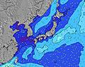 |  |  | 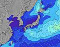 |  | ||||||||||||
Wave Height (m) Direction Period (s) | E 16 | E 16 | E 16 | E 16 | E 16 | E 16 | E 17 | E 17 | E 17 | E 17 | E 17 | E 17 | E 17 | E 17 | E 17 | E 17 | E 17 | E 18 | E 18 | E 18 |
Wave Graph | ||||||||||||||||||||
701 | 843 | 977 | 952 | 1115 | 1134 | 1502 | 1716 | 1722 | 1929 | 2381 | 2624 | 2846 | 2781 | 2893 | 3583 | 3921 | 5074 | 6842 | 9199 | |
Wind (km/h) | ||||||||||||||||||||
Wind State on-shore cross-onshore cross-shore cross-offshore off-shore glassy | cross | cross-off | cross-off | cross-off | cross-off | cross | cross | cross-on | cross-on | cross-on | cross-on | cross-on | cross-on | cross-on | cross | cross | cross | cross | cross | cross |
High Tide | 9:22AM1.98m | 9:46PM2.01m | 10:06AM1.83m | 10:18PM1.94m | 11:03AM1.67m | |||||||||||||||
Low Tide | 3:31PM0.64m | 4:01AM0.71m | 4:03PM0.83m | 4:50AM0.74m | 4:39PM1.02m | |||||||||||||||
— | — | — | — | — | 5:52 | — | — | — | — | — | — | — | 5:54 | — | — | — | — | — | — | |
— | — | 7:14 | — | — | — | — | — | — | — | 7:13 | — | — | — | — | — | — | — | 7:13 | — | |
mm | — | — | — | — | — | 1 | 1 | 1 | — | 2 | 1 | — | — | 1 | — | 1 | — | — | — | — |
Temp °C | 31 | 31 | 30 | 28 | 28 | 28 | 27 | 30 | 31 | 30 | 30 | 29 | 28 | 28 | 28 | 30 | 31 | 31 | 30 | 29 |
Feels °C | 34 | 33 | 33 | 31 | 31 | 32 | 30 | 33 | 34 | 33 | 33 | 32 | 31 | 30 | 31 | 32 | 32 | 32 | 32 | 31 |
Swell 1 Height (m) Direction Period (s) | E 16 | E 16 | E 16 | E 16 | E 16 | E 16 | E 17 | E 17 | E 17 | E 17 | E 17 | E 17 | E 17 | E 17 | E 17 | E 17 | E 17 | E 18 | E 18 | E 18 |
701 | 843 | 977 | 952 | 1115 | 1134 | 1502 | 1716 | 1722 | 1929 | 2381 | 2624 | 2846 | 2781 | 2893 | 3583 | 3921 | 5074 | 6842 | 9199 | |
Swell 2 Height (m) Direction Period (s) | SSE 7 | SSE 7 | SSE 7 | S 7 | S 7 | S 7 | SSE 7 | SE 8 | SE 8 | SSE 8 | — | — | SE 8 | — | S 8 | SSE 8 | S 8 | S 7 | S 7 | — |
5 | 5 | 10 | 9 | 8 | 9 | 10 | 15 | 16 | 26 | — | — | 28 | — | 18 | 37 | 18 | 17 | 17 | — | |
Swell 3 Height (m) Direction Period (s) | SE 8 | ESE 8 | ESE 8 | SE 8 | SE 8 | SE 8 | SE 8 | SE 10 | — | — | — | — | — | — | — | — | — | — | — | — |
11 | 7 | 7 | 3 | 11 | 11 | 3 | 4 | — | — | — | — | — | — | — | — | — | — | — | — | |
Wind waves Height (m) Direction Period (s) | W 7 | W 7 | NW 7 | — | N 4 | NNE 4 | SE 8 | SE 8 | SE 8 | SE 8 | SE 8 | SE 8 | — | SE 8 | SE 8 | — | SE 8 | SE 7 | NNE 5 | — |
1 | 1 | 2 | — | 10 | 13 | 16 | 21 | 22 | 32 | 23 | 21 | — | 28 | 28 | — | 28 | 34 | 42 | — | |
Nearest Offshore or Glassy | ||||||||||||||||||||
Distance (km) | 14 | 0 | 47 | 0 | 0 | 14 | 14 | 14 | 14 | 14 | 14 | 14 | 14 | 14 | 14 | 14 | 830 | 789 | 644 | 644 |
Best forecast wave conditions in Okinawa | ||||||||||||||||||||
Best forecast wave conditions in Japan | ||||||||||||||||||||
Header Global | ||||||||||||||||||||
- Map Icons:
 Break
Break Live Wave Height (m)
 Live Wind Speed (km/h)
 Surf Rating (10 Max)
 Ocean Swells (m)
- Wind Speed (km/h)
Latest Updates


FREE! Surf-Forecast.com widget for your website
The surf report / weather widget below is available to embed on third party websites free of charge and provides a summary of our Futami surf forecast. Simply grab the html code snippet that we provide and paste it into your own site. You can choose your preferred language and metric/imperial units for the surf forecast feed to suit users of your site. Click here to get the code.
 Nearest