

Surf Forecasts:

Frishman surf forecast from 30 Jul 2026:
- Most powerful swell: Friday 31 Jul, 6AM (local time) - 2.5ft (0.8m), 8s period, WNW swell with 78 kJ wave energy.
Best Forecast Surf Conditions for Frishman this week:
The most powerful waves expected at Frishman in the next 16 days are 0.8m 8s and forecast to arrive on Friday (Jul 31) at 6AM. Winds are predicted to be glassy at the time the swell arrives.
| Wave Type | Time (IDT) & Date | Wave Height & Period |
|---|---|---|
| Next good surf (1 star+) | - | - |
| Best Surf | - | - |
| Most Powerful | 6AM (Fri 31st Jul) | 2.5ft (0.8m) 8s |
Table - best surf conditions forecast for Frishman over the next 16 days.
The Lowdown
Right, if you’re looking at Frishman, I’ve got to be straight with you: this outlook is a tough one. For the entire 16-day window, from today through to the 14th of August, there’s nothing on the cards that’s worth paddling out for. The swell is just too small, never getting above 3ft, and the combined energy never climbs above 62 (weak energy), so there’s no real push or power.
The water is sitting at 84°F at the start, which is a touch warmer than normal for this time of year, but that’s small comfort when there’s no surf.
The wind does offer some glassy mornings—like Friday the 31st of July morning and Tuesday the 4th of August morning—but the swell is simply too weak to make anything of it. The period is mostly short, between 5 and 8 seconds, giving you bumpy, weak lines that won’t hold up. The best you’ll see is a 3ft, 8-second groundswell from the WNW, but it’s still not enough to offer a rideable wave.
From the 8th of August onwards, the swell drops even further, dipping to 1ft with combined energy values as low as 6 (very weak). It’s a blank run of about two weeks with no real surf to get excited about. For this area, with the break being inconsistent and sheltered, that kind of run is more normal than unusual.
Don’t write it off completely though—forecasts can change. For now, leave the board in the car and check back in a few days.
Rusty
Short Range ForecastMostly dry. Warm (max 30°C on Thu morning, min 27°C on Thu night). Wind will be generally light. | Days 4-6 Weather SummaryMostly dry. Warm (max 30°C on Sun morning, min 26°C on Tue night). Wind will be generally light. | ||||||||||||||||||||
Thursday 30 | Friday 31 | Saturday 1 | Sunday 2 | Monday 3 | Tuesday 4 | Wednesday 5 | |||||||||||||||
AM | PM | Night | AM | PM | Night | AM | PM | Night | AM | PM | Night | AM | PM | Night | AM | PM | Night | AM | PM | Night | |
Swell Height Map |  | 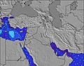 | 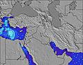 | 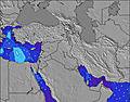 | 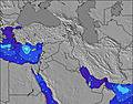 | 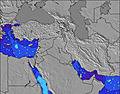 | 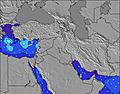 | ||||||||||||||
Wave Height (m) Direction Period (s) | WNW 7 | WNW 7 | WNW 9 | WNW 8 | WNW 8 | WNW 8 | WNW 7 | WNW 8 | NW 7 | WNW 7 | WNW 6 | NW 4 | WNW 5 | NW 5 | NW 5 | NW 5 | NW 6 | NW 6 | WNW 6 | WNW 6 | WNW 6 |
Wave Graph | |||||||||||||||||||||
62 | 41 | 31 | 71 | 50 | 52 | 47 | 33 | 38 | 29 | 25 | 16 | 15 | 28 | 23 | 29 | 31 | 34 | 25 | 34 | 33 | |
Wind (km/h) | |||||||||||||||||||||
Wind State on-shore cross-onshore cross-shore cross-offshore off-shore glassy | cross-on | on | glassy | glassy | cross-on | cross | on | cross-on | glassy | on | on | cross | on | cross-on | cross-on | glassy | cross-on | cross-on | glassy | on | glassy |
High Tide | 11:25AM0.40m | 11:59PM0.33m | 11:55AM0.40m | 00:26AM0.34m | 12:24PM0.39m | 00:54AM0.34m | 12:55PM0.37m | 1:24AM0.34m | 1:29PM0.34m | 1:58AM0.33m | 2:07PM0.30m | 2:39AM0.32m | 2:56PM0.26m | 3:35AM0.30m | |||||||
Low Tide | 5:53PM0.01m | 5:45AM0.06m | 6:20PM0.01m | 6:16AM0.06m | 6:46PM0.02m | 6:49AM0.06m | 7:14PM0.03m | 7:25AM0.07m | 7:43PM0.06m | 8:06AM0.09m | 8:15PM0.09m | 9:00AM0.11m | 8:55PM0.12m | ||||||||
5:54 | — | — | 5:54 | — | — | 5:54 | — | — | 5:56 | — | — | 5:56 | — | — | 5:56 | — | — | 5:58 | — | — | |
— | 7:39 | — | — | 7:38 | — | — | 7:37 | — | — | 7:37 | — | — | 7:37 | — | — | 7:36 | — | — | 7:35 | — | |
mm | — | — | — | — | — | — | — | — | — | — | — | — | — | — | — | — | — | — | — | — | — |
Temp °C | 30 | 30 | 28 | 30 | 30 | 28 | 30 | 30 | 28 | 30 | 30 | 29 | 30 | 30 | 28 | 29 | 29 | 27 | 28 | 29 | 27 |
Feels °C | 31 | 30 | 30 | 30 | 29 | 29 | 30 | 29 | 29 | 30 | 31 | 31 | 30 | 29 | 29 | 29 | 29 | 29 | 29 | 30 | 30 |
Swell 1 Height (m) Direction Period (s) | WNW 7 | WNW 7 | WNW 6 | WNW 8 | WNW 8 | WNW 8 | WNW 7 | WNW 8 | NW 7 | WNW 7 | — | NW 4 | WNW 5 | — | NW 5 | NW 5 | — | NW 6 | WNW 6 | — | WNW 6 |
62 | 41 | 23 | 71 | 50 | 52 | 47 | 33 | 38 | 29 | — | 16 | 15 | — | 23 | 29 | — | 34 | 25 | — | 33 | |
Swell 2 Height (m) Direction Period (s) | — | — | WNW 9 | — | — | — | — | — | — | — | — | — | NNW 6 | — | — | — | — | — | — | — | — |
— | — | 31 | — | — | — | — | — | — | — | — | — | 6 | — | — | — | — | — | — | — | — | |
Swell 3 Height (m) Direction Period (s) | — | — | — | — | — | — | — | — | — | — | — | — | — | — | — | — | — | — | — | — | — |
— | — | — | — | — | — | — | — | — | — | — | — | — | — | — | — | — | — | — | — | — | |
Wind waves Height (m) Direction Period (s) | — | — | — | — | — | — | — | NW 3 | — | — | WNW 6 | — | — | NW 5 | — | — | NW 6 | — | — | WNW 6 | — |
— | — | — | — | — | — | — | 2 | — | — | 25 | — | — | 28 | — | — | 31 | — | — | 34 | — | |
Nearest Offshore or Glassy | |||||||||||||||||||||
Distance (km) | 8 | 376 | 2 | 2 | 1326 | 2 | 2223 | 2224 | 935 | 1326 | 1326 | 2224 | 3370 | 3752 | 2224 | 3326 | 3714 | 2224 | 3375 | 2224 | 2224 |
Best forecast wave conditions in Tel Aviv and South | |||||||||||||||||||||
Best forecast wave conditions in Israel | |||||||||||||||||||||
Header Global | |||||||||||||||||||||
- Map Icons:
 Break
Break Live Wave Height (m)
 Live Wind Speed (km/h)
 Surf Rating (10 Max)
 Ocean Swells (m)
- Wind Speed (km/h)
Latest Updates


FREE! Surf-Forecast.com widget for your website
The surf report / weather widget below is available to embed on third party websites free of charge and provides a summary of our Frishman surf forecast. Simply grab the html code snippet that we provide and paste it into your own site. You can choose your preferred language and metric/imperial units for the surf forecast feed to suit users of your site. Click here to get the code.
Information about the Frishman Surf forecast
The above surf forecast table for Frishman provides essential information for determining whether the surfing conditions will be good over the next 16 days. A general guide to surfing at Frishman can be found by selecting the local surf guide option on the grey menu. Our Frishman surf forecast is unique since it includes wave energy (power) that defines the real feel of the surf rather than just the height or the period. If you surf the same spot (Frishman) regularly then make a mental note of the wave energy from the surf forecast table each time you go. Very soon you may start to choose your surf days based on the wave energy alone combined with our forecast of favourable offshore wind conditions. Our star ratings will help here and of course you will also find the usual wave height and period predictions on our surf forecasts as well as a full break down of the swell components under our advanced users option (to reveal that, click the little Einstein character under the tide times).
Further information to help with frequently asked questions about our surf forecast for Frishman may be found under the help tab on the top menu and also by moving your mouse over the question marks on the surf forecast table itself. Please always bear in mind that the forecast is for near-shore open water and local factors at each surf break influence the actual breaking wave height, such as the beach / reef profile, water depths offshore and shelter.
Frishman is 1 km (1 miles) from the city of Tel Aviv. If you plan a holiday in Tel Aviv and South, look for hotels and other accommodation in Tel Aviv. Tel Aviv has rooms for a wide range of budgets as well as car hire and transport links.
 Nearest