

Surf Forecasts:

Castles surf forecast from 3 Aug 2026:
- Best quality surf: Monday 10 Aug, 6PM (local time) - 8ft (2.5m), 16s period, SW swell with glassy winds.
- Most powerful swell: Monday 10 Aug, 12AM (local time) - 11ft (3.5m), 17s period, SW swell with 6,560 kJ wave energy.
- Next surfable swell (1★+): Tuesday 4 Aug, 12AM (local time) - 4.5ft (1.3m), 13s period with SW swell.
Best Forecast Surf Conditions for Castles this week:
The surf forecast for Castles over the next 16 days: The first swell (rated 1 star or higher) is forecast to arrive on Tuesday (Aug 04) at 12AM. The primary swell is predicted to be 1.3m and 13s period with a secondary swell of 0.6m and 17s. The wind is predicted to be offshore as the swell arrives.
The most powerful waves expected at Castles in the next 16 days are 3.5m 17s and forecast to arrive on Monday (Aug 10) at 12AM. Winds are predicted to be cross-onshore at the time the swell arrives. The largest open ocean swell (not directed at the beach) is 0.9m 4s period and expected on Saturday (Aug 08) at 3AM.
| Wave Type | Time (ACST) & Date | Wave Height & Period |
|---|---|---|
| Next good surf (1 star+) | 12AM (Tue 4th Aug) | 4.5ft (1.3m) 13s |
| Best Surf | 6PM (Mon 10th Aug) | 8ft (2.5m) 16s |
| Most Powerful | 12AM (Mon 10th Aug) | 11ft (3.5m) 17s |
Table - best surf conditions forecast for Castles over the next 16 days.
The Lowdown
Alright folks, Rusty here. Let’s get into it.
We’ve got a solid run of swell heading our way for Castles, but it’s a mixed bag with the wind. The first real action kicks off in the morning on Monday, August 3rd. The ocean is packing some serious energy, with a combined swell energy of 1273 – that’s a good, solid push of power. The swell is coming in at 6ft from the SW, with a long, juicy 14-second period. The best part? It’s glassy. That’s rare and it’s a treat. The water is sitting at 60°F, which is about average for this time of year. This is a window for the experienced surfer – 6ft of SW groundswell with glassy conditions is about as good as it gets for a Monday morning. It’s a standout.
The rest of Monday afternoon gets a bit cross-shore and marginal, and Tuesday morning sees the wind pick up from the NE at 12 mph, making it cross-off but the swell drops to 4ft. Tuesday afternoon cleans up nicely with light offshore winds from the East, but the swell is only 3ft. Wednesday and Thursday offer some clean windows, but the swell is inconsistent, and the real energy is missing.
We have a gap of poor conditions from Friday, August 7th, through to Monday, August 10th, with strong winds and rain spoiling the party. The swell gets big – over 8ft – but it’s onshore and messy. Unless you’re an expert looking for a beating, leave it.
Things start to look promising again on Thursday, August 13th. The morning has a light cross-shore breeze and a solid 8ft SW swell (3425 energy). It’s a big, powerful wave, but it’s still a bit lumpy. The real standout arrives on Monday, August 17th. The morning is clean, with a light offshore breeze from the ENE, and the swell is a solid 7ft from the SW with a 16-second period. The energy is high at 2078. This is another session for the experienced crew – clean, powerful, and organized. It’s a true highlight.
Heading into Tuesday, August 18th, the morning is glassy again with a 5ft SW swell and 16-second period. The energy is 1381. Another clean, quality session to close out the run. If you can only pick one, the standouts are Monday morning, August 3rd, for the glassy 6ft, and Monday morning, August 17th, for the clean 7ft.
Stay safe, pick your moments, and I’ll see you out there.
Rusty
Short Range ForecastMostly dry. Warm (max 20°C on Wed afternoon, min 10°C on Tue morning). Wind will be generally light. | Days 5-7 Weather SummaryModerate rain (total 13mm), heaviest on Sat morning. Warm (max 21°C on Fri afternoon, min 12°C on Sat night). Winds increasing (light winds from the SE on Fri night, near gales from the WSW by Sat night). | |||||||||||||||||||
Mon 3 | Tuesday 4 | Wednesday 5 | Thursday 6 | Friday 7 | Saturday 8 | Sunday 9 | ||||||||||||||
PM | Night | AM | PM | Night | AM | PM | Night | AM | PM | Night | AM | PM | Night | AM | PM | Night | AM | PM | Night | |
Swell Height Map |  | 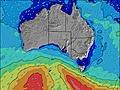 | 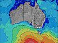 | 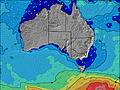 | 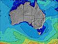 | 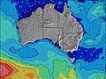 | 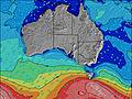 | |||||||||||||
Wave Height (m) Direction Period (s) | SW 14 | SW 13 | SW 12 | SW 15 | SW 15 | SW 19 | SW 18 | SW 16 | SW 16 | SW 16 | SW 15 | SW 16 | SW 17 | SW 16 | SW 16 | WSW 16 | WSW 15 | SW 14 | SW 16 | SW 17 |
Wave Graph | ||||||||||||||||||||
990 | 600 | 319 | 258 | 322 | 361 | 694 | 581 | 567 | 909 | 1216 | 1256 | 1131 | 966 | 1082 | 2338 | 3238 | 2667 | 3622 | 6560 | |
Wind (km/h) | ||||||||||||||||||||
Wind State on-shore cross-onshore cross-shore cross-offshore off-shore glassy | cross | off | cross-off | glassy | cross-off | cross-off | on | cross | cross-off | cross | off | cross-off | cross-off | cross-off | cross | cross-on | on | on | on | cross-on |
High Tide | 2:48AM1.04m | 2:45PM1.07m | 3:17AM1.01m | 2:52PM0.90m | 3:49AM0.95m | 2:24PM0.75m | 4:31AM0.85m | 11:17AM0.96m | 2:07AM0.58m | 11:38AM1.14m | 1:00AM0.58m | |||||||||
Low Tide | 8:45PM0.08m | 8:43AM0.19m | 9:00PM0.13m | 9:12AM0.35m | 9:08PM0.19m | 9:37AM0.53m | 8:59PM0.25m | 9:18AM0.74m | 8:14PM0.26m | 7:25PM0.20m | 4:19AM0.56m | 7:12PM0.14m | ||||||||
— | — | 7:24 | — | — | 7:24 | — | — | 7:22 | — | — | 7:22 | — | — | 7:22 | — | — | 7:20 | — | — | |
6:01 | — | — | 6:02 | — | — | 6:02 | — | — | 6:04 | — | — | 6:05 | — | — | 6:05 | — | — | 6:06 | — | |
mm | — | — | — | — | — | — | — | — | — | — | — | — | — | 1 | 9 | 1 | 2 | — | — | — |
Temp °C | 14 | 12 | 15 | 18 | 17 | 19 | 20 | 17 | 17 | 18 | 17 | 19 | 21 | 19 | 15 | 17 | 13 | 14 | 14 | 14 |
Feels °C | 10 | 7 | 11 | 14 | 11 | 14 | 16 | 14 | 15 | 15 | 13 | 11 | 15 | 14 | 11 | 8 | 3 | 7 | 7 | 10 |
Swell 1 Height (m) Direction Period (s) | SW 14 | SW 13 | SW 12 | SW 15 | SW 15 | SW 19 | SW 18 | SW 16 | SW 16 | SW 16 | SW 15 | SW 16 | SW 17 | SW 16 | SW 16 | — | — | — | — | SW 17 |
990 | 600 | 319 | 258 | 322 | 361 | 694 | 581 | 567 | 909 | 1216 | 1256 | 1131 | 966 | 1082 | — | — | — | — | 6560 | |
Swell 2 Height (m) Direction Period (s) | SW 18 | SW 17 | SW 15 | SW 10 | SW 21 | SW 15 | SW 9 | SSW 8 | — | S 7 | — | — | — | — | — | — | — | — | — | — |
81 | 181 | 233 | 106 | 150 | 134 | 20 | 13 | — | 4 | — | — | — | — | — | — | — | — | — | — | |
Swell 3 Height (m) Direction Period (s) | — | — | — | — | ESE 3 | SSW 10 | — | — | — | — | — | — | — | — | — | — | — | — | — | — |
— | — | — | — | 1 | 36 | — | — | — | — | — | — | — | — | — | — | — | — | — | — | |
Wind waves Height (m) Direction Period (s) | SW 14 | — | NE 3 | — | NE 3 | N 3 | SW 18 | — | — | — | ENE 3 | N 3 | NNW 4 | N 4 | NW 4 | WSW 16 | WSW 15 | SW 14 | SW 16 | SW 18 |
50 | — | 2 | — | 3 | 8 | 81 | — | — | — | 3 | 6 | 12 | 18 | 18 | 2338 | 3238 | 2667 | 3622 | 4185 | |
Nearest Offshore or Glassy | ||||||||||||||||||||
Distance (km) | 0 | 941 | 0 | 0 | 0 | 0 | 1 | 1 | 0 | 0 | 1 | 0 | 402 | 564 | 564 | 1166 | 1166 | 1344 | 1045 | 1242 |
Best forecast wave conditions in Nullarbor | ||||||||||||||||||||
Best forecast wave conditions in Australia | ||||||||||||||||||||
Header Global | ||||||||||||||||||||
- Map Icons:
 Break
Break Live Wave Height (m)
 Live Wind Speed (km/h)
 Surf Rating (10 Max)
 Ocean Swells (m)
- Wind Speed (km/h)
Latest Updates


FREE! Surf-Forecast.com widget for your website
The surf report / weather widget below is available to embed on third party websites free of charge and provides a summary of our Castles surf forecast. Simply grab the html code snippet that we provide and paste it into your own site. You can choose your preferred language and metric/imperial units for the surf forecast feed to suit users of your site. Click here to get the code.
Information about the Castles Surf forecast
The above surf forecast table for Castles provides essential information for determining whether the surfing conditions will be good over the next 16 days. A general guide to surfing at Castles can be found by selecting the local surf guide option on the grey menu. Our Castles surf forecast is unique since it includes wave energy (power) that defines the real feel of the surf rather than just the height or the period. If you surf the same spot (Castles) regularly then make a mental note of the wave energy from the surf forecast table each time you go. Very soon you may start to choose your surf days based on the wave energy alone combined with our forecast of favourable offshore wind conditions. Our star ratings will help here and of course you will also find the usual wave height and period predictions on our surf forecasts as well as a full break down of the swell components under our advanced users option (to reveal that, click the little Einstein character under the tide times).
Further information to help with frequently asked questions about our surf forecast for Castles may be found under the help tab on the top menu and also by moving your mouse over the question marks on the surf forecast table itself. Please always bear in mind that the forecast is for near-shore open water and local factors at each surf break influence the actual breaking wave height, such as the beach / reef profile, water depths offshore and shelter.
Are you planning a holiday in Nullarbor? If you are looking for accommodation near Castles, camping, hotels and holiday cottages in Nullarbor, consider staying in Thevenard which is 64 km (40 miles) away.
 Nearest