

Surf Forecasts:

Bennys (Hikkaduwa) surf forecast from 16 Jul 2026:
- Most powerful swell: Monday 20 Jul, 5PM (local time) - 4.5ft (1.4m), 17s period, SSW swell with 1,086 kJ wave energy.
Best Forecast Surf Conditions for Bennys (Hikkaduwa) this week:
The most powerful waves expected at Bennys (Hikkaduwa) in the next 16 days are 1.4m 17s and forecast to arrive on Monday (Jul 20) at 5PM. Winds are predicted to be cross-onshore at the time the swell arrives.
| Wave Type | Time (+0530) & Date | Wave Height & Period |
|---|---|---|
| Next good surf (1 star+) | - | - |
| Best Surf | - | - |
| Most Powerful | 5PM (Mon 20th Jul) | 4.5ft (1.4m) 17s |
Table - best surf conditions forecast for Bennys (Hikkaduwa) over the next 16 days.
The Lowdown
Alright, Rusty here. Let’s talk about what’s doing for the southwest coast of Sri Lanka.
To be honest, the next couple of weeks at Bennys (Hikkaduwa) are looking grim. You’re staring down the barrel of a proper flat spell with sloppy, onshore winds making a mess of things. The water’s sitting at 83° – about a degree and a half warmer than usual for this time of year, so that’s nice if you’re just floating around, but not much else.
We’ve got a long gap with no real surf to speak of. From Thursday the 16th right through to Monday the 20th, it’s all weak, cross-onshore junk. Swell is tiny – around 2ft to 3ft – and the wind is howling from the west at 12 to 15 mph. The wave energy is twitching between 338 and 617 (weak to moderate), but it’s not doing anything clean. Thursday morning the 16th is a total write-off: 3ft of SW swell, but that onshore wind has it chop-city. Friday and the weekend are just more of the same grey, stormy rubbish.
Monday the 20th shows a bit more pulse – 5ft from the SSW with a very long 18-second period. That’s groundswell energy, which is normally a good sign (1561 combined energy). But the cross-onshore wind blows that chance too. It’s marginal at best – sets might roll through but it’ll be lumpy.
There’s nothing worth highlighting until we jump way ahead to Wednesday the 29th of July. That morning, the swell is 4ft from the SW with a very long 20-second period and combined energy climbing to 1225. Still, wind is cross-onshore from the west at 12 mph, so it’s only a marginal call. The afternoon of the 29th pushes energy up to 1631 with 4ft from the SW, but same cross-onshore story. Clean it’s not.
Thursday the 30th of July sees the biggest swell of the window – 7ft from the SW, period 19 seconds, and combined energy at a solid 3699. That’s strong energy, but again, cross-onshore and the wave comment only rates it a 2 out of 10. For advanced surfers only, and even then, it’s going to be a messy, powerful beast at a reef setup.
Honestly, this whole stretch is a bust. If you’re a paddle surfer, save your energy. The wind is relentless from the west and southwest, and the swell direction isn’t lining up with the optimum from the SW cleanly. There is no standout day in this outlook. For a break that’s fairly consistent like Bennys, this kind of blank run is a bit unusual, but it happens. You’d be better off waiting for the forecasts to shift. This setup looks more interesting for kite surfing than paddling.
Rusty.
Short Range ForecastModerate rain (total 15mm), heaviest on Fri night. Warm (max 28°C on Thu morning, min 26°C on Fri night). Wind will be generally light. | Days 4-6 Weather SummaryModerate rain (total 18mm), heaviest on Sun night. Warm (max 28°C on Sun morning, min 27°C on Sun morning). Wind will be generally light. | ||||||||||||||||||||
Thursday 16 | Friday 17 | Saturday 18 | Sunday 19 | Monday 20 | Tuesday 21 | Wednesday 22 | |||||||||||||||
AM | PM | Night | AM | PM | Night | AM | PM | Night | AM | PM | Night | AM | PM | Night | AM | PM | Night | AM | PM | Night | |
Swell Height Map | 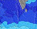 | 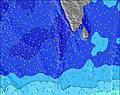 | 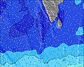 | 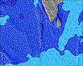 | 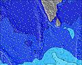 | 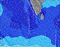 | 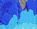 | ||||||||||||||
Wave Height (m) Direction Period (s) | SW 14 | SW 14 | SW 14 | SW 14 | SW 14 | SW 14 | SW 14 | SW 13 | SW 13 | SW 13 | W 10 | W 10 | SSW 18 | SSW 17 | SSW 16 | SSW 15 | SSW 14 | SSW 14 | SSW 13 | SSW 13 | SSW 12 |
Wave Graph | |||||||||||||||||||||
404 | 404 | 404 | 350 | 346 | 281 | 224 | 212 | 212 | 172 | 314 | 326 | 547 | 1086 | 575 | 716 | 602 | 415 | 390 | 321 | 206 | |
Wind (km/h) | |||||||||||||||||||||
Wind State on-shore cross-onshore cross-shore cross-offshore off-shore glassy | on | cross-on | on | on | on | on | cross-on | cross-on | on | on | cross-on | on | on | cross-on | on | on | on | cross-on | on | on | on |
High Tide | 3:28PM0.65m | 3:59AM0.56m | 3:58PM0.63m | 4:36AM0.57m | 4:27PM0.60m | 5:12AM0.56m | 4:55PM0.56m | 5:48AM0.54m | 5:22PM0.51m | 6:26AM0.51m | 5:50PM0.46m | 7:11AM0.48m | 6:17PM0.40m | ||||||||
Low Tide | 9:11AM0.08m | 9:53PM0.03m | 9:49AM0.10m | 10:23PM0.02m | 10:26AM0.13m | 10:52PM0.02m | 11:02AM0.16m | 11:21PM0.05m | 11:38AM0.20m | 11:50PM0.08m | 12:18PM0.24m | 00:20AM0.13m | 1:09PM0.29m | 00:53AM0.18m | |||||||
6:01 | — | — | 6:01 | — | — | 6:01 | — | — | 6:01 | — | — | 6:03 | — | — | 6:03 | — | — | 6:03 | — | — | |
— | 6:29 | — | — | 6:29 | — | — | 6:29 | — | — | 6:29 | — | — | 6:29 | — | — | 6:29 | — | — | 6:29 | — | |
mm | — | — | — | — | 2 | 5 | 2 | 3 | 3 | 2 | 2 | 5 | 2 | 1 | 2 | 1 | — | 3 | 3 | 1 | 4 |
Temp °C | 28 | 28 | 27 | 28 | 27 | 27 | 28 | 28 | 27 | 28 | 28 | 27 | 28 | 28 | 27 | 28 | 28 | 27 | 27 | 28 | 27 |
Feels °C | 29 | 28 | 29 | 28 | 27 | 29 | 29 | 28 | 29 | 29 | 28 | 29 | 29 | 29 | 30 | 30 | 30 | 30 | 29 | 30 | 30 |
Swell 1 Height (m) Direction Period (s) | SW 14 | SW 14 | WSW 6 | SW 14 | SW 14 | SW 14 | SW 14 | SW 13 | SW 13 | SW 13 | SSW 13 | W 10 | W 10 | SSW 17 | W 10 | SSW 15 | SSW 14 | SSW 14 | SSW 13 | SSW 13 | SSW 12 |
404 | 404 | 86 | 350 | 346 | 281 | 224 | 212 | 212 | 172 | 206 | 307 | 301 | 1086 | 279 | 716 | 602 | 415 | 390 | 321 | 206 | |
Swell 2 Height (m) Direction Period (s) | S 10 | S 10 | SW 14 | S 10 | S 10 | S 9 | W 10 | SSW 6 | S 9 | SSW 6 | S 8 | SSW 13 | SSW 18 | W 10 | SSW 16 | W 10 | W 9 | W 9 | W 8 | W 8 | W 8 |
100 | 94 | 404 | 65 | 45 | 25 | 30 | 27 | 23 | 28 | 48 | 326 | 547 | 233 | 575 | 223 | 170 | 126 | 113 | 49 | 32 | |
Swell 3 Height (m) Direction Period (s) | SSW 6 | — | S 10 | S 6 | WNW 10 | W 10 | S 9 | W 10 | S 9 | SSW 8 | SSW 21 | SSW 19 | SSW 13 | SSW 5 | SSW 12 | S 5 | S 5 | SSW 5 | SW 18 | W 13 | W 10 |
30 | — | 70 | 3 | 31 | 47 | 25 | 45 | 55 | 22 | 89 | 214 | 321 | 15 | 199 | 14 | 13 | 8 | 12 | 3 | 18 | |
Wind waves Height (m) Direction Period (s) | W 6 | WSW 6 | W 6 | W 6 | W 6 | WSW 6 | WSW 6 | W 6 | WSW 6 | W 6 | W 10 | W 6 | W 10 | W 6 | W 6 | W 5 | W 6 | W 5 | — | W 5 | W 5 |
83 | 95 | 89 | 91 | 101 | 106 | 113 | 71 | 121 | 116 | 314 | 109 | 392 | 71 | 48 | 21 | 22 | 13 | — | 16 | 20 | |
Nearest Offshore or Glassy | |||||||||||||||||||||
Distance (km) | 211 | 737 | 212 | 211 | 736 | 212 | 209 | 212 | 212 | 211 | 211 | 324 | 211 | 736 | 736 | 638 | 32 | 736 | 638 | 736 | 212 |
Best forecast wave conditions in West Sri Lanka | |||||||||||||||||||||
Best forecast wave conditions in Sri Lanka | |||||||||||||||||||||
Header Global | |||||||||||||||||||||
- Map Icons:
 Break
Break Live Wave Height (m)
 Live Wind Speed (km/h)
 Surf Rating (10 Max)
 Ocean Swells (m)
- Wind Speed (km/h)


FREE! Surf-Forecast.com widget for your website
The surf report / weather widget below is available to embed on third party websites free of charge and provides a summary of our Bennys (Hikkaduwa) surf forecast. Simply grab the html code snippet that we provide and paste it into your own site. You can choose your preferred language and metric/imperial units for the surf forecast feed to suit users of your site. Click here to get the code.
Information about the Bennys (Hikkaduwa) Surf forecast
The above surf forecast table for Bennys (Hikkaduwa) provides essential information for determining whether the surfing conditions will be good over the next 16 days. A general guide to surfing at Bennys (Hikkaduwa) can be found by selecting the local surf guide option on the grey menu. Our Bennys (Hikkaduwa) surf forecast is unique since it includes wave energy (power) that defines the real feel of the surf rather than just the height or the period. If you surf the same spot (Bennys (Hikkaduwa)) regularly then make a mental note of the wave energy from the surf forecast table each time you go. Very soon you may start to choose your surf days based on the wave energy alone combined with our forecast of favourable offshore wind conditions. Our star ratings will help here and of course you will also find the usual wave height and period predictions on our surf forecasts as well as a full break down of the swell components under our advanced users option (to reveal that, click the little Einstein character under the tide times).
Further information to help with frequently asked questions about our surf forecast for Bennys (Hikkaduwa) may be found under the help tab on the top menu and also by moving your mouse over the question marks on the surf forecast table itself. Please always bear in mind that the forecast is for near-shore open water and local factors at each surf break influence the actual breaking wave height, such as the beach / reef profile, water depths offshore and shelter.
Bennys (Hikkaduwa) is 1 km (1 miles) from Ambalangoda. If you plan a holiday in West Sri Lanka, look for hotels and other accommodation in Ambalangoda. Ambalangoda has rooms for a wide range of budgets as well as car hire and transport links.
 Nearest