

Surf Forecasts:

Beach Break (Hikkaduwa) surf forecast from 16 Jul 2026:
- Most powerful swell: Monday 20 Jul, 5PM (local time) - 5.5ft (1.7m), 16s period, S swell with 1,564 kJ wave energy.
Best Forecast Surf Conditions for Beach Break (Hikkaduwa) this week:
The most powerful waves expected at Beach Break (Hikkaduwa) in the next 16 days are 1.7m 16s and forecast to arrive on Monday (Jul 20) at 5PM. Winds are predicted to be onshore at the time the swell arrives.
| Wave Type | Time (+0530) & Date | Wave Height & Period |
|---|---|---|
| Next good surf (1 star+) | - | - |
| Best Surf | - | - |
| Most Powerful | 5PM (Mon 20th Jul) | 5.5ft (1.7m) 16s |
Table - best surf conditions forecast for Beach Break (Hikkaduwa) over the next 16 days.
The Lowdown
Alright, Rusty here again. Let’s break down the Hikkaduwa scene in feet and miles per hour.
It’s a grim start, no two ways about it. From Thursday the 16th right through the weekend and into Monday the 20th, it’s all poor surf with onshore wind and chop. The swell is there but it’s weak, with combined energy in the 525 to 825 range – that’s low energy, not worth the paddle.
Things get a bit more interesting come Monday the 20th of July. The swell reaches 4ft from the S, with a period of 18 seconds – that’s proper groundswell. The combined energy hits 1732 (moderate wave energy) and the wind is offshore from the WSW. The break is Beach Break (Hikkaduwa), a reef setup that loves a SW swell. Water temp is about average for this time of year. That afternoon, the swell bumps to 6ft with a 16-second period and energy at 1909 – still offshore. That’s the standout window. The wave quality is still marginal, but on a reef, a long-period S swell like this can draw up some proper lines. Crowds are sometimes a factor, so you might have a few others out, but it’s not a circus.
Tuesday the 21st holds 5ft swell from the S, with a 15-second period, but the wind turns cross-onshore in the afternoon, making it choppier. The morning still looks okay with offshore wind and energy at 1282. It’s not the same level as Monday, but a decent backup.
After that, it fades fast. Wednesday the 22nd and Thursday the 23rd drop back to 4ft and smaller, with onshore winds and poor conditions. Energy drops to 590 and below. Another gap opens. Saturday the 26th and Sunday the 27th offer nothing but poor surf and onshore wind.
Looking further out, the last few days of July have a pulse of energy. On the 30th, a very long-period 24-second swell from the SSW kicks in during the afternoon, with energy jumping to 2380 – that’s strong. But the wind is onshore and there’s a risk of thunderstorms. The 31st shows a 6ft SSW swell with a 20-second period and energy at 3044 (very strong wave energy), but again, cross-onshore wind and storms. It’s promising but far off, and the wind is the enemy. For now, if you’re in Hikkaduwa, keep your eyes on Monday the 20th – that’s your best bet.
Rusty out.
Short Range ForecastLight rain (total 7mm), mostly falling on Fri morning. Warm (max 28°C on Thu morning, min 26°C on Fri night). Wind will be generally light. | Days 5-7 Weather SummaryModerate rain (total 13mm), heaviest on Sun afternoon. Warm (max 28°C on Mon morning, min 27°C on Sat night). Wind will be generally light. | ||||||||||||||||||||
Thursday 16 | Friday 17 | Saturday 18 | Sunday 19 | Monday 20 | Tuesday 21 | Wed 22 | |||||||||||||||
Night | AM | PM | Night | AM | PM | Night | AM | PM | Night | AM | PM | Night | AM | PM | Night | AM | PM | Night | AM | PM | |
Swell Height Map |  | 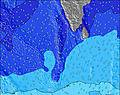 | 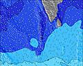 | 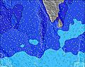 | 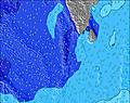 | 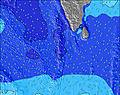 | 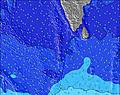 | 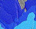 | |||||||||||||
Wave Height (m) Direction Period (s) | SW 16 | SW 14 | SW 14 | SW 14 | SW 14 | SSW 14 | SSW 14 | SSW 14 | SSW 13 | SSW 13 | SSW 13 | SSW 13 | SSW 13 | S 18 | S 16 | S 16 | S 15 | S 14 | S 14 | S 13 | SSW 13 |
Wave Graph | |||||||||||||||||||||
558 | 482 | 482 | 482 | 482 | 425 | 347 | 323 | 277 | 277 | 242 | 285 | 303 | 899 | 1564 | 858 | 978 | 951 | 715 | 498 | 277 | |
Wind (km/h) | |||||||||||||||||||||
Wind State on-shore cross-onshore cross-shore cross-offshore off-shore glassy | on | on | cross-on | on | cross-on | on | on | cross-on | cross-on | on | on | cross-on | on | on | on | on | on | cross-on | on | on | cross-on |
High Tide | 3:19AM0.54m | 3:26PM0.67m | 3:58AM0.57m | 3:58PM0.65m | 4:36AM0.59m | 4:28PM0.63m | 5:13AM0.59m | 4:57PM0.59m | 5:50AM0.57m | 5:25PM0.53m | 6:30AM0.53m | 5:53PM0.47m | 7:16AM0.49m | 6:20PM0.40m | |||||||
Low Tide | 9:22PM0.05m | 9:09AM0.09m | 9:52PM0.04m | 9:46AM0.11m | 10:21PM0.03m | 10:22AM0.15m | 10:49PM0.05m | 10:57AM0.19m | 11:17PM0.07m | 11:33AM0.22m | 11:45PM0.10m | 12:12PM0.26m | 00:14AM0.14m | 1:03PM0.29m | |||||||
— | 6:01 | — | — | 6:01 | — | — | 6:01 | — | — | 6:01 | — | — | 6:01 | — | — | 6:03 | — | — | 6:03 | — | |
— | — | 6:28 | — | — | 6:28 | — | — | 6:28 | — | — | 6:28 | — | — | 6:28 | — | — | 6:28 | — | — | 6:28 | |
mm | — | — | — | — | 1 | — | 3 | 2 | 1 | 3 | 2 | 3 | 1 | — | — | 3 | 1 | — | 3 | — | 1 |
Temp °C | 27 | 28 | 28 | 27 | 28 | 28 | 27 | 28 | 28 | 27 | 27 | 27 | 27 | 28 | 28 | 27 | 28 | 28 | 27 | 28 | 28 |
Feels °C | 29 | 29 | 28 | 29 | 28 | 28 | 28 | 28 | 28 | 29 | 27 | 27 | 29 | 29 | 29 | 29 | 30 | 30 | 30 | 30 | 29 |
Swell 1 Height (m) Direction Period (s) | S 11 | SW 14 | SW 14 | SW 14 | SW 14 | SSW 14 | SSW 14 | SSW 14 | SSW 13 | SSW 13 | SSW 13 | SSW 13 | SSW 13 | S 18 | S 16 | S 16 | S 15 | S 14 | S 14 | S 13 | SSW 13 |
269 | 482 | 482 | 482 | 482 | 425 | 347 | 323 | 277 | 277 | 242 | 285 | 303 | 899 | 1564 | 858 | 978 | 951 | 715 | 498 | 277 | |
Swell 2 Height (m) Direction Period (s) | SW 16 | S 10 | S 10 | SSE 10 | SSE 10 | SSE 10 | SSE 9 | S 9 | S 9 | WNW 10 | WNW 9 | WNW 10 | WNW 10 | S 13 | W 12 | S 12 | W 10 | W 9 | W 9 | W 8 | W 8 |
558 | 239 | 204 | 131 | 98 | 98 | 65 | 79 | 76 | 94 | 115 | 128 | 160 | 414 | 3 | 333 | 273 | 198 | 150 | 69 | 69 | |
Swell 3 Height (m) Direction Period (s) | SE 9 | ESE 8 | WNW 10 | WNW 10 | W 10 | WNW 10 | W 10 | WNW 10 | WNW 10 | S 8 | S 8 | S 8 | S 8 | W 9 | W 13 | W 10 | SE 8 | SE 8 | SW 18 | SE 8 | S 8 |
3 | 7 | 19 | 18 | 7 | 20 | 47 | 77 | 100 | 69 | 64 | 63 | 60 | 87 | 3 | 174 | 10 | 16 | 12 | 9 | 30 | |
Wind waves Height (m) Direction Period (s) | W 6 | W 6 | W 6 | W 6 | W 6 | W 6 | W 6 | W 6 | W 6 | W 6 | W 6 | W 6 | W 6 | W 10 | W 10 | W 6 | W 5 | — | — | W 4 | W 5 |
113 | 104 | 96 | 72 | 123 | 108 | 127 | 96 | 75 | 89 | 109 | 95 | 71 | 332 | 339 | 59 | 21 | — | — | 14 | 23 | |
Nearest Offshore or Glassy | |||||||||||||||||||||
Distance (km) | 211 | 211 | 739 | 211 | 210 | 339 | 211 | 210 | 739 | 333 | 210 | 739 | 211 | 720 | 738 | 58 | 738 | 739 | 58 | 647 | 739 |
Best forecast wave conditions in West Sri Lanka | |||||||||||||||||||||
Best forecast wave conditions in Sri Lanka | |||||||||||||||||||||
Header Global | |||||||||||||||||||||
- Map Icons:
 Break
Break Live Wave Height (m)
 Live Wind Speed (km/h)
 Surf Rating (10 Max)
 Ocean Swells (m)
- Wind Speed (km/h)


FREE! Surf-Forecast.com widget for your website
The surf report / weather widget below is available to embed on third party websites free of charge and provides a summary of our Beach Break (Hikkaduwa) surf forecast. Simply grab the html code snippet that we provide and paste it into your own site. You can choose your preferred language and metric/imperial units for the surf forecast feed to suit users of your site. Click here to get the code.
Information about the Beach Break (Hikkaduwa) Surf forecast
The above surf forecast table for Beach Break (Hikkaduwa) provides essential information for determining whether the surfing conditions will be good over the next 16 days. A general guide to surfing at Beach Break (Hikkaduwa) can be found by selecting the local surf guide option on the grey menu. Our Beach Break (Hikkaduwa) surf forecast is unique since it includes wave energy (power) that defines the real feel of the surf rather than just the height or the period. If you surf the same spot (Beach Break (Hikkaduwa)) regularly then make a mental note of the wave energy from the surf forecast table each time you go. Very soon you may start to choose your surf days based on the wave energy alone combined with our forecast of favourable offshore wind conditions. Our star ratings will help here and of course you will also find the usual wave height and period predictions on our surf forecasts as well as a full break down of the swell components under our advanced users option (to reveal that, click the little Einstein character under the tide times).
Further information to help with frequently asked questions about our surf forecast for Beach Break (Hikkaduwa) may be found under the help tab on the top menu and also by moving your mouse over the question marks on the surf forecast table itself. Please always bear in mind that the forecast is for near-shore open water and local factors at each surf break influence the actual breaking wave height, such as the beach / reef profile, water depths offshore and shelter.
Beach Break (Hikkaduwa) is 9 km (6 miles) from the city of Ambalangoda. If you plan a holiday in West Sri Lanka, look for hotels and other accommodation in Ambalangoda. Ambalangoda has rooms for a wide range of budgets as well as car hire and transport links.
 Nearest