

Surf Forecasts:

Bahia de Cata surf forecast from 12 Jul 2026:
- Most powerful swell: Monday 13 Jul, 11AM (local time) - 2.5ft (0.8m), 6s period, NNE swell with 44 kJ wave energy.
Best Forecast Surf Conditions for Bahia de Cata this week:
The most powerful waves expected at Bahia de Cata in the next 16 days are 0.8m 6s and forecast to arrive on Monday (Jul 13) at 11AM. Winds are predicted to be onshore at the time the swell arrives. The largest open ocean swell (not directed at the beach) is 2.4m 7s period and expected on Friday (Jul 17) at 8PM.
| Wave Type | Time (-04) & Date | Wave Height & Period |
|---|---|---|
| Next good surf (1 star+) | - | - |
| Best Surf | - | - |
| Most Powerful | 11AM (Mon 13th Jul) | 2.5ft (0.8m) 6s |
Table - best surf conditions forecast for Bahia de Cata over the next 16 days.
Alright folks, Rusty here. Let’s have a look at what’s cookin’ for Bahia de Cata.
Right off the bat, I gotta be straight with you – this is a tough one. The next 16 days are lookin’ real quiet. There’s a short window of small, weak swell on the morning of Sunday the 12th, but it’s comin’ with a risk of thunderstorms and a cross-onshore wind. That’s a no-go. After that, we’re lookin’ at a long, dry spell. From Sunday afternoon all the way through to the morning of Wednesday the 22nd, there’s just nothing. No swell to speak of, just flat spells and poor conditions. That’s a solid 10-day gap with zero recommendations.
The first real chance of anything rideable comes on the morning of Wednesday the 22nd. We’ve got a tiny 3ft swell from the NNE, with a short period of 6 seconds. The combined energy is weak (71). The wind is glassy, which is a positive, but the swell is just too small and weak to get excited about. It’s a lake out there.
The next, and possibly the only other flicker of life, is on the morning of Monday the 27th. A tiny 1ft swell from the NNE, again with a short 7-second period and very weak energy (18). Glassy conditions again, but it’s a whisper of a wave.
Now, because the spot is a sheltered bay, it needs a very specific swell direction to work. The guidance says it’s best with a NNE swell, and while these tiny pulses are from that direction, there’s just not enough power. The water temp is a toasty 82°, which is about normal for this time of year.
Honestly, this is a classic case of a blank run. For this area, when the swell window shuts, it really shuts. The setup looks more interesting for a paddleboard than a surfboard right now. Don’t hold your breath, but forecasts can change.
Rusty.
Short Range ForecastHeavy rain (total 36mm), heaviest during Mon night. Warm (max 30°C on Tue morning, min 25°C on Sun night). Wind will be generally light. | Days 4-6 Weather SummaryLight rain (total 4mm), mostly falling on Wed afternoon. Warm (max 30°C on Wed morning, min 24°C on Wed night). Wind will be generally light. | ||||||||||||||||||||
Sunday 12 | Monday 13 | Tuesday 14 | Wednesday 15 | Thursday 16 | Friday 17 | Saturday 18 | |||||||||||||||
AM | PM | Night | AM | PM | Night | AM | PM | Night | AM | PM | Night | AM | PM | Night | AM | PM | Night | AM | PM | Night | |
Swell Height Map |  |  | 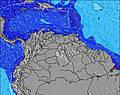 | 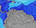 | 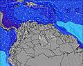 | 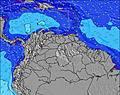 | 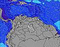 | ||||||||||||||
Wave Height (m) Direction Period (s) | NE 7 | NE 7 | ENE 8 | NNE 6 | ENE 6 | ENE 7 | ENE 7 | ENE 7 | ENE 7 | NE 7 | ENE 7 | ENE 7 | ENE 7 | ENE 7 | ENE 7 | ENE 7 | ENE 7 | ENE 7 | ENE 7 | ENE 7 | ENE 7 |
Wave Graph | |||||||||||||||||||||
122 | 0 | 0 | 44 | 0 | 0 | 0 | 0 | 0 | 0 | 0 | 0 | 0 | 0 | 0 | 0 | 0 | 0 | 0 | 0 | 0 | |
Wind (km/h) | |||||||||||||||||||||
Wind State on-shore cross-onshore cross-shore cross-offshore off-shore glassy | cross-on | cross-on | off | on | cross-on | cross-off | cross-on | cross-on | off | on | cross-on | off | on | cross-on | off | on | cross-on | glassy | on | cross-on | glassy |
High Tide | 11:15PM0.48m | 00:06AM0.48m | 1:00AM0.46m | 1:57AM0.43m | 6:01PM0.19m | 2:58AM0.38m | 6:09PM0.24m | 4:05AM0.33m | 6:31PM0.28m | ||||||||||||
Low Tide | 8:28AM-0.03m | 9:08AM-0.02m | 9:43AM0.00m | 10:14AM0.04m | 7:28PM0.19m | 10:37AM0.07m | 9:02PM0.21m | 10:53AM0.11m | 10:35PM0.22m | ||||||||||||
6:15 | — | — | 6:15 | — | — | 6:16 | — | — | 6:16 | — | — | 6:16 | — | — | 6:16 | — | — | 6:16 | — | — | |
— | 6:57 | — | — | 6:57 | — | — | 6:57 | — | — | 6:57 | — | — | 6:57 | — | — | 6:57 | — | — | 6:57 | — | |
mm | 2 | 4 | 2 | 2 | 3 | 19 | — | 2 | 2 | — | 1 | — | — | — | — | — | 2 | 1 | — | 2 | — |
Temp °C | 28 | 27 | 26 | 29 | 27 | 25 | 30 | 30 | 26 | 30 | 29 | 26 | 29 | 29 | 26 | 29 | 27 | 26 | 28 | 27 | 26 |
Feels °C | 32 | 32 | 30 | 33 | 30 | 28 | 34 | 33 | 30 | 33 | 30 | 29 | 31 | 31 | 29 | 32 | 30 | 30 | 31 | 29 | 30 |
Swell 1 Height (m) Direction Period (s) | NE 7 | — | NE 6 | ENE 7 | N 10 | ENE 7 | ENE 7 | N 8 | ENE 7 | — | — | ENE 7 | — | — | ENE 7 | — | — | — | — | — | — |
122 | — | 95 | 78 | 2 | 205 | 237 | 1 | 230 | — | — | 294 | — | — | 311 | — | — | — | — | — | — | |
Swell 2 Height (m) Direction Period (s) | ENE 8 | — | ENE 8 | NNE 6 | — | N 9 | N 8 | — | — | — | — | — | — | — | — | — | — | — | — | — | — |
140 | — | 34 | 44 | — | 2 | 1 | — | — | — | — | — | — | — | — | — | — | — | — | — | — | |
Swell 3 Height (m) Direction Period (s) | — | — | — | N 10 | — | — | — | — | — | — | — | — | — | — | — | — | — | — | — | — | — |
— | — | — | 2 | — | — | — | — | — | — | — | — | — | — | — | — | — | — | — | — | — | |
Wind waves Height (m) Direction Period (s) | — | NE 7 | ENE 8 | — | ENE 6 | — | — | ENE 7 | — | NE 7 | ENE 7 | ENE 7 | ENE 7 | ENE 7 | — | ENE 7 | ENE 7 | ENE 7 | ENE 7 | ENE 7 | ENE 7 |
— | 193 | 102 | — | 193 | — | — | 329 | — | 254 | 520 | 198 | 218 | 262 | — | 264 | 467 | 270 | 175 | 273 | 282 | |
Nearest Offshore or Glassy | |||||||||||||||||||||
Distance (km) | 84 | 21 | 4 | 15 | 84 | 4 | 4 | 84 | 4 | 84 | 84 | 4 | 84 | 84 | 4 | 84 | 84 | 4 | 84 | 84 | 4 |
Best forecast wave conditions in Zona del Centro | |||||||||||||||||||||
Best forecast wave conditions in Venezuela | |||||||||||||||||||||
Header Global | |||||||||||||||||||||
- Map Icons:
 Break
Break Live Wave Height (m)
 Live Wind Speed (km/h)
 Surf Rating (10 Max)
 Ocean Swells (m)
- Wind Speed (km/h)


FREE! Surf-Forecast.com widget for your website
The surf report / weather widget below is available to embed on third party websites free of charge and provides a summary of our Bahia de Cata surf forecast. Simply grab the html code snippet that we provide and paste it into your own site. You can choose your preferred language and metric/imperial units for the surf forecast feed to suit users of your site. Click here to get the code.
Information about the Bahia de Cata Surf forecast
The above surf forecast table for Bahia de Cata provides essential information for determining whether the surfing conditions will be good over the next 16 days. A general guide to surfing at Bahia de Cata can be found by selecting the local surf guide option on the grey menu. Our Bahia de Cata surf forecast is unique since it includes wave energy (power) that defines the real feel of the surf rather than just the height or the period. If you surf the same spot (Bahia de Cata) regularly then make a mental note of the wave energy from the surf forecast table each time you go. Very soon you may start to choose your surf days based on the wave energy alone combined with our forecast of favourable offshore wind conditions. Our star ratings will help here and of course you will also find the usual wave height and period predictions on our surf forecasts as well as a full break down of the swell components under our advanced users option (to reveal that, click the little Einstein character under the tide times).
Further information to help with frequently asked questions about our surf forecast for Bahia de Cata may be found under the help tab on the top menu and also by moving your mouse over the question marks on the surf forecast table itself. Please always bear in mind that the forecast is for near-shore open water and local factors at each surf break influence the actual breaking wave height, such as the beach / reef profile, water depths offshore and shelter.
Bahia de Cata is 22 km (14 miles) from the city of Mariara. If you plan a holiday in Zona del Centro, look for hotels and other accommodation in Mariara. Mariara has rooms for a wide range of budgets as well as car hire and transport links.
 Nearest