

Surf Forecasts:

How big are the waves at Aufaga today (03 Aug):
- Afternoon surf: Afternoon surf (03 Aug, local time) - 3.5ft (1.0m), 11s period with SSE swell.
- Evening surf: Evening surf (03 Aug, local time) - 3ft (0.9m), 11s period with SSE swell.
The current surf forecast for Aufaga at 10PM is: 0.9m 11s primary swell from a South-southeast direction (forecast issued at 06:00pm August 03). An open ocean swell of 0.9m 8s is not directed at the surf break. The wind direction is predicted to be cross-offshore and the swell rating is 2.
| Time (+13) & Date | Wave Height | Wave Period |
|---|---|---|
| Morning (03 Aug) | - | - |
| Afternoon (03 Aug) | 3.5ft (1.0m) | 11s |
| Evening (03 Aug) | 3ft (0.9m) | 11s |
Table - waves today at Aufaga. (Swell directed towards the surf break)
Short Range ForecastModerate rain (total 13mm), heaviest on Mon afternoon. Warm (max 27°C on Mon afternoon, min 24°C on Wed night). Winds increasing (calm on Mon night, fresh winds from the SSE by Wed night). | |||||||||||||||||||
Mon 3 | Tuesday 4 | Wednesday 5 | |||||||||||||||||
4 PM | 7 PM | 10 PM | 1 AM | 4 AM | 7 AM | 10 AM | 1 PM | 4 PM | 7 PM | 10 PM | 1 AM | 4 AM | 7 AM | 10 AM | 1 PM | 4 PM | 7 PM | 10 PM | |
Swell Height Map |  |  |  | 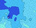 | 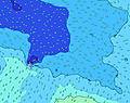 | 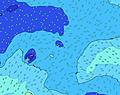 | 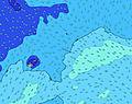 | ||||||||||||
Wave Height (m) Direction Period (s) | SSE 11 | SSE 11 | SSE 11 | SSE 11 | SSE 11 | SE 12 | SE 11 | SW 13 | SW 13 | SW 13 | SW 13 | SW 13 | S 15 | S 14 | SSW 13 | S 13 | S 13 | S 12 | SSW 12 |
Wave Graph | |||||||||||||||||||
261 | 219 | 219 | 219 | 223 | 192 | 189 | 140 | 138 | 138 | 136 | 130 | 272 | 243 | 295 | 355 | 395 | 365 | 418 | |
Wind (km/h) | |||||||||||||||||||
Wind State on-shore cross-onshore cross-shore cross-offshore off-shore glassy | cross-off | cross-off | cross-off | off | off | glassy | on | on | on | on | cross-on | cross-on | cross-on | cross-on | cross-on | cross-on | cross-on | cross-on | cross-on |
High Tide | 10:04PM0.93m | 10:20AM0.91m | 10:54PM0.94m | 11:16AM0.88m | |||||||||||||||
Low Tide | 4:09AM0.27m | 4:29PM0.24m | 5:05AM0.27m | 5:22PM0.25m | |||||||||||||||
— | — | — | — | 6:46 | — | — | — | — | — | — | — | 6:46 | — | — | — | — | — | — | |
6:16 | — | — | — | — | — | — | — | 6:17 | — | — | — | — | — | — | — | 6:17 | — | — | |
mm | 1 | 1 | — | — | — | — | — | — | — | — | — | 1 | 1 | 1 | 1 | 1 | 1 | 1 | 1 |
Temp °C | 26 | 27 | 27 | 27 | 26 | 26 | 26 | 26 | 26 | 25 | 25 | 25 | 25 | 25 | 25 | 25 | 25 | 25 | 25 |
Feels °C | 29 | 30 | 30 | 30 | 29 | 31 | 30 | 29 | 28 | 26 | 26 | 26 | 25 | 25 | 25 | 25 | 25 | 24 | 24 |
Swell 1 Height (m) Direction Period (s) | E 8 | E 8 | SSE 11 | SSE 11 | SSE 11 | SE 12 | SE 11 | E 8 | E 8 | E 8 | E 8 | E 8 | S 15 | S 14 | SSW 13 | S 13 | S 13 | S 12 | SSW 12 |
114 | 114 | 219 | 219 | 223 | 192 | 189 | 78 | 80 | 58 | 58 | 58 | 272 | 243 | 295 | 355 | 395 | 365 | 418 | |
Swell 2 Height (m) Direction Period (s) | SSE 11 | SSE 11 | E 8 | E 8 | E 8 | E 8 | E 8 | SW 13 | SW 13 | SE 10 | SE 10 | SW 13 | ENE 8 | ENE 8 | E 8 | E 8 | E 8 | E 8 | E 8 |
261 | 219 | 93 | 90 | 78 | 76 | 78 | 140 | 138 | 110 | 110 | 130 | 58 | 62 | 58 | 60 | 61 | 44 | 43 | |
Swell 3 Height (m) Direction Period (s) | SSW 14 | SW 14 | SW 14 | SW 14 | SW 14 | SW 13 | SW 13 | SSE 10 | SSE 10 | SW 13 | SW 13 | SE 10 | SW 12 | SW 12 | SW 12 | SW 12 | SW 12 | SW 12 | SSW 18 |
140 | 169 | 167 | 164 | 155 | 144 | 142 | 65 | 65 | 138 | 136 | 85 | 124 | 126 | 126 | 120 | 120 | 89 | 226 | |
Wind waves Height (m) Direction Period (s) | — | — | — | — | — | — | — | — | — | SSE 3 | SSE 4 | SSE 4 | SSE 5 | SSE 5 | SSE 6 | SSE 5 | SSE 5 | SSE 5 | SSE 5 |
— | — | — | — | — | — | — | — | — | 3 | 11 | 16 | 25 | 40 | 40 | 39 | 49 | 48 | 50 | |
Nearest Offshore or Glassy | |||||||||||||||||||
Distance (km) | 0 | 0 | 0 | 0 | 0 | 0 | 2 | 12 | 12 | 82 | 82 | 1274 | 82 | 82 | 82 | 82 | 875 | 1486 | 1486 |
Best forecast wave conditions in Upolu | |||||||||||||||||||
Best forecast wave conditions in Samoa | |||||||||||||||||||
Header Global | |||||||||||||||||||
- Map Icons:
 Break
Break Live Wave Height (m)
 Live Wind Speed (km/h)
 Surf Rating (10 Max)
 Ocean Swells (m)
- Wind Speed (km/h)
Latest Updates


FREE! Surf-Forecast.com widget for your website
The surf report / weather widget below is available to embed on third party websites free of charge and provides a summary of our Aufaga surf forecast. Simply grab the html code snippet that we provide and paste it into your own site. You can choose your preferred language and metric/imperial units for the surf forecast feed to suit users of your site. Click here to get the code.
 Nearest