
Surf Forecasts:

Anse Bougainville surf forecast from 3 Aug 2026:
- Most powerful swell: Saturday 8 Aug, 4AM (local time) - 8ft (2.5m), 10s period, SE swell with 1,271 kJ wave energy.
Best Forecast Surf Conditions for Anse Bougainville this week:
The most powerful waves expected at Anse Bougainville in the next 16 days are 2.5m 10s and forecast to arrive on Saturday (Aug 08) at 4AM. Winds are predicted to be onshore at the time the swell arrives. The largest open ocean swell (not directed at the beach) is 0.1m 11s period and expected on Friday (Aug 07) at 7AM.
| Wave Type | Time (+04) & Date | Wave Height & Period |
|---|---|---|
| Next good surf (1 star+) | - | - |
| Best Surf | - | - |
| Most Powerful | 4AM (Sat 8th Aug) | 8ft (2.5m) 10s |
Table - best surf conditions forecast for Anse Bougainville over the next 16 days.
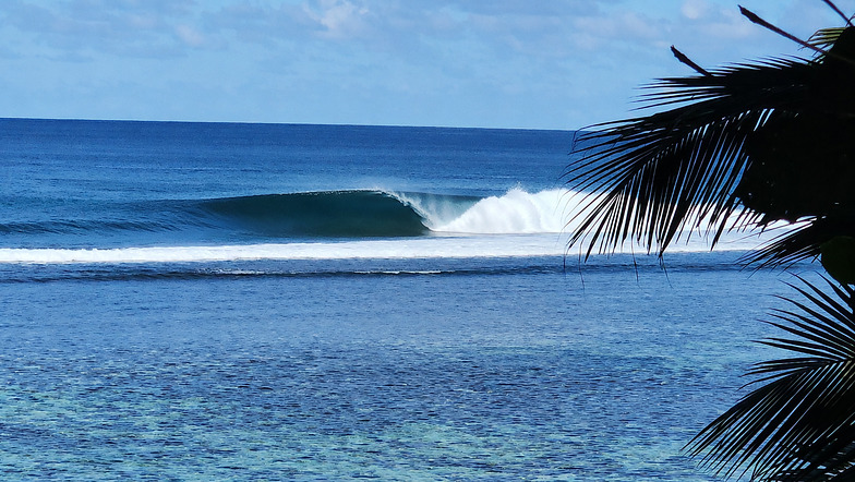
The Lowdown
Alright, this is Rusty, and I’ve got the outlook for your local waters. Let’s get into it.
Look, I’ll be straight with you – the next couple of weeks are a tough watch for anyone looking to get a decent wave. The only spot on the cards is Anse Bougainville, a reef break that’s exposed to the swell. But for the vast majority of the forecast, it’s a no-go. The wind is blowing straight onshore, mostly from the southeast, and it’s not letting up. The water here is sitting at a touch warmer than normal for this time of year, about 82°F.
From Monday, August 3rd, right through to the morning of Tuesday, August 18th, the conditions are just plain poor. The wind is relentless, blowing onshore at 16 mph to 22 mph, sometimes even stronger. The waves are there, but they’re a messy, blown-out mess. On Monday morning, August 3rd, we’ve got a 4ft swell from the southeast with a 9-second period, but the combined energy is moderate (583), and it’s not worth paddling out. The whole first week is a write-off, with the swell bouncing between 4ft and 8ft, but every single time, the wind is just ruining it.
There’s a bit of a pulse around the 6th and 9th of August, with swell heights hitting 8ft and combined energy climbing into the strong range (1254 and 1277), but it’s all onshore slop. That kind of size with onshore wind is just a washing machine. Beginners should stay away from anything over 5ft here, and by the 6th, it’s already over that, but honestly, the conditions are so poor it doesn’t matter.
Now, after a long, bleak stretch, we finally get a glimmer of hope. On Tuesday, August 18th, the wind finally swings around. In the morning, it goes glassy, with a light 3 mph offshore from the southwest. The swell is a 6ft from the SSE with a 9-second period, and the combined energy is moderate (768). This is the standout. It’s the only time in the entire 16-day window where the conditions are described as “very good.” The afternoon also looks rideable with a light cross-shore breeze, but it’s a bit more marginal. This is your window. It’s a long way out, so take it with a pinch of salt, but if you can get to Anse Bougainville on the morning of the 18th, you’ll be in for some clean, chest-to-head-high waves. The reef should handle the period well.
There’s a huge gap of over two weeks of junk before that one good morning. It’s a tough run, but sometimes that’s the way it goes. Keep an eye on it, because forecasts can change.
Rusty.
Short Range ForecastLight rain (total 3mm), mostly falling on Tue morning. Warm (max 26°C on Mon morning, min 25°C on Mon morning). Mainly fresh winds. | Days 4-6 Weather SummaryLight rain (total 3mm), mostly falling on Thu morning. Warm (max 26°C on Thu afternoon, min 25°C on Thu morning). Mainly strong winds. | ||||||||||||||||||||
Monday 3 | Tuesday 4 | Wednesday 5 | Thursday 6 | Friday 7 | Saturday 8 | Sunday 9 | |||||||||||||||
AM | PM | Night | AM | PM | Night | AM | PM | Night | AM | PM | Night | AM | PM | Night | AM | PM | Night | AM | PM | Night | |
Swell Height Map |  |  |  | 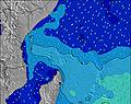 | 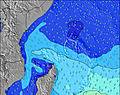 | 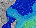 | 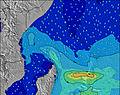 | ||||||||||||||
Wave Height (m) Direction Period (s) | SE 9 | S 17 | SE 9 | SE 9 | SE 9 | SSE 9 | SSE 9 | SSE 9 | SE 9 | SE 10 | SE 10 | SE 10 | SE 9 | SE 9 | SE 10 | SE 10 | SE 10 | SE 10 | SE 10 | SE 10 | SE 10 |
Wave Graph | |||||||||||||||||||||
225 | 283 | 287 | 721 | 734 | 359 | 268 | 274 | 526 | 1234 | 1138 | 964 | 887 | 816 | 1235 | 1092 | 1005 | 985 | 1175 | 992 | 817 | |
Wind (km/h) | |||||||||||||||||||||
Wind State on-shore cross-onshore cross-shore cross-offshore off-shore glassy | on | on | on | on | on | on | on | on | on | on | on | on | on | on | on | on | on | on | on | on | on |
High Tide | 7:25PM1.17m | 8:09AM1.25m | 7:58PM1.05m | 8:50AM1.26m | 8:36PM0.91m | 9:41AM1.25m | 9:23PM0.76m | 10:48AM1.23m | 10:40PM0.63m | 12:13PM1.24m | 00:49AM0.59m | 1:40PM1.30m | 2:34AM0.66m | ||||||||
Low Tide | 1:32PM0.30m | 1:42AM0.11m | 2:18PM0.34m | 2:09AM0.14m | 3:13PM0.40m | 2:41AM0.19m | 4:27PM0.45m | 3:23AM0.24m | 6:12PM0.45m | 4:26AM0.30m | 8:00PM0.38m | 6:03AM0.34m | 9:09PM0.27m | ||||||||
6:26 | — | — | 6:26 | — | — | 6:26 | — | — | 6:26 | — | — | 6:26 | — | — | 6:24 | — | — | 6:24 | — | — | |
— | 6:21 | — | — | 6:21 | — | — | 6:21 | — | — | 6:21 | — | — | 6:21 | — | — | 6:21 | — | — | 6:21 | — | |
mm | — | — | — | 1 | — | — | — | — | 2 | 2 | — | 1 | — | — | — | — | — | — | — | — | — |
Temp °C | 26 | 26 | 26 | 26 | 26 | 25 | 26 | 26 | 26 | 25 | 26 | 26 | 26 | 26 | 25 | 26 | 26 | 26 | 26 | 26 | 26 |
Feels °C | 27 | 28 | 27 | 24 | 24 | 23 | 26 | 26 | 25 | 23 | 23 | 24 | 23 | 23 | 22 | 23 | 24 | 24 | 24 | 24 | 24 |
Swell 1 Height (m) Direction Period (s) | SE 9 | SE 8 | S 16 | S 20 | S 19 | ESE 9 | SSE 9 | E 8 | S 14 | S 13 | SSW 13 | S 16 | S 15 | S 15 | S 16 | S 18 | S 16 | SSW 22 | SSW 21 | S 20 | S 18 |
225 | 154 | 122 | 186 | 173 | 243 | 268 | 144 | 37 | 14 | 34 | 20 | 18 | 17 | 20 | 24 | 21 | 95 | 85 | 67 | 57 | |
Swell 2 Height (m) Direction Period (s) | S 18 | S 17 | S 21 | SSW 14 | SSW 14 | S 18 | E 8 | S 15 | SW 7 | S 17 | S 17 | S 12 | N 11 | N 11 | — | S 26 | S 24 | S 16 | S 15 | N 11 | S 13 |
162 | 283 | 81 | 40 | 19 | 150 | 173 | 41 | 2 | 6 | 24 | 11 | 2 | 2 | — | 13 | 46 | 20 | 17 | 2 | 3 | |
Swell 3 Height (m) Direction Period (s) | SSW 14 | ESE 9 | S 10 | WSW 7 | WSW 7 | SSW 13 | S 16 | SW 8 | — | — | N 11 | N 11 | — | — | — | S 15 | N 11 | N 11 | N 11 | S 20 | N 11 |
69 | 66 | 8 | 5 | 5 | 17 | 80 | 2 | — | — | 2 | 2 | — | — | — | 4 | 2 | 2 | 2 | 8 | 2 | |
Wind waves Height (m) Direction Period (s) | SSE 8 | — | SE 9 | SE 9 | SE 9 | SSE 9 | — | SSE 9 | SE 9 | SE 10 | SE 10 | SE 10 | SE 9 | SE 9 | SE 10 | SE 10 | SE 10 | SE 10 | SE 10 | SE 10 | SE 10 |
127 | — | 287 | 721 | 734 | 359 | — | 274 | 526 | 1234 | 1138 | 964 | 887 | 816 | 1235 | 1092 | 1005 | 985 | 1175 | 992 | 817 | |
Nearest Offshore or Glassy | |||||||||||||||||||||
Distance (km) | 7 | 1797 | 1745 | 1791 | 1797 | 1745 | 7 | 1797 | 1745 | 1791 | 1797 | 1791 | 1797 | 1797 | 1745 | 1791 | 1797 | 1745 | 1791 | 1797 | 1745 |
Best forecast wave conditions in Mahe | |||||||||||||||||||||
Best forecast wave conditions in Seychelles | |||||||||||||||||||||
Header Global | |||||||||||||||||||||
- Map Icons:
 Break
Break Live Wave Height (m)
 Live Wind Speed (km/h)
 Surf Rating (10 Max)
 Ocean Swells (m)
- Wind Speed (km/h)
Latest Updates


FREE! Surf-Forecast.com widget for your website
The surf report / weather widget below is available to embed on third party websites free of charge and provides a summary of our Anse Bougainville surf forecast. Simply grab the html code snippet that we provide and paste it into your own site. You can choose your preferred language and metric/imperial units for the surf forecast feed to suit users of your site. Click here to get the code.
Information about the Anse Bougainville Surf forecast
The above surf forecast table for Anse Bougainville provides essential information for determining whether the surfing conditions will be good over the next 16 days. A general guide to surfing at Anse Bougainville can be found by selecting the local surf guide option on the grey menu. Our Anse Bougainville surf forecast is unique since it includes wave energy (power) that defines the real feel of the surf rather than just the height or the period. If you surf the same spot (Anse Bougainville) regularly then make a mental note of the wave energy from the surf forecast table each time you go. Very soon you may start to choose your surf days based on the wave energy alone combined with our forecast of favourable offshore wind conditions. Our star ratings will help here and of course you will also find the usual wave height and period predictions on our surf forecasts as well as a full break down of the swell components under our advanced users option (to reveal that, click the little Einstein character under the tide times).
Further information to help with frequently asked questions about our surf forecast for Anse Bougainville may be found under the help tab on the top menu and also by moving your mouse over the question marks on the surf forecast table itself. Please always bear in mind that the forecast is for near-shore open water and local factors at each surf break influence the actual breaking wave height, such as the beach / reef profile, water depths offshore and shelter.
Are you planning a holiday in Mahe? If you are looking for accommodation near Anse Bougainville, camping, hotels and holiday cottages in Mahe, consider staying in Victoria which is 18 km (11 miles) away.
 Nearest