

Surf Forecasts:

Trincomalee surf forecast from 3 Aug 2026:
- Most powerful swell: Monday 10 Aug, 2AM (local time) - 1.5ft (0.4m), 18s period, S swell with 97 kJ wave energy.
Best Forecast Surf Conditions for Trincomalee this week:
The most powerful waves expected at Trincomalee in the next 16 days are 0.4m 18s and forecast to arrive on Monday (Aug 10) at 2AM. Winds are predicted to be cross-offshore at the time the swell arrives. The largest open ocean swell (not directed at the beach) is 1.1m 4s period and expected on Saturday (Aug 08) at 8AM.
| Wave Type | Time (+0530) & Date | Wave Height & Period |
|---|---|---|
| Next good surf (1 star+) | - | - |
| Best Surf | - | - |
| Most Powerful | 2AM (Mon 10th Aug) | 1.5ft (0.4m) 18s |
Table - best surf conditions forecast for Trincomalee over the next 16 days.
The Lowdown
Alright folks, Rusty here. Let’s have a look at what’s on offer for our stretch of coast.
Honestly, I’ve got to be straight with you – this is a tough one. The whole 16-day window is looking flat and pretty hopeless for a proper paddle. We’re looking at a long, dry spell with barely a ripple. The first real surf recommendation doesn't show up for a while, and even then it's tiny. There’s a long gap of nothing from the start of the period until the second week, with nothing to get excited about.
The only break that’s even in the picture is Trincomalee, a point break that’s rated for beginners but it rarely breaks, so don’t get your hopes up. The water temperature is sitting around 83°, which is about normal for this time of year, so at least a dip won’t be a shock.
For the first week, from Monday the 3rd of August right through to Sunday the 9th, it’s a write-off. We’re talking swell heights of 0.3ft to 1.0ft, with combined wave energy barely reaching double digits (like 4 to 82). The wind is a persistent cross-off from the WSW, which is fine for keeping the surface clean, but there’s just no swell to work with. It’s all poor surf conditions.
Things don’t really improve until we get into the second week. Around Monday the 10th of August, we finally see a slight bump. The swell bumps up to 1ft from the SSE, and the combined energy is starting to creep up – 60 on Monday afternoon. The wind goes light offshore from the west at 9 mph, making for some gentle offshore and clean conditions. It’s still tiny, but for a longboard or a learner, you might find a knee-high wave.
The best of a bad bunch looks like it’ll be on Saturday the 15th of August. We’ve got a 2ft swell from the SSE, with a period of 11 seconds, and the combined energy hits 110 (moderate energy). The wind is still a cross-off, so the surface will be clean. It’s not going to be a classic, but for a point break that barely works, this is your best shot. The swell direction from the SSE is a bit off from the optimum S direction for the break, but it’s the biggest we get.
After that, we drift back into tiny, weak surf for the rest of the window with energy dropping back under 100. The very last day, Tuesday the 18th of August, shows a brief moment of glassy conditions in the afternoon with a light NE wind at 3 mph, but the swell is only 1ft.
It’s a grim outlook, to be honest. But these things happen. It tends not to stay this flat forever, and forecasts can change, so keep an eye on it. For now, leave the board in the shed.
Rusty.
Short Range ForecastModerate rain (total 10mm), heaviest on Mon morning. Warm (max 31°C on Wed afternoon, min 25°C on Mon morning). Winds decreasing (strong winds from the WSW on Mon night, moderate winds from the W by Wed morning). | Days 4-6 Weather SummaryMostly dry. Warm (max 32°C on Sat afternoon, min 26°C on Sat night). Mainly strong winds. | ||||||||||||||||||||
Monday 3 | Tuesday 4 | Wednesday 5 | Thursday 6 | Friday 7 | Saturday 8 | Sunday 9 | |||||||||||||||
AM | PM | Night | AM | PM | Night | AM | PM | Night | AM | PM | Night | AM | PM | Night | AM | PM | Night | AM | PM | Night | |
Swell Height Map | 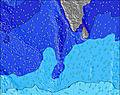 |  | 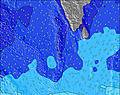 | 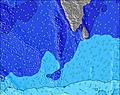 | 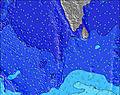 | 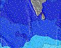 | 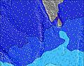 | ||||||||||||||
Wave Height (m) Direction Period (s) | S 18 | SE 9 | SE 9 | SE 8 | SE 9 | S 16 | S 14 | SE 9 | S 21 | SE 9 | S 18 | S 20 | SSE 8 | S 20 | SSE 12 | SSE 12 | S 19 | SSE 8 | SSE 11 | SSE 9 | S 18 |
Wave Graph | |||||||||||||||||||||
24 | 3 | 3 | 3 | 3 | 5 | 4 | 3 | 9 | 3 | 7 | 8 | 7 | 8 | 50 | 14 | 28 | 28 | 45 | 29 | 97 | |
Wind (km/h) | |||||||||||||||||||||
Wind State on-shore cross-onshore cross-shore cross-offshore off-shore glassy | cross-off | cross-off | cross-off | cross-off | cross-off | cross-off | off | cross-off | cross-off | cross-off | cross-off | cross-off | cross-off | cross-off | cross-off | cross-off | cross-off | cross-off | cross-off | cross-off | cross-off |
High Tide | 10:50AM0.58m | 11:38PM0.49m | 11:20AM0.56m | 00:25AM0.49m | 11:59AM0.52m | 1:22AM0.49m | 12:48PM0.48m | 2:35AM0.50m | 1:56PM0.44m | 4:01AM0.52m | 3:31PM0.41m | 5:19AM0.56m | 5:13PM0.42m | ||||||||
Low Tide | 5:15PM0.08m | 5:14AM0.18m | 5:56PM0.09m | 6:06AM0.22m | 6:44PM0.10m | 7:12AM0.25m | 7:42PM0.12m | 8:40AM0.27m | 8:53PM0.13m | 10:16AM0.26m | 10:08PM0.13m | 11:38AM0.22m | 11:19PM0.12m | ||||||||
5:56 | — | — | 5:56 | — | — | 5:56 | — | — | 5:56 | — | — | 5:56 | — | — | 5:56 | — | — | 5:56 | — | — | |
— | 6:24 | — | — | 6:24 | — | — | 6:24 | — | — | 6:23 | — | — | 6:23 | — | — | 6:23 | — | — | 6:22 | — | |
mm | 5 | — | — | 2 | 3 | — | — | — | — | — | — | — | — | — | — | — | — | — | — | — | — |
Temp °C | 26 | 26 | 26 | 25 | 25 | 26 | 29 | 31 | 27 | 30 | 31 | 27 | 30 | 30 | 27 | 29 | 32 | 27 | 30 | 32 | 27 |
Feels °C | 25 | 23 | 22 | 23 | 25 | 25 | 29 | 31 | 25 | 28 | 29 | 25 | 28 | 28 | 25 | 28 | 30 | 24 | 29 | 31 | 25 |
Swell 1 Height (m) Direction Period (s) | SE 8 | SE 9 | NW 4 | NW 5 | SE 4 | SE 9 | NNW 4 | SE 9 | SE 9 | S 8 | SSE 8 | SSE 8 | SSE 8 | SSE 8 | SSE 9 | SSE 8 | SSE 8 | SSE 8 | SSE 11 | SSE 9 | SSE 9 |
11 | 3 | 1 | 1 | 1 | 3 | 2 | 3 | 3 | 1 | 7 | 7 | 7 | 7 | 16 | 14 | 14 | 28 | 45 | 29 | 32 | |
Swell 2 Height (m) Direction Period (s) | S 18 | S 9 | S 8 | SE 5 | SE 9 | N 5 | SE 9 | — | S 8 | SE 9 | SE 9 | S 16 | SE 6 | S 12 | S 19 | SSE 12 | SSE 11 | SSE 11 | S 19 | S 19 | S 18 |
6 | 1 | 1 | 1 | 3 | 1 | 3 | — | 1 | 3 | 3 | 5 | 1 | 3 | 30 | 13 | 12 | 11 | 7 | 7 | 6 | |
Swell 3 Height (m) Direction Period (s) | S 18 | SE 5 | SE 9 | SE 8 | S 8 | S 16 | S 14 | S 8 | S 21 | S 6 | S 18 | S 20 | S 13 | S 20 | SSE 12 | WNW 5 | S 19 | S 18 | S 20 | — | S 18 |
24 | 1 | 3 | 3 | 1 | 5 | 4 | 1 | 9 | 1 | 6 | 8 | 4 | 8 | 50 | 2 | 28 | 6 | 30 | — | 97 | |
Wind waves Height (m) Direction Period (s) | WSW 4 | WSW 4 | SW 4 | SW 4 | SW 3 | WSW 4 | W 3 | WSW 3 | WSW 4 | WSW 4 | WSW 4 | WSW 4 | WSW 4 | WSW 4 | WSW 4 | WSW 4 | W 4 | SW 4 | WSW 4 | WSW 4 | WSW 4 |
22 | 14 | 22 | 14 | 6 | 11 | 6 | 4 | 17 | 11 | 11 | 30 | 11 | 12 | 30 | 13 | 12 | 40 | 19 | 11 | 35 | |
Nearest Offshore or Glassy | |||||||||||||||||||||
Distance (km) | 194 | 194 | 194 | 194 | 204 | 194 | 201 | 1059 | 194 | 194 | 201 | 194 | 194 | 194 | 194 | 194 | 194 | 194 | 194 | 194 | 194 |
Best forecast wave conditions in East Sri Lanka | |||||||||||||||||||||
Best forecast wave conditions in Sri Lanka | |||||||||||||||||||||
Header Global | |||||||||||||||||||||
- Map Icons:
 Break
Break Live Wave Height (m)
 Live Wind Speed (km/h)
 Surf Rating (10 Max)
 Ocean Swells (m)
- Wind Speed (km/h)
Latest Updates


FREE! Surf-Forecast.com widget for your website
The surf report / weather widget below is available to embed on third party websites free of charge and provides a summary of our Trincomalee surf forecast. Simply grab the html code snippet that we provide and paste it into your own site. You can choose your preferred language and metric/imperial units for the surf forecast feed to suit users of your site. Click here to get the code.
Information about the Trincomalee Surf forecast
The above surf forecast table for Trincomalee provides essential information for determining whether the surfing conditions will be good over the next 16 days. A general guide to surfing at Trincomalee can be found by selecting the local surf guide option on the grey menu. Our Trincomalee surf forecast is unique since it includes wave energy (power) that defines the real feel of the surf rather than just the height or the period. If you surf the same spot (Trincomalee) regularly then make a mental note of the wave energy from the surf forecast table each time you go. Very soon you may start to choose your surf days based on the wave energy alone combined with our forecast of favourable offshore wind conditions. Our star ratings will help here and of course you will also find the usual wave height and period predictions on our surf forecasts as well as a full break down of the swell components under our advanced users option (to reveal that, click the little Einstein character under the tide times).
Further information to help with frequently asked questions about our surf forecast for Trincomalee may be found under the help tab on the top menu and also by moving your mouse over the question marks on the surf forecast table itself. Please always bear in mind that the forecast is for near-shore open water and local factors at each surf break influence the actual breaking wave height, such as the beach / reef profile, water depths offshore and shelter.
Are you planning a holiday in East Sri Lanka? If you are looking for accommodation near Trincomalee, camping, hotels and holiday cottages in East Sri Lanka, consider staying in Trincomalee which is 3 km (2 miles) away. Other places in and around East Sri Lanka where you can find information about places to rent, and car hire include Vavuniya which is 86 km (53 miles) away, Eravur Town and Anuradhapura.
 Nearest