

Surf Forecasts:

Topleca surf forecast from 15 Jul 2026:
- Best quality surf: Wednesday 15 Jul, 9PM (local time) - 3ft (0.9m), 13s period, SSW swell with cross-offshore winds.
- Most powerful swell: Monday 20 Jul, 3PM (local time) - 4ft (1.2m), 16s period, SW swell with 719 kJ wave energy.
- Next surfable swell (1★+): Wednesday 15 Jul, 9PM (local time) - 3ft (0.9m), 13s period with SSW swell.
Best Forecast Surf Conditions for Topleca this week:
The surf forecast for Topleca over the next 16 days: The first swell (rated 1 star or higher) is forecast to arrive on Wednesday (Jul 15) at 9PM. The primary swell is predicted to be 0.7m and 16s period with a secondary swell of 0.9m and 7s. Another secondary swell of 0.9m and 13s is also forecast. Another secondary swell of 0.3m and 2s is also forecast. The wind is predicted to be cross-offshore as the swell arrives.
The most powerful waves expected at Topleca in the next 16 days are 1.2m 16s and forecast to arrive on Monday (Jul 20) at 3PM. Winds are predicted to be cross-onshore at the time the swell arrives. The largest open ocean swell (not directed at the beach) is 1.0m 7s period and expected on Thursday (Jul 16) at 3PM.
| Wave Type | Time (CST) & Date | Wave Height & Period |
|---|---|---|
| Next good surf (1 star+) | 9PM (Wed 15th Jul) | 3ft (0.9m) 13s |
| Best Surf | 9PM (Wed 15th Jul) | 3ft (0.9m) 13s |
| Most Powerful | 3PM (Mon 20th Jul) | 4ft (1.2m) 16s |
Table - best surf conditions forecast for Topleca over the next 16 days.
The Lowdown
Alright folks, Rusty here. We’ve got one spot on the menu for the next couple of weeks, and it’s a reef setup that’s going to serve up some serious sessions if you time it right.
The water’s sitting at a toasty 87°F, which is a touch warmer than normal for this time of year, so you can leave the thick rubber at home.
The next week is all about building into something special. Wednesday morning (15th July) kicks off with a clean, glassy 3ft SSW swell, but it’s small and the energy is only moderate (353). It’s a decent start, but the real juice comes later. The mornings are consistently the go, with glassy conditions and clean surf. Thursday morning (16th July) is similar with 3ft on offer. Friday morning (17th July) drops a bit to 2ft, but that S swell has a longer period and the wind is clean.
The standout window starts Sunday morning (19th July) and runs through to Tuesday morning (21st July). The swell builds from 3ft to 4ft, consistently from the SW, with very long period groundswell (16-17 seconds). The wave energy jumps up to a strong 894 (930 on Monday morning). With glassy conditions and that long period, this reef is going to be lining up beautifully. The direction is right on the money for Topleca. Crowds are possible here, so get in early.
Then, after a few quieter days mid-week, there’s another big spike. The following Friday morning (24th July) sees a 3ft SSW swell with a *very* long period of 24 seconds – that’s some serious groundswell energy. And then Saturday morning (25th July) and Sunday morning (26th July) are your absolute best bets. The swell is 4ft to 5ft, from the SW, with that very long period (18-20 seconds) and the wave energy is incredibly strong (1217 and 1603). The conditions are glassy, clean, and this is excellent surf for experienced surfers. The size is manageable and the quality will be top-tier. The Monday morning (27th July) after that also holds excellent conditions with 5ft SW swell, but that’s getting into the territory where only the more experienced should be out.
The final Thursday morning (30th July) offers a solid 4ft SSW swell with glassy conditions, a great way to wrap up the period.
So, to sum it up: the whole run is good, but the absolute standout is the Sunday 26th July morning. The combination of 5ft SW groundswell, very long period, glassy conditions, and massive energy (1603) is as good as it gets. Saturday 25th morning is a very close second. Don’t sleep on those days.
Rusty.
Short Range ForecastModerate rain (total 12mm), heaviest on Wed afternoon. Warm (max 31°C on Wed morning, min 25°C on Fri night). Wind will be generally light. | Days 4-6 Weather SummarySome drizzle, heaviest during Sat night. Warm (max 31°C on Sun morning, min 25°C on Sun night). Wind will be generally light. | ||||||||||||||||||||
Wednesday 15 | Thursday 16 | Friday 17 | Saturday 18 | Sunday 19 | Monday 20 | Tuesday 21 | |||||||||||||||
AM | PM | Night | AM | PM | Night | AM | PM | Night | AM | PM | Night | AM | PM | Night | AM | PM | Night | AM | PM | Night | |
Swell Height Map |  |  |  | 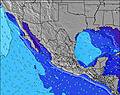 | 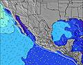 | 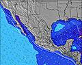 | 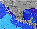 | ||||||||||||||
Wave Height (m) Direction Period (s) | SSW 14 | SSW 13 | SSW 13 | SSW 13 | SSW 13 | SSW 12 | S 14 | S 14 | SSW 13 | SW 18 | SSW 12 | SSW 12 | SW 17 | SW 17 | SW 17 | SW 16 | SW 16 | SW 15 | SW 15 | SW 14 | SW 13 |
Wave Graph | |||||||||||||||||||||
239 | 312 | 264 | 235 | 238 | 109 | 148 | 132 | 286 | 252 | 189 | 258 | 505 | 499 | 580 | 661 | 719 | 589 | 485 | 422 | 299 | |
Wind (km/h) | |||||||||||||||||||||
Wind State on-shore cross-onshore cross-shore cross-offshore off-shore glassy | glassy | cross-on | cross-off | glassy | cross-on | off | cross-off | cross-on | cross-off | glassy | cross-on | cross-off | glassy | cross-on | off | glassy | cross-on | cross-off | glassy | cross-on | cross-off |
High Tide | 3:07PM1.27m | 3:34AM1.00m | 4:01PM1.25m | 4:34AM1.07m | 4:53PM1.20m | 5:31AM1.13m | 5:44PM1.15m | 6:25AM1.16m | 6:32PM1.07m | 7:16AM1.17m | 7:19PM1.00m | 8:04AM1.15m | 8:06PM0.92m | ||||||||
Low Tide | 9:38PM0.06m | 9:37AM0.04m | 10:28PM0.02m | 10:38AM0.07m | 11:17PM0.00m | 11:37AM0.10m | 00:03AM-0.00m | 12:33PM0.15m | 00:48AM0.02m | 1:28PM0.19m | 1:31AM0.06m | 2:21PM0.23m | 2:13AM0.10m | ||||||||
6:03 | — | — | 6:03 | — | — | 6:03 | — | — | 6:03 | — | — | 6:03 | — | — | 6:03 | — | — | 6:05 | — | — | |
— | 7:00 | — | — | 7:00 | — | — | 7:00 | — | — | 7:00 | — | — | 7:00 | — | — | 7:00 | — | — | 7:00 | — | |
mm | — | 2 | 2 | — | 2 | 1 | — | — | 5 | — | — | 1 | — | — | — | — | — | — | — | — | 1 |
Temp °C | 31 | 31 | 28 | 30 | 30 | 27 | 31 | 31 | 28 | 30 | 30 | 28 | 31 | 30 | 27 | 30 | 31 | 27 | 31 | 31 | 27 |
Feels °C | 33 | 34 | 32 | 32 | 34 | 31 | 33 | 33 | 32 | 32 | 32 | 31 | 34 | 32 | 31 | 32 | 33 | 30 | 34 | 34 | 31 |
Swell 1 Height (m) Direction Period (s) | SSW 14 | SSW 13 | SSW 13 | SSW 13 | SSW 13 | SE 8 | SSW 12 | SSW 12 | SSW 13 | S 12 | SSW 12 | SSW 12 | S 13 | SW 17 | SW 17 | SW 16 | SW 16 | SW 15 | SW 15 | SW 14 | SW 13 |
239 | 312 | 246 | 235 | 238 | 71 | 106 | 109 | 286 | 199 | 189 | 258 | 350 | 499 | 580 | 661 | 719 | 589 | 485 | 422 | 299 | |
Swell 2 Height (m) Direction Period (s) | S 13 | SW 16 | SE 7 | SE 8 | SE 8 | E 6 | SE 8 | S 14 | SE 8 | SW 18 | ESE 9 | ESE 9 | SW 17 | SSW 11 | S 14 | S 12 | S 13 | S 13 | S 13 | S 13 | S 12 |
89 | 264 | 44 | 55 | 66 | 30 | 45 | 132 | 77 | 252 | 53 | 50 | 505 | 123 | 329 | 184 | 273 | 170 | 153 | 116 | 72 | |
Swell 3 Height (m) Direction Period (s) | S 7 | ESE 8 | SW 16 | SW 16 | SW 15 | SSW 12 | S 14 | SSE 9 | SW 13 | SE 7 | SW 16 | SW 16 | ESE 8 | S 13 | ESE 8 | W 11 | W 10 | W 10 | S 7 | S 8 | S 7 |
25 | 26 | 264 | 91 | 112 | 109 | 148 | 45 | 88 | 43 | 171 | 165 | 39 | 87 | 43 | 85 | 73 | 90 | 38 | 42 | 27 | |
Wind waves Height (m) Direction Period (s) | — | — | WSW 6 | — | E 7 | — | — | — | NNE 6 | — | — | W 3 | — | — | — | — | — | — | — | — | — |
— | — | 4 | — | 89 | — | — | — | 4 | — | — | 3 | — | — | — | — | — | — | — | — | — | |
Nearest Offshore or Glassy | |||||||||||||||||||||
Distance (km) | 0 | 766 | 0 | 0 | 1057 | 0 | 0 | 139 | 0 | 0 | 1087 | 0 | 0 | 139 | 0 | 0 | 164 | 0 | 0 | 1085 | 0 |
Best forecast wave conditions in Oaxaca | |||||||||||||||||||||
Best forecast wave conditions in Mexico | |||||||||||||||||||||
Header Global | |||||||||||||||||||||
- Map Icons:
 Break
Break Live Wave Height (m)
 Live Wind Speed (km/h)
 Surf Rating (10 Max)
 Ocean Swells (m)
- Wind Speed (km/h)


FREE! Surf-Forecast.com widget for your website
The surf report / weather widget below is available to embed on third party websites free of charge and provides a summary of our Topleca surf forecast. Simply grab the html code snippet that we provide and paste it into your own site. You can choose your preferred language and metric/imperial units for the surf forecast feed to suit users of your site. Click here to get the code.
Information about the Topleca Surf forecast
The above surf forecast table for Topleca provides essential information for determining whether the surfing conditions will be good over the next 16 days. A general guide to surfing at Topleca can be found by selecting the local surf guide option on the grey menu. Our Topleca surf forecast is unique since it includes wave energy (power) that defines the real feel of the surf rather than just the height or the period. If you surf the same spot (Topleca) regularly then make a mental note of the wave energy from the surf forecast table each time you go. Very soon you may start to choose your surf days based on the wave energy alone combined with our forecast of favourable offshore wind conditions. Our star ratings will help here and of course you will also find the usual wave height and period predictions on our surf forecasts as well as a full break down of the swell components under our advanced users option (to reveal that, click the little Einstein character under the tide times).
Further information to help with frequently asked questions about our surf forecast for Topleca may be found under the help tab on the top menu and also by moving your mouse over the question marks on the surf forecast table itself. Please always bear in mind that the forecast is for near-shore open water and local factors at each surf break influence the actual breaking wave height, such as the beach / reef profile, water depths offshore and shelter.
Are you planning a holiday in Oaxaca? If you are looking for accommodation near Topleca, camping, hotels and holiday cottages in Oaxaca, consider staying in Puerto Escondido which is 48 km (30 miles) away. Other places in and around Oaxaca where you can find information about places to rent, and car hire include Nopala which is 71 km (44 miles) away and Miahuatlan de Porfirio Diaz, 72 km (45 miles) away.
 Nearest