

Surf Forecasts:

The Core surf forecast from 3 Aug 2026:
- Best quality surf: Thursday 6 Aug, 8PM (local time) - 10ft (3.0m), 18s period, ENE swell with cross-onshore winds.
- Most powerful swell: Saturday 8 Aug, 11PM (local time) - 18ft (5.5m), 15s period, NE swell with 13,513 kJ wave energy.
- Next surfable swell (1★+): Monday 3 Aug, 11PM (local time) - 2.5ft (0.8m), 16s period with E swell.
Best Forecast Surf Conditions for The Core this week:
The surf forecast for The Core over the next 16 days: The first swell (rated 1 star or higher) is forecast to arrive on Monday (Aug 03) at 11PM. The primary swell is predicted to be 0.8m and 16s period with a secondary swell of 0.4m and 6s. The wind is predicted to be glassy as the swell arrives.
The most powerful waves expected at The Core in the next 16 days are 5.5m 15s and forecast to arrive on Saturday (Aug 08) at 11PM. Winds are predicted to be cross-offshore at the time the swell arrives. The largest open ocean swell (not directed at the beach) is 2.0m 12s period and expected on Monday (Aug 10) at 11PM.
| Wave Type | Time (CST) & Date | Wave Height & Period |
|---|---|---|
| Next good surf (1 star+) | 11PM (Mon 3rd Aug) | 2.5ft (0.8m) 16s |
| Best Surf | 8PM (Thu 6th Aug) | 10ft (3.0m) 18s |
| Most Powerful | 11PM (Sat 8th Aug) | 18ft (5.5m) 15s |
Table - best surf conditions forecast for The Core over the next 16 days.
The Lowdown
Alright, let me get a look at what’s on the table. I’ve got my eyes on a bit of a wait, but there’s some serious muscle coming.
Alright, so we’ve got a slow start at The Core. Nothing doing right now, just a bit of a flat spell. The first real chance doesn’t kick in until the morning of August 4th.
Tuesday the 4th, we’ll see some easterly swell start to trickle in. It’s small, around 4ft, but that’s a long period groundswell at 16 seconds, which is always a good sign for shape. The breeze is light cross-onshore though, so it’ll be a bit bumpy. As the day goes on, the swell builds a little to 4ft, still with that lovely 17-second period. The water here is sitting at a warm 84°, which is bang on average for this time of year.
Now, things get interesting from Wednesday the 5th into Thursday. The swell keeps climbing, and the wind turns light offshore or light onshore, so we’re looking at some clean lines. On Wednesday morning we’ve got 5ft, 17-second swell from the east with a light NE offshore wind – that’s a real nice combo. The energy is building too, hitting 1364 – moderate but moving in the right direction.
But the real standout is the afternoon of August 6th, Thursday. We get a 10ft swell from the east-northeast, with an 18-second period. That’s a proper long-period groundswell. The energy reading is massive, at 5139 – strong wave energy. Now, with a north wind at 12 mph it’s cross-onshore, so it’ll be a bit lumpy, but this is a serious amount of water. However, this is getting big – over 8ft – so this is strictly for experienced surfers only. The Core is an exposed break and with that long period, it’ll reel off nicely, but it’s going to be a handful.
Friday the 7th and Saturday the 8th keep the size going, with 10ft to 15ft on the cards, but the wind is moderate to fresh cross-shore, which will make it choppy and challenging. The energy numbers are through the roof, hitting over 9000 and then 12454 – that’s very strong wave energy. For a beginner spot like The Core, this is way too much.
We do get a moment of pure magic on Monday the 10th. Early morning, glassy conditions with a light southerly wind and a 13ft swell from the north-northeast. That’s a big, clean groundswell. But again, that’s only for the brave. The afternoon sees it drop to 10ft and the glassy conditions are gone.
After that, it dies off fast. From Tuesday the 11th right through to the 18th, we’re looking at tiny, weak surf. Most days are showing poor conditions or just flat, with swell under 3ft and energy readings below 300. There’s a small window on the afternoon of the 12th with glassy conditions and 2ft, and again on the 18th, but it’s barely surfable.
So, the best of the bunch, the real standout? The Core on Wednesday morning, August 5th. That 5ft east swell with the 17-second period and light offshore wind is as good as it gets for this spot in this window. It’s clean, it’s got power, and it’s not too crazy. Remember though, The Core is an inconsistent spot, so when it does line up like this, it’s worth making the call to go.
Stay safe out there.
Rusty
Short Range ForecastMostly dry. Warm (max 34°C on Thu afternoon, min 26°C on Mon night). Wind will be generally light. | Days 5-7 Weather SummaryMostly dry. Warm (max 35°C on Fri afternoon, min 27°C on Thu night). Winds increasing (light winds from the NW on Thu night, fresh winds from the NW by Sat morning). | ||||||||||||||||||
Tuesday 4 | Wednesday 5 | Thursday 6 | Friday 7 | Saturday 8 | Sunday 9 | ||||||||||||||
Night | AM | PM | Night | AM | PM | Night | AM | PM | Night | AM | PM | Night | AM | PM | Night | AM | PM | Night | |
Swell Height Map | 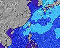 | 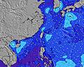 | 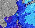 | 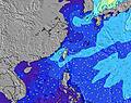 | 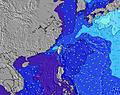 | 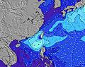 | 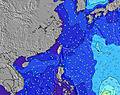 | ||||||||||||
Wave Height (m) Direction Period (s) | E 16 | E 16 | E 17 | E 17 | E 17 | E 17 | E 18 | E 18 | E 18 | ENE 18 | ENE 18 | NE 16 | ENE 16 | NE 16 | NE 16 | NE 16 | NE 15 | NNE 15 | NNE 15 |
Wave Graph | |||||||||||||||||||
412 | 646 | 1003 | 1116 | 1326 | 1266 | 2426 | 4299 | 4160 | 5922 | 7140 | 7795 | 10265 | 13104 | 11932 | 13270 | 11529 | 12746 | 8169 | |
Wind (km/h) | |||||||||||||||||||
Wind State on-shore cross-onshore cross-shore cross-offshore off-shore glassy | glassy | cross-on | cross-on | cross-off | on | on | cross-off | cross-on | cross-on | cross | cross | cross | cross-off | cross | cross-off | cross-off | cross-off | cross-off | cross-off |
High Tide | 9:24PM1.31m | 9:29AM1.22m | 9:56PM1.32m | 10:30AM1.09m | 10:35PM1.33m | 11:59AM0.98m | 11:26PM1.33m | 2:16PM0.95m | 00:36AM1.33m | 4:13PM1.03m | 1:59AM1.37m | 5:11PM1.11m | 3:16AM1.45m | ||||||
Low Tide | 3:31AM0.52m | 3:33PM0.50m | 4:27AM0.50m | 4:06PM0.63m | 5:39AM0.47m | 4:46PM0.76m | 7:09AM0.42m | 5:51PM0.88m | 8:41AM0.32m | 7:43PM0.95m | 9:53AM0.19m | 9:21PM0.93m | |||||||
— | 5:20 | — | — | 5:22 | — | — | 5:22 | — | — | 5:22 | — | — | 5:22 | — | — | 5:22 | — | — | |
6:36 | — | 6:35 | — | — | 6:35 | — | — | 6:34 | — | — | 6:32 | — | — | 6:32 | — | — | 6:31 | — | |
mm | — | — | — | — | — | — | — | — | — | — | — | — | — | — | — | — | — | — | — |
Temp °C | 27 | 31 | 31 | 27 | 32 | 32 | 28 | 33 | 34 | 29 | 33 | 35 | 31 | 34 | 32 | 30 | 32 | 33 | 32 |
Feels °C | 32 | 34 | 34 | 33 | 34 | 34 | 33 | 35 | 35 | 32 | 30 | 32 | 32 | 31 | 30 | 30 | 30 | 31 | 33 |
Swell 1 Height (m) Direction Period (s) | E 16 | E 16 | E 17 | E 17 | E 17 | E 17 | E 18 | E 18 | E 18 | ENE 18 | ENE 18 | NE 16 | ENE 16 | NE 16 | NE 16 | NE 16 | NE 15 | NNE 15 | NNE 15 |
412 | 646 | 1003 | 1116 | 1326 | 1266 | 2426 | 4299 | 4160 | 5922 | 7140 | 7795 | 10265 | 13104 | 11932 | 13270 | 11529 | 12746 | 8169 | |
Swell 2 Height (m) Direction Period (s) | SE 6 | SE 8 | ESE 6 | SE 8 | SE 7 | SSE 7 | SSE 8 | SSE 8 | SSE 9 | SSE 8 | SSE 8 | SSW 8 | — | S 9 | S 9 | S 10 | S 11 | S 11 | S 11 |
9 | 11 | 10 | 31 | 25 | 19 | 26 | 22 | 26 | 24 | 13 | 19 | — | 59 | 62 | 100 | 244 | 295 | 348 | |
Swell 3 Height (m) Direction Period (s) | SSE 7 | ESE 8 | SSE 8 | SE 10 | SE 10 | SE 10 | SSE 8 | — | — | — | — | — | — | — | — | — | — | — | — |
5 | 7 | 7 | 4 | 4 | 4 | 22 | — | — | — | — | — | — | — | — | — | — | — | — | |
Wind waves Height (m) Direction Period (s) | — | — | — | — | NNE 5 | NE 4 | NNE 5 | NNW 4 | N 5 | NNW 5 | WNW 5 | — | NW 4 | — | NW 5 | WNW 6 | WNW 6 | — | WNW 4 |
— | — | — | — | 13 | 13 | 11 | 16 | 92 | 59 | 27 | — | 36 | — | 119 | 126 | 202 | — | 36 | |
Nearest Offshore or Glassy | |||||||||||||||||||
Distance (km) | 329 | 0 | 645 | 329 | 0 | 287 | 20 | 20 | 329 | 183 | 6 | 548 | 66 | 183 | 281 | 183 | 183 | 281 | 16 |
Best forecast wave conditions in North Taiwan | |||||||||||||||||||
Best forecast wave conditions in Taiwan | |||||||||||||||||||
Header Global | |||||||||||||||||||
- Map Icons:
 Break
Break Live Wave Height (m)
 Live Wind Speed (km/h)
 Surf Rating (10 Max)
 Ocean Swells (m)
- Wind Speed (km/h)
Latest Updates


FREE! Surf-Forecast.com widget for your website
The surf report / weather widget below is available to embed on third party websites free of charge and provides a summary of our The Core surf forecast. Simply grab the html code snippet that we provide and paste it into your own site. You can choose your preferred language and metric/imperial units for the surf forecast feed to suit users of your site. Click here to get the code.
Information about the The Core Surf forecast
The above surf forecast table for The Core provides essential information for determining whether the surfing conditions will be good over the next 16 days. A general guide to surfing at The Core can be found by selecting the local surf guide option on the grey menu. Our The Core surf forecast is unique since it includes wave energy (power) that defines the real feel of the surf rather than just the height or the period. If you surf the same spot (The Core) regularly then make a mental note of the wave energy from the surf forecast table each time you go. Very soon you may start to choose your surf days based on the wave energy alone combined with our forecast of favourable offshore wind conditions. Our star ratings will help here and of course you will also find the usual wave height and period predictions on our surf forecasts as well as a full break down of the swell components under our advanced users option (to reveal that, click the little Einstein character under the tide times).
Further information to help with frequently asked questions about our surf forecast for The Core may be found under the help tab on the top menu and also by moving your mouse over the question marks on the surf forecast table itself. Please always bear in mind that the forecast is for near-shore open water and local factors at each surf break influence the actual breaking wave height, such as the beach / reef profile, water depths offshore and shelter.
Are you planning a holiday in North Taiwan? If you are looking for accommodation near The Core, camping, hotels and holiday cottages in North Taiwan, consider staying in I-lan which is 6 km (4 miles) away. Other places in and around North Taiwan where you can find information about places to rent, and car hire include Gueishan which is 31 km (19 miles) away, Sindian, Sijhih and Jhonghe.
 Nearest