

Surf Forecasts:

How big are the waves at Teavapiti today (02 Aug):
- Morning surf: Morning surf (02 Aug, local time) - 3.5ft (1.1m), 15s period with SSW swell.
- Afternoon surf: Afternoon surf (02 Aug, local time) - 4ft (1.2m), 15s period with SSW swell.
- Evening surf: Evening surf (02 Aug, local time) - 4ft (1.2m), 14s period with SSW swell.
The current surf forecast for Teavapiti at 6PM is: 1.2m 14s primary swell from a South-southwest direction and 1.0m 10s secondary swell from a South-southeast direction (forecast issued at 01:00pm August 02). The wind direction is predicted to be cross-shore.
| Time (-10) & Date | Wave Height | Wave Period |
|---|---|---|
| Morning (02 Aug) | 3.5ft (1.1m) | 15s |
| Afternoon (02 Aug) | 4ft (1.2m) | 15s |
| Evening (02 Aug) | 4ft (1.2m) | 14s |
Table - waves today at Teavapiti. (Swell directed towards the surf break)
Short Range ForecastMostly dry. Warm (max 26°C on Tue morning, min 24°C on Sun night). Wind will be generally light. | |||||||||||||||||||||
Sun 2 | Monday 3 | Tuesday 4 | |||||||||||||||||||
11 AM | 2 PM | 5 PM | 8 PM | 11 PM | 2 AM | 5 AM | 8 AM | 11 AM | 2 PM | 5 PM | 8 PM | 11 PM | 2 AM | 5 AM | 8 AM | 11 AM | 2 PM | 5 PM | 8 PM | 11 PM | |
Swell Height Map |  |  |  |  |  |  |  | 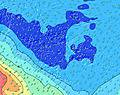 | |||||||||||||
Wave Height (m) Direction Period (s) | SSW 15 | SSW 15 | SSW 14 | SSW 14 | SSW 14 | SSW 13 | SSW 13 | SSW 13 | SSW 13 | SSW 13 | SW 14 | SSW 14 | SSW 13 | SSW 13 | SSW 13 | SSW 16 | SSW 13 | SSW 14 | SSW 14 | SSW 14 | SSW 14 |
Wave Graph | |||||||||||||||||||||
530 | 610 | 602 | 494 | 519 | 408 | 396 | 289 | 303 | 303 | 206 | 213 | 158 | 282 | 151 | 223 | 225 | 437 | 647 | 638 | 578 | |
Wind (km/h) | |||||||||||||||||||||
Wind State on-shore cross-onshore cross-shore cross-offshore off-shore glassy | cross-on | cross-on | cross | cross | cross-on | cross-on | cross-on | cross-on | cross-on | cross-on | cross-on | cross-on | on | on | on | on | on | on | glassy | cross-on | cross-on |
High Tide | 2:00PM0.23m | 1:52AM0.21m | 2:16PM0.22m | 2:03AM0.21m | 2:30PM0.20m | ||||||||||||||||
Low Tide | 8:13PM0.05m | 8:11AM0.03m | 8:21PM0.07m | 8:26AM0.04m | 8:20PM0.08m | ||||||||||||||||
— | — | — | — | — | — | 6:30 | — | — | — | — | — | — | — | 6:28 | — | — | — | — | — | — | |
— | — | 5:52 | — | — | — | — | — | — | — | 5:52 | — | — | — | — | — | — | — | 5:53 | — | — | |
mm | — | — | — | — | — | — | — | — | — | — | — | — | — | — | — | — | — | — | — | — | — |
Temp °C | 24 | 25 | 25 | 25 | 24 | 24 | 24 | 24 | 25 | 25 | 25 | 25 | 25 | 25 | 25 | 26 | 26 | 25 | 25 | 25 | 25 |
Feels °C | 24 | 26 | 25 | 25 | 24 | 24 | 24 | 23 | 25 | 25 | 25 | 25 | 24 | 25 | 26 | 26 | 27 | 26 | 27 | 26 | 27 |
Swell 1 Height (m) Direction Period (s) | SSE 10 | SSW 15 | SSW 14 | SSW 14 | SSW 14 | SSW 13 | SSW 13 | SSW 13 | SSW 13 | SSW 13 | SW 14 | SSW 14 | SSW 13 | SSW 13 | SSW 13 | SSW 16 | SSW 13 | SSW 14 | SSW 14 | SSW 14 | SSW 14 |
294 | 610 | 602 | 494 | 519 | 408 | 396 | 289 | 303 | 303 | 206 | 213 | 158 | 282 | 151 | 223 | 225 | 437 | 647 | 638 | 578 | |
Swell 2 Height (m) Direction Period (s) | SSW 15 | SSE 10 | SSE 10 | SSE 10 | SSE 10 | SSE 10 | SSE 9 | SSE 9 | SSE 9 | SSE 8 | SSE 8 | SSE 8 | SSE 8 | SE 7 | SE 7 | S 13 | SSW 16 | ESE 7 | ESE 7 | E 8 | ESE 8 |
530 | 250 | 209 | 218 | 166 | 163 | 124 | 113 | 90 | 75 | 55 | 55 | 39 | 18 | 25 | 119 | 171 | 67 | 69 | 72 | 62 | |
Swell 3 Height (m) Direction Period (s) | ENE 7 | ENE 7 | ENE 7 | S 18 | S 18 | S 18 | S 17 | S 16 | S 16 | S 15 | S 14 | S 14 | S 13 | NE 12 | S 13 | ENE 7 | SE 7 | S 12 | NE 11 | SSW 23 | NE 6 |
43 | 31 | 31 | 229 | 226 | 216 | 195 | 243 | 174 | 110 | 199 | 96 | 85 | 23 | 53 | 26 | 26 | 25 | 19 | 51 | 15 | |
Wind waves Height (m) Direction Period (s) | — | — | — | — | ENE 7 | ENE 7 | ENE 8 | — | — | — | — | ENE 7 | ENE 6 | ENE 7 | ENE 7 | — | — | — | — | — | — |
— | — | — | — | 31 | 31 | 44 | — | — | — | — | 31 | 16 | 36 | 37 | — | — | — | — | — | — | |
Nearest Offshore or Glassy | |||||||||||||||||||||
Distance (km) | 8 | 8 | 41 | 41 | 8 | 8 | 8 | 8 | 8 | 8 | 8 | 8 | 12 | 12 | 8 | 8 | 8 | 8 | 0 | 8 | 8 |
Best forecast wave conditions in Raiatea | |||||||||||||||||||||
Best forecast wave conditions in French Polynesia | |||||||||||||||||||||
Header Global | |||||||||||||||||||||
- Map Icons:
 Break
Break Live Wave Height (m)
 Live Wind Speed (km/h)
 Surf Rating (10 Max)
 Ocean Swells (m)
- Wind Speed (km/h)
Latest Updates


FREE! Surf-Forecast.com widget for your website
The surf report / weather widget below is available to embed on third party websites free of charge and provides a summary of our Teavapiti surf forecast. Simply grab the html code snippet that we provide and paste it into your own site. You can choose your preferred language and metric/imperial units for the surf forecast feed to suit users of your site. Click here to get the code.
 Nearest