

Surf Forecasts:

How big are the waves at Shipwrecks today (03 Aug):
- Morning surf: Morning surf (03 Aug, local time) - 10ft (3.0m), 12s period with S swell.
- Afternoon surf: Afternoon surf (03 Aug, local time) - 10ft (3.0m), 12s period with SSE swell.
- Evening surf: Evening surf (03 Aug, local time) - 10ft (3.0m), 11s period with SSE swell.
The current surf forecast for Shipwrecks at 4PM is: 3.0m 12s primary swell from a South-southeast direction and 0.4m 22s secondary swell from a South-southwest direction, 0.2m 18s secondary swell from a South-southwest direction (forecast issued at 10:00am August 03). The wind direction is predicted to be cross-offshore and the swell rating is 11.
| Time (+11) & Date | Wave Height | Wave Period |
|---|---|---|
| Morning (03 Aug) | 10ft (3.0m) | 12s |
| Afternoon (03 Aug) | 10ft (3.0m) | 12s |
| Evening (03 Aug) | 10ft (3.0m) | 11s |
Table - waves today at Shipwrecks. (Swell directed towards the surf break)
Short Range ForecastMostly dry. Warm (max 21°C on Mon morning, min 18°C on Tue night). Winds decreasing (strong winds from the SE on Mon afternoon, light winds from the E by Tue night). | ||||||||||||||||||||||
Monday 3 | Tuesday 4 | Wednesday 5 | ||||||||||||||||||||
8 AM | 11 AM | 2 PM | 5 PM | 8 PM | 11 PM | 2 AM | 5 AM | 8 AM | 11 AM | 2 PM | 5 PM | 8 PM | 11 PM | 2 AM | 5 AM | 8 AM | 11 AM | 2 PM | 5 PM | 8 PM | 11 PM | |
Swell Height Map |  | 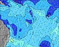 | 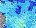 | 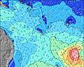 | 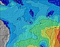 | 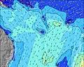 |  | 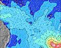 | ||||||||||||||
Wave Height (m) Direction Period (s) | S 13 | S 12 | SSE 12 | SSE 12 | SSE 11 | SSE 10 | SSE 10 | SSW 20 | SSW 19 | SE 10 | SSW 18 | SSW 18 | SE 10 | SSW 17 | SSW 16 | SE 9 | SSW 16 | SSW 16 | SSW 16 | SE 8 | SE 8 | SE 8 |
Wave Graph | ||||||||||||||||||||||
2522 | 2277 | 2315 | 2053 | 1814 | 1429 | 1275 | 746 | 838 | 865 | 803 | 751 | 734 | 717 | 667 | 516 | 493 | 487 | 475 | 446 | 418 | 350 | |
Wind (km/h) | ||||||||||||||||||||||
Wind State on-shore cross-onshore cross-shore cross-offshore off-shore glassy | cross-off | cross-off | cross-off | cross-off | cross-off | cross-off | cross-off | cross-off | cross-off | cross-off | cross-off | cross-off | off | cross-off | off | off | off | cross-off | cross-off | cross-off | off | off |
High Tide | 10:45AM1.08m | 11:06PM1.29m | 11:31AM1.06m | 11:39PM1.23m | 12:25PM1.04m | |||||||||||||||||
Low Tide | 4:43PM0.26m | 5:34AM0.26m | 5:24PM0.35m | 6:14AM0.26m | 6:12PM0.46m | |||||||||||||||||
6:28 | — | — | — | — | — | — | 6:28 | — | — | — | — | — | — | — | 6:26 | — | — | — | — | — | — | |
— | — | — | 5:37 | — | — | — | — | — | — | — | 5:37 | — | — | — | — | — | — | — | 5:37 | — | — | |
mm | — | — | — | — | — | — | — | — | — | — | — | — | — | — | — | — | — | — | — | — | — | — |
Temp °C | 19 | 21 | 21 | 20 | 19 | 19 | 19 | 19 | 19 | 20 | 20 | 21 | 20 | 19 | 18 | 18 | 18 | 19 | 20 | 21 | 20 | 19 |
Feels °C | 13 | 15 | 15 | 13 | 13 | 14 | 14 | 13 | 14 | 15 | 14 | 15 | 17 | 16 | 16 | 16 | 16 | 17 | 17 | 18 | 17 | 17 |
Swell 1 Height (m) Direction Period (s) | S 13 | S 12 | S 12 | SSW 22 | SSW 21 | SSW 21 | SSW 21 | S 10 | S 10 | SE 10 | SSW 18 | SSW 18 | SE 10 | SE 9 | SE 9 | SE 8 | SSE 9 | SSE 8 | SE 8 | SE 8 | SE 8 | SE 8 |
2522 | 2277 | 1870 | 190 | 397 | 502 | 666 | 489 | 308 | 612 | 803 | 751 | 441 | 321 | 300 | 262 | 247 | 224 | 187 | 226 | 241 | 186 | |
Swell 2 Height (m) Direction Period (s) | SE 11 | SE 16 | SE 14 | SSW 18 | SSW 21 | SE 14 | SE 14 | SSW 20 | SSW 19 | SSW 19 | S 10 | S 10 | SSW 17 | SSW 17 | SSW 16 | SSW 16 | SSW 16 | SSW 16 | SSW 16 | SSW 15 | SSW 15 | SSW 15 |
46 | 38 | 54 | 32 | 393 | 31 | 30 | 746 | 838 | 848 | 161 | 122 | 734 | 717 | 667 | 499 | 493 | 487 | 475 | 445 | 339 | 305 | |
Swell 3 Height (m) Direction Period (s) | SW 24 | SSW 18 | SSW 18 | SSW 18 | SSE 14 | SE 14 | SE 14 | — | SSW 19 | S 11 | SE 10 | SE 14 | S 10 | S 9 | S 9 | SSW 9 | S 8 | SSE 13 | SE 12 | SE 12 | SE 12 | S 10 |
22 | 31 | 62 | 31 | 20 | 8 | 32 | — | 758 | 229 | 192 | 7 | 68 | 43 | 41 | 28 | 34 | 16 | 6 | 6 | 6 | 2 | |
Wind waves Height (m) Direction Period (s) | SE 13 | — | SSE 12 | SSE 12 | SSE 11 | SSE 10 | SSE 10 | SE 9 | SE 9 | SE 10 | SE 10 | SE 10 | SE 10 | SE 9 | SE 9 | SE 9 | SE 8 | — | SE 8 | SE 8 | SE 8 | SE 8 |
104 | — | 2315 | 2053 | 1814 | 1429 | 1275 | 552 | 587 | 865 | 480 | 507 | 712 | 577 | 540 | 516 | 433 | — | 344 | 446 | 418 | 350 | |
Nearest Offshore or Glassy | ||||||||||||||||||||||
Distance (km) | 1374 | 1369 | 1353 | 1353 | 1375 | 44 | 44 | 1278 | 45 | 1353 | 1353 | 1278 | 0 | 6 | 0 | 0 | 0 | 0 | 44 | 42 | 0 | 0 |
Best forecast wave conditions in New Caledonia | ||||||||||||||||||||||
Best forecast wave conditions in New Caledonia | ||||||||||||||||||||||
Header Global | ||||||||||||||||||||||
- Map Icons:
 Break
Break Live Wave Height (m)
 Live Wind Speed (km/h)
 Surf Rating (10 Max)
 Ocean Swells (m)
- Wind Speed (km/h)
Latest Updates


FREE! Surf-Forecast.com widget for your website
The surf report / weather widget below is available to embed on third party websites free of charge and provides a summary of our Shipwrecks surf forecast. Simply grab the html code snippet that we provide and paste it into your own site. You can choose your preferred language and metric/imperial units for the surf forecast feed to suit users of your site. Click here to get the code.
 Nearest