

Surf Forecasts:

Propellers surf forecast from 14 Jul 2026:
- Best quality surf: Friday 17 Jul, 12PM (local time) - 6.5ft (2.0m), 14s period, S swell with cross-offshore winds.
- Most powerful swell: Saturday 18 Jul, 9PM (local time) - 4.5ft (1.4m), 23s period, S swell with 2,003 kJ wave energy.
- Next surfable swell (1★+): Friday 17 Jul, 6AM (local time) - 3.5ft (1.1m), 11s period with S swell.
Best Forecast Surf Conditions for Propellers this week:
The surf forecast for Propellers over the next 16 days: The first swell (rated 1 star or higher) is forecast to arrive on Friday (Jul 17) at 6AM. The primary swell is predicted to be 1.1m and 11s period with a secondary swell of 0.7m and 14s. The wind is predicted to be glassy as the swell arrives.
The most powerful waves expected at Propellers in the next 16 days are 1.4m 23s and forecast to arrive on Saturday (Jul 18) at 9PM. Winds are predicted to be cross-onshore at the time the swell arrives. The largest open ocean swell (not directed at the beach) is 1.8m 6s period and expected on Thursday (Jul 16) at 3AM.
| Wave Type | Time (NZST) & Date | Wave Height & Period |
|---|---|---|
| Next good surf (1 star+) | 6AM (Fri 17th Jul) | 3.5ft (1.1m) 11s |
| Best Surf | 12PM (Fri 17th Jul) | 6.5ft (2.0m) 14s |
| Most Powerful | 9PM (Sat 18th Jul) | 4.5ft (1.4m) 23s |
Table - best surf conditions forecast for Propellers over the next 16 days.
The Lowdown
Alright, let’s look at what’s cooking for Propellers. This is a reef break, and it’s only for the advanced crew because it’s inconsistent. The water temp is about what you’d expect for this time of year.
Right now, the start of the week is a total dud. Wednesday the 15th through Thursday the 16th, you’ve got a measly 0.6ft of SSW slop. The wind is ripping offshore, but with that size, it’s just a waste of time. The wave energy is pathetic, around 24-27 (combined energy). Don’t even bother.
We finally get a pulse on Friday the 17th. The swell jumps to 6ft from the SSW, with a 14-second period. That’s real groundswell, and you can feel it in the 1363 (combined energy) reading. The morning is a bit off with a cross-shore wind, but the afternoon cleans up with a light cross-offshore breeze. The surf is solid, but at 6ft on a reef, this is for experienced surfers only. It’s a decent call, but the wind is better the next day.
Saturday the 18th is the one to circle. The swell drops to 4ft in the morning from the S, but it’s the afternoon that’s pure magic. The wind goes glassy, dead calm, and the swell settles to 2ft with a very long 23-second period. The energy is moderate at 500 (combined energy). That long period will make the waves at Propellers peel off perfectly. The crowd factor is “sometimes,” so you might have a few others, but it’s worth it for the glassy perfection.
Sunday the 19th is a mess with onshore wind, and Monday the 20th is a tricky one. The morning has 6ft of S swell at 14 seconds and glassy conditions, which is excellent for the experienced crew, but the wind turns onshore in the afternoon. Get out there at dawn.
After that, it’s a slow fade. From Tuesday the 21st, the swell drops and the energy goes flat. There’s a late possibility on Monday the 30th, where a 8ft SSW swell shows up with an 11-second period. That’s big, over 8ft, so it’s for experts only. The wind is a clean cross-offshore, and the energy is pumping at 1387 (combined energy). But that’s way off, so don’t bank on it yet.
So, the best bet is Saturday afternoon, the 18th. Glassy, long period, and clean. The backup is Friday afternoon, the 17th, and the early morning of Monday the 20th. The rest is a long, flat stretch.
Rusty.
Short Range ForecastMostly dry. Very mild (max 14°C on Wed afternoon, min 10°C on Thu night). Winds decreasing (strong winds from the NW on Wed night, calm by Thu night). | Days 5-7 Weather SummaryMostly dry. Very mild (max 11°C on Sat morning, min 9°C on Fri night). Mainly fresh winds. | ||||||||||||||||||||
Wednesday 15 | Thursday 16 | Friday 17 | Saturday 18 | Sunday 19 | Monday 20 | Tue 21 | |||||||||||||||
Night | AM | PM | Night | AM | PM | Night | AM | PM | Night | AM | PM | Night | AM | PM | Night | AM | PM | Night | AM | PM | |
Swell Height Map |  |  |  |  |  |  |  | 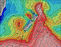 | |||||||||||||
Wave Height (m) Direction Period (s) | S 18 | SSW 16 | SSW 16 | SSW 15 | SSW 15 | SSW 15 | S 7 | SSW 14 | SSW 12 | S 10 | S 9 | S 23 | SSW 22 | SSW 17 | SSW 16 | S 15 | S 14 | S 13 | S 13 | S 12 | S 12 |
Wave Graph | |||||||||||||||||||||
6 | 26 | 24 | 22 | 23 | 22 | 16 | 1363 | 1025 | 432 | 202 | 384 | 1858 | 1057 | 871 | 847 | 1063 | 915 | 771 | 505 | 339 | |
Wind (km/h) | |||||||||||||||||||||
Wind State on-shore cross-onshore cross-shore cross-offshore off-shore glassy | off | off | off | off | off | off | glassy | cross | cross-off | cross-off | cross-off | glassy | cross-on | on | on | cross-on | glassy | cross-on | cross-off | cross-off | cross-off |
High Tide | 5:00AM1.65m | 5:20PM1.84m | 5:59AM1.65m | 6:20PM1.81m | 6:57AM1.65m | 7:19PM1.77m | 7:54AM1.65m | 8:17PM1.73m | 8:48AM1.66m | 9:14PM1.69m | 9:40AM1.66m | 10:08PM1.66m | 10:31AM1.66m | ||||||||
Low Tide | 10:48PM0.52m | 11:06AM0.48m | 11:52PM0.50m | 12:05PM0.45m | 00:53AM0.49m | 1:04PM0.44m | 1:50AM0.49m | 2:02PM0.46m | 2:44AM0.51m | 3:01PM0.49m | 3:37AM0.53m | 3:59PM0.54m | 4:27AM0.57m | 4:53PM0.58m | |||||||
— | 7:43 | — | — | 7:41 | — | — | 7:41 | — | — | 7:41 | — | — | 7:39 | — | — | 7:39 | — | — | 7:39 | — | |
— | — | 5:09 | — | — | 5:10 | — | — | 5:12 | — | — | 5:12 | — | — | 5:13 | — | — | 5:14 | — | — | 5:15 | |
mm | — | — | — | — | — | — | — | — | — | — | — | — | — | — | — | — | — | — | — | — | — |
Temp °C | 13 | 13 | 14 | 14 | 14 | 14 | 12 | 11 | 12 | 10 | 11 | 11 | 10 | 10 | 10 | 9 | 9 | 9 | 8 | 8 | 8 |
Feels °C | 6 | 7 | 8 | 7 | 9 | 11 | 10 | 9 | 9 | 7 | 6 | 9 | 5 | 6 | 5 | 5 | 7 | 7 | 6 | 3 | 4 |
Swell 1 Height (m) Direction Period (s) | E 13 | SSW 16 | SSW 16 | SSW 15 | ESE 14 | ESE 16 | ESE 16 | SSW 14 | SSW 12 | S 10 | S 9 | ESE 14 | SSW 22 | SSW 17 | SSW 16 | S 15 | S 14 | S 13 | S 13 | S 12 | S 12 |
14 | 26 | 24 | 22 | 19 | 52 | 147 | 1363 | 1025 | 432 | 202 | 342 | 1858 | 1057 | 871 | 847 | 1063 | 915 | 771 | 505 | 339 | |
Swell 2 Height (m) Direction Period (s) | S 8 | E 12 | ESE 12 | ESE 13 | SSW 15 | SSW 15 | S 7 | ESE 16 | ESE 16 | ESE 15 | ESE 14 | S 8 | SE 13 | SE 13 | SE 13 | ESE 12 | SE 12 | ESE 12 | SE 11 | SE 11 | SE 11 |
1 | 11 | 14 | 17 | 23 | 22 | 16 | 284 | 318 | 393 | 362 | 116 | 261 | 175 | 170 | 101 | 71 | 56 | 33 | 31 | 31 | |
Swell 3 Height (m) Direction Period (s) | S 18 | S 8 | NW 16 | ESE 14 | E 10 | SW 9 | NW 6 | — | — | — | S 24 | S 23 | S 22 | SSW 22 | — | S 19 | — | — | ESE 12 | — | — |
6 | 1 | 10 | 36 | 8 | 3 | 8 | — | — | — | 11 | 384 | 987 | 154 | — | 262 | — | — | 13 | — | — | |
Wind waves Height (m) Direction Period (s) | NNW 6 | NW 5 | NNW 5 | NW 5 | NW 6 | NW 6 | — | — | — | NNW 3 | NW 4 | — | — | — | — | E 3 | — | — | — | NNW 3 | NNW 4 |
188 | 49 | 88 | 154 | 209 | 34 | — | — | — | 3 | 8 | — | — | — | — | 1 | — | — | — | 5 | 15 | |
Nearest Offshore or Glassy | |||||||||||||||||||||
Distance (km) | 106 | 51 | 77 | 106 | 77 | 2 | 1 | 2 | 0 | 2 | 35 | 0 | 60 | 29 | 60 | 29 | 0 | 29 | 0 | 2 | 2 |
Best forecast wave conditions in Wellington | |||||||||||||||||||||
Best forecast wave conditions in New Zealand | |||||||||||||||||||||
Header Global | |||||||||||||||||||||
- Map Icons:
 Break
Break Live Wave Height (m)
 Live Wind Speed (km/h)
 Surf Rating (10 Max)
 Ocean Swells (m)
- Wind Speed (km/h)


FREE! Surf-Forecast.com widget for your website
The surf report / weather widget below is available to embed on third party websites free of charge and provides a summary of our Propellers surf forecast. Simply grab the html code snippet that we provide and paste it into your own site. You can choose your preferred language and metric/imperial units for the surf forecast feed to suit users of your site. Click here to get the code.
Information about the Propellers Surf forecast
The above surf forecast table for Propellers provides essential information for determining whether the surfing conditions will be good over the next 16 days. A general guide to surfing at Propellers can be found by selecting the local surf guide option on the grey menu. Our Propellers surf forecast is unique since it includes wave energy (power) that defines the real feel of the surf rather than just the height or the period. If you surf the same spot (Propellers) regularly then make a mental note of the wave energy from the surf forecast table each time you go. Very soon you may start to choose your surf days based on the wave energy alone combined with our forecast of favourable offshore wind conditions. Our star ratings will help here and of course you will also find the usual wave height and period predictions on our surf forecasts as well as a full break down of the swell components under our advanced users option (to reveal that, click the little Einstein character under the tide times).
Further information to help with frequently asked questions about our surf forecast for Propellers may be found under the help tab on the top menu and also by moving your mouse over the question marks on the surf forecast table itself. Please always bear in mind that the forecast is for near-shore open water and local factors at each surf break influence the actual breaking wave height, such as the beach / reef profile, water depths offshore and shelter.
Propellers is 8 km (5 miles) from the city of Wellington. If you plan a holiday in Wellington, look for hotels and other accommodation in Wellington. Wellington has rooms for a wide range of budgets as well as car hire and transport links.
 Nearest