

Surf Forecasts:

How big are the waves at Chicama - Malpaso today (19 Jun):
- Morning surf: Morning surf (19 Jun, local time) - 3ft (0.9m), 16s period with SW swell.
- Afternoon surf: Afternoon surf (19 Jun, local time) - 3ft (0.9m), 15s period with SW swell.
- Evening surf: Evening surf (19 Jun, local time) - 3ft (0.9m), 15s period with SW swell.
The current surf forecast for Chicama - Malpaso at 5PM is: 0.9m 15s primary swell from a Southwest direction and 0.5m 9s secondary swell from a Southwest direction (forecast issued at 12:00pm June 19). An open ocean swell of 1.0m 6s is not directed at the surf break. The wind direction is predicted to be offshore.
| Time (-05) & Date | Wave Height | Wave Period |
|---|---|---|
| Morning (19 Jun) | 3ft (0.9m) | 16s |
| Afternoon (19 Jun) | 3ft (0.9m) | 15s |
| Evening (19 Jun) | 3ft (0.9m) | 15s |
Table - waves today at Chicama - Malpaso. (Swell directed towards the surf break)
Updates in hr min s Forecast update imminent
Short Range ForecastMostly dry. Warm (max 23°C on Fri morning, min 20°C on Fri night). Wind will be generally light. | ||||||||||||||||||||||||
Fri 19 | Saturday 20 | Sunday 21 | Mon 22 | |||||||||||||||||||||
10 AM | 1 PM | 4 PM | 7 PM | 10 PM | 1 AM | 4 AM | 7 AM | 10 AM | 1 PM | 4 PM | 7 PM | 10 PM | 1 AM | 4 AM | 7 AM | 10 AM | 1 PM | 4 PM | 7 PM | 10 PM | 1 AM | 4 AM | 7 AM | |
Swell Height Map | 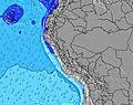 | 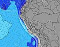 | 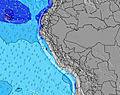 | 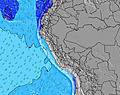 | 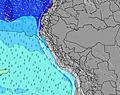 | 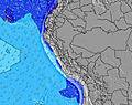 | 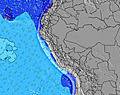 | 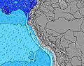 | 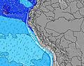 | |||||||||||||||
Wave Height (m) Direction Period (s) | SW 16 | SW 16 | SW 15 | SW 15 | SW 14 | SW 14 | SW 14 | WSW 14 | SW 14 | SW 14 | SW 13 | SW 18 | SW 18 | SW 18 | SW 18 | S 8 | S 8 | SW 16 | SW 16 | SW 20 | SW 20 | SW 20 | SW 19 | SW 19 |
Wave Graph | ||||||||||||||||||||||||
362 | 353 | 322 | 309 | 305 | 305 | 301 | 264 | 203 | 189 | 183 | 155 | 155 | 154 | 150 | 140 | 135 | 208 | 208 | 208 | 306 | 455 | 817 | 583 | |
Wind (km/h) | ||||||||||||||||||||||||
Wind State on-shore cross-onshore cross-shore cross-offshore off-shore glassy | off | off | off | off | off | off | off | off | off | off | off | off | off | off | off | off | off | off | off | off | off | off | off | off |
High Tide | 8:06AM1.41m | 8:03PM1.01m | 8:59AM1.35m | 9:13PM0.97m | 9:51AM1.27m | 10:29PM0.95m | ||||||||||||||||||
Low Tide | 2:32PM0.41m | 2:08AM0.23m | 3:32PM0.42m | 3:04AM0.37m | 4:33PM0.41m | 4:08AM0.49m | ||||||||||||||||||
6:28 | — | — | — | — | — | 6:28 | — | — | — | — | — | — | — | 6:28 | — | — | — | — | — | — | — | 6:28 | — | |
— | — | 6:08 | — | — | — | — | — | — | — | 6:08 | — | — | — | — | — | — | — | 6:08 | — | — | — | — | 6:09 | |
mm | — | — | — | — | — | — | — | — | — | — | — | — | — | — | — | — | — | — | — | — | — | — | — | — |
Temp °C | 22 | 23 | 22 | 21 | 21 | 20 | 20 | 20 | 22 | 22 | 22 | 21 | 21 | 20 | 20 | 20 | 22 | 22 | 22 | 22 | 21 | 20 | 20 | 20 |
Feels °C | 20 | 21 | 20 | 19 | 20 | 19 | 19 | 20 | 21 | 21 | 21 | 20 | 20 | 20 | 20 | 20 | 21 | 21 | 21 | 21 | 20 | 20 | 20 | 21 |
Swell 1 Height (m) Direction Period (s) | SW 16 | SW 16 | SW 15 | SW 15 | SW 14 | SW 14 | SW 14 | WSW 14 | SW 14 | SW 14 | SW 13 | SW 13 | SW 13 | SW 13 | SW 13 | SW 17 | SW 16 | SW 16 | SW 16 | SW 16 | SW 20 | SW 20 | S 7 | S 7 |
362 | 353 | 322 | 309 | 305 | 305 | 301 | 264 | 203 | 189 | 183 | 142 | 142 | 142 | 140 | 140 | 130 | 208 | 208 | 208 | 306 | 455 | 103 | 103 | |
Swell 2 Height (m) Direction Period (s) | SW 9 | SW 9 | SW 9 | SW 9 | SW 9 | SW 9 | SSW 9 | SSW 9 | SW 18 | SW 18 | SW 18 | SW 18 | SW 18 | SW 18 | SW 18 | SW 13 | SW 13 | SW 13 | SW 12 | SW 20 | SW 16 | SW 16 | SW 19 | SW 19 |
31 | 30 | 41 | 41 | 21 | 21 | 30 | 29 | 162 | 157 | 155 | 155 | 155 | 154 | 150 | 84 | 83 | 79 | 75 | 196 | 125 | 206 | 817 | 583 | |
Swell 3 Height (m) Direction Period (s) | S 9 | S 9 | SW 20 | SW 20 | SW 20 | SW 20 | SW 20 | SW 19 | SSW 8 | SW 8 | SW 8 | SW 8 | SW 8 | SW 8 | SW 8 | SW 23 | SW 21 | SW 21 | SW 21 | SW 12 | SW 12 | SW 12 | SW 12 | SW 15 |
15 | 14 | 62 | 97 | 98 | 98 | 97 | 93 | 28 | 18 | 18 | 18 | 18 | 17 | 18 | 21 | 72 | 117 | 157 | 73 | 73 | 37 | 36 | 104 | |
Wind waves Height (m) Direction Period (s) | S 6 | S 6 | S 6 | S 6 | S 6 | S 6 | S 6 | S 7 | S 7 | S 7 | S 7 | S 7 | S 7 | S 7 | S 7 | S 8 | S 8 | S 7 | S 7 | S 7 | S 7 | S 7 | — | — |
43 | 55 | 66 | 85 | 105 | 113 | 100 | 110 | 113 | 120 | 123 | 126 | 126 | 131 | 130 | 135 | 135 | 131 | 131 | 130 | 126 | 127 | — | — | |
Nearest Offshore or Glassy | ||||||||||||||||||||||||
Distance (km) | 99 | 564 | 564 | 493 | 3 | 3 | 3 | 3 | 56 | 541 | 564 | 99 | 56 | 3 | 3 | 3 | 56 | 564 | 564 | 493 | 3 | 56 | 3 | 2 |
Best forecast wave conditions in La Libertad and Lambayeque | ||||||||||||||||||||||||
Best forecast wave conditions in Peru | ||||||||||||||||||||||||
Header Global | ||||||||||||||||||||||||
- Map Icons:
 Break
Break Live Wave Height (m)
 Live Wind Speed (km/h)
 Surf Rating (10 Max)
 Ocean Swells (m)
- Wind Speed (km/h)


FREE! Surf-Forecast.com widget for your website
The surf report / weather widget below is available to embed on third party websites free of charge and provides a summary of our Chicama - Malpaso surf forecast. Simply grab the html code snippet that we provide and paste it into your own site. You can choose your preferred language and metric/imperial units for the surf forecast feed to suit users of your site. Click here to get the code.
 Nearest