

Surf Forecasts:

How big are the waves at Lorient today (19 Jun):
- Afternoon surf: Afternoon surf (19 Jun, local time) - 5ft (1.6m), 7s period with E swell.
- Evening surf: Evening surf (19 Jun, local time) - 5ft (1.5m), 7s period with E swell.
The current surf forecast for Lorient at 10PM is: 1.5m 7s primary swell from a East direction and 0.3m 10s secondary swell from a North-northeast direction, 0.2m 12s secondary swell from a North-northeast direction (forecast issued at 07:00pm June 19). The wind direction is predicted to be cross-offshore.
| Time (AST) & Date | Wave Height | Wave Period |
|---|---|---|
| Morning (19 Jun) | - | - |
| Afternoon (19 Jun) | 5ft (1.6m) | 7s |
| Evening (19 Jun) | 5ft (1.5m) | 7s |
Table - waves today at Lorient. (Swell directed towards the surf break)
Updates in hr min s Forecast update imminent
Short Range ForecastMostly dry. Warm (max 27°C on Sat afternoon, min 25°C on Fri night). Mainly fresh winds. | ||||||||||||||||||||||||
Fri 19 | Saturday 20 | Sunday 21 | Mon 22 | |||||||||||||||||||||
5 PM | 8 PM | 11 PM | 2 AM | 5 AM | 8 AM | 11 AM | 2 PM | 5 PM | 8 PM | 11 PM | 2 AM | 5 AM | 8 AM | 11 AM | 2 PM | 5 PM | 8 PM | 11 PM | 2 AM | 5 AM | 8 AM | 11 AM | 2 PM | |
Swell Height Map |  |  |  |  |  |  |  |  | 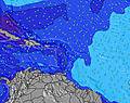 | |||||||||||||||
Wave Height (m) Direction Period (s) | E 7 | E 7 | E 7 | E 7 | E 7 | E 7 | E 7 | E 7 | E 7 | E 8 | E 8 | E 8 | E 8 | E 8 | E 8 | E 8 | E 8 | E 8 | E 8 | E 8 | E 8 | E 8 | E 8 | E 8 |
Wave Graph | ||||||||||||||||||||||||
243 | 243 | 269 | 261 | 222 | 229 | 206 | 205 | 210 | 222 | 282 | 282 | 291 | 294 | 302 | 310 | 310 | 310 | 307 | 358 | 403 | 403 | 410 | 378 | |
Wind (km/h) | ||||||||||||||||||||||||
Wind State on-shore cross-onshore cross-shore cross-offshore off-shore glassy | cross-off | cross-off | cross-off | cross-off | cross-off | cross-off | cross-off | cross-off | cross-off | cross-off | cross-off | cross-off | cross-off | cross-off | cross-off | cross-off | cross-off | cross-off | cross-off | cross-off | cross-off | cross-off | cross-off | cross-off |
High Tide | 11:27PM0.39m | 10:34AM0.29m | 11:46PM0.36m | 12:42PM0.29m | 00:00AM0.35m | |||||||||||||||||||
Low Tide | 4:32PM0.01m | 6:39AM0.22m | 5:27PM0.12m | 7:27AM0.13m | 6:30PM0.21m | 8:10AM0.06m | ||||||||||||||||||
— | — | — | — | 5:35 | — | — | — | — | — | — | — | 5:35 | — | — | — | — | — | — | — | 5:37 | — | — | — | |
6:47 | — | — | — | — | — | — | — | 6:47 | — | — | — | — | — | — | — | 6:49 | — | — | — | — | — | — | 6:49 | |
mm | — | — | — | — | — | — | — | — | — | — | — | — | — | — | — | — | — | — | — | — | — | — | — | — |
Temp °C | 26 | 26 | 25 | 25 | 25 | 26 | 26 | 27 | 26 | 26 | 26 | 26 | 26 | 26 | 26 | 27 | 27 | 26 | 26 | 26 | 26 | 25 | 26 | 26 |
Feels °C | 26 | 25 | 24 | 23 | 24 | 25 | 25 | 26 | 25 | 25 | 25 | 25 | 25 | 26 | 26 | 27 | 27 | 26 | 26 | 25 | 25 | 24 | 25 | 25 |
Swell 1 Height (m) Direction Period (s) | NNE 10 | NNE 10 | NNE 10 | NNE 10 | NNE 10 | NNE 12 | NNE 12 | NNE 11 | NNE 11 | NNE 11 | NNE 11 | NNE 11 | NNE 11 | NNE 11 | NNE 11 | NNE 11 | NNE 10 | NNE 10 | NNE 10 | NNE 10 | NNE 10 | NNE 10 | NNE 10 | NNE 10 |
33 | 33 | 19 | 19 | 19 | 46 | 45 | 43 | 40 | 23 | 23 | 22 | 23 | 23 | 22 | 22 | 20 | 20 | 20 | 20 | 20 | 20 | 19 | 10 | |
Swell 2 Height (m) Direction Period (s) | N 10 | NW 10 | NNE 12 | NNE 12 | NNE 12 | NW 7 | N 8 | N 8 | N 8 | N 8 | N 8 | N 8 | N 7 | NW 7 | NW 8 | NW 7 | NW 7 | NW 7 | NW 7 | N 7 | NE 13 | N 7 | N 7 | NE 12 |
2 | 4 | 15 | 28 | 28 | 2 | 1 | 1 | 1 | 1 | 1 | 1 | 1 | 2 | 2 | 2 | 2 | 2 | 2 | 1 | 7 | 1 | 1 | 6 | |
Swell 3 Height (m) Direction Period (s) | — | — | N 10 | N 10 | N 10 | N 12 | — | N 8 | N 8 | N 8 | N 11 | N 11 | N 11 | N 11 | N 7 | N 7 | N 7 | N 6 | — | N 13 | N 7 | N 10 | N 10 | N 7 |
— | — | 2 | 2 | 2 | 3 | — | 1 | 1 | 1 | 2 | 2 | 2 | 2 | 1 | 1 | 1 | 1 | — | 3 | 1 | 2 | 2 | 1 | |
Wind waves Height (m) Direction Period (s) | E 7 | E 7 | E 7 | E 7 | E 7 | E 7 | E 7 | E 7 | E 7 | E 8 | E 8 | E 8 | E 8 | E 8 | E 8 | E 8 | E 8 | E 8 | E 8 | E 8 | E 8 | E 8 | E 8 | E 8 |
243 | 243 | 269 | 261 | 222 | 229 | 206 | 205 | 210 | 222 | 282 | 282 | 291 | 294 | 302 | 310 | 310 | 310 | 307 | 358 | 403 | 403 | 410 | 378 | |
Nearest Offshore or Glassy | ||||||||||||||||||||||||
Distance (km) | 660 | 660 | 470 | 366 | 213 | 192 | 3 | 192 | 660 | 660 | 660 | 366 | 681 | 754 | 332 | 332 | 332 | 927 | 805 | 332 | 332 | 754 | 332 | 927 |
Best forecast wave conditions in Saint Barthélemy | ||||||||||||||||||||||||
Best forecast wave conditions in Saint Barthélemy | ||||||||||||||||||||||||
Header Global | ||||||||||||||||||||||||
- Map Icons:
 Break
Break Live Wave Height (m)
 Live Wind Speed (km/h)
 Surf Rating (10 Max)
 Ocean Swells (m)
- Wind Speed (km/h)


FREE! Surf-Forecast.com widget for your website
The surf report / weather widget below is available to embed on third party websites free of charge and provides a summary of our Lorient surf forecast. Simply grab the html code snippet that we provide and paste it into your own site. You can choose your preferred language and metric/imperial units for the surf forecast feed to suit users of your site. Click here to get the code.
 Nearest