

Surf Forecasts:

Lohi's surf forecast from 30 Jul 2026:
- Best quality surf: Monday 3 Aug, 11PM (local time) - 3ft (0.9m), 16s period, SW swell with cross-offshore winds.
- Most powerful swell: Friday 31 Jul, 8PM (local time) - 10ft (3.0m), 8s period, W swell with 1,217 kJ wave energy.
- Next surfable swell (1★+): Saturday 1 Aug, 11PM (local time) - 2.5ft (0.8m), 14s period with SSW swell.
Best Forecast Surf Conditions for Lohi's this week:
The surf forecast for Lohi's over the next 16 days: The first swell (rated 1 star or higher) is forecast to arrive on Saturday (Aug 01) at 11PM. The primary swell is predicted to be 0.8m and 14s period with a secondary swell of 0.7m and 6s. The wind is predicted to be cross-offshore as the swell arrives.
The most powerful waves expected at Lohi's in the next 16 days are 3.0m 8s and forecast to arrive on Friday (Jul 31) at 8PM. Winds are predicted to be cross-offshore at the time the swell arrives. The largest open ocean swell (not directed at the beach) is 2.5m 8s period and expected on Friday (Jul 31) at 11PM.
| Wave Type | Time (+05) & Date | Wave Height & Period |
|---|---|---|
| Next good surf (1 star+) | 11PM (Sat 1st Aug) | 2.5ft (0.8m) 14s |
| Best Surf | 11PM (Mon 3rd Aug) | 3ft (0.9m) 16s |
| Most Powerful | 8PM (Fri 31st Jul) | 10ft (3.0m) 8s |
Table - best surf conditions forecast for Lohi's over the next 16 days.
The Lowdown
Alright folks, Rusty here. Let’s get into it.
First up, we’re looking at a pretty mixed bag for the next couple of weeks. The real standout window is a bit of a tease, but there’s a morning that’s worth setting the alarm for. The water’s sitting at 85° right now, which is about average for the time of year, so the only thing you’ll need to worry about is the wind.
The only break on the cards is Lohi's, a reef setup that’s an exposed beginner spot, but it’s inconsistent. It prefers swell from the south. The early part of the forecast is a bust. Thursday afternoon and Friday are a write-off with strong cross-off winds and poor conditions. Friday afternoon gets a bit wild with a 10ft short-period W swell and a near gale – that’s a big, messy paddle for anyone, and really only for the hardcore crew. Saturday stays lumpy.
Now, here’s the one that gets the heart rate up. Sunday morning, August 2nd, is the pick of the run. We’ve got a clean 3ft swell from the SSW, with a very long period of 14 seconds, which is proper groundswell energy. The wind is a gentle offshore from the NW, meaning glassy conditions. The combined energy is moderate (431). This is clean, organized, and the offshore wind will make it a dream. For a beginner reef, that’s as good as it gets. Just keep in mind the inconsistency – it might not be pumping all day, but when a set comes through, it’ll be worth it.
The rest of the first week stays marginal. We get a few more mornings with clean conditions but the swell drops off or the wind turns cross-off. The energy stays moderate, between 420 and 941. It’s not terrible, but it’s not the peak of Sunday.
Heading into the second week, the outlook gets more average. From the 8th of August onwards, the wind turns more cross-shore, creating lumpy conditions. The swell picks up a bit, hitting 6ft by the 13th, but the wind is a cross-shore mess, chopping it up. The energy climbs into the strong range (1014) on Thursday the 13th afternoon, but it’s a messy cross-shore chop. That’s more for the wind-kiters than the paddle crew. The final days of the 14th and 15th fade out with gentle cross-shore conditions and dropping energy.
So, bottom line: if you want clean lines, be on the water Sunday morning, August 2nd. The rest of the window is a lot of sitting and waiting for something clean.
Stay wet.
Rusty
Short Range ForecastHeavy rain (total 49mm), heaviest during Fri night. Warm (max 28°C on Sat afternoon, min 25°C on Fri afternoon). Winds decreasing (strong winds from the W on Fri afternoon, light winds from the NNW by Sun morning). | Days 5-7 Weather SummaryModerate rain (total 19mm), heaviest on Mon night. Warm (max 28°C on Sun night, min 27°C on Mon afternoon). Wind will be generally light. | ||||||||||||||||||
Friday 31 | Saturday 1 | Sunday 2 | Monday 3 | Tuesday 4 | Wednesday 5 | ||||||||||||||
Night | AM | PM | Night | AM | PM | Night | AM | PM | Night | AM | PM | Night | AM | PM | Night | AM | PM | Night | |
Swell Height Map |  | 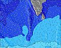 | 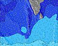 | 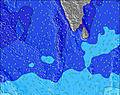 | 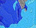 | 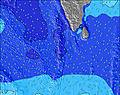 | 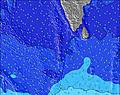 | ||||||||||||
Wave Height (m) Direction Period (s) | SE 10 | SSW 18 | W 7 | SSW 16 | SSW 16 | SSW 15 | SSW 14 | SSW 14 | S 9 | S 9 | SSE 9 | SSW 17 | SSW 16 | SSW 16 | SSW 15 | SSW 15 | SSW 19 | SSW 18 | S 18 |
Wave Graph | |||||||||||||||||||
200 | 491 | 823 | 532 | 273 | 372 | 261 | 243 | 185 | 181 | 240 | 563 | 505 | 512 | 468 | 339 | 502 | 737 | 390 | |
Wind (km/h) | |||||||||||||||||||
Wind State on-shore cross-onshore cross-shore cross-offshore off-shore glassy | cross | cross-off | cross-off | cross | cross | cross | off | off | cross-off | cross-off | cross-off | cross-off | cross-off | cross-off | cross-off | cross-off | cross-off | cross-off | cross-off |
High Tide | 1:57AM0.70m | 2:26PM0.95m | 2:30AM0.74m | 2:48PM0.95m | 3:03AM0.77m | 3:10PM0.92m | 3:38AM0.79m | 3:31PM0.88m | 4:16AM0.78m | 3:51PM0.82m | 4:59AM0.76m | 4:09PM0.75m | |||||||
Low Tide | 8:19PM0.23m | 7:47AM0.11m | 8:42PM0.19m | 8:18AM0.14m | 9:05PM0.16m | 8:49AM0.18m | 9:29PM0.14m | 9:21AM0.24m | 9:54PM0.12m | 9:54AM0.30m | 10:23PM0.11m | 10:29AM0.38m | 10:55PM0.12m | ||||||
— | 6:01 | — | — | 6:01 | — | — | 6:01 | — | — | 6:01 | — | — | 6:01 | — | — | 6:01 | — | — | |
— | — | 6:21 | — | — | 6:21 | — | — | 6:20 | — | — | 6:20 | — | — | 6:20 | — | — | 6:20 | — | |
mm | 8 | 6 | 10 | 12 | 2 | 1 | 10 | — | — | — | 2 | 2 | 6 | 1 | 2 | 3 | 1 | 2 | 7 |
Temp °C | 27 | 27 | 26 | 27 | 27 | 28 | 28 | 27 | 28 | 28 | 28 | 27 | 27 | 28 | 28 | 27 | 28 | 27 | 28 |
Feels °C | 27 | 26 | 23 | 27 | 27 | 30 | 29 | 30 | 29 | 29 | 31 | 28 | 29 | 29 | 29 | 28 | 30 | 27 | 29 |
Swell 1 Height (m) Direction Period (s) | NW 8 | SE 10 | SSW 17 | NW 8 | WNW 9 | WNW 10 | WNW 10 | WNW 11 | WNW 10 | WNW 9 | WNW 9 | WNW 9 | WNW 9 | WNW 9 | WNW 8 | WNW 10 | WNW 9 | S 10 | S 10 |
101 | 154 | 622 | 470 | 629 | 635 | 522 | 610 | 439 | 327 | 313 | 255 | 272 | 197 | 173 | 226 | 141 | 250 | 267 | |
Swell 2 Height (m) Direction Period (s) | SE 10 | SSW 18 | SE 10 | SSW 16 | SSW 16 | SSW 15 | S 9 | S 8 | S 9 | S 9 | SSE 9 | SSE 8 | SSE 8 | SSW 16 | SSW 15 | SSW 15 | SSW 15 | SSW 18 | WNW 8 |
200 | 491 | 151 | 532 | 273 | 372 | 146 | 117 | 185 | 181 | 203 | 194 | 157 | 512 | 468 | 339 | 283 | 737 | 100 | |
Swell 3 Height (m) Direction Period (s) | S 11 | SW 14 | S 8 | SE 10 | SE 10 | SE 10 | SSW 14 | SSW 14 | SSW 13 | SSW 13 | SSW 15 | SSW 17 | SSW 16 | SSE 8 | SE 8 | S 8 | SSW 19 | WNW 8 | S 18 |
114 | 214 | 31 | 106 | 110 | 106 | 261 | 243 | 154 | 116 | 240 | 563 | 505 | 116 | 64 | 41 | 502 | 128 | 390 | |
Wind waves Height (m) Direction Period (s) | WSW 4 | W 6 | W 7 | SW 7 | SW 6 | SW 6 | — | — | — | — | — | — | — | — | — | — | — | — | — |
25 | 236 | 823 | 194 | 78 | 38 | — | — | — | — | — | — | — | — | — | — | — | — | — | |
Nearest Offshore or Glassy | |||||||||||||||||||
Distance (km) | 2646 | 405 | 662 | 947 | 951 | 662 | 934 | 0 | 0 | 260 | 2 | 0 | 3 | 260 | 15 | 260 | 3 | 3 | 260 |
Best forecast wave conditions in North Male Atoll | |||||||||||||||||||
Best forecast wave conditions in Maldives | |||||||||||||||||||
Header Global | |||||||||||||||||||
- Map Icons:
 Break
Break Live Wave Height (m)
 Live Wind Speed (km/h)
 Surf Rating (10 Max)
 Ocean Swells (m)
- Wind Speed (km/h)
Latest Updates


FREE! Surf-Forecast.com widget for your website
The surf report / weather widget below is available to embed on third party websites free of charge and provides a summary of our Lohi's surf forecast. Simply grab the html code snippet that we provide and paste it into your own site. You can choose your preferred language and metric/imperial units for the surf forecast feed to suit users of your site. Click here to get the code.
Information about the Lohi's Surf forecast
The above surf forecast table for Lohi's provides essential information for determining whether the surfing conditions will be good over the next 16 days. A general guide to surfing at Lohi's can be found by selecting the local surf guide option on the grey menu. Our Lohi's surf forecast is unique since it includes wave energy (power) that defines the real feel of the surf rather than just the height or the period. If you surf the same spot (Lohi's) regularly then make a mental note of the wave energy from the surf forecast table each time you go. Very soon you may start to choose your surf days based on the wave energy alone combined with our forecast of favourable offshore wind conditions. Our star ratings will help here and of course you will also find the usual wave height and period predictions on our surf forecasts as well as a full break down of the swell components under our advanced users option (to reveal that, click the little Einstein character under the tide times).
Further information to help with frequently asked questions about our surf forecast for Lohi's may be found under the help tab on the top menu and also by moving your mouse over the question marks on the surf forecast table itself. Please always bear in mind that the forecast is for near-shore open water and local factors at each surf break influence the actual breaking wave height, such as the beach / reef profile, water depths offshore and shelter.
Are you planning a holiday in North Male Atoll? If you are looking for accommodation near Lohi's, camping, hotels and holiday cottages in North Male Atoll, consider staying in Male which is 48 km (30 miles) away.
 Nearest