

Surf Forecasts:

How big are the waves at Lohi's today (04 Aug):
- Afternoon surf: Afternoon surf (04 Aug, local time) - 2.5ft (0.7m), 17s period with SSW swell.
- Evening surf: Evening surf (04 Aug, local time) - 3.5ft (1.0m), 17s period with SSW swell.
The current surf forecast for Lohi's at 12AM is: 0.9m 16s primary swell from a Southwest direction and 0.9m 8s secondary swell from a South-southeast direction (forecast issued at 04:00pm August 03). An open ocean swell of 1.4m 9s is not directed at the surf break. The wind direction is predicted to be cross-offshore.
| Time (+05) & Date | Wave Height | Wave Period |
|---|---|---|
| Morning (04 Aug) | - | - |
| Afternoon (04 Aug) | 2.5ft (0.7m) | 17s |
| Evening (04 Aug) | 3.5ft (1.0m) | 17s |
Table - waves today at Lohi's. (Swell directed towards the surf break)
Short Range ForecastModerate rain (total 14mm), heaviest on Tue night. Warm (max 28°C on Mon afternoon, min 27°C on Mon afternoon). Wind will be generally light. | ||||||||||||||||||||
Mon 3 | Tuesday 4 | Wednesday 5 | ||||||||||||||||||
2 PM | 5 PM | 8 PM | 11 PM | 2 AM | 5 AM | 8 AM | 11 AM | 2 PM | 5 PM | 8 PM | 11 PM | 2 AM | 5 AM | 8 AM | 11 AM | 2 PM | 5 PM | 8 PM | 11 PM | |
Swell Height Map |  | 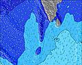 | 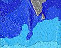 | 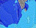 | 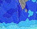 |  | 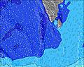 | 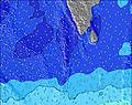 | ||||||||||||
Wave Height (m) Direction Period (s) | SSW 17 | SSW 17 | SSW 17 | SW 16 | SSW 16 | SW 16 | SSW 16 | SSW 16 | SSW 15 | SSW 15 | SSW 15 | SSW 15 | SSW 15 | SSW 15 | SSW 20 | SSW 19 | SSW 19 | SSW 18 | SSW 18 | SSW 18 |
Wave Graph | ||||||||||||||||||||
315 | 563 | 608 | 376 | 499 | 371 | 525 | 512 | 487 | 468 | 461 | 417 | 339 | 339 | 395 | 502 | 913 | 737 | 713 | 705 | |
Wind (km/h) | ||||||||||||||||||||
Wind State on-shore cross-onshore cross-shore cross-offshore off-shore glassy | cross-off | cross-off | cross-off | cross-off | cross-off | cross-off | cross-off | cross-off | cross-off | cross-off | cross-off | cross-off | cross-off | cross-off | cross-off | cross-off | cross-off | cross-off | cross-off | cross-off |
High Tide | 3:31PM0.88m | 4:16AM0.78m | 3:51PM0.82m | 4:59AM0.76m | 4:09PM0.75m | |||||||||||||||
Low Tide | 9:54PM0.12m | 9:54AM0.30m | 10:23PM0.11m | 10:29AM0.38m | 10:55PM0.12m | |||||||||||||||
— | — | — | — | — | 6:01 | — | — | — | — | — | — | — | 6:01 | — | — | — | — | — | — | |
— | 6:20 | — | — | — | — | — | — | — | 6:20 | — | — | — | — | — | — | — | 6:20 | — | — | |
mm | — | — | 1 | 1 | 1 | 1 | — | — | — | — | 1 | 2 | 2 | 2 | 1 | — | — | — | 1 | 1 |
Temp °C | 27 | 28 | 27 | 27 | 27 | 27 | 27 | 27 | 28 | 28 | 27 | 27 | 27 | 27 | 27 | 28 | 28 | 28 | 28 | 28 |
Feels °C | 28 | 29 | 28 | 29 | 29 | 29 | 28 | 27 | 29 | 29 | 28 | 29 | 28 | 28 | 27 | 28 | 27 | 28 | 28 | 28 |
Swell 1 Height (m) Direction Period (s) | WNW 9 | WNW 9 | WNW 9 | WNW 9 | WNW 9 | WNW 9 | WNW 9 | WNW 9 | SSW 15 | SSW 15 | WNW 8 | SSW 15 | SSW 15 | SSW 15 | SSW 15 | SSW 15 | SSW 19 | SSW 18 | SSW 18 | SSW 18 |
362 | 362 | 320 | 313 | 280 | 273 | 233 | 202 | 487 | 468 | 173 | 417 | 339 | 339 | 339 | 279 | 913 | 737 | 713 | 705 | |
Swell 2 Height (m) Direction Period (s) | SSE 8 | SSW 17 | SSW 17 | SSE 8 | SSW 16 | SSE 8 | SSW 16 | SSW 16 | SSE 8 | SSE 8 | SSW 15 | SSE 8 | S 8 | SSW 20 | SSW 20 | SSW 19 | S 9 | S 10 | S 10 | S 10 |
137 | 563 | 608 | 99 | 499 | 96 | 525 | 512 | 75 | 67 | 461 | 63 | 42 | 307 | 395 | 502 | 61 | 133 | 127 | 200 | |
Swell 3 Height (m) Direction Period (s) | SSW 17 | SSE 8 | SSE 8 | SW 16 | SSE 8 | SW 16 | SSE 8 | SSE 8 | E 9 | E 9 | SSE 8 | SSW 21 | S 21 | S 8 | S 9 | S 9 | SE 8 | WNW 10 | WNW 10 | WNW 10 |
315 | 134 | 108 | 376 | 96 | 371 | 94 | 75 | 2 | 2 | 65 | 150 | 229 | 28 | 57 | 57 | 24 | 59 | 42 | 41 | |
Wind waves Height (m) Direction Period (s) | — | — | — | — | — | — | — | W 4 | WNW 9 | WNW 8 | WNW 5 | WNW 8 | WNW 8 | WNW 9 | WNW 8 | WNW 8 | WNW 8 | WNW 8 | WNW 8 | WNW 8 |
— | — | — | — | — | — | — | 15 | 297 | 302 | 40 | 267 | 273 | 280 | 273 | 261 | 237 | 207 | 212 | 207 | |
Nearest Offshore or Glassy | ||||||||||||||||||||
Distance (km) | 260 | 260 | 3 | 3 | 3 | 3 | 3 | 251 | 15 | 15 | 3 | 260 | 260 | 260 | 260 | 260 | 260 | 260 | 405 | 260 |
Best forecast wave conditions in North Male Atoll | ||||||||||||||||||||
Best forecast wave conditions in Maldives | ||||||||||||||||||||
Header Global | ||||||||||||||||||||
- Map Icons:
 Break
Break Live Wave Height (m)
 Live Wind Speed (km/h)
 Surf Rating (10 Max)
 Ocean Swells (m)
- Wind Speed (km/h)
Latest Updates


FREE! Surf-Forecast.com widget for your website
The surf report / weather widget below is available to embed on third party websites free of charge and provides a summary of our Lohi's surf forecast. Simply grab the html code snippet that we provide and paste it into your own site. You can choose your preferred language and metric/imperial units for the surf forecast feed to suit users of your site. Click here to get the code.
 Nearest