

Surf Forecasts:

How big are the waves at Lautaunuu today (31 Jul):
- Morning surf: Morning surf (31 Jul, local time) - 2ft (0.6m), 14s period with NE swell.
- Afternoon surf: Afternoon surf (31 Jul, local time) - 1.5ft (0.4m), 14s period with NE swell.
- Evening surf: Evening surf (31 Jul, local time) - 4.5ft (1.4m), 7s period with E swell.
The current surf forecast for Lautaunuu at 1PM is: 0.4m 14s primary swell from a Northeast direction and 0.4m 12s secondary swell from a Northeast direction (forecast issued at 06:00am July 31). An open ocean swell of 1.5m 6s is not directed at the surf break. The wind direction is predicted to be cross-shore.
| Time (+13) & Date | Wave Height | Wave Period |
|---|---|---|
| Morning (31 Jul) | 2ft (0.6m) | 14s |
| Afternoon (31 Jul) | 1.5ft (0.4m) | 14s |
| Evening (31 Jul) | 4.5ft (1.4m) | 7s |
Table - waves today at Lautaunuu. (Swell directed towards the surf break)
Short Range ForecastMostly dry. Warm (max 25°C on Sat morning, min 24°C on Fri morning). Mainly fresh winds. | |||||||||||||||||||||||
Friday 31 | Saturday 1 | Sunday 2 | |||||||||||||||||||||
4 AM | 7 AM | 10 AM | 1 PM | 4 PM | 7 PM | 10 PM | 1 AM | 4 AM | 7 AM | 10 AM | 1 PM | 4 PM | 7 PM | 10 PM | 1 AM | 4 AM | 7 AM | 10 AM | 1 PM | 4 PM | 7 PM | 10 PM | |
Swell Height Map |  |  |  |  | 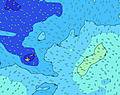 |  |  | 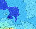 |  | ||||||||||||||
Wave Height (m) Direction Period (s) | NE 14 | NE 14 | ESE 6 | NE 14 | NE 14 | E 7 | E 7 | E 7 | E 7 | E 7 | E 8 | E 8 | E 8 | E 8 | E 8 | E 8 | E 8 | E 8 | E 8 | E 8 | E 8 | E 8 | E 8 |
Wave Graph | |||||||||||||||||||||||
151 | 164 | 167 | 72 | 72 | 181 | 203 | 200 | 205 | 205 | 217 | 223 | 198 | 203 | 208 | 208 | 177 | 153 | 153 | 133 | 137 | 127 | 134 | |
Wind (km/h) | |||||||||||||||||||||||
Wind State on-shore cross-onshore cross-shore cross-offshore off-shore glassy | cross-off | cross-off | cross | cross | cross | cross | cross | cross | cross | cross | cross | cross | cross | cross | cross | cross | cross | cross | cross | cross | cross | cross-off | cross-off |
High Tide | 7:07AM0.91m | 7:33PM0.80m | 7:44AM0.90m | 8:11PM0.80m | 8:24AM0.87m | 8:52PM0.80m | |||||||||||||||||
Low Tide | 1:05AM0.07m | 1:40PM0.00m | 1:40AM0.07m | 2:13PM0.02m | 2:19AM0.08m | 2:49PM0.04m | |||||||||||||||||
6:48 | — | — | — | — | — | — | — | 6:48 | — | — | — | — | — | — | — | 6:47 | — | — | — | — | — | — | |
— | — | — | — | 6:17 | — | — | — | — | — | — | — | 6:17 | — | — | — | — | — | — | — | 6:17 | — | — | |
mm | — | — | — | — | — | — | — | — | — | — | — | — | — | — | — | — | — | — | — | — | — | — | — |
Temp °C | 24 | 24 | 24 | 24 | 24 | 24 | 24 | 24 | 24 | 24 | 24 | 25 | 25 | 25 | 24 | 24 | 24 | 25 | 25 | 25 | 25 | 25 | 25 |
Feels °C | 20 | 20 | 20 | 20 | 20 | 20 | 20 | 21 | 21 | 22 | 21 | 23 | 23 | 23 | 23 | 23 | 23 | 24 | 24 | 25 | 25 | 25 | 25 |
Swell 1 Height (m) Direction Period (s) | NE 14 | NE 14 | NE 14 | NE 14 | ENE 12 | NE 13 | NE 13 | NE 13 | NE 12 | NE 13 | NE 12 | NE 12 | NE 12 | NE 12 | NE 12 | NE 11 | E 8 | E 8 | E 8 | E 8 | E 8 | E 8 | E 8 |
151 | 164 | 167 | 72 | 57 | 138 | 138 | 109 | 35 | 80 | 73 | 72 | 116 | 69 | 68 | 64 | 177 | 153 | 153 | 133 | 137 | 127 | 134 | |
Swell 2 Height (m) Direction Period (s) | SW 12 | SW 12 | SW 12 | NE 12 | NE 14 | SW 12 | SSW 12 | NNE 10 | NE 13 | NNE 16 | NNE 16 | NNE 16 | NNE 9 | NNE 15 | SSE 13 | SSE 13 | NE 11 | NE 11 | NE 11 | NE 11 | NE 10 | NE 10 | SSE 12 |
39 | 38 | 23 | 37 | 72 | 21 | 13 | 9 | 28 | 25 | 25 | 24 | 17 | 21 | 16 | 17 | 92 | 92 | 71 | 71 | 54 | 63 | 56 | |
Swell 3 Height (m) Direction Period (s) | SSE 12 | SSE 12 | NNE 9 | SW 12 | SW 12 | NNE 10 | NNE 10 | SSW 12 | NE 16 | NNE 10 | SW 11 | SSE 13 | SSE 13 | SSE 12 | NNE 10 | NNE 10 | SE 12 | SE 12 | SE 12 | SSE 12 | SSE 12 | SSE 12 | NE 10 |
15 | 15 | 8 | 22 | 21 | 9 | 9 | 13 | 38 | 9 | 5 | 16 | 16 | 15 | 9 | 9 | 39 | 37 | 37 | 57 | 57 | 57 | 25 | |
Wind waves Height (m) Direction Period (s) | ESE 6 | ESE 6 | ESE 6 | ESE 6 | ESE 6 | E 7 | E 7 | E 7 | E 7 | E 7 | E 8 | E 8 | E 8 | E 8 | E 8 | E 8 | — | — | — | — | — | — | — |
127 | 144 | 156 | 160 | 147 | 181 | 203 | 200 | 205 | 205 | 217 | 223 | 198 | 203 | 208 | 208 | — | — | — | — | — | — | — | |
Nearest Offshore or Glassy | |||||||||||||||||||||||
Distance (km) | 890 | 890 | 890 | 1261 | 890 | 1261 | 890 | 599 | 888 | 888 | 888 | 599 | 599 | 65 | 65 | 105 | 105 | 599 | 104 | 65 | 65 | 65 | 65 |
Best forecast wave conditions in Upolu | |||||||||||||||||||||||
Best forecast wave conditions in Samoa | |||||||||||||||||||||||
Header Global | |||||||||||||||||||||||
- Map Icons:
 Break
Break Live Wave Height (m)
 Live Wind Speed (km/h)
 Surf Rating (10 Max)
 Ocean Swells (m)
- Wind Speed (km/h)
Latest Updates


FREE! Surf-Forecast.com widget for your website
The surf report / weather widget below is available to embed on third party websites free of charge and provides a summary of our Lautaunuu surf forecast. Simply grab the html code snippet that we provide and paste it into your own site. You can choose your preferred language and metric/imperial units for the surf forecast feed to suit users of your site. Click here to get the code.
 Nearest