

Surf Forecasts:

How big are the waves at Indicas today (31 Jul):
- Morning surf: Morning surf (31 Jul, local time) - 1.5ft (0.4m), 9s period with E swell.
- Afternoon surf: Afternoon surf (31 Jul, local time) - 1.5ft (0.4m), 9s period with E swell.
- Evening surf: Evening surf (31 Jul, local time) - 2ft (0.6m), 7s period with SE swell.
The current surf forecast for Indicas at 9PM is: 0.6m 7s primary swell from a Southeast direction and 0.4m 9s secondary swell from a East direction (forecast issued at 01:00pm July 31). An open ocean swell of 0.2m 3s is not directed at the surf break. The wind direction is predicted to be cross-shore.
| Time (EDT) & Date | Wave Height | Wave Period |
|---|---|---|
| Morning (31 Jul) | 1.5ft (0.4m) | 9s |
| Afternoon (31 Jul) | 1.5ft (0.4m) | 9s |
| Evening (31 Jul) | 2ft (0.6m) | 7s |
Table - waves today at Indicas. (Swell directed towards the surf break)
Short Range ForecastModerate rain (total 17mm), heaviest on Sun night. Warm (max 30°C on Fri afternoon, min 28°C on Fri night). Mainly fresh winds. | |||||||||||||||||||||
Fri 31 | Saturday 1 | Sunday 2 | |||||||||||||||||||
11 AM | 2 PM | 5 PM | 8 PM | 11 PM | 2 AM | 5 AM | 8 AM | 11 AM | 2 PM | 5 PM | 8 PM | 11 PM | 2 AM | 5 AM | 8 AM | 11 AM | 2 PM | 5 PM | 8 PM | 11 PM | |
Swell Height Map |  | 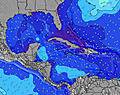 | 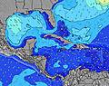 | 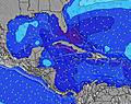 | 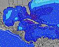 | 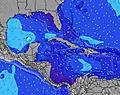 | 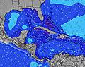 | 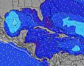 | |||||||||||||
Wave Height (m) Direction Period (s) | E 9 | E 9 | ESE 7 | SE 7 | ESE 7 | ESE 8 | SE 8 | ESE 8 | ESE 8 | ESE 8 | ESE 8 | ESE 8 | ESE 8 | ESE 8 | ESE 8 | ESE 8 | ESE 8 | ESE 8 | ESE 8 | ESE 8 | ESE 8 |
Wave Graph | |||||||||||||||||||||
27 | 26 | 31 | 37 | 42 | 105 | 151 | 122 | 122 | 157 | 133 | 119 | 119 | 130 | 107 | 149 | 85 | 154 | 154 | 142 | 142 | |
Wind (km/h) | |||||||||||||||||||||
Wind State on-shore cross-onshore cross-shore cross-offshore off-shore glassy | cross | cross | cross-off | cross | cross | cross | cross | cross | cross | cross | cross-off | cross | cross-on | cross-on | cross-on | cross-on | cross-on | cross-on | cross-on | cross-on | cross-on |
High Tide | 9:37AM0.79m | 9:55PM0.97m | 10:19AM0.82m | 10:31PM0.93m | 11:02AM0.86m | ||||||||||||||||
Low Tide | 3:30PM0.18m | 4:18AM0.17m | 4:15PM0.20m | 4:52AM0.16m | 5:03PM0.22m | ||||||||||||||||
— | — | — | — | — | — | 6:31 | — | — | — | — | — | — | — | 6:33 | — | — | — | — | — | — | |
— | — | 7:55 | — | — | — | — | — | — | — | 7:54 | — | — | — | — | — | — | — | 7:53 | — | — | |
mm | 5 | — | — | — | — | 1 | 3 | 1 | — | 1 | 1 | — | — | — | — | — | — | 1 | 2 | — | — |
Temp °C | 29 | 29 | 30 | 29 | 28 | 28 | 28 | 28 | 29 | 30 | 29 | 29 | 28 | 28 | 28 | 28 | 28 | 28 | 28 | 28 | 28 |
Feels °C | 33 | 32 | 32 | 32 | 31 | 31 | 30 | 29 | 29 | 30 | 30 | 31 | 29 | 28 | 29 | 28 | 28 | 29 | 29 | 28 | 30 |
Swell 1 Height (m) Direction Period (s) | SE 6 | SE 6 | ESE 7 | SE 7 | ESE 7 | ESE 8 | NW 5 | ESE 8 | ESE 8 | ESE 8 | ESE 8 | ESE 8 | ESE 8 | — | ESE 8 | — | ESE 8 | ESE 8 | ESE 8 | ESE 8 | — |
21 | 19 | 31 | 37 | 42 | 105 | 1 | 122 | 122 | 157 | 133 | 119 | 119 | — | 107 | — | 85 | 154 | 154 | 142 | — | |
Swell 2 Height (m) Direction Period (s) | E 9 | E 9 | E 9 | E 9 | E 9 | NW 5 | — | NW 4 | — | — | — | SW 4 | SSW 4 | N 7 | — | — | — | N 6 | N 6 | N 7 | — |
27 | 26 | 27 | 26 | 25 | 1 | — | 1 | — | — | — | 4 | 1 | 1 | — | — | — | 1 | 1 | 1 | — | |
Swell 3 Height (m) Direction Period (s) | NW 6 | NW 5 | ESE 8 | ESE 8 | NW 5 | — | — | — | — | — | — | NW 4 | NW 4 | — | — | — | — | — | — | — | — |
1 | 1 | 7 | 7 | 1 | — | — | — | — | — | — | 1 | 1 | — | — | — | — | — | — | — | — | |
Wind waves Height (m) Direction Period (s) | SSW 3 | SSW 3 | SSW 3 | SSW 3 | SSW 2 | — | SE 8 | S 3 | S 4 | SSW 4 | SW 4 | — | — | ESE 8 | — | ESE 8 | SE 5 | — | — | — | ESE 8 |
1 | 1 | 1 | 1 | 1 | — | 151 | 6 | 10 | 6 | 5 | — | — | 130 | — | 149 | 33 | — | — | — | 142 | |
Nearest Offshore or Glassy | |||||||||||||||||||||
Distance (km) | 124 | 124 | 1682 | 899 | 899 | 899 | 899 | 965 | 1682 | 24 | 24 | 131 | 313 | 899 | 373 | 546 | 546 | 546 | 373 | 468 | 546 |
Best forecast wave conditions in Great Abaco - Bahamas | |||||||||||||||||||||
Best forecast wave conditions in Bahamas | |||||||||||||||||||||
Header Global | |||||||||||||||||||||
- Map Icons:
 Break
Break Live Wave Height (m)
 Live Wind Speed (km/h)
 Surf Rating (10 Max)
 Ocean Swells (m)
- Wind Speed (km/h)
Latest Updates


FREE! Surf-Forecast.com widget for your website
The surf report / weather widget below is available to embed on third party websites free of charge and provides a summary of our Indicas surf forecast. Simply grab the html code snippet that we provide and paste it into your own site. You can choose your preferred language and metric/imperial units for the surf forecast feed to suit users of your site. Click here to get the code.
 Nearest