

Surf Forecasts:

How big are the waves at Garur today (08 Jul):
- Morning surf: Morning surf (08 Jul, local time) - 5.5ft (1.7m), 9s period with SSW swell.
- Afternoon surf: Afternoon surf (08 Jul, local time) - 5.5ft (1.7m), 9s period with SW swell.
- Evening surf: Evening surf (08 Jul, local time) - 5ft (1.5m), 9s period with SW swell.
The current surf forecast for Garur at 4PM is: 1.6m 9s primary swell from a Southwest direction and 0.2m 15s secondary swell from a South direction (forecast issued at 11:00am July 08). The wind direction is predicted to be cross-offshore and the swell rating is 2.
| Time (GMT) & Date | Wave Height | Wave Period |
|---|---|---|
| Morning (08 Jul) | 5.5ft (1.7m) | 9s |
| Afternoon (08 Jul) | 5.5ft (1.7m) | 9s |
| Evening (08 Jul) | 5ft (1.5m) | 9s |
Table - waves today at Garur. (Swell directed towards the surf break)
Short Range ForecastLight rain (total 6mm), mostly falling on Wed night. Very mild (max 10°C on Wed morning, min 10°C on Wed morning). Winds increasing (light winds from the WSW on Thu night, strong winds from the SSE by Fri night). | ||||||||||||||||||||||||
Wed 8 | Thursday 9 | Friday 10 | Sat 11 | |||||||||||||||||||||
9 AM | 12 PM | 3 PM | 6 PM | 9 PM | 12 AM | 3 AM | 6 AM | 9 AM | 12 PM | 3 PM | 6 PM | 9 PM | 12 AM | 3 AM | 6 AM | 9 AM | 12 PM | 3 PM | 6 PM | 9 PM | 12 AM | 3 AM | 6 AM | |
Swell Height Map | 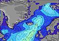 | 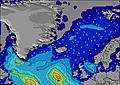 | 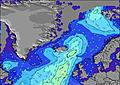 | 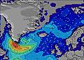 |  | 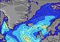 | 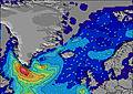 | 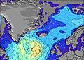 | 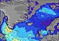 | |||||||||||||||
Wave Height (m) Direction Period (s) | SSW 9 | SSW 9 | SW 9 | SW 9 | SW 9 | SSW 9 | SSW 8 | SSW 8 | SSW 8 | SSW 9 | SSW 10 | SSW 10 | SSW 9 | SSW 9 | SSW 9 | SW 9 | SSW 9 | SW 9 | SW 8 | SW 8 | SW 8 | SSW 7 | SSW 7 | SSW 7 |
Wave Graph | ||||||||||||||||||||||||
497 | 450 | 481 | 427 | 349 | 395 | 432 | 294 | 524 | 547 | 622 | 553 | 441 | 354 | 370 | 471 | 346 | 334 | 256 | 244 | 261 | 279 | 302 | 329 | |
Wind (km/h) | ||||||||||||||||||||||||
Wind State on-shore cross-onshore cross-shore cross-offshore off-shore glassy | cross-off | cross-off | cross-off | off | off | cross-off | off | cross-off | cross-off | cross-off | cross-off | cross | cross-on | cross-on | on | cross-on | cross | cross | cross-off | cross-off | cross-off | cross-off | cross-off | cross-off |
High Tide | 12:04PM2.65m | 00:22AM2.64m | 1:11PM2.68m | 1:34AM2.58m | 2:24PM2.78m | 2:51AM2.62m | ||||||||||||||||||
Low Tide | 6:12PM0.92m | 6:45AM0.76m | 7:27PM0.96m | 7:56AM0.77m | 8:47PM0.88m | |||||||||||||||||||
3:24 | — | — | — | — | — | 3:26 | — | — | — | — | — | — | — | 3:29 | — | — | — | — | — | — | — | 3:31 | — | |
— | — | — | — | 11:45 | — | — | — | — | — | — | — | 11:42 | — | — | — | — | — | — | — | 11:39 | — | — | 11:37 | |
mm | — | — | — | — | — | 1 | — | 1 | 1 | 1 | 1 | 1 | — | — | — | — | — | — | — | — | — | — | — | — |
Temp °C | 10 | 10 | 10 | 10 | 10 | 10 | 10 | 10 | 10 | 10 | 10 | 10 | 10 | 10 | 10 | 10 | 10 | 10 | 10 | 10 | 10 | 10 | 10 | 10 |
Feels °C | 5 | 5 | 6 | 6 | 5 | 4 | 3 | 4 | 4 | 5 | 5 | 6 | 7 | 7 | 5 | 5 | 5 | 5 | 4 | 4 | 4 | 3 | 2 | 3 |
Swell 1 Height (m) Direction Period (s) | SSW 9 | SSW 9 | SW 9 | SW 9 | SW 9 | SSW 10 | SW 9 | SSW 13 | SSW 8 | SSW 9 | SSW 10 | SSW 10 | SSW 9 | SSW 9 | SSW 9 | SW 9 | SSW 9 | SW 9 | SW 8 | S 12 | S 12 | S 12 | S 12 | S 12 |
497 | 450 | 481 | 427 | 349 | 245 | 302 | 18 | 323 | 547 | 622 | 553 | 441 | 354 | 370 | 471 | 346 | 334 | 256 | 12 | 12 | 3 | 12 | 11 | |
Swell 2 Height (m) Direction Period (s) | SSW 15 | SSW 15 | SSW 15 | S 15 | S 14 | SSW 14 | SSW 13 | SW 13 | SW 12 | S 13 | S 13 | S 13 | S 13 | S 13 | S 13 | — | — | S 18 | — | — | — | — | — | — |
21 | 21 | 21 | 17 | 16 | 18 | 17 | 7 | 23 | 14 | 29 | 14 | 14 | 14 | 14 | — | — | 6 | — | — | — | — | — | — | |
Swell 3 Height (m) Direction Period (s) | SE 6 | S 15 | S 15 | ESE 6 | S 12 | ESE 6 | W 13 | — | S 13 | — | — | — | — | — | — | — | — | — | S 18 | — | S 18 | — | — | S 19 |
2 | 17 | 17 | 3 | 11 | 3 | 4 | — | 14 | — | — | — | — | — | — | — | — | — | 6 | — | 6 | — | — | 7 | |
Wind waves Height (m) Direction Period (s) | — | — | — | — | E 6 | SSW 9 | SSW 8 | SSW 8 | SSW 8 | — | — | — | — | — | WNW 4 | WNW 5 | W 5 | NW 4 | — | SW 8 | SW 8 | SSW 7 | SSW 7 | SSW 7 |
— | — | — | — | 1 | 395 | 432 | 294 | 524 | — | — | — | — | — | 17 | 31 | 16 | 4 | — | 244 | 261 | 279 | 302 | 329 | |
Nearest Offshore or Glassy | ||||||||||||||||||||||||
Distance (km) | 34 | 34 | 34 | 0 | 0 | 1156 | 1131 | 1131 | 337 | 1131 | 337 | 1131 | 30 | 30 | 70 | 70 | 70 | 1119 | 1119 | 1119 | 1061 | 1061 | 1061 | 1061 |
Best forecast wave conditions in Reykjanes Peninsula | ||||||||||||||||||||||||
Best forecast wave conditions in Iceland | ||||||||||||||||||||||||
Header Global | ||||||||||||||||||||||||
- Map Icons:
 Break
Break Live Wave Height (m)
 Live Wind Speed (km/h)
 Surf Rating (10 Max)
 Ocean Swells (m)
- Wind Speed (km/h)


FREE! Surf-Forecast.com widget for your website
The surf report / weather widget below is available to embed on third party websites free of charge and provides a summary of our Garur surf forecast. Simply grab the html code snippet that we provide and paste it into your own site. You can choose your preferred language and metric/imperial units for the surf forecast feed to suit users of your site. Click here to get the code.
 Nearest