

Surf Forecasts:

Dazendorf surf forecast from 1 Aug 2026:
- Most powerful swell: Friday 7 Aug, 5AM (local time) - 3ft (0.9m), 4s period, WNW swell with 28 kJ wave energy.
Best Forecast Surf Conditions for Dazendorf this week:
The most powerful waves expected at Dazendorf in the next 16 days are 0.9m 4s and forecast to arrive on Friday (Aug 07) at 5AM. Winds are predicted to be cross-onshore at the time the swell arrives. The largest open ocean swell (not directed at the beach) is 0.8m 4s period and expected on Tuesday (Aug 04) at 2PM.
| Wave Type | Time (CEST) & Date | Wave Height & Period |
|---|---|---|
| Next good surf (1 star+) | - | - |
| Best Surf | - | - |
| Most Powerful | 5AM (Fri 7th Aug) | 3ft (0.9m) 4s |
Table - best surf conditions forecast for Dazendorf over the next 16 days.
The Lowdown
Alright, I’ll level with you – this 16-day stretch at Dazendorf is a total bust. Nothing worth paddling for, so I’ll run through the whole sorry story.
We’re looking at a real dry spell. The only spot in the region is Dazendorf, and it’s an inconsistent beginner break, so a long stretch of nada is just part of the deal here. The first week is a ghost town – from Saturday the 1st right through to Saturday the 8th, the swell is either zero or so tiny you’d need a magnifying glass. The combined wave energy is pathetic, hitting a max of 3 (on Saturday morning) and mostly sitting at 0. Water temp is 66°F, which is dead average for this time of year, so no surprises there.
There’s a little hiccup on Friday the 7th, with a 3ft NW swell at 4 seconds and a combined energy of 20, but the wind is a fresh cross-onshore at 19 mph, making it lumpy and ugly. For a beach break like this, those short-period, onshore conditions are way more interesting for kite surfing than paddle surfing.
The one day that might get your attention is Friday the 14th of August. That morning we finally see a 4ft swell from the WNW, with a period of 5 seconds and a combined energy of 69. That’s the biggest energy of the whole outlook, and it’s a moderate wave energy. But the wind is cross-onshore at 12-16 mph, so it’s choppy. For a beginner spot, 4ft is fine, but the sloppy wind kills any quality. The swell direction is off the optimal NNW, so it’s not wrapping in great. It’s a one-hit wonder, and the afternoon drops to 4ft and 64 energy, still with choppy cross-onshore wind.
The rest of the second week, the 15th and 16th, fades back to 2ft waves with weak energy and lumpy wind. Not worth a second thought.
So, the bottom line: there’s no standout session. The best you’ve got is that Friday the 14th, but it’s a long-range call with poor wind and messy waves. If you’re really keen, you might get a few crumbly closeouts, but don’t hold your breath. We’ll see if the models change, but for now, it’s a long, flat wait.
Rusty.
Short Range ForecastMostly dry. Warm (max 22°C on Mon afternoon, min 15°C on Sat night). Winds increasing (calm on Sun afternoon, fresh winds from the E by Mon night). | Days 4-6 Weather SummarySome drizzle, heaviest during Thu afternoon. Warm (max 28°C on Wed afternoon, min 16°C on Thu night). Winds increasing (light winds from the W on Thu morning, fresh winds from the W by Thu night). | ||||||||||||||||||||
Saturday 1 | Sunday 2 | Monday 3 | Tuesday 4 | Wednesday 5 | Thursday 6 | Friday 7 | |||||||||||||||
AM | PM | Night | AM | PM | Night | AM | PM | Night | AM | PM | Night | AM | PM | Night | AM | PM | Night | AM | PM | Night | |
Swell Height Map | 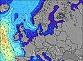 | 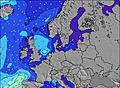 | 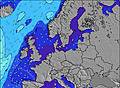 | 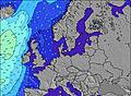 | 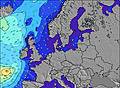 | 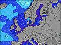 | 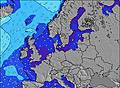 | ||||||||||||||
Wave Height (m) Direction Period (s) | NNW 3 | NNW 3 | WNW 3 | W 3 | WNW 3 | — | — | ESE 2 | ESE 4 | E 3 | E 4 | E 4 | — | — | WNW 3 | W 3 | — | WNW 4 | WNW 4 | NW 4 | NW 4 |
Wave Graph | |||||||||||||||||||||
3 | 1 | 3 | 3 | 1 | 0 | 0 | 0 | 0 | 0 | 0 | 0 | 0 | 0 | 4 | 1 | 0 | 20 | 28 | 16 | 17 | |
Wind (km/h) | |||||||||||||||||||||
Wind State on-shore cross-onshore cross-shore cross-offshore off-shore glassy | cross-on | on | cross-on | cross-on | glassy | off | off | cross-off | off | cross-off | off | cross | cross-on | cross-on | cross | cross-on | cross-off | cross-on | cross-on | cross-on | cross-on |
High Tide | 8:13PM0.01m | 7:47AM0.01m | 8:55PM0.00m | 9:03AM0.00m | 9:34PM0.00m | 10:38AM0.00m | 10:10PM0.00m | 12:08PM0.00m | 10:55PM0.01m | 1:28PM0.01m | 11:38PM0.01m | 2:28PM0.01m | 00:24AM0.02m | ||||||||
Low Tide | 2:32PM-0.00m | 1:26AM0.00m | 3:08PM-0.00m | 2:45AM-0.00m | 3:46PM-0.01m | 3:57AM-0.01m | 4:12PM-0.00m | 5:11AM-0.01m | 4:33PM-0.00m | 6:13AM-0.01m | 4:53PM0.00m | 7:09AM-0.00m | 5:21PM0.01m | ||||||||
5:26 | — | — | 5:28 | — | — | 5:30 | — | — | 5:31 | — | — | 5:33 | — | — | 5:35 | — | — | 5:37 | — | — | |
— | — | 9:16 | — | — | 9:15 | — | — | 9:13 | — | — | 9:10 | — | — | 9:08 | — | — | 9:07 | — | — | 9:05 | |
mm | — | — | — | — | — | — | — | — | — | — | — | — | — | — | — | — | 1 | — | — | — | — |
Temp °C | 16 | 19 | 19 | 18 | 20 | 20 | 19 | 22 | 22 | 21 | 27 | 27 | 25 | 28 | 26 | 23 | 27 | 24 | 17 | 19 | 18 |
Feels °C | 13 | 17 | 15 | 16 | 19 | 17 | 16 | 18 | 17 | 20 | 26 | 26 | 24 | 26 | 23 | 23 | 26 | 20 | 11 | 12 | 11 |
Swell 1 Height (m) Direction Period (s) | — | — | — | — | WNW 3 | — | — | — | — | — | — | E 4 | — | — | NW 4 | — | — | — | — | — | — |
— | — | — | — | 1 | — | — | — | — | — | — | 3 | — | — | 1 | — | — | — | — | — | — | |
Swell 2 Height (m) Direction Period (s) | — | — | — | — | — | — | — | — | — | — | — | — | — | — | — | — | — | — | — | — | — |
— | — | — | — | — | — | — | — | — | — | — | — | — | — | — | — | — | — | — | — | — | |
Swell 3 Height (m) Direction Period (s) | — | — | — | — | — | — | — | — | — | — | — | — | — | — | — | — | — | — | — | — | — |
— | — | — | — | — | — | — | — | — | — | — | — | — | — | — | — | — | — | — | — | — | |
Wind waves Height (m) Direction Period (s) | NNW 3 | NNW 3 | WNW 3 | W 3 | — | — | — | ESE 2 | ESE 4 | E 3 | E 4 | — | — | — | WNW 3 | W 3 | — | WNW 4 | WNW 4 | NW 4 | NW 4 |
3 | 1 | 3 | 3 | — | — | — | 1 | 10 | 8 | 21 | — | — | — | 4 | 1 | — | 20 | 28 | 16 | 17 | |
Nearest Offshore or Glassy | |||||||||||||||||||||
Distance (km) | 982 | 1208 | 1225 | 1046 | 1046 | 259 | 259 | 992 | 259 | 1000 | 795 | 994 | 640 | 712 | 712 | 726 | 795 | 1183 | 840 | 1169 | 253 |
Best forecast wave conditions in Ostsee | |||||||||||||||||||||
Best forecast wave conditions in Germany | |||||||||||||||||||||
Header Global | |||||||||||||||||||||
- Map Icons:
 Break
Break Live Wave Height (m)
 Live Wind Speed (km/h)
 Surf Rating (10 Max)
 Ocean Swells (m)
- Wind Speed (km/h)
Latest Updates


FREE! Surf-Forecast.com widget for your website
The surf report / weather widget below is available to embed on third party websites free of charge and provides a summary of our Dazendorf surf forecast. Simply grab the html code snippet that we provide and paste it into your own site. You can choose your preferred language and metric/imperial units for the surf forecast feed to suit users of your site. Click here to get the code.
Information about the Dazendorf Surf forecast
The above surf forecast table for Dazendorf provides essential information for determining whether the surfing conditions will be good over the next 16 days. A general guide to surfing at Dazendorf can be found by selecting the local surf guide option on the grey menu. Our Dazendorf surf forecast is unique since it includes wave energy (power) that defines the real feel of the surf rather than just the height or the period. If you surf the same spot (Dazendorf) regularly then make a mental note of the wave energy from the surf forecast table each time you go. Very soon you may start to choose your surf days based on the wave energy alone combined with our forecast of favourable offshore wind conditions. Our star ratings will help here and of course you will also find the usual wave height and period predictions on our surf forecasts as well as a full break down of the swell components under our advanced users option (to reveal that, click the little Einstein character under the tide times).
Further information to help with frequently asked questions about our surf forecast for Dazendorf may be found under the help tab on the top menu and also by moving your mouse over the question marks on the surf forecast table itself. Please always bear in mind that the forecast is for near-shore open water and local factors at each surf break influence the actual breaking wave height, such as the beach / reef profile, water depths offshore and shelter.
 Nearest