

Surf Forecasts:

Chacopata surf forecast from 5 Jul 2026:
- Most powerful swell: Friday 10 Jul, 5PM (local time) - 2ft (0.6m), 3s period, ENE swell with 7 kJ wave energy.
Best Forecast Surf Conditions for Chacopata this week:
The most powerful waves expected at Chacopata in the next 16 days are 0.6m 3s and forecast to arrive on Friday (Jul 10) at 5PM. Winds are predicted to be onshore at the time the swell arrives.
| Wave Type | Time (-04) & Date | Wave Height & Period |
|---|---|---|
| Next good surf (1 star+) | - | - |
| Best Surf | - | - |
| Most Powerful | 5PM (Fri 10th Jul) | 2ft (0.6m) 3s |
Table - best surf conditions forecast for Chacopata over the next 16 days.
Updates in hr min s Forecast update imminent
Alright, Rusty here. Let’s have a look at what’s cookin’ for the next couple of weeks.
To be straight with you, this is a tough one. The outlook for the next 16 days is a real flat spell, and there’s just no surf worth paddling out for. The first recommendation doesn’t come until the afternoon of the 5th of July, and even then it’s a tiny, weak slop. The pattern is consistent: small, wind-affected waves and onshore breezes day after day.
We’re looking at a long stretch of disappointment. The combined swell energy never gets above 7 for the entire period, which is dead weak. The swell is coming from the ENE and NE, which is directly onshore for Chacopata (NE optimum), so the wind is constantly messing up what little wave there is. The wind is either a fresh breeze or a strong breeze, which means the surface is blown out and choppy.
The water temperature is about normal for this time of year, so no surprises there.
The 15th of July morning has a tiny 0.3 ft swell from the NE with a period of 8 seconds, but it’s just a flicker in the pan with wind ruining it. The 17th of July morning is a similar story: 0.3 ft from the NE with a 7-second period, but again, the onshore wind is too strong. There’s nothing to get excited about.
This is a blank run for the whole 16-day window. The only break on offer is Chacopata, a reef setup, but it just doesn’t have the juice. The wind is always onshore, so this setup looks more interesting for kite surfing than paddle surfing. Sometimes it’s a good spot, but not this time. The forecast can change, but right now, leave the boards at home.
Rusty.
Short Range ForecastLight rain (total 2mm), mostly falling on Tue afternoon. Warm (max 27°C on Sat night, min 25°C on Sat night). Mainly fresh winds. | Days 5-7 Weather SummaryMostly dry. Warm (max 29°C on Wed morning, min 25°C on Tue night). Mainly fresh winds. | ||||||||||||||||||||
Sunday 5 | Monday 6 | Tuesday 7 | Wednesday 8 | Thursday 9 | Friday 10 | Sat 11 | |||||||||||||||
Night | AM | PM | Night | AM | PM | Night | AM | PM | Night | AM | PM | Night | AM | PM | Night | AM | PM | Night | AM | PM | |
Swell Height Map |  | 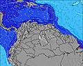 | 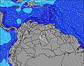 | 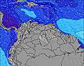 | 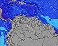 | 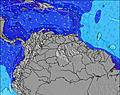 | 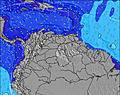 | 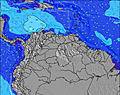 | |||||||||||||
Wave Height (m) Direction Period (s) | — | — | ENE 3 | NE 8 | — | NE 2 | E 2 | — | ENE 3 | E 2 | ENE 2 | ENE 3 | — | E 2 | NE 3 | — | ENE 2 | ENE 3 | E 2 | ENE 3 | ENE 3 |
Wave Graph | |||||||||||||||||||||
0 | 0 | 4 | 3 | 0 | 1 | 1 | 0 | 5 | 1 | 1 | 3 | 0 | 1 | 2 | 0 | 1 | 7 | 1 | 1 | 3 | |
Wind (km/h) | |||||||||||||||||||||
Wind State on-shore cross-onshore cross-shore cross-offshore off-shore glassy | cross-on | on | on | cross-on | on | on | cross-on | on | on | cross-on | cross-on | on | cross-on | cross-on | on | cross-on | on | on | cross-on | on | on |
High Tide | 00:30AM0.24m | 7:32AM0.31m | 00:42AM0.26m | 7:54AM0.27m | 00:59AM0.29m | 8:19AM0.23m | 1:18AM0.31m | 8:40AM0.17m | 1:40AM0.34m | 3:11PM0.13m | 2:10AM0.37m | 4:26PM0.11m | 2:47AM0.39m | ||||||||
Low Tide | 3:03AM0.22m | 4:07PM0.09m | 4:12AM0.21m | 4:29PM0.10m | 5:18AM0.19m | 4:53PM0.11m | 6:31AM0.16m | 5:16PM0.11m | 11:52AM0.10m | 5:37PM0.11m | 11:57AM0.05m | 5:49PM0.11m | 12:14PM0.00m | ||||||||
— | 5:56 | — | — | 5:58 | — | — | 5:58 | — | — | 5:58 | — | — | 5:58 | — | — | 5:58 | — | — | 5:58 | — | |
6:40 | — | 6:40 | — | — | 6:40 | — | — | 6:40 | — | — | 6:40 | — | — | 6:40 | — | — | 6:40 | — | — | 6:40 | |
mm | — | — | — | — | — | — | — | — | 2 | — | — | — | — | — | — | — | — | — | — | — | — |
Temp °C | 27 | 27 | 27 | 27 | 26 | 27 | 27 | 27 | 27 | 26 | 29 | 27 | 26 | 28 | 28 | 27 | 28 | 28 | 27 | 26 | 26 |
Feels °C | 27 | 28 | 27 | 27 | 28 | 28 | 28 | 28 | 28 | 26 | 28 | 25 | 25 | 27 | 27 | 27 | 27 | 25 | 25 | 24 | 23 |
Swell 1 Height (m) Direction Period (s) | — | — | — | NE 8 | — | — | — | — | — | — | — | — | — | — | — | — | — | — | — | — | — |
— | — | — | 3 | — | — | — | — | — | — | — | — | — | — | — | — | — | — | — | — | — | |
Swell 2 Height (m) Direction Period (s) | — | — | — | — | — | — | — | — | — | — | — | — | — | — | — | — | — | — | — | — | — |
— | — | — | — | — | — | — | — | — | — | — | — | — | — | — | — | — | — | — | — | — | |
Swell 3 Height (m) Direction Period (s) | — | — | — | — | — | — | — | — | — | — | — | — | — | — | — | — | — | — | — | — | — |
— | — | — | — | — | — | — | — | — | — | — | — | — | — | — | — | — | — | — | — | — | |
Wind waves Height (m) Direction Period (s) | — | — | ENE 3 | — | — | NE 2 | E 2 | — | ENE 3 | E 2 | ENE 2 | ENE 3 | — | E 2 | NE 3 | — | ENE 2 | ENE 3 | E 2 | ENE 3 | ENE 3 |
— | — | 4 | — | — | 1 | 1 | — | 5 | 1 | 1 | 3 | — | 1 | 2 | — | 1 | 7 | 1 | 1 | 3 | |
Nearest Offshore or Glassy | |||||||||||||||||||||
Distance (km) | 51 | 269 | 269 | 60 | 165 | 349 | 51 | 165 | 269 | 51 | 60 | 320 | 260 | 260 | 269 | 260 | 1426 | 931 | 260 | 349 | 349 |
Best forecast wave conditions in Sucre | |||||||||||||||||||||
Best forecast wave conditions in Venezuela | |||||||||||||||||||||
Header Global | |||||||||||||||||||||
- Map Icons:
 Break
Break Live Wave Height (m)
 Live Wind Speed (km/h)
 Surf Rating (10 Max)
 Ocean Swells (m)
- Wind Speed (km/h)


FREE! Surf-Forecast.com widget for your website
The surf report / weather widget below is available to embed on third party websites free of charge and provides a summary of our Chacopata surf forecast. Simply grab the html code snippet that we provide and paste it into your own site. You can choose your preferred language and metric/imperial units for the surf forecast feed to suit users of your site. Click here to get the code.
Information about the Chacopata Surf forecast
The above surf forecast table for Chacopata provides essential information for determining whether the surfing conditions will be good over the next 16 days. A general guide to surfing at Chacopata can be found by selecting the local surf guide option on the grey menu. Our Chacopata surf forecast is unique since it includes wave energy (power) that defines the real feel of the surf rather than just the height or the period. If you surf the same spot (Chacopata) regularly then make a mental note of the wave energy from the surf forecast table each time you go. Very soon you may start to choose your surf days based on the wave energy alone combined with our forecast of favourable offshore wind conditions. Our star ratings will help here and of course you will also find the usual wave height and period predictions on our surf forecasts as well as a full break down of the swell components under our advanced users option (to reveal that, click the little Einstein character under the tide times).
Further information to help with frequently asked questions about our surf forecast for Chacopata may be found under the help tab on the top menu and also by moving your mouse over the question marks on the surf forecast table itself. Please always bear in mind that the forecast is for near-shore open water and local factors at each surf break influence the actual breaking wave height, such as the beach / reef profile, water depths offshore and shelter.
Chacopata is 12 km (7 miles) from the city of El Guamache. If you plan a holiday in Sucre, look for hotels and other accommodation in El Guamache. El Guamache has rooms for a wide range of budgets as well as car hire and transport links.
 Nearest