

Surf Forecasts:

Boston Bay surf forecast from 29 Jul 2026:
- Most powerful swell: Friday 31 Jul, 1PM (local time) - 6.5ft (2.0m), 9s period, ESE swell with 643 kJ wave energy.
Best Forecast Surf Conditions for Boston Bay this week:
The most powerful waves expected at Boston Bay in the next 16 days are 2.0m 9s and forecast to arrive on Friday (Jul 31) at 1PM. Winds are predicted to be onshore at the time the swell arrives.
| Wave Type | Time (EST) & Date | Wave Height & Period |
|---|---|---|
| Next good surf (1 star+) | - | - |
| Best Surf | - | - |
| Most Powerful | 1PM (Fri 31st Jul) | 6.5ft (2.0m) 9s |
Table - best surf conditions forecast for Boston Bay over the next 16 days.
The Lowdown
Alright folks, Rusty here. Let’s get into it.
Well, I’ll be straight with you – this 16-day stretch for Boston Bay is a tough one. The whole period is a battle with onshore winds that just won’t give up. We’re looking at a solid run of poor surf conditions, so don’t go getting your hopes up for anything clean or classic.
The pattern is pretty monotonous. From the get-go on Tuesday the 28th of July, we’ve got a persistent ESE wind blowing straight onshore, smashing up a weak, short-period swell. The water is a balmy 85°F with a water temp anomaly of 2°F, so it’s basically average for the time of year. The first few days offer nothing but poor surf with combined swell energy struggling to break triple digits, like a measly 68 on the 28th.
We finally see a bit of size pick up around Thursday the 30th, with the swell hitting 4ft to 6ft but the wind is still on it, and the energy starts climbing into the moderate range (183-347). By Friday the 31st, we’ve got 6ft of ESE swell coming in at a 9-second period, with combined energy hitting 593-607, but it’s all cross-onshore and choppy. Still, the surf report screams “poor.”
The only real standout, if you can call it that, comes on the morning of Saturday the 1st of August. The swell is still 6ft from the ESE with a 9-second period, and the combined energy is a solid 729. The wind is straight onshore, but for a brief moment, the forecast calls it “marginal” rather than “poor.” That’s the best we’ve got all week, and it’s barely a whisper.
The same story repeats through the rest of the first week and into the second. There’s a couple of days with a bit of size—like the morning of Friday the 7th of August with 8ft swell and energy of 1415, and the 11th of August with 8ft swell and a whopping 1813 of combined energy. But that’s big, onshore, and messy. For a beginner spot like Boston Bay, anything over 5ft is already too much, and over 8ft is expert-only territory. With the onshore wind, it’s just a washing machine. In fact, with that much wind and swell, the setup looks more interesting for kite surfing than paddle surfing.
Honestly, there’s no clean, glassy, or offshore window in the entire 16 days. I can’t give you a single break to run to. It’s a long, flat, and bumpy outlook. Keep your board in the car and check the forecast again in a few days – things can change.
Rusty
Short Range ForecastLight rain (total 9mm), mostly falling on Wed night. Warm (max 30°C on Wed morning, min 27°C on Tue night). Wind will be generally light. | Days 5-7 Weather SummaryLight rain (total 4mm), mostly falling on Fri night. Warm (max 30°C on Mon morning, min 27°C on Fri night). Wind will be generally light. | |||||||||||||||||||
Tue 28 | Wednesday 29 | Thursday 30 | Friday 31 | Saturday 1 | Sunday 2 | Monday 3 | ||||||||||||||
PM | Night | AM | PM | Night | AM | PM | Night | AM | PM | Night | AM | PM | Night | AM | PM | Night | AM | PM | Night | |
Swell Height Map |  | 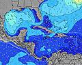 | 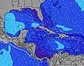 | 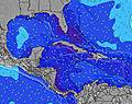 | 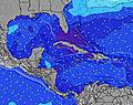 | 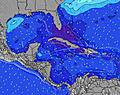 | 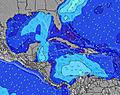 | |||||||||||||
Wave Height (m) Direction Period (s) | ESE 6 | ESE 6 | ESE 6 | ESE 6 | ESE 7 | ESE 7 | ESE 8 | ESE 8 | ESE 9 | ESE 9 | ESE 9 | ESE 9 | ESE 8 | ESE 8 | ESE 8 | ESE 8 | ESE 8 | ESE 8 | ESE 8 | SE 9 |
Wave Graph | ||||||||||||||||||||
66 | 47 | 47 | 78 | 158 | 181 | 344 | 453 | 588 | 601 | 354 | 419 | 249 | 232 | 183 | 284 | 298 | 365 | 294 | 429 | |
Wind (km/h) | ||||||||||||||||||||
Wind State on-shore cross-onshore cross-shore cross-offshore off-shore glassy | on | on | on | on | on | on | on | cross-on | cross-on | on | on | on | cross-on | cross-on | on | on | cross-on | on | cross-on | cross-on |
High Tide | 9:01PM0.35m | 8:35AM0.20m | 9:29PM0.35m | 9:14AM0.22m | 9:55PM0.35m | 9:56AM0.24m | 10:21PM0.34m | 10:41AM0.25m | 10:46PM0.32m | 11:33AM0.26m | 11:14PM0.29m | 12:33PM0.27m | 11:46PM0.26m | |||||||
Low Tide | 3:39AM0.11m | 2:22PM0.05m | 4:05AM0.11m | 2:58PM0.07m | 4:31AM0.11m | 3:36PM0.09m | 4:58AM0.11m | 4:19PM0.12m | 5:26AM0.10m | 5:11PM0.14m | 6:00AM0.09m | 6:19PM0.16m | ||||||||
— | — | 5:41 | — | — | 5:41 | — | — | 5:43 | — | — | 5:43 | — | — | 5:43 | — | — | 5:43 | — | — | |
6:40 | — | — | 6:40 | — | — | 6:39 | — | — | 6:39 | — | — | 6:38 | — | — | 6:38 | — | — | 6:37 | — | |
mm | — | — | — | — | 4 | 3 | 2 | — | — | — | 1 | 1 | 1 | — | — | — | 1 | — | — | — |
Temp °C | 29 | 28 | 30 | 30 | 28 | 29 | 29 | 28 | 30 | 29 | 28 | 29 | 29 | 27 | 29 | 29 | 28 | 30 | 30 | 28 |
Feels °C | 30 | 31 | 31 | 32 | 31 | 30 | 30 | 30 | 31 | 30 | 30 | 30 | 30 | 29 | 29 | 30 | 30 | 30 | 31 | 30 |
Swell 1 Height (m) Direction Period (s) | NE 7 | ESE 6 | NE 7 | NE 7 | — | E 10 | NE 9 | NE 7 | ENE 7 | ESE 9 | ESE 9 | ESE 9 | ESE 8 | NE 7 | NE 7 | NE 6 | NE 7 | ESE 8 | NE 6 | ESE 8 |
2 | 47 | 2 | 2 | — | 2 | 3 | 14 | 5 | 601 | 354 | 267 | 249 | 24 | 15 | 9 | 13 | 237 | 11 | 267 | |
Swell 2 Height (m) Direction Period (s) | — | NE 7 | — | — | — | — | — | — | — | ENE 8 | NE 8 | NE 7 | NE 6 | — | — | — | — | ENE 7 | — | NE 7 |
— | 2 | — | — | — | — | — | — | — | 6 | 17 | 43 | 51 | — | — | — | — | 5 | — | 14 | |
Swell 3 Height (m) Direction Period (s) | — | — | — | — | — | — | — | — | — | — | — | — | — | — | — | — | — | — | — | — |
— | — | — | — | — | — | — | — | — | — | — | — | — | — | — | — | — | — | — | — | |
Wind waves Height (m) Direction Period (s) | ESE 6 | — | ESE 6 | ESE 6 | ESE 7 | ESE 7 | ESE 8 | ESE 8 | ESE 9 | — | — | ESE 9 | — | ESE 8 | ESE 8 | ESE 8 | ESE 8 | ESE 8 | ESE 8 | SE 9 |
66 | — | 47 | 78 | 158 | 181 | 344 | 453 | 588 | — | — | 419 | — | 232 | 183 | 284 | 298 | 365 | 294 | 429 | |
Nearest Offshore or Glassy | ||||||||||||||||||||
Distance (km) | 401 | 40 | 801 | 401 | 34 | 781 | 401 | 805 | 749 | 401 | 34 | 519 | 401 | 34 | 644 | 401 | 34 | 803 | 401 | 34 |
Best forecast wave conditions in Jamaica | ||||||||||||||||||||
Best forecast wave conditions in Jamaica | ||||||||||||||||||||
Header Global | ||||||||||||||||||||
- Map Icons:
 Break
Break Live Wave Height (m)
 Live Wind Speed (km/h)
 Surf Rating (10 Max)
 Ocean Swells (m)
- Wind Speed (km/h)


FREE! Surf-Forecast.com widget for your website
The surf report / weather widget below is available to embed on third party websites free of charge and provides a summary of our Boston Bay surf forecast. Simply grab the html code snippet that we provide and paste it into your own site. You can choose your preferred language and metric/imperial units for the surf forecast feed to suit users of your site. Click here to get the code.
Information about the Boston Bay Surf forecast
The above surf forecast table for Boston Bay provides essential information for determining whether the surfing conditions will be good over the next 16 days. A general guide to surfing at Boston Bay can be found by selecting the local surf guide option on the grey menu. Our Boston Bay surf forecast is unique since it includes wave energy (power) that defines the real feel of the surf rather than just the height or the period. If you surf the same spot (Boston Bay) regularly then make a mental note of the wave energy from the surf forecast table each time you go. Very soon you may start to choose your surf days based on the wave energy alone combined with our forecast of favourable offshore wind conditions. Our star ratings will help here and of course you will also find the usual wave height and period predictions on our surf forecasts as well as a full break down of the swell components under our advanced users option (to reveal that, click the little Einstein character under the tide times).
Further information to help with frequently asked questions about our surf forecast for Boston Bay may be found under the help tab on the top menu and also by moving your mouse over the question marks on the surf forecast table itself. Please always bear in mind that the forecast is for near-shore open water and local factors at each surf break influence the actual breaking wave height, such as the beach / reef profile, water depths offshore and shelter.
Are you planning a holiday in Jamaica? If you are looking for accommodation near Boston Bay, camping, hotels and holiday cottages in Jamaica, consider staying in Port Antonio which is 5 km (3 miles) away. Other places in and around Jamaica where you can find information about places to rent, and car hire include Rocky Point which is 29 km (18 miles) away, New Kingston, Kingston and Half Way Tree.
 Nearest