

Surf Forecasts:

Bat Galim surf forecast from 19 Jul 2026:
- Best quality surf: Saturday 25 Jul, 12AM (local time) - 3ft (0.9m), 7s period, WNW swell with cross-offshore winds.
- Most powerful swell: Friday 24 Jul, 6PM (local time) - 3ft (0.9m), 7s period, WNW swell with 91 kJ wave energy.
- Next surfable swell (1★+): Saturday 25 Jul, 12AM (local time) - 3ft (0.9m), 7s period with WNW swell.
Best Forecast Surf Conditions for Bat Galim this week:
The surf forecast for Bat Galim over the next 16 days: The first swell (rated 1 star or higher) is forecast to arrive on Saturday (Jul 25) at 12AM. The primary swell is predicted to be 0.9m and 7s period. The wind is predicted to be cross-offshore as the swell arrives.
The most powerful waves expected at Bat Galim in the next 16 days are 0.9m 7s and forecast to arrive on Friday (Jul 24) at 6PM. Winds are predicted to be cross-onshore at the time the swell arrives. The largest open ocean swell (not directed at the beach) is 0.5m 3s period and expected on Thursday (Jul 23) at 12PM.
| Wave Type | Time (IDT) & Date | Wave Height & Period |
|---|---|---|
| Next good surf (1 star+) | 12AM (Sat 25th Jul) | 3ft (0.9m) 7s |
| Best Surf | 12AM (Sat 25th Jul) | 3ft (0.9m) 7s |
| Most Powerful | 6PM (Fri 24th Jul) | 3ft (0.9m) 7s |
Table - best surf conditions forecast for Bat Galim over the next 16 days.
The Lowdown
Alright, Rusty here. Let's have a look at what's on the table for Bat Galim.
To be straight with you, the next 16 days are looking pretty flat and frustrating. The whole window is a run of poor surf conditions, with no standout sessions on offer. The swell is tiny, and the wind is mostly messy. The first recommendation doesn't come until the 19th of July, and even then it's a struggle.
We start off on Sunday the 19th with a tiny 2ft swell from the WNW, but the wind is cross and cross-on, making for choppy, bumpy waves. The combined energy is weak (27), and it's just not worth paddling out.
Monday the 20th drops even smaller, 1ft to 1ft, and the cross-onshore breeze keeps things ugly. The energy is virtually nothing (7 to 13). Tuesday the 21st and Wednesday the 22nd get a bit cleaner with a cross-off breeze in the mornings, but the swell is still puny at 1ft to 2ft. The energy is still weak (11 to 15).
Thursday the 23rd through to Saturday the 25th see a slight bump in swell to 2ft-3ft, with cleaner mornings thanks to a light cross-off breeze from the SSW. The combined energy climbs to a moderate 55-64 on Saturday morning the 25th, but the swell is short-period (6-7 seconds), so it'll be weak and lack any push. The best of a bad bunch is probably Saturday morning the 25th of July, with a 3ft WNW swell under a light cross-off breeze. The water is about average for this time of year, nothing to write home about.
Then we hit a real lull from Sunday the 26th into Monday the 28th with onshore winds and the swell dropping to 1ft-1ft. The energy is gone (7 to 11).
On Monday the 27th of July, the swell picks up to 4ft from the WNW, but it's accompanied by a strong onshore NNW wind blowing at 12 mph. That onshore wind will tear it to shreds. The wave energy is moderate (235), but the quality is poor. This is a no-go.
The rest of the week into early August is a sad story of tiny waves and onshore or cross-shore winds. The swell never gets above 3ft, and the energy stays weak (10 to 68). The spot is inconsistent, and this long stretch of flatness is pretty normal for the area.
Look, I hate to say it, but there's nothing here that gets me excited. The best chance for a splash is Saturday morning the 25th of July. It's not a standout, but it's the cleanest window with that 3ft WNW swell and a light cross-off breeze. The combined energy is a moderate 64, so there's a little bit of life. Just keep your expectations low.
Rusty.
Short Range ForecastMostly dry. Warm (max 29°C on Sun morning, min 26°C on Sat night). Wind will be generally light. | Days 5-7 Weather SummaryMostly dry. Warm (max 29°C on Wed morning, min 25°C on Tue night). Wind will be generally light. | ||||||||||||||||||
Sunday 19 | Monday 20 | Tuesday 21 | Wednesday 22 | Thursday 23 | Friday 24 | ||||||||||||||
Night | AM | PM | Night | AM | PM | Night | AM | PM | Night | AM | PM | Night | AM | PM | Night | AM | PM | Night | |
Swell Height Map | 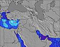 | 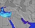 | 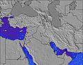 | 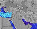 | 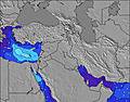 | 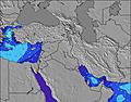 | 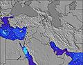 | ||||||||||||
Wave Height (m) Direction Period (s) | WNW 8 | WNW 7 | WNW 7 | WNW 6 | WNW 6 | WNW 6 | WNW 6 | WNW 5 | WNW 5 | WNW 5 | W 5 | W 5 | W 6 | WNW 7 | W 7 | W 6 | WNW 6 | WNW 6 | WNW 7 |
Wave Graph | |||||||||||||||||||
33 | 27 | 26 | 13 | 13 | 7 | 7 | 11 | 14 | 7 | 15 | 19 | 20 | 17 | 47 | 54 | 55 | 50 | 84 | |
Wind (km/h) | |||||||||||||||||||
Wind State on-shore cross-onshore cross-shore cross-offshore off-shore glassy | glassy | cross | cross-on | cross-on | cross-on | cross-on | glassy | cross-off | cross-on | cross-off | cross-off | cross | cross-off | cross-off | cross | cross-off | cross-off | cross | cross-off |
High Tide | 2:03AM0.31m | 2:01PM0.32m | 2:41AM0.30m | 2:40PM0.28m | 3:24AM0.29m | 3:30PM0.24m | 4:22AM0.28m | 5:00PM0.21m | 5:49AM0.27m | 7:37PM0.21m | 7:24AM0.28m | 8:57PM0.23m | |||||||
Low Tide | 7:57AM0.10m | 8:21PM0.08m | 8:44AM0.12m | 8:54PM0.11m | 9:43AM0.14m | 9:32PM0.14m | 11:17AM0.15m | 10:35PM0.16m | 1:23PM0.14m | 00:30AM0.17m | 2:41PM0.12m | 2:04AM0.16m | |||||||
— | 5:43 | — | — | 5:45 | — | — | 5:46 | — | — | 5:46 | — | — | 5:47 | — | — | 5:47 | — | — | |
7:47 | — | 7:46 | — | — | 7:46 | — | — | 7:45 | — | — | 7:45 | — | — | 7:45 | — | — | 7:44 | — | |
mm | — | — | — | — | — | — | — | — | — | — | — | — | — | — | — | — | — | — | — |
Temp °C | 27 | 29 | 29 | 27 | 28 | 28 | 27 | 29 | 28 | 27 | 29 | 28 | 27 | 29 | 29 | 27 | 29 | 29 | 27 |
Feels °C | 31 | 29 | 30 | 31 | 30 | 29 | 31 | 29 | 29 | 31 | 29 | 29 | 32 | 29 | 30 | 31 | 29 | 31 | 31 |
Swell 1 Height (m) Direction Period (s) | WNW 8 | WNW 7 | WNW 7 | WNW 6 | WNW 6 | WNW 6 | WNW 6 | WNW 5 | — | WNW 5 | W 5 | WNW 7 | W 6 | WNW 7 | W 7 | W 6 | WNW 6 | WNW 6 | WNW 7 |
33 | 27 | 26 | 13 | 13 | 7 | 7 | 11 | — | 7 | 15 | 5 | 20 | 17 | 47 | 54 | 55 | 50 | 84 | |
Swell 2 Height (m) Direction Period (s) | — | — | — | W 8 | — | — | — | — | — | — | — | — | W 8 | — | — | — | — | — | — |
— | — | — | 1 | — | — | — | — | — | — | — | — | 1 | — | — | — | — | — | — | |
Swell 3 Height (m) Direction Period (s) | — | — | — | — | — | — | — | — | — | — | — | — | — | — | — | — | — | — | — |
— | — | — | — | — | — | — | — | — | — | — | — | — | — | — | — | — | — | — | |
Wind waves Height (m) Direction Period (s) | — | — | — | — | — | — | — | — | WNW 5 | — | — | W 5 | — | SW 3 | SW 3 | — | — | — | — |
— | — | — | — | — | — | — | — | 14 | — | — | 19 | — | 2 | 3 | — | — | — | — | |
Nearest Offshore or Glassy | |||||||||||||||||||
Distance (km) | 2691 | 2423 | 3747 | 2226 | 3043 | 3465 | 2780 | 2226 | 2226 | 2172 | 2172 | 2226 | 1454 | 1451 | 2226 | 5 | 2226 | 2226 | 0 |
Best forecast wave conditions in North of Tel Aviv | |||||||||||||||||||
Best forecast wave conditions in Israel | |||||||||||||||||||
Header Global | |||||||||||||||||||
- Map Icons:
 Break
Break Live Wave Height (m)
 Live Wind Speed (km/h)
 Surf Rating (10 Max)
 Ocean Swells (m)
- Wind Speed (km/h)


FREE! Surf-Forecast.com widget for your website
The surf report / weather widget below is available to embed on third party websites free of charge and provides a summary of our Bat Galim surf forecast. Simply grab the html code snippet that we provide and paste it into your own site. You can choose your preferred language and metric/imperial units for the surf forecast feed to suit users of your site. Click here to get the code.
Information about the Bat Galim Surf forecast
The above surf forecast table for Bat Galim provides essential information for determining whether the surfing conditions will be good over the next 16 days. A general guide to surfing at Bat Galim can be found by selecting the local surf guide option on the grey menu. Our Bat Galim surf forecast is unique since it includes wave energy (power) that defines the real feel of the surf rather than just the height or the period. If you surf the same spot (Bat Galim) regularly then make a mental note of the wave energy from the surf forecast table each time you go. Very soon you may start to choose your surf days based on the wave energy alone combined with our forecast of favourable offshore wind conditions. Our star ratings will help here and of course you will also find the usual wave height and period predictions on our surf forecasts as well as a full break down of the swell components under our advanced users option (to reveal that, click the little Einstein character under the tide times).
Further information to help with frequently asked questions about our surf forecast for Bat Galim may be found under the help tab on the top menu and also by moving your mouse over the question marks on the surf forecast table itself. Please always bear in mind that the forecast is for near-shore open water and local factors at each surf break influence the actual breaking wave height, such as the beach / reef profile, water depths offshore and shelter.
Bat Galim is 2 km (1 miles) from Haifa. If you plan a holiday in North of Tel Aviv, look for hotels and other accommodation in Haifa. Haifa has rooms for a wide range of budgets as well as car hire and transport links.
 Nearest