

Surf Forecasts:

How big are the waves at Amouli today (02 Aug):
- Morning surf: Morning surf (02 Aug, local time) - 4.5ft (1.3m), 11s period with SSE swell.
- Afternoon surf: Afternoon surf (02 Aug, local time) - 4ft (1.2m), 11s period with SSE swell.
- Evening surf: Evening surf (02 Aug, local time) - 3.5ft (1.1m), 11s period with SE swell.
The current surf forecast for Amouli at 7PM is: 1.1m 11s primary swell from a Southeast direction and 1.0m 8s secondary swell from a East direction (forecast issued at 12:00pm August 02). The wind direction is predicted to be cross-shore.
| Time (SST) & Date | Wave Height | Wave Period |
|---|---|---|
| Morning (02 Aug) | 4.5ft (1.3m) | 11s |
| Afternoon (02 Aug) | 4ft (1.2m) | 11s |
| Evening (02 Aug) | 3.5ft (1.1m) | 11s |
Table - waves today at Amouli. (Swell directed towards the surf break)
Short Range ForecastLight rain (total 6mm), mostly falling on Tue night. Warm (max 26°C on Sun morning, min 25°C on Mon night). Winds increasing (calm on Mon morning, fresh winds from the SSE by Tue night). | |||||||||||||||||||||
Sun 2 | Monday 3 | Tuesday 4 | |||||||||||||||||||
10 AM | 1 PM | 4 PM | 7 PM | 10 PM | 1 AM | 4 AM | 7 AM | 10 AM | 1 PM | 4 PM | 7 PM | 10 PM | 1 AM | 4 AM | 7 AM | 10 AM | 1 PM | 4 PM | 7 PM | 10 PM | |
Swell Height Map |  |  | 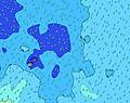 | 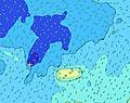 | 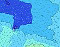 |  | 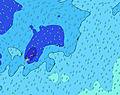 | 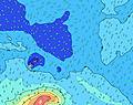 | |||||||||||||
Wave Height (m) Direction Period (s) | SSE 11 | SSE 11 | SSE 11 | SE 11 | SE 11 | SE 11 | SE 12 | SW 13 | SW 13 | SW 13 | SW 13 | SW 13 | SW 13 | SSW 15 | SSW 14 | S 14 | SW 13 | SSW 13 | SSW 12 | SSW 12 | SSW 12 |
Wave Graph | |||||||||||||||||||||
386 | 335 | 335 | 283 | 283 | 288 | 259 | 290 | 286 | 286 | 286 | 330 | 325 | 360 | 350 | 377 | 363 | 515 | 469 | 503 | 579 | |
Wind (km/h) | |||||||||||||||||||||
Wind State on-shore cross-onshore cross-shore cross-offshore off-shore glassy | cross | cross | cross | cross | cross | cross-off | cross-off | glassy | glassy | cross-on | cross-on | cross-on | on | on | on | on | on | on | on | on | on |
High Tide | 9:26AM0.92m | 9:57PM0.91m | 10:14AM0.88m | 10:48PM0.91m | 11:11AM0.85m | ||||||||||||||||
Low Tide | 3:38PM0.21m | 4:03AM0.25m | 4:24PM0.22m | 4:59AM0.26m | 5:17PM0.24m | ||||||||||||||||
6:43 | — | — | — | — | — | 6:43 | — | — | — | — | — | — | — | 6:43 | — | — | — | — | — | — | |
— | — | 6:13 | — | — | — | — | — | — | — | 6:13 | — | — | — | — | — | — | — | 6:14 | — | — | |
mm | — | — | — | 1 | — | — | 1 | — | — | — | — | — | — | — | — | — | — | — | — | — | — |
Temp °C | 26 | 26 | 26 | 26 | 26 | 26 | 26 | 26 | 26 | 26 | 26 | 26 | 25 | 25 | 25 | 25 | 25 | 25 | 26 | 25 | 25 |
Feels °C | 28 | 28 | 29 | 29 | 29 | 29 | 30 | 30 | 31 | 30 | 28 | 27 | 25 | 26 | 26 | 26 | 25 | 25 | 27 | 25 | 25 |
Swell 1 Height (m) Direction Period (s) | SSE 11 | SSE 11 | SSE 11 | SE 11 | SE 11 | SE 11 | SE 12 | SSE 12 | SW 13 | SW 13 | SW 13 | SW 13 | SW 13 | SW 13 | SW 12 | SW 12 | SW 13 | SSW 13 | SSW 12 | SSW 12 | SSW 12 |
386 | 335 | 335 | 283 | 283 | 288 | 259 | 231 | 286 | 286 | 286 | 330 | 325 | 315 | 295 | 291 | 363 | 515 | 469 | 503 | 579 | |
Swell 2 Height (m) Direction Period (s) | SW 15 | E 8 | E 8 | E 8 | E 8 | ENE 8 | ENE 8 | E 8 | E 8 | E 8 | SE 10 | SE 10 | SE 10 | SSW 15 | SSW 14 | S 14 | S 13 | SW 12 | SW 12 | SW 12 | SW 11 |
215 | 138 | 135 | 111 | 118 | 94 | 96 | 93 | 74 | 76 | 157 | 157 | 129 | 360 | 350 | 377 | 355 | 319 | 319 | 309 | 255 | |
Swell 3 Height (m) Direction Period (s) | NE 10 | SW 15 | SW 14 | SW 14 | SW 14 | SW 14 | SW 14 | SW 13 | SE 10 | SE 10 | E 8 | E 8 | SSW 15 | NE 9 | E 8 | SSW 5 | SSW 5 | SSE 9 | E 8 | E 8 | SW 18 |
23 | 218 | 203 | 248 | 248 | 241 | 221 | 290 | 100 | 98 | 78 | 76 | 228 | 21 | 58 | 21 | 16 | 53 | 78 | 61 | 266 | |
Wind waves Height (m) Direction Period (s) | E 8 | — | — | — | — | — | — | — | — | — | — | SSE 3 | ESE 8 | SE 10 | SSE 4 | E 8 | E 8 | E 8 | — | SE 9 | ESE 8 |
163 | — | — | — | — | — | — | — | — | — | — | 4 | 105 | 286 | 22 | 78 | 97 | 76 | — | 87 | 100 | |
Nearest Offshore or Glassy | |||||||||||||||||||||
Distance (km) | 2 | 2 | 2 | 2 | 2 | 0 | 0 | 0 | 0 | 28 | 28 | 28 | 28 | 28 | 28 | 622 | 621 | 621 | 1386 | 1386 | 1386 |
Best forecast wave conditions in American-Samoa - Tutuila | |||||||||||||||||||||
Best forecast wave conditions in American Samoa | |||||||||||||||||||||
Header Global | |||||||||||||||||||||
- Map Icons:
 Break
Break Live Wave Height (m)
 Live Wind Speed (km/h)
 Surf Rating (10 Max)
 Ocean Swells (m)
- Wind Speed (km/h)
Latest Updates


FREE! Surf-Forecast.com widget for your website
The surf report / weather widget below is available to embed on third party websites free of charge and provides a summary of our Amouli surf forecast. Simply grab the html code snippet that we provide and paste it into your own site. You can choose your preferred language and metric/imperial units for the surf forecast feed to suit users of your site. Click here to get the code.
 Nearest