

Surf Forecasts:

How big are the waves at Ambinanibe today (03 Aug):
- Morning surf: Morning surf (03 Aug, local time) - 2.5ft (0.7m), 11s period with SSE swell.
- Afternoon surf: Afternoon surf (03 Aug, local time) - 2.5ft (0.7m), 12s period with SSW swell.
- Evening surf: Evening surf (03 Aug, local time) - 2ft (0.6m), 12s period with S swell.
The current surf forecast for Ambinanibe at 7AM is: 0.8m 10s primary swell from a South-southeast direction (forecast issued at 02:00am August 03). An open ocean swell of 1.4m 9s is not directed at the surf break. The wind direction is predicted to be cross-offshore.
| Time (EAT) & Date | Wave Height | Wave Period |
|---|---|---|
| Morning (03 Aug) | 2.5ft (0.7m) | 11s |
| Afternoon (03 Aug) | 2.5ft (0.7m) | 12s |
| Evening (03 Aug) | 2ft (0.6m) | 12s |
Table - waves today at Ambinanibe. (Swell directed towards the surf break)
Short Range ForecastSome drizzle, heaviest during Mon night. Warm (max 25°C on Wed morning, min 20°C on Mon night). Wind will be generally light. | ||||||||||||||||||||||||
Monday 3 | Tuesday 4 | Wednesday 5 | ||||||||||||||||||||||
12 AM | 3 AM | 6 AM | 9 AM | 12 PM | 3 PM | 6 PM | 9 PM | 12 AM | 3 AM | 6 AM | 9 AM | 12 PM | 3 PM | 6 PM | 9 PM | 12 AM | 3 AM | 6 AM | 9 AM | 12 PM | 3 PM | 6 PM | 9 PM | |
Swell Height Map |  | 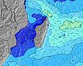 | 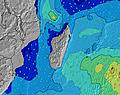 | 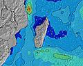 | 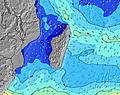 | 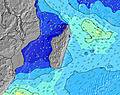 | 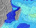 | 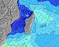 | 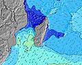 | |||||||||||||||
Wave Height (m) Direction Period (s) | SW 13 | SSE 11 | SSE 10 | SSE 11 | SSE 10 | SSW 12 | S 12 | S 12 | S 12 | S 12 | S 12 | S 12 | SSW 15 | SSW 15 | SSW 16 | SSW 13 | SSW 14 | SSW 14 | SSW 14 | SSW 14 | SSW 13 | SSW 13 | SSW 13 | SSW 13 |
Wave Graph | ||||||||||||||||||||||||
494 | 121 | 118 | 119 | 112 | 129 | 97 | 102 | 98 | 98 | 98 | 101 | 123 | 174 | 212 | 120 | 220 | 223 | 285 | 220 | 201 | 195 | 195 | 192 | |
Wind (km/h) | ||||||||||||||||||||||||
Wind State on-shore cross-onshore cross-shore cross-offshore off-shore glassy | cross-off | off | cross-off | glassy | on | cross-on | cross | cross-off | cross-off | off | cross-off | glassy | on | cross-on | cross | cross-off | cross-off | cross-off | cross-off | cross-off | cross | cross | cross-off | cross-off |
High Tide | 10:30PM0.41m | 10:39AM0.30m | 10:51PM0.39m | 11:06AM0.28m | 11:12PM0.36m | 11:35AM0.26m | ||||||||||||||||||
Low Tide | 5:02AM0.03m | 4:34PM0.04m | 5:27AM0.04m | 4:58PM0.06m | 5:52AM0.05m | 5:20PM0.09m | ||||||||||||||||||
— | — | 6:28 | — | — | — | — | — | — | — | 6:28 | — | — | — | — | — | — | — | 6:26 | — | — | — | — | — | |
— | — | — | — | — | 5:28 | — | — | — | — | — | — | — | 5:28 | — | — | — | — | — | — | — | 5:29 | — | — | |
mm | — | — | — | — | — | — | — | 1 | — | — | — | — | — | — | — | — | — | — | — | — | — | — | — | — |
Temp °C | 20 | 19 | 19 | 21 | 23 | 23 | 22 | 21 | 20 | 20 | 20 | 22 | 24 | 24 | 22 | 21 | 21 | 20 | 20 | 23 | 25 | 25 | 22 | 21 |
Feels °C | 21 | 20 | 20 | 22 | 23 | 23 | 23 | 22 | 21 | 21 | 22 | 25 | 25 | 25 | 22 | 21 | 22 | 20 | 20 | 22 | 22 | 22 | 20 | 20 |
Swell 1 Height (m) Direction Period (s) | ESE 9 | ESE 9 | ESE 9 | ESE 9 | ESE 10 | ESE 9 | ESE 9 | ESE 9 | ESE 9 | E 10 | ESE 10 | ESE 10 | ESE 9 | ESE 9 | ESE 9 | ESE 9 | E 9 | E 9 | E 9 | SSW 14 | SSW 13 | SSW 13 | SSW 13 | SSW 13 |
266 | 307 | 294 | 307 | 408 | 402 | 383 | 348 | 424 | 423 | 492 | 492 | 487 | 400 | 391 | 333 | 413 | 417 | 416 | 220 | 201 | 195 | 195 | 192 | |
Swell 2 Height (m) Direction Period (s) | SW 13 | SW 9 | SSE 10 | SW 9 | SSE 10 | SSW 12 | S 12 | S 12 | S 12 | S 12 | S 12 | S 12 | S 12 | SSW 15 | SSW 16 | SSW 13 | SSW 14 | SSW 14 | SSW 14 | SSE 11 | SSE 11 | SSE 11 | SSE 10 | SSE 10 |
494 | 114 | 118 | 76 | 112 | 129 | 97 | 102 | 98 | 98 | 98 | 101 | 101 | 174 | 212 | 120 | 220 | 223 | 285 | 24 | 40 | 22 | 22 | 11 | |
Swell 3 Height (m) Direction Period (s) | S 10 | SSE 11 | SW 9 | SSE 11 | SW 9 | S 10 | SW 8 | SSE 9 | SW 8 | SSE 9 | SW 8 | SSW 15 | SSW 15 | S 12 | S 11 | S 11 | S 11 | S 11 | SSE 11 | SW 7 | SW 7 | SW 7 | W 6 | W 6 |
77 | 121 | 78 | 119 | 59 | 74 | 33 | 48 | 32 | 32 | 16 | 86 | 123 | 98 | 66 | 63 | 61 | 62 | 41 | 2 | 2 | 2 | 1 | 1 | |
Wind waves Height (m) Direction Period (s) | — | — | — | — | — | — | — | — | — | NE 5 | NE 5 | — | — | — | — | NE 4 | — | ENE 9 | ENE 9 | E 9 | E 9 | E 9 | ENE 9 | ENE 9 |
— | — | — | — | — | — | — | — | — | 83 | 65 | — | — | — | — | 15 | — | 564 | 579 | 533 | 541 | 553 | 639 | 626 | |
Nearest Offshore or Glassy | ||||||||||||||||||||||||
Distance (km) | 0 | 0 | 0 | 0 | 20 | 20 | 8 | 0 | 0 | 0 | 0 | 0 | 20 | 959 | 20 | 8 | 0 | 0 | 0 | 20 | 368 | 963 | 961 | 20 |
Best forecast wave conditions in Madagascar - East | ||||||||||||||||||||||||
Best forecast wave conditions in Madagascar | ||||||||||||||||||||||||
Header Global | ||||||||||||||||||||||||
- Map Icons:
 Break
Break Live Wave Height (m)
 Live Wind Speed (km/h)
 Surf Rating (10 Max)
 Ocean Swells (m)
- Wind Speed (km/h)
Latest Updates


FREE! Surf-Forecast.com widget for your website
The surf report / weather widget below is available to embed on third party websites free of charge and provides a summary of our Ambinanibe surf forecast. Simply grab the html code snippet that we provide and paste it into your own site. You can choose your preferred language and metric/imperial units for the surf forecast feed to suit users of your site. Click here to get the code.
 Nearest