

Surf Forecasts:

How big are the waves at Vivier today (24 Jun):
- Morning surf: Morning surf (24 Jun, local time) - 3.5ft (1.0m), 14s period with SW swell.
- Afternoon surf: Afternoon surf (24 Jun, local time) - 3.5ft (1.0m), 14s period with SW swell.
- Evening surf: Evening surf (24 Jun, local time) - 3.5ft (1.0m), 14s period with SW swell.
The current surf forecast for Vivier at 7AM is: 1.0m 14s primary swell from a Southwest direction (forecast issued at 11:00pm June 23). An open ocean swell of 0.9m 8s is not directed at the surf break. The wind direction is predicted to be cross-shore.
| Time (GMT) & Date | Wave Height | Wave Period |
|---|---|---|
| Morning (24 Jun) | 3.5ft (1.0m) | 14s |
| Afternoon (24 Jun) | 3.5ft (1.0m) | 14s |
| Evening (24 Jun) | 3.5ft (1.0m) | 14s |
Table - waves today at Vivier. (Swell directed towards the surf break)
Updates in hr min s Forecast update imminent
Short Range ForecastLight rain (total 7mm), mostly falling on Wed afternoon. Warm (max 26°C on Tue night, min 22°C on Thu night). Winds decreasing (fresh winds from the E on Wed afternoon, calm by Fri morning). | ||||||||||||||||||||||||
Wednesday 24 | Thursday 25 | Friday 26 | ||||||||||||||||||||||
9 PM | 12 AM | 3 AM | 6 AM | 9 AM | 12 PM | 3 PM | 6 PM | 9 PM | 12 AM | 3 AM | 6 AM | 9 AM | 12 PM | 3 PM | 6 PM | 9 PM | 12 AM | 3 AM | 6 AM | 9 AM | 12 PM | 3 PM | 6 PM | |
Swell Height Map | 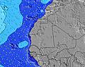 | 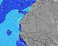 | 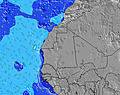 | 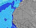 | 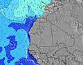 | 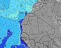 | 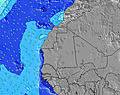 | 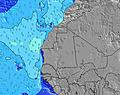 | 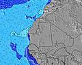 | 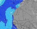 | ||||||||||||||
Wave Height (m) Direction Period (s) | SW 14 | SW 14 | SW 14 | SW 14 | SW 14 | SW 14 | SW 14 | SW 14 | SW 14 | SW 14 | SSW 13 | SSW 13 | SSW 13 | SSW 13 | SW 13 | SW 13 | SSW 13 | SW 13 | SW 12 | SW 12 | SW 12 | SSW 12 | SSW 12 | SSW 12 |
Wave Graph | ||||||||||||||||||||||||
305 | 301 | 395 | 437 | 368 | 379 | 390 | 395 | 390 | 363 | 309 | 304 | 304 | 299 | 249 | 245 | 212 | 164 | 154 | 149 | 147 | 96 | 94 | 94 | |
Wind (km/h) | ||||||||||||||||||||||||
Wind State on-shore cross-onshore cross-shore cross-offshore off-shore glassy | cross-on | cross-on | cross-on | cross | cross-off | cross-off | cross-off | on | cross | cross-off | cross-off | cross-off | cross-off | cross-off | cross-off | cross-off | cross-off | cross | cross | cross | glassy | on | cross-on | cross |
High Tide | 4:54AM0.96m | 5:06PM0.96m | 5:52AM0.98m | 6:07PM0.93m | 6:44AM1.01m | |||||||||||||||||||
Low Tide | 10:21PM0.29m | 10:47AM0.38m | 11:16PM0.30m | 11:53AM0.36m | 00:08AM0.28m | 12:50PM0.32m | ||||||||||||||||||
— | — | — | 6:41 | — | — | — | — | — | — | — | 6:41 | — | — | — | — | — | — | — | 6:41 | — | — | — | — | |
— | — | — | — | — | — | — | 7:42 | — | — | — | — | — | — | — | 7:42 | — | — | — | — | — | — | — | 7:42 | |
mm | — | — | — | — | — | — | 4 | 3 | — | — | — | — | — | — | — | — | — | — | — | — | — | — | — | — |
Temp °C | 26 | 25 | 25 | 24 | 24 | 24 | 24 | 24 | 24 | 24 | 23 | 23 | 23 | 23 | 23 | 23 | 23 | 23 | 23 | 22 | 22 | 23 | 24 | 23 |
Feels °C | 29 | 28 | 27 | 27 | 28 | 26 | 22 | 26 | 25 | 25 | 24 | 24 | 23 | 24 | 23 | 23 | 23 | 23 | 23 | 23 | 25 | 24 | 24 | 22 |
Swell 1 Height (m) Direction Period (s) | NNW 8 | NNW 8 | SW 14 | SW 14 | SW 14 | SW 14 | SW 14 | SW 14 | SW 14 | SW 14 | SSW 13 | NNW 9 | SSW 13 | SSW 13 | SW 13 | SW 13 | NNW 7 | SW 13 | SW 12 | NNW 7 | NNW 7 | NNW 7 | NNW 7 | NNW 8 |
107 | 102 | 395 | 437 | 368 | 379 | 390 | 395 | 390 | 363 | 309 | 141 | 304 | 299 | 249 | 245 | 105 | 164 | 154 | 136 | 117 | 125 | 125 | 128 | |
Swell 2 Height (m) Direction Period (s) | SW 14 | SW 14 | NNW 8 | NNW 8 | NNW 8 | NNW 8 | NNW 7 | NW 9 | NW 9 | NW 9 | S 7 | SSW 13 | NNW 6 | NW 8 | NW 9 | NW 8 | SSW 13 | SSW 6 | WNW 13 | SW 12 | SW 12 | SSW 12 | SSW 12 | SSW 12 |
305 | 301 | 107 | 87 | 77 | 75 | 54 | 67 | 40 | 41 | 8 | 304 | 41 | 35 | 27 | 35 | 212 | 4 | 17 | 149 | 147 | 96 | 94 | 94 | |
Swell 3 Height (m) Direction Period (s) | NW 10 | NW 10 | NNW 10 | NW 10 | NNW 10 | NW 9 | NNW 9 | S 7 | S 7 | S 7 | SSW 6 | S 6 | NW 8 | SSW 6 | SSW 6 | SSW 6 | SSW 6 | WNW 8 | SSW 6 | WNW 13 | NW 12 | NW 12 | NW 12 | NW 12 |
16 | 37 | 21 | 48 | 61 | 43 | 56 | 24 | 15 | 14 | 8 | 7 | 35 | 8 | 8 | 4 | 4 | 7 | 4 | 17 | 38 | 37 | 37 | 35 | |
Wind waves Height (m) Direction Period (s) | SW 3 | — | — | — | — | — | — | NNW 8 | NNW 7 | NNW 7 | NNW 9 | — | — | NNW 6 | NNW 6 | NNW 7 | NW 4 | NNW 7 | NNW 7 | NW 7 | — | — | W 3 | WNW 3 |
2 | — | — | — | — | — | — | 58 | 54 | 73 | 147 | — | — | 37 | 75 | 77 | 4 | 136 | 143 | 32 | — | — | 1 | 4 | |
Nearest Offshore or Glassy | ||||||||||||||||||||||||
Distance (km) | 2 | 613 | 613 | 1 | 0 | 1 | 929 | 2 | 613 | 613 | 613 | 45 | 0 | 0 | 613 | 613 | 613 | 613 | 624 | 1 | 0 | 2 | 646 | 613 |
Best forecast wave conditions in Senegal | ||||||||||||||||||||||||
Best forecast wave conditions in Senegal | ||||||||||||||||||||||||
Header Global | ||||||||||||||||||||||||
- Map Icons:
 Break
Break Live Wave Height (m)
 Live Wind Speed (km/h)
 Surf Rating (10 Max)
 Ocean Swells (m)
- Wind Speed (km/h)


FREE! Surf-Forecast.com widget for your website
The surf report / weather widget below is available to embed on third party websites free of charge and provides a summary of our Vivier surf forecast. Simply grab the html code snippet that we provide and paste it into your own site. You can choose your preferred language and metric/imperial units for the surf forecast feed to suit users of your site. Click here to get the code.
 Nearest