

Surf Forecasts:

How big are the waves at Sulima today (26 Jul):
- Morning surf: Morning surf (26 Jul, local time) - 3ft (0.9m), 8s period with SSW swell.
- Afternoon surf: Afternoon surf (26 Jul, local time) - 2.5ft (0.8m), 8s period with S swell.
- Evening surf: Evening surf (26 Jul, local time) - 3.5ft (1.1m), 8s period with SSW swell.
The current surf forecast for Sulima at 6AM is: 0.9m 8s primary swell from a South direction and 0.3m 13s secondary swell from a South-southwest direction, 0.5m 4s secondary swell from a West-southwest direction (forecast issued at 11:00pm July 25). The wind direction is predicted to be cross-onshore.
| Time (GMT) & Date | Wave Height | Wave Period |
|---|---|---|
| Morning (26 Jul) | 3ft (0.9m) | 8s |
| Afternoon (26 Jul) | 2.5ft (0.8m) | 8s |
| Evening (26 Jul) | 3.5ft (1.1m) | 8s |
Table - waves today at Sulima. (Swell directed towards the surf break)
Short Range ForecastHeavy rain (total 44mm), heaviest during Mon night. Warm (max 26°C on Sun afternoon, min 23°C on Mon night). Wind will be generally light. | |||||||||||||||||
Sunday 26 | Monday 27 | ||||||||||||||||
9 PM | 12 AM | 3 AM | 6 AM | 9 AM | 12 PM | 3 PM | 6 PM | 9 PM | 12 AM | 3 AM | 6 AM | 9 AM | 12 PM | 3 PM | 6 PM | 9 PM | |
Swell Height Map | 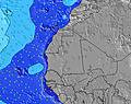 | 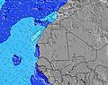 | 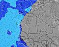 | 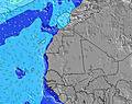 | 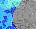 | 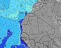 | 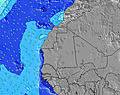 | ||||||||||
Wave Height (m) Direction Period (s) | S 8 | S 8 | SSW 8 | S 8 | SSW 8 | SSW 8 | S 8 | SSW 8 | SSW 8 | SSW 5 | S 8 | S 8 | S 5 | S 8 | S 8 | S 8 | S 8 |
Wave Graph | |||||||||||||||||
149 | 149 | 137 | 105 | 119 | 116 | 84 | 122 | 146 | 57 | 103 | 99 | 45 | 76 | 57 | 57 | 55 | |
Wind (km/h) | |||||||||||||||||
Wind State on-shore cross-onshore cross-shore cross-offshore off-shore glassy | cross-on | cross-on | cross-on | cross-on | cross-on | cross-on | cross-on | cross-on | cross-on | cross-on | cross | cross | cross-on | cross-on | cross-on | cross | cross |
High Tide | 5:03AM1.04m | 4:57PM0.95m | 5:45AM1.10m | 5:40PM0.99m | |||||||||||||
Low Tide | 10:20PM0.30m | 11:07AM0.44m | 11:05PM0.25m | 11:48AM0.39m | |||||||||||||
— | — | — | 6:39 | — | — | — | — | — | — | — | 6:39 | — | — | — | — | — | |
— | — | — | — | — | — | — | 7:06 | — | — | — | — | — | — | — | 7:06 | — | |
mm | — | — | 1 | 1 | — | — | — | — | — | — | 1 | 2 | 1 | — | 1 | 5 | 8 |
Temp °C | 25 | 25 | 25 | 24 | 25 | 25 | 26 | 25 | 25 | 25 | 25 | 24 | 25 | 25 | 25 | 25 | 24 |
Feels °C | 26 | 27 | 27 | 26 | 27 | 27 | 27 | 25 | 26 | 26 | 27 | 26 | 28 | 27 | 26 | 27 | 27 |
Swell 1 Height (m) Direction Period (s) | SSW 13 | SSW 13 | SSW 13 | S 8 | SSW 8 | SSW 12 | S 8 | SSW 12 | SSW 12 | SSW 12 | S 8 | S 8 | S 5 | S 8 | S 8 | S 8 | S 8 |
33 | 33 | 33 | 105 | 119 | 30 | 84 | 29 | 29 | 29 | 103 | 99 | 45 | 76 | 57 | 57 | 55 | |
Swell 2 Height (m) Direction Period (s) | S 11 | SE 11 | S 11 | SSW 13 | SSW 12 | S 11 | SSW 12 | S 12 | S 12 | SSW 13 | SSW 12 | SSW 12 | SSW 14 | SSW 11 | SSW 11 | SSW 11 | SSW 11 |
2 | 5 | 2 | 32 | 30 | 2 | 29 | 11 | 11 | 17 | 29 | 29 | 18 | 12 | 12 | 12 | 24 | |
Swell 3 Height (m) Direction Period (s) | — | — | — | S 11 | S 11 | S 12 | S 11 | — | SE 10 | S 12 | SE 10 | S 12 | SW 11 | SSW 14 | SSW 14 | SSW 14 | SSW 14 |
— | — | — | 2 | 2 | 3 | 2 | — | 4 | 11 | 4 | 11 | 5 | 20 | 20 | 20 | 18 | |
Wind waves Height (m) Direction Period (s) | S 8 | S 8 | SSW 8 | WSW 4 | — | SSW 8 | WSW 4 | SSW 8 | SSW 8 | SSW 5 | WSW 4 | WSW 4 | W 5 | WSW 5 | WSW 5 | WSW 5 | WSW 5 |
149 | 149 | 137 | 12 | — | 116 | 12 | 122 | 146 | 57 | 15 | 16 | 11 | 18 | 17 | 19 | 24 | |
Nearest Offshore or Glassy | |||||||||||||||||
Distance (km) | 110 | 110 | 110 | 576 | 576 | 1060 | 1081 | 1060 | 576 | 576 | 576 | 576 | 576 | 1072 | 1072 | 2356 | 1632 |
Best forecast wave conditions in Sierra-Leone | |||||||||||||||||
Best forecast wave conditions in Sierra Leone | |||||||||||||||||
Header Global | |||||||||||||||||
- Map Icons:
 Break
Break Live Wave Height (m)
 Live Wind Speed (km/h)
 Surf Rating (10 Max)
 Ocean Swells (m)
- Wind Speed (km/h)


FREE! Surf-Forecast.com widget for your website
The surf report / weather widget below is available to embed on third party websites free of charge and provides a summary of our Sulima surf forecast. Simply grab the html code snippet that we provide and paste it into your own site. You can choose your preferred language and metric/imperial units for the surf forecast feed to suit users of your site. Click here to get the code.
 Nearest