

Surf Forecasts:

Shek O surf forecast from 28 Jul 2026:
- Most powerful swell: Wednesday 29 Jul, 5PM (local time) - 4.5ft (1.4m), 7s period, SE swell with 171 kJ wave energy.
Best Forecast Surf Conditions for Shek O this week:
The most powerful waves expected at Shek O in the next 16 days are 1.4m 7s and forecast to arrive on Wednesday (Jul 29) at 5PM. Winds are predicted to be cross-onshore at the time the swell arrives. The largest open ocean swell (not directed at the beach) is 1.6m 6s period and expected on Sunday (Aug 02) at 11PM.
| Wave Type | Time (HKT) & Date | Wave Height & Period |
|---|---|---|
| Next good surf (1 star+) | - | - |
| Best Surf | - | - |
| Most Powerful | 5PM (Wed 29th Jul) | 4.5ft (1.4m) 7s |
Table - best surf conditions forecast for Shek O over the next 16 days.
The Lowdown
Right, folks, it’s Rusty here, and I’ve got to be straight with you – the outlook for Shek O over the next 16 days is a bit of a heartbreaker. The data is pretty clear: there’s just no good surf on offer. Every single record is marked as "poor surf conditions," which means you’re looking at a long, blank run. It’s one of those times where the ocean just isn’t cooperating, and for this area, a stretch like this isn’t totally out of the ordinary. The forecast can change, but for now, it’s a waiting game.
We start off on Tuesday, July 28th, and it’s grim. The swell is weak, coming in at 3 ft from the SE with a short period of 6 seconds, and the wind is a cross-on from the East at 9 mph. The combined energy is a measly 53, so there’s nothing to work with. That trend continues through the week. On Wednesday the 29th, we see a slight bump to 5 ft from the SE, but the period is still a short 7 seconds, and the wind is howling cross-on at 16 mph. It’s just a messy, lumpy mess.
The water temperature is sitting at 85°F with an anomaly of 1°F, so it’s about average for this time of year, but you won’t care about that when you’re staring at flat, choppy water. The wind stays onshore or cross-onshore for the first week, and the swell just doesn’t have any power. The highest combined energy we see is 175 on Wednesday afternoon, but that’s still weak and paired with terrible conditions.
The weekend of August 2nd and 3rd is a write-off. The swell drops to 0.3 ft, and while we get a brief window of clean, cross-off wind on Sunday afternoon, the wave height is non-existent. There’s literally nothing to ride. The second week from August 4th through to the 12th is much the same – tiny, weak swells with periods all over the place, but never enough size or energy to get excited about. Monday morning, August 11th, shows a small pulse of 3 ft from the ENE with a period of 5 seconds, and the wind is offshore from the NW at 3 mph, which is clean. But the combined energy is only 39, and the period is too short for any proper shape. It’s a tease.
I’m sorry to say it, but there are no standouts here. Not one. The setup is so weak that if you’re desperate for a paddle, you’d be better off looking for a kite or a foil board, because the wave energy just isn’t there for a proper surf. Hang in there, and keep an eye on the charts – things can turn around quick.
Rusty.
Short Range ForecastHeavy rain (total 69mm), heaviest during Wed afternoon. Warm (max 28°C on Tue morning, min 25°C on Thu night). Winds decreasing (fresh winds from the E on Tue night, light winds from the NE by Thu night). | Days 4-6 Weather SummaryHeavy rain (total 208mm), heaviest during Sun morning. Warm (max 27°C on Sun afternoon, min 25°C on Fri morning). Winds increasing (light winds from the ESE on Fri afternoon, fresh winds from the S by Sun morning). | ||||||||||||||||||||
Tuesday 28 | Wednesday 29 | Thursday 30 | Friday 31 | Saturday 1 | Sunday 2 | Monday 3 | |||||||||||||||
AM | PM | Night | AM | PM | Night | AM | PM | Night | AM | PM | Night | AM | PM | Night | AM | PM | Night | AM | PM | Night | |
Swell Height Map | 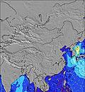 | 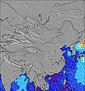 | 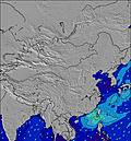 | 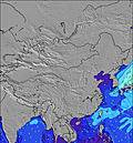 | 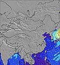 | 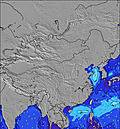 | 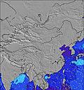 | ||||||||||||||
Wave Height (m) Direction Period (s) | SE 6 | ESE 6 | ESE 6 | E 6 | SE 7 | E 6 | E 5 | E 5 | E 5 | E 5 | E 5 | E 5 | E 5 | E 5 | SSE 6 | E 10 | ESE 4 | E 9 | E 19 | SE 18 | SE 16 |
Wave Graph | |||||||||||||||||||||
43 | 103 | 140 | 103 | 171 | 40 | 24 | 10 | 19 | 45 | 37 | 65 | 75 | 43 | 109 | 2 | 6 | 2 | 7 | 12 | 11 | |
Wind (km/h) | |||||||||||||||||||||
Wind State on-shore cross-onshore cross-shore cross-offshore off-shore glassy | cross-on | cross-on | on | cross-on | cross-on | on | cross-on | cross-on | cross | cross-on | cross-on | cross-on | on | on | on | cross-on | cross-off | cross-off | off | cross | cross-off |
High Tide | 10:57PM0.83m | 7:40AM1.76m | 11:24PM0.82m | 8:18AM1.79m | 11:47PM0.83m | 8:54AM1.79m | 11:59PM0.86m | 9:28AM1.74m | 11:34PM0.93m | 10:04AM1.65m | 11:19PM1.05m | 10:42AM1.51m | 11:41PM1.20m | ||||||||
Low Tide | 3:00PM0.21m | 1:04AM0.77m | 3:36PM0.17m | 1:55AM0.73m | 4:11PM0.15m | 2:44AM0.70m | 4:43PM0.16m | 3:33AM0.67m | 5:14PM0.19m | 4:25AM0.65m | 5:44PM0.25m | 5:21AM0.63m | 6:14PM0.34m | ||||||||
5:52 | — | — | 5:52 | — | — | 5:52 | — | — | 5:54 | — | — | 5:54 | — | — | 5:54 | — | — | 5:54 | — | — | |
— | 7:05 | — | — | 7:05 | — | — | 7:04 | — | — | 7:04 | — | — | 7:02 | — | — | 7:02 | — | — | 7:01 | — | |
mm | 7 | 3 | 14 | 10 | 16 | 7 | 6 | 5 | 1 | 3 | 6 | 11 | 10 | 6 | 17 | 109 | 30 | 16 | 3 | — | 3 |
Temp °C | 28 | 28 | 27 | 27 | 26 | 26 | 26 | 27 | 26 | 26 | 25 | 26 | 25 | 25 | 26 | 25 | 27 | 27 | 28 | 29 | 28 |
Feels °C | 32 | 29 | 27 | 27 | 26 | 27 | 27 | 30 | 29 | 28 | 28 | 28 | 26 | 24 | 25 | 25 | 26 | 26 | 32 | 32 | 31 |
Swell 1 Height (m) Direction Period (s) | SE 6 | S 8 | S 8 | S 7 | S 8 | S 7 | S 8 | S 8 | S 8 | S 8 | S 7 | S 7 | S 7 | S 7 | E 9 | E 10 | S 7 | E 9 | E 9 | SE 18 | SSW 7 |
43 | 55 | 43 | 61 | 29 | 150 | 90 | 72 | 57 | 41 | 39 | 36 | 38 | 35 | 2 | 2 | 86 | 2 | 2 | 12 | 79 | |
Swell 2 Height (m) Direction Period (s) | S 8 | SSE 6 | ESE 11 | SE 10 | SE 10 | SE 10 | SE 10 | E 5 | SE 10 | SE 10 | SE 9 | E 9 | E 9 | E 9 | E 9 | E 10 | ESE 4 | — | E 19 | E 9 | ESE 4 |
41 | 36 | 11 | 4 | 4 | 4 | 4 | 10 | 4 | 4 | 3 | 2 | 2 | 2 | 2 | 2 | 6 | — | 7 | 2 | 3 | |
Swell 3 Height (m) Direction Period (s) | SE 10 | ESE 10 | — | — | — | — | ESE 10 | SE 10 | — | — | — | — | — | — | — | E 6 | E 10 | — | E 15 | E 9 | SE 16 |
4 | 10 | — | — | — | — | 10 | 4 | — | — | — | — | — | — | — | 1 | 2 | — | 4 | 2 | 11 | |
Wind waves Height (m) Direction Period (s) | E 3 | ESE 6 | ESE 6 | E 6 | SE 7 | E 6 | E 5 | — | E 5 | E 5 | E 5 | E 5 | E 5 | E 5 | SSE 6 | S 7 | S 7 | S 6 | S 7 | S 7 | — |
6 | 103 | 140 | 103 | 171 | 40 | 24 | — | 19 | 45 | 37 | 65 | 75 | 43 | 109 | 142 | 155 | 182 | 100 | 100 | — | |
Nearest Offshore or Glassy | |||||||||||||||||||||
Distance (km) | 802 | 802 | 580 | 580 | 682 | 162 | 802 | 41 | 41 | 802 | 617 | 145 | 2329 | 749 | 617 | 654 | 682 | 580 | 7 | 749 | 580 |
Best forecast wave conditions in Hong Kong | |||||||||||||||||||||
Best forecast wave conditions in China | |||||||||||||||||||||
Header Global | |||||||||||||||||||||
- Map Icons:
 Break
Break Live Wave Height (m)
 Live Wind Speed (km/h)
 Surf Rating (10 Max)
 Ocean Swells (m)
- Wind Speed (km/h)


FREE! Surf-Forecast.com widget for your website
The surf report / weather widget below is available to embed on third party websites free of charge and provides a summary of our Shek O surf forecast. Simply grab the html code snippet that we provide and paste it into your own site. You can choose your preferred language and metric/imperial units for the surf forecast feed to suit users of your site. Click here to get the code.
Information about the Shek O Surf forecast
The above surf forecast table for Shek O provides essential information for determining whether the surfing conditions will be good over the next 16 days. A general guide to surfing at Shek O can be found by selecting the local surf guide option on the grey menu. Our Shek O surf forecast is unique since it includes wave energy (power) that defines the real feel of the surf rather than just the height or the period. If you surf the same spot (Shek O) regularly then make a mental note of the wave energy from the surf forecast table each time you go. Very soon you may start to choose your surf days based on the wave energy alone combined with our forecast of favourable offshore wind conditions. Our star ratings will help here and of course you will also find the usual wave height and period predictions on our surf forecasts as well as a full break down of the swell components under our advanced users option (to reveal that, click the little Einstein character under the tide times).
Further information to help with frequently asked questions about our surf forecast for Shek O may be found under the help tab on the top menu and also by moving your mouse over the question marks on the surf forecast table itself. Please always bear in mind that the forecast is for near-shore open water and local factors at each surf break influence the actual breaking wave height, such as the beach / reef profile, water depths offshore and shelter.
Are you planning a holiday in Hong Kong? If you are looking for accommodation near Shek O, camping, hotels and holiday cottages in Hong Kong, consider staying in Hong Kong which is 10 km (6 miles) away. Other places in and around Hong Kong where you can find information about places to rent, and car hire include Aberdeen which is 11 km (7 miles) away, Kowloon, Shenzhen and Yantian.
 Nearest