

Surf Forecasts:

How big are the waves at Salailua today (28 Jul):
- Morning surf: Morning surf (28 Jul, local time) - 5.5ft (1.7m), 16s period with SW swell.
- Afternoon surf: Afternoon surf (28 Jul, local time) - 6ft (1.9m), 15s period with SW swell.
- Evening surf: Evening surf (28 Jul, local time) - 6ft (1.9m), 15s period with SW swell.
The current surf forecast for Salailua at 3PM is: 1.9m 15s primary swell from a Southwest direction and 0.9m 12s secondary swell from a South-southeast direction, 1.1m 6s secondary swell from a South direction (forecast issued at 06:00am July 28). The wind direction is predicted to be cross-shore.
| Time (+13) & Date | Wave Height | Wave Period |
|---|---|---|
| Morning (28 Jul) | 5.5ft (1.7m) | 16s |
| Afternoon (28 Jul) | 6ft (1.9m) | 15s |
| Evening (28 Jul) | 6ft (1.9m) | 15s |
Table - waves today at Salailua. (Swell directed towards the surf break)
Short Range ForecastModerate rain (total 16mm), heaviest on Tue afternoon. Warm (max 25°C on Tue morning, min 23°C on Thu night). Mainly strong winds. | |||||||||||||||||||||||
Tuesday 28 | Wednesday 29 | Thursday 30 | |||||||||||||||||||||
4 AM | 7 AM | 10 AM | 1 PM | 4 PM | 7 PM | 10 PM | 1 AM | 4 AM | 7 AM | 10 AM | 1 PM | 4 PM | 7 PM | 10 PM | 1 AM | 4 AM | 7 AM | 10 AM | 1 PM | 4 PM | 7 PM | 10 PM | |
Swell Height Map |  | 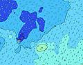 | 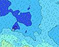 | 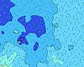 | 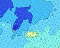 | 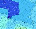 |  | 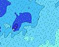 | 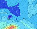 | ||||||||||||||
Wave Height (m) Direction Period (s) | SW 17 | SW 16 | SW 16 | SW 16 | SW 15 | SW 15 | SW 15 | SW 14 | SW 14 | SW 14 | SW 14 | SW 14 | SW 14 | SW 14 | SW 14 | SW 14 | SW 14 | SW 13 | SW 13 | SW 13 | SW 13 | SW 13 | SW 13 |
Wave Graph | |||||||||||||||||||||||
1098 | 1436 | 1571 | 1651 | 1730 | 1641 | 1466 | 1387 | 1089 | 976 | 934 | 877 | 890 | 742 | 731 | 721 | 630 | 517 | 501 | 431 | 424 | 424 | 405 | |
Wind (km/h) | |||||||||||||||||||||||
Wind State on-shore cross-onshore cross-shore cross-offshore off-shore glassy | cross | cross | cross | cross | cross | cross | cross | cross | cross | cross | cross | cross | cross | cross | cross | cross | cross | cross | cross | cross | cross | cross | cross |
High Tide | 5:33AM1.13m | 6:03PM0.99m | 6:10AM1.16m | 6:38PM1.01m | 6:46AM1.17m | 7:13PM1.04m | |||||||||||||||||
Low Tide | 11:58AM0.19m | 11:54PM0.25m | 12:32PM0.17m | 00:30AM0.24m | 1:06PM0.17m | ||||||||||||||||||
6:52 | — | — | — | — | — | — | — | 6:52 | — | — | — | — | — | — | — | 6:52 | — | — | — | — | — | — | |
— | — | — | — | 6:21 | — | — | — | — | — | — | — | 6:21 | — | — | — | — | — | — | — | 6:21 | — | — | |
mm | 1 | 1 | 1 | 1 | 1 | 2 | 2 | 1 | 1 | 1 | 1 | 1 | 1 | — | — | 1 | 1 | 1 | — | — | — | — | — |
Temp °C | 25 | 25 | 25 | 25 | 25 | 25 | 25 | 24 | 24 | 24 | 24 | 24 | 24 | 24 | 24 | 24 | 24 | 24 | 24 | 24 | 24 | 24 | 23 |
Feels °C | 26 | 27 | 27 | 26 | 26 | 26 | 24 | 23 | 23 | 22 | 22 | 22 | 21 | 21 | 21 | 21 | 20 | 21 | 21 | 21 | 21 | 20 | 19 |
Swell 1 Height (m) Direction Period (s) | SW 17 | SW 16 | SW 16 | SW 16 | SW 15 | SW 15 | SW 15 | SW 14 | SW 14 | SW 14 | SW 14 | SW 14 | SW 14 | SW 14 | SW 14 | SW 14 | SW 14 | SW 13 | SW 13 | SW 13 | SW 13 | SW 13 | SW 13 |
1098 | 1436 | 1571 | 1651 | 1730 | 1641 | 1466 | 1387 | 1089 | 976 | 934 | 877 | 890 | 742 | 731 | 721 | 630 | 517 | 501 | 431 | 424 | 424 | 382 | |
Swell 2 Height (m) Direction Period (s) | NNW 7 | NNW 7 | SSE 16 | SSE 16 | SSE 12 | SSE 15 | SSE 15 | SSE 14 | SSE 14 | SSE 14 | SSE 15 | SSE 15 | SSE 15 | SSE 15 | SSE 14 | SSE 14 | S 13 | S 13 | S 13 | S 13 | S 13 | S 12 | S 12 |
10 | 9 | 51 | 50 | 199 | 86 | 85 | 111 | 107 | 113 | 309 | 314 | 228 | 188 | 183 | 156 | 117 | 123 | 166 | 212 | 209 | 193 | 235 | |
Swell 3 Height (m) Direction Period (s) | ENE 10 | — | ENE 10 | SSE 16 | SSE 15 | ENE 8 | SSE 15 | SSE 14 | NE 10 | SE 13 | NE 9 | NE 11 | S 13 | SSW 12 | SSW 12 | S 12 | NE 10 | SSE 13 | SSE 13 | SSE 13 | SSE 13 | NE 9 | NE 16 |
11 | — | 10 | 50 | 126 | 11 | 123 | 149 | 4 | 7 | 3 | 5 | 14 | 47 | 49 | 75 | 4 | 156 | 156 | 116 | 114 | 3 | 10 | |
Wind waves Height (m) Direction Period (s) | SSE 12 | SSE 12 | SSE 12 | SSE 12 | S 6 | SSE 12 | SSE 6 | SSE 6 | SSE 6 | SSE 6 | SSE 6 | SSE 6 | SSE 6 | SSE 6 | SSE 6 | SSE 6 | SSE 6 | SSE 7 | SSE 7 | SSE 7 | SSE 7 | SSE 7 | SSE 7 |
503 | 503 | 569 | 560 | 95 | 541 | 173 | 154 | 154 | 159 | 192 | 222 | 176 | 151 | 153 | 187 | 290 | 295 | 257 | 230 | 251 | 384 | 405 | |
Nearest Offshore or Glassy | |||||||||||||||||||||||
Distance (km) | 1602 | 1596 | 201 | 865 | 201 | 1143 | 1183 | 1183 | 1600 | 2440 | 1600 | 1183 | 1177 | 1183 | 2286 | 1600 | 1177 | 1177 | 1177 | 1177 | 2298 | 1177 | 1177 |
Best forecast wave conditions in Savaii | |||||||||||||||||||||||
Best forecast wave conditions in Samoa | |||||||||||||||||||||||
Header Global | |||||||||||||||||||||||
- Map Icons:
 Break
Break Live Wave Height (m)
 Live Wind Speed (km/h)
 Surf Rating (10 Max)
 Ocean Swells (m)
- Wind Speed (km/h)


FREE! Surf-Forecast.com widget for your website
The surf report / weather widget below is available to embed on third party websites free of charge and provides a summary of our Salailua surf forecast. Simply grab the html code snippet that we provide and paste it into your own site. You can choose your preferred language and metric/imperial units for the surf forecast feed to suit users of your site. Click here to get the code.
 Nearest