

Surf Forecasts:

How big are the waves at Pirae today (19 Jun):
- Morning surf: Morning surf (19 Jun, local time) - 0.5ft (0.1m), 11s period with NE swell.
- Afternoon surf: Afternoon surf (19 Jun, local time) - 0.5ft (0.1m), 11s period with NE swell.
- Evening surf: Evening surf (19 Jun, local time) - 4.5ft (1.3m), 7s period with ENE swell.
The current surf forecast for Pirae at 5PM is: 1.4m 7s primary swell from a East-northeast direction (forecast issued at 01:00pm June 19). An open ocean swell of 0.4m 15s is not directed at the surf break, a second open ocean swell of 0.4m 13s is not directed at the surf break. The wind direction is predicted to be cross-offshore.
| Time (-10) & Date | Wave Height | Wave Period |
|---|---|---|
| Morning (19 Jun) | 0.5ft (0.1m) | 11s |
| Afternoon (19 Jun) | 0.5ft (0.1m) | 11s |
| Evening (19 Jun) | 4.5ft (1.3m) | 7s |
Table - waves today at Pirae. (Swell directed towards the surf break)
Updates in hr min s Forecast update imminent
Short Range ForecastSome drizzle, heaviest during Sat afternoon. Warm (max 26°C on Fri night, min 25°C on Fri afternoon). Winds increasing (moderate winds from the E on Fri night, strong winds from the E by Sat night). | ||||||||||||||||||||||||
Fri 19 | Saturday 20 | Sunday 21 | Mon 22 | |||||||||||||||||||||
11 AM | 2 PM | 5 PM | 8 PM | 11 PM | 2 AM | 5 AM | 8 AM | 11 AM | 2 PM | 5 PM | 8 PM | 11 PM | 2 AM | 5 AM | 8 AM | 11 AM | 2 PM | 5 PM | 8 PM | 11 PM | 2 AM | 5 AM | 8 AM | |
Swell Height Map |  |  |  |  |  |  |  | 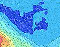 |  | |||||||||||||||
Wave Height (m) Direction Period (s) | NE 11 | NE 11 | ENE 7 | ENE 7 | ENE 7 | ENE 7 | ENE 7 | NNE 10 | NNE 10 | NNE 10 | NNE 10 | NNE 10 | E 8 | E 8 | E 8 | NNE 9 | NNE 9 | ENE 8 | NE 9 | NE 9 | ENE 8 | ENE 8 | NW 11 | NW 11 |
Wave Graph | ||||||||||||||||||||||||
5 | 5 | 183 | 171 | 176 | 176 | 151 | 10 | 10 | 10 | 10 | 9 | 0 | 0 | 0 | 8 | 8 | 355 | 3 | 3 | 234 | 234 | 5 | 5 | |
Wind (km/h) | ||||||||||||||||||||||||
Wind State on-shore cross-onshore cross-shore cross-offshore off-shore glassy | cross-off | cross-off | cross-off | cross-off | cross-off | cross-off | cross-off | cross-off | cross-off | cross-off | cross-off | cross-off | cross-off | cross-off | cross-off | cross-off | cross-off | cross-off | cross-off | cross-off | cross-off | cross-off | cross-off | cross-off |
High Tide | 3:37PM0.39m | 3:45AM0.34m | 4:40PM0.37m | 4:45AM0.33m | 6:22PM0.35m | 6:23AM0.32m | ||||||||||||||||||
Low Tide | 8:58AM0.21m | 10:08PM0.25m | 9:47AM0.22m | 11:21PM0.27m | 10:52AM0.24m | 1:18AM0.28m | ||||||||||||||||||
— | — | — | — | — | — | 6:26 | — | — | — | — | — | — | — | 6:26 | — | — | — | — | — | — | — | 6:26 | — | |
— | — | 5:30 | — | — | — | — | — | — | — | 5:31 | — | — | — | — | — | — | — | 5:31 | — | — | — | — | 5:31 | |
mm | — | — | — | — | — | — | — | — | — | — | 1 | — | — | — | — | — | — | — | — | — | — | — | — | — |
Temp °C | 25 | 25 | 25 | 26 | 25 | 25 | 25 | 25 | 25 | 25 | 25 | 25 | 25 | 25 | 25 | 25 | 25 | 25 | 25 | 26 | 25 | 25 | 25 | 26 |
Feels °C | 22 | 23 | 23 | 25 | 22 | 22 | 23 | 23 | 22 | 22 | 21 | 20 | 19 | 20 | 20 | 20 | 21 | 22 | 23 | 24 | 23 | 24 | 23 | 25 |
Swell 1 Height (m) Direction Period (s) | SSW 15 | SSW 15 | SSW 15 | SSW 14 | SW 14 | SW 14 | SW 14 | SSW 16 | SSW 16 | SSW 16 | SSW 16 | SSW 15 | SSW 15 | SSW 15 | SW 15 | SSW 18 | SSW 18 | SSW 17 | SSW 17 | SSW 16 | SSW 16 | SSW 16 | SSW 16 | SSW 16 |
91 | 85 | 85 | 81 | 52 | 53 | 53 | 104 | 102 | 100 | 98 | 87 | 85 | 84 | 104 | 280 | 273 | 267 | 246 | 229 | 226 | 223 | 164 | 162 | |
Swell 2 Height (m) Direction Period (s) | SE 14 | SE 13 | SE 13 | SE 13 | ESE 13 | ESE 13 | ESE 13 | ESE 13 | ESE 13 | ESE 13 | NNE 10 | NNE 10 | SSW 20 | SSW 19 | SW 19 | ESE 12 | ESE 12 | ESE 12 | NE 9 | NE 9 | NNE 9 | ESE 11 | NE 8 | NE 8 |
46 | 46 | 46 | 45 | 34 | 34 | 34 | 17 | 17 | 16 | 10 | 9 | 38 | 71 | 88 | 14 | 14 | 14 | 3 | 3 | 7 | 12 | 3 | 3 | |
Swell 3 Height (m) Direction Period (s) | NE 11 | NE 11 | SW 14 | NE 11 | NE 11 | SSW 18 | SSW 18 | NNE 10 | NNE 10 | NNE 10 | NW 12 | NW 12 | ESE 13 | ESE 12 | ESE 12 | NNE 9 | NNE 9 | NW 11 | SE 12 | SE 12 | SE 12 | NE 9 | NW 11 | NW 11 |
5 | 5 | 7 | 5 | 5 | 31 | 31 | 10 | 10 | 10 | 6 | 6 | 16 | 15 | 15 | 8 | 8 | 5 | 6 | 6 | 6 | 3 | 5 | 5 | |
Wind waves Height (m) Direction Period (s) | E 7 | ENE 7 | ENE 7 | ENE 7 | ENE 7 | ENE 7 | ENE 7 | E 7 | E 7 | E 7 | E 6 | E 7 | E 8 | E 8 | E 8 | E 8 | E 8 | ENE 8 | E 8 | E 8 | ENE 8 | ENE 8 | ENE 8 | E 8 |
212 | 197 | 183 | 171 | 176 | 176 | 151 | 142 | 117 | 157 | 241 | 452 | 487 | 482 | 441 | 419 | 377 | 355 | 265 | 258 | 234 | 234 | 238 | 277 | |
Nearest Offshore or Glassy | ||||||||||||||||||||||||
Distance (km) | 1155 | 1153 | 184 | 25 | 3841 | 3841 | 3841 | 3521 | 1155 | 2612 | 2612 | 2612 | 2612 | 2612 | 2612 | 2612 | 2612 | 2612 | 2612 | 2612 | 2612 | 1153 | 1146 | 1146 |
Best forecast wave conditions in Tahiti | ||||||||||||||||||||||||
Best forecast wave conditions in French Polynesia | ||||||||||||||||||||||||
Header Global | ||||||||||||||||||||||||
- Map Icons:
 Break
Break Live Wave Height (m)
 Live Wind Speed (km/h)
 Surf Rating (10 Max)
 Ocean Swells (m)
- Wind Speed (km/h)


FREE! Surf-Forecast.com widget for your website
The surf report / weather widget below is available to embed on third party websites free of charge and provides a summary of our Pirae surf forecast. Simply grab the html code snippet that we provide and paste it into your own site. You can choose your preferred language and metric/imperial units for the surf forecast feed to suit users of your site. Click here to get the code.
 Nearest