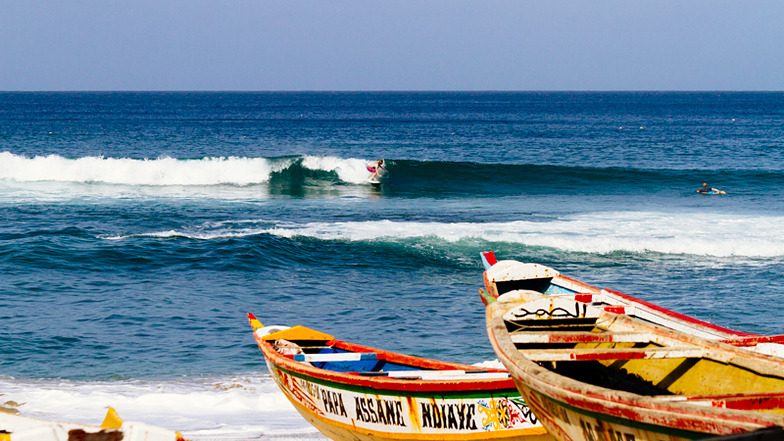

Surf Forecasts:

How big are the waves at Ouakam today (20 Jun):
- Morning surf: Morning surf (20 Jun, local time) - 1.5ft (0.4m), 8s period with SSW swell.
- Afternoon surf: Afternoon surf (20 Jun, local time) - 1.5ft (0.4m), 8s period with SSW swell.
- Evening surf: Evening surf (20 Jun, local time) - 1.5ft (0.5m), 9s period with NW swell.
The current surf forecast for Ouakam at 7AM is: 0.4m 9s primary swell from a South-southwest direction (forecast issued at 11:00pm June 19). An open ocean swell of 1.1m 8s is not directed at the surf break, a second open ocean swell of 0.6m 10s is not directed at the surf break. The wind direction is predicted to be offshore.
| Time (GMT) & Date | Wave Height | Wave Period |
|---|---|---|
| Morning (20 Jun) | 1.5ft (0.4m) | 8s |
| Afternoon (20 Jun) | 1.5ft (0.4m) | 8s |
| Evening (20 Jun) | 1.5ft (0.5m) | 9s |
Table - waves today at Ouakam. (Swell directed towards the surf break)
Updates in hr min s Forecast update imminent
Short Range ForecastMostly dry. Warm (max 23°C on Fri night, min 22°C on Fri night). Wind will be generally light. | ||||||||||||||||||||||||
Saturday 20 | Sunday 21 | Monday 22 | ||||||||||||||||||||||
9 PM | 12 AM | 3 AM | 6 AM | 9 AM | 12 PM | 3 PM | 6 PM | 9 PM | 12 AM | 3 AM | 6 AM | 9 AM | 12 PM | 3 PM | 6 PM | 9 PM | 12 AM | 3 AM | 6 AM | 9 AM | 12 PM | 3 PM | 6 PM | |
Swell Height Map |  |  |  | 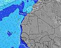 | 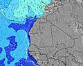 | 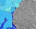 | 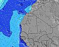 | 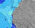 | 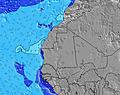 | 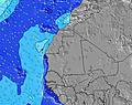 | ||||||||||||||
Wave Height (m) Direction Period (s) | NW 10 | NW 10 | NW 10 | SSW 9 | SSW 8 | SSW 8 | SSW 8 | NW 10 | NW 9 | NW 9 | SSW 7 | SSW 7 | WNW 7 | WNW 6 | SW 14 | SW 13 | SW 13 | SW 13 | SW 13 | SW 18 | SW 13 | SW 12 | SW 16 | SW 16 |
Wave Graph | ||||||||||||||||||||||||
85 | 80 | 50 | 25 | 24 | 24 | 23 | 44 | 42 | 41 | 10 | 10 | 29 | 23 | 46 | 53 | 27 | 27 | 27 | 49 | 43 | 55 | 68 | 127 | |
Wind (km/h) | ||||||||||||||||||||||||
Wind State on-shore cross-onshore cross-shore cross-offshore off-shore glassy | cross | cross | cross | cross | on | cross-on | cross | cross | cross | cross-off | cross-off | cross-off | cross | cross-on | cross-on | cross | cross-on | cross-on | cross-on | on | on | cross-on | cross-on | on |
High Tide | 00:52AM1.03m | 1:12PM1.28m | 1:48AM0.99m | 2:06PM1.20m | 2:47AM0.97m | 3:03PM1.10m | ||||||||||||||||||
Low Tide | 6:41PM0.10m | 6:36AM0.17m | 7:35PM0.17m | 7:31AM0.25m | 8:29PM0.23m | 8:31AM0.32m | ||||||||||||||||||
— | — | — | 6:41 | — | — | — | — | — | — | — | 6:41 | — | — | — | — | — | — | — | 6:41 | — | — | — | — | |
— | — | — | — | — | — | — | 7:40 | — | — | — | — | — | — | — | 7:40 | — | — | — | — | — | — | — | 7:40 | |
mm | — | — | — | — | — | — | — | — | — | — | — | — | — | — | — | — | — | — | — | — | — | — | — | — |
Temp °C | 23 | 23 | 22 | 22 | 22 | 22 | 23 | 23 | 22 | 22 | 22 | 22 | 22 | 22 | 22 | 22 | 22 | 22 | 22 | 22 | 23 | 23 | 23 | 23 |
Feels °C | 23 | 23 | 22 | 22 | 23 | 22 | 22 | 21 | 21 | 21 | 21 | 22 | 23 | 23 | 23 | 22 | 23 | 22 | 22 | 22 | 23 | 23 | 23 | 24 |
Swell 1 Height (m) Direction Period (s) | NNW 8 | NNW 8 | NNW 8 | NNW 8 | NNW 7 | NNW 7 | NNW 7 | NNW 7 | NW 9 | NW 9 | NNW 9 | NNW 9 | NNW 7 | NNW 7 | NNW 7 | NNW 8 | NNW 8 | NNW 8 | NNW 8 | NNW 8 | NNW 8 | NNW 8 | NNW 8 | NNW 8 |
183 | 179 | 183 | 135 | 104 | 88 | 70 | 101 | 42 | 41 | 30 | 30 | 127 | 135 | 128 | 186 | 220 | 181 | 191 | 196 | 170 | 196 | 244 | 306 | |
Swell 2 Height (m) Direction Period (s) | NW 10 | NW 10 | NW 10 | NNW 10 | NNW 10 | NNW 10 | NNW 10 | NW 10 | SSW 8 | SSW 8 | SSW 7 | SSW 7 | NNW 9 | NNW 9 | NNW 9 | SW 13 | SW 13 | SSW 6 | SSW 6 | SW 13 | SW 13 | SW 12 | SW 12 | SW 16 |
85 | 80 | 50 | 65 | 64 | 64 | 61 | 44 | 20 | 11 | 10 | 10 | 30 | 32 | 32 | 45 | 27 | 8 | 8 | 44 | 43 | 55 | 37 | 127 | |
Swell 3 Height (m) Direction Period (s) | SSW 9 | SSW 9 | SSW 11 | SSW 9 | SSW 8 | SSW 8 | SSW 8 | SSW 8 | SSW 13 | SSW 14 | NNW 12 | NNW 12 | SSW 7 | SSW 7 | SW 14 | SSW 7 | SSW 6 | SW 13 | SW 13 | SW 18 | SSW 18 | SSW 18 | SW 16 | SW 12 |
26 | 26 | 22 | 25 | 24 | 24 | 23 | 22 | 18 | 21 | 14 | 13 | 10 | 9 | 46 | 9 | 8 | 27 | 27 | 49 | 31 | 30 | 68 | 37 | |
Wind waves Height (m) Direction Period (s) | WNW 4 | WNW 4 | WNW 4 | — | — | — | WNW 6 | — | NNW 7 | NNW 7 | NNW 7 | NNW 7 | WNW 7 | WNW 6 | WNW 7 | NW 8 | — | — | — | — | — | — | — | — |
7 | 8 | 9 | — | — | — | 17 | — | 125 | 131 | 148 | 148 | 29 | 23 | 29 | 53 | — | — | — | — | — | — | — | — | |
Nearest Offshore or Glassy | ||||||||||||||||||||||||
Distance (km) | 615 | 615 | 647 | 647 | 647 | 615 | 615 | 615 | 615 | 648 | 850 | 648 | 648 | 864 | 648 | 1545 | 1185 | 1589 | 615 | 615 | 615 | 617 | 615 | 615 |
Best forecast wave conditions in Senegal | ||||||||||||||||||||||||
Best forecast wave conditions in Senegal | ||||||||||||||||||||||||
Header Global | ||||||||||||||||||||||||
- Map Icons:
 Break
Break Live Wave Height (m)
 Live Wind Speed (km/h)
 Surf Rating (10 Max)
 Ocean Swells (m)
- Wind Speed (km/h)


FREE! Surf-Forecast.com widget for your website
The surf report / weather widget below is available to embed on third party websites free of charge and provides a summary of our Ouakam surf forecast. Simply grab the html code snippet that we provide and paste it into your own site. You can choose your preferred language and metric/imperial units for the surf forecast feed to suit users of your site. Click here to get the code.
 Nearest