

Surf Forecasts:

How big are the waves at Mu omu a (M&Ms) today (03 Aug):
- Afternoon surf: Afternoon surf (03 Aug, local time) - 4ft (1.2m), 13s period with SW swell.
- Evening surf: Evening surf (03 Aug, local time) - 4ft (1.2m), 13s period with SW swell.
The current surf forecast for Mu omu a (M&Ms) at 11PM is: 1.2m 13s primary swell from a Southwest direction and 0.8m 12s secondary swell from a Southeast direction, 0.8m 4s secondary swell from a South-southwest direction (forecast issued at 06:00pm August 03). The wind direction is predicted to be cross-onshore.
| Time (+13) & Date | Wave Height | Wave Period |
|---|---|---|
| Morning (03 Aug) | - | - |
| Afternoon (03 Aug) | 4ft (1.2m) | 13s |
| Evening (03 Aug) | 4ft (1.2m) | 13s |
Table - waves today at Mu omu a (M&Ms). (Swell directed towards the surf break)
Short Range ForecastMostly dry. Warm (max 22°C on Mon afternoon, min 20°C on Tue morning). Mainly fresh winds. | |||||||||||||||||||
Mon 3 | Tuesday 4 | Wednesday 5 | |||||||||||||||||
4 PM | 7 PM | 10 PM | 1 AM | 4 AM | 7 AM | 10 AM | 1 PM | 4 PM | 7 PM | 10 PM | 1 AM | 4 AM | 7 AM | 10 AM | 1 PM | 4 PM | 7 PM | 10 PM | |
Swell Height Map | 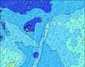 | 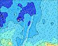 | 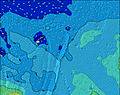 | 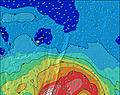 | 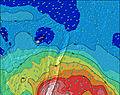 | 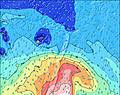 | 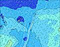 | ||||||||||||
Wave Height (m) Direction Period (s) | SW 13 | SW 13 | SW 13 | SW 13 | SW 13 | SW 13 | SW 12 | SW 12 | SW 12 | SW 12 | SW 12 | SW 12 | S 12 | S 11 | S 11 | SW 18 | SW 18 | SW 17 | S 10 |
Wave Graph | |||||||||||||||||||
495 | 488 | 488 | 609 | 600 | 643 | 593 | 773 | 874 | 846 | 772 | 698 | 515 | 556 | 585 | 534 | 614 | 671 | 669 | |
Wind (km/h) | |||||||||||||||||||
Wind State on-shore cross-onshore cross-shore cross-offshore off-shore glassy | cross-on | cross-on | cross-on | cross-on | on | on | on | cross-on | cross-on | cross-on | cross-on | cross-on | cross | cross | cross | cross | cross-on | cross-on | cross |
High Tide | 10:43PM1.09m | 10:59AM1.03m | 11:28PM1.11m | 11:53AM1.01m | |||||||||||||||
Low Tide | 4:53AM0.29m | 5:07PM0.26m | 5:46AM0.27m | 5:56PM0.27m | |||||||||||||||
— | — | — | — | — | 7:03 | — | — | — | — | — | — | — | 7:03 | — | — | — | — | — | |
6:21 | — | — | — | — | — | — | — | 6:21 | — | — | — | — | — | — | — | 6:22 | — | — | |
mm | — | — | — | — | — | — | — | — | — | — | — | — | — | — | — | — | — | — | — |
Temp °C | 22 | 22 | 21 | 21 | 21 | 21 | 21 | 20 | 21 | 20 | 20 | 20 | 21 | 21 | 21 | 21 | 21 | 21 | 21 |
Feels °C | 20 | 20 | 18 | 18 | 18 | 18 | 17 | 16 | 17 | 16 | 17 | 17 | 19 | 18 | 18 | 18 | 18 | 17 | 17 |
Swell 1 Height (m) Direction Period (s) | SW 13 | SW 13 | SW 13 | SW 13 | SW 13 | SW 13 | SW 12 | SW 12 | SW 12 | SW 12 | SW 12 | SW 12 | SW 11 | S 11 | S 11 | S 10 | S 10 | S 10 | SW 17 |
495 | 488 | 488 | 609 | 600 | 643 | 593 | 773 | 874 | 846 | 772 | 698 | 515 | 556 | 585 | 402 | 452 | 452 | 648 | |
Swell 2 Height (m) Direction Period (s) | SE 11 | SE 11 | SE 11 | SE 12 | SE 12 | SE 12 | S 15 | S 14 | S 14 | S 13 | S 12 | S 12 | S 12 | SW 11 | SW 11 | SW 12 | SW 18 | SW 17 | S 12 |
176 | 176 | 155 | 167 | 167 | 139 | 209 | 257 | 261 | 289 | 446 | 497 | 511 | 375 | 268 | 224 | 614 | 671 | 166 | |
Swell 3 Height (m) Direction Period (s) | ENE 9 | ENE 9 | ENE 9 | ENE 9 | ENE 8 | E 8 | SE 12 | SE 12 | SE 11 | E 8 | SW 20 | SW 20 | SW 19 | SW 19 | SW 18 | SW 18 | SW 12 | SW 12 | SW 12 |
62 | 68 | 61 | 59 | 36 | 33 | 112 | 110 | 79 | 34 | 206 | 239 | 303 | 436 | 552 | 534 | 200 | 172 | 89 | |
Wind waves Height (m) Direction Period (s) | SSW 4 | SSW 4 | SSW 4 | SSW 5 | SSW 5 | SSW 5 | SW 6 | — | — | — | — | — | — | — | — | — | — | SSE 3 | S 10 |
11 | 20 | 27 | 30 | 33 | 34 | 52 | — | — | — | — | — | — | — | — | — | — | 7 | 669 | |
Nearest Offshore or Glassy | |||||||||||||||||||
Distance (km) | 582 | 582 | 582 | 582 | 582 | 582 | 595 | 605 | 605 | 606 | 606 | 923 | 606 | 606 | 606 | 282 | 282 | 1526 | 1526 |
Best forecast wave conditions in Tonga Vava'u | |||||||||||||||||||
Best forecast wave conditions in Tonga | |||||||||||||||||||
Header Global | |||||||||||||||||||
- Map Icons:
 Break
Break Live Wave Height (m)
 Live Wind Speed (km/h)
 Surf Rating (10 Max)
 Ocean Swells (m)
- Wind Speed (km/h)
Latest Updates


FREE! Surf-Forecast.com widget for your website
The surf report / weather widget below is available to embed on third party websites free of charge and provides a summary of our Mu omu a (M&Ms) surf forecast. Simply grab the html code snippet that we provide and paste it into your own site. You can choose your preferred language and metric/imperial units for the surf forecast feed to suit users of your site. Click here to get the code.
 Nearest