

Surf Forecasts:

Mount Irvine surf forecast from 13 Jul 2026:
- Most powerful swell: Sunday 19 Jul, 8AM (local time) - 6ft (1.8m), 8s period, ENE swell with 353 kJ wave energy.
Best Forecast Surf Conditions for Mount Irvine this week:
The most powerful waves expected at Mount Irvine in the next 16 days are 1.8m 8s and forecast to arrive on Sunday (Jul 19) at 8AM. Winds are predicted to be cross-offshore at the time the swell arrives.
| Wave Type | Time (AST) & Date | Wave Height & Period |
|---|---|---|
| Next good surf (1 star+) | - | - |
| Best Surf | - | - |
| Most Powerful | 8AM (Sun 19th Jul) | 6ft (1.8m) 8s |
Table - best surf conditions forecast for Mount Irvine over the next 16 days.
Alright folks, Rusty here. Let's have a look at what's on the cards for the next couple of weeks.
It's a tough one this time. The overall pattern is pretty grim, with a long stretch of onshore, cross-off winds and poor conditions. There's a small window late in the period that might just save it, but patience is going to be the name of the game.
The first real chance for a surf doesn't come until Sunday the 25th of July. For the whole week before that, from the 12th through to the 24th, it's a write-off – strong winds from the east and east-northeast at 15 to 18 mph, combined with a messy, short-period swell (7-8 seconds) and a combined energy that's mostly weak to moderate (173-357). The forecast says "poor surf conditions" for almost every session, and I'm not about to argue. It's a whole lot of nothing for the paddle.
But then, Sunday the 25th of July afternoon shows a little flicker of life. It's not a massive change, but it's the only real standout in the whole 16 days.
Mount Irvine is the only spot in the game. It's a reef and point setup, and it's consistent, which is a plus. It's exposed to the swell, and the optimum direction is from the northeast. The water temp is sitting at 82°, which is about normal for the time of year, so no surprises there.
The standout moment is Sunday afternoon, the 25th. The wind finally swings around to an offshore direction from the east-southeast at 15 mph. That's a game-changer for a point break like Mount Irvine, promising clean, lined-up waves. We've got a swell of 5 ft coming from the east, with a period of 8 seconds and a combined energy jumping to 458 – that's a solid, moderate pulse of energy. The crowd factor is "sometimes", so you might have a few other keen locals out, but it shouldn't be a zoo. This is the one to aim for. The only slight caveat is the period is a touch short, so it might not have the raw power of a groundswell, but with offshore wind, it'll be fun.
The next day, Monday the 26th, the wind is back onshore and the energy drops off a cliff. So you really have to be on that Sunday arvo window.
For the rest of the period, it's back to the same old story of poor conditions. The 24th of July Friday afternoon has a big spike in energy (611) from a 6 ft east swell, but the wind is still cross-off, so it's just a messy, blown-out proposition. Not worth the drive.
So, in short: the first week and a half are a brutal, wind-affected slog. Your one and only call is Mount Irvine on the Sunday afternoon of the 25th. It's a long-range call, so keep an eye on it, but if the wind holds, it could be a solid session.
Stay patient.
Rusty
Short Range ForecastModerate rain (total 10mm), heaviest on Sun night. Warm (max 27°C on Sun night, min 26°C on Sun night). Mainly fresh winds. | Days 5-7 Weather SummarySome drizzle, heaviest during Sat morning. Warm (max 27°C on Wed night, min 26°C on Wed night). Mainly fresh winds. | ||||||||||||||||||||
Monday 13 | Tuesday 14 | Wednesday 15 | Thursday 16 | Friday 17 | Saturday 18 | Sun 19 | |||||||||||||||
Night | AM | PM | Night | AM | PM | Night | AM | PM | Night | AM | PM | Night | AM | PM | Night | AM | PM | Night | AM | PM | |
Swell Height Map |  |  |  | 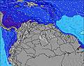 | 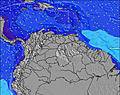 | 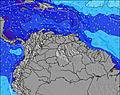 | 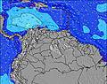 | 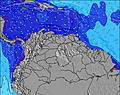 | |||||||||||||
Wave Height (m) Direction Period (s) | ENE 8 | ENE 8 | E 8 | E 8 | ENE 8 | ENE 8 | ENE 7 | ENE 7 | E 7 | E 7 | E 7 | E 7 | ENE 7 | E 7 | E 7 | ENE 7 | ENE 7 | ENE 8 | ENE 7 | ENE 8 | ENE 8 |
Wave Graph | |||||||||||||||||||||
155 | 210 | 227 | 227 | 173 | 176 | 197 | 167 | 134 | 155 | 146 | 146 | 175 | 166 | 146 | 215 | 349 | 250 | 327 | 310 | 311 | |
Wind (km/h) | |||||||||||||||||||||
Wind State on-shore cross-onshore cross-shore cross-offshore off-shore glassy | cross-off | cross-off | cross-off | cross-off | cross-off | cross-off | cross-off | cross-off | cross-off | cross-off | cross-off | cross-off | cross-off | cross-off | cross-off | cross-off | cross-off | cross-off | cross-off | cross-off | cross-off |
High Tide | 5:31AM-0.02m | 4:45PM0.73m | 7:02AM0.02m | 5:40PM0.68m | 8:18AM0.09m | 6:37PM0.61m | 9:15AM0.17m | 7:35PM0.53m | 10:02AM0.27m | 8:35PM0.43m | 10:44AM0.36m | 9:37PM0.34m | 11:23AM0.44m | ||||||||
Low Tide | 00:38AM-0.17m | 8:29AM-0.04m | 1:27AM-0.18m | 9:32AM0.01m | 2:13AM-0.19m | 11:02AM0.07m | 2:54AM-0.18m | 12:56PM0.12m | 3:32AM-0.17m | 2:50PM0.14m | 4:07AM-0.14m | 4:32PM0.12m | 4:39AM-0.11m | 5:59PM0.08m | |||||||
— | 5:47 | — | — | 5:47 | — | — | 5:47 | — | — | 5:47 | — | — | 5:48 | — | — | 5:48 | — | — | 5:48 | — | |
6:30 | — | 6:30 | — | — | 6:30 | — | — | 6:30 | — | — | 6:30 | — | — | 6:30 | — | — | 6:30 | — | — | 6:30 | |
mm | 3 | — | 1 | 3 | 1 | 2 | — | — | — | — | — | — | — | — | — | — | 1 | — | — | — | — |
Temp °C | 27 | 26 | 26 | 26 | 26 | 27 | 26 | 27 | 27 | 27 | 27 | 27 | 26 | 26 | 27 | 27 | 27 | 27 | 27 | 27 | 27 |
Feels °C | 28 | 26 | 26 | 26 | 26 | 27 | 26 | 26 | 26 | 27 | 27 | 27 | 25 | 25 | 26 | 27 | 26 | 27 | 26 | 27 | 26 |
Swell 1 Height (m) Direction Period (s) | N 12 | N 11 | N 11 | N 11 | ESE 8 | N 10 | N 10 | N 10 | N 10 | N 10 | N 9 | N 9 | N 9 | N 9 | N 9 | N 8 | N 8 | N 8 | — | — | — |
11 | 9 | 9 | 9 | 6 | 8 | 8 | 8 | 8 | 7 | 2 | 2 | 2 | 1 | 2 | 1 | 5 | 1 | — | — | — | |
Swell 2 Height (m) Direction Period (s) | — | NNE 11 | — | — | N 10 | ESE 8 | SE 8 | N 8 | — | — | — | — | — | — | — | — | — | — | — | — | — |
— | 11 | — | — | 8 | 6 | 2 | 1 | — | — | — | — | — | — | — | — | — | — | — | — | — | |
Swell 3 Height (m) Direction Period (s) | — | — | — | — | — | N 8 | — | — | — | — | — | — | — | — | — | — | — | — | — | — | — |
— | — | — | — | — | 1 | — | — | — | — | — | — | — | — | — | — | — | — | — | — | — | |
Wind waves Height (m) Direction Period (s) | ENE 8 | ENE 8 | E 8 | E 8 | ENE 8 | ENE 8 | ENE 7 | ENE 7 | E 7 | E 7 | E 7 | E 7 | ENE 7 | E 7 | E 7 | ENE 7 | ENE 7 | ENE 8 | ENE 7 | ENE 8 | ENE 8 |
155 | 210 | 227 | 227 | 173 | 176 | 197 | 167 | 134 | 155 | 146 | 146 | 175 | 166 | 146 | 215 | 349 | 250 | 327 | 310 | 311 | |
Nearest Offshore or Glassy | |||||||||||||||||||||
Distance (km) | 6 | 142 | 590 | 650 | 590 | 590 | 142 | 590 | 142 | 142 | 590 | 678 | 678 | 590 | 678 | 142 | 590 | 678 | 678 | 142 | 142 |
Best forecast wave conditions in Tobago | |||||||||||||||||||||
Best forecast wave conditions in Trinidad and Tobago | |||||||||||||||||||||
Header Global | |||||||||||||||||||||
- Map Icons:
 Break
Break Live Wave Height (m)
 Live Wind Speed (km/h)
 Surf Rating (10 Max)
 Ocean Swells (m)
- Wind Speed (km/h)


FREE! Surf-Forecast.com widget for your website
The surf report / weather widget below is available to embed on third party websites free of charge and provides a summary of our Mount Irvine surf forecast. Simply grab the html code snippet that we provide and paste it into your own site. You can choose your preferred language and metric/imperial units for the surf forecast feed to suit users of your site. Click here to get the code.
Information about the Mount Irvine Surf forecast
The above surf forecast table for Mount Irvine provides essential information for determining whether the surfing conditions will be good over the next 16 days. A general guide to surfing at Mount Irvine can be found by selecting the local surf guide option on the grey menu. Our Mount Irvine surf forecast is unique since it includes wave energy (power) that defines the real feel of the surf rather than just the height or the period. If you surf the same spot (Mount Irvine) regularly then make a mental note of the wave energy from the surf forecast table each time you go. Very soon you may start to choose your surf days based on the wave energy alone combined with our forecast of favourable offshore wind conditions. Our star ratings will help here and of course you will also find the usual wave height and period predictions on our surf forecasts as well as a full break down of the swell components under our advanced users option (to reveal that, click the little Einstein character under the tide times).
Further information to help with frequently asked questions about our surf forecast for Mount Irvine may be found under the help tab on the top menu and also by moving your mouse over the question marks on the surf forecast table itself. Please always bear in mind that the forecast is for near-shore open water and local factors at each surf break influence the actual breaking wave height, such as the beach / reef profile, water depths offshore and shelter.
Mount Irvine is 6 km (4 miles) from Obago. If you plan a holiday in Tobago, look for hotels and other accommodation in Obago. Obago has rooms for a wide range of budgets as well as car hire and transport links.
 Nearest