

Surf Forecasts:

How big are the waves at Monogaga today (19 Jun):
- Afternoon surf: Afternoon surf (19 Jun, local time) - 0.5ft (0.1m), 15s period with S swell.
- Evening surf: Evening surf (19 Jun, local time) - 0.5ft (0.1m), 16s period with SW swell.
The current surf forecast for Monogaga at 8PM is: 0.1m 16s primary swell from a Southwest direction (forecast issued at 05:00pm June 19). An open ocean swell of 1.7m 10s is not directed at the surf break, a second open ocean swell of 1.9m 10s is not directed at the surf break. The wind direction is predicted to be cross-onshore.
| Time (GMT) & Date | Wave Height | Wave Period |
|---|---|---|
| Morning (19 Jun) | - | - |
| Afternoon (19 Jun) | 0.5ft (0.1m) | 15s |
| Evening (19 Jun) | 0.5ft (0.1m) | 16s |
Table - waves today at Monogaga. (Swell directed towards the surf break)
Updates in hr min s Forecast update imminent
Short Range ForecastHeavy rain (total 37mm), heaviest during Sun morning. Warm (max 26°C on Fri night, min 24°C on Fri night). Wind will be generally light. | ||||||||||||||||||||||||
Fri 19 | Saturday 20 | Sunday 21 | Mon 22 | |||||||||||||||||||||
3 PM | 6 PM | 9 PM | 12 AM | 3 AM | 6 AM | 9 AM | 12 PM | 3 PM | 6 PM | 9 PM | 12 AM | 3 AM | 6 AM | 9 AM | 12 PM | 3 PM | 6 PM | 9 PM | 12 AM | 3 AM | 6 AM | 9 AM | 12 PM | |
Swell Height Map | 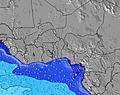 | 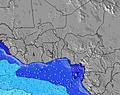 | 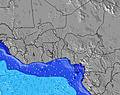 | 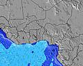 |  |  |  |  | 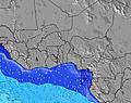 | |||||||||||||||
Wave Height (m) Direction Period (s) | S 15 | SSE 10 | SW 16 | S 16 | S 16 | SW 13 | SSW 13 | SSW 14 | SSW 15 | SSW 14 | SW 5 | SSW 13 | S 10 | S 10 | S 10 | S 10 | S 10 | SSW 18 | SSW 13 | SSW 13 | SSW 17 | SSW 16 | SSW 16 | S 16 |
Wave Graph | ||||||||||||||||||||||||
4 | 0 | 10 | 7 | 7 | 7 | 18 | 21 | 21 | 21 | 37 | 18 | 510 | 510 | 500 | 500 | 490 | 31 | 34 | 33 | 30 | 51 | 86 | 131 | |
Wind (km/h) | ||||||||||||||||||||||||
Wind State on-shore cross-onshore cross-shore cross-offshore off-shore glassy | cross-on | cross-on | cross-on | cross | cross | cross | cross | cross | cross | cross | cross | cross | cross | cross-on | cross-on | cross | cross | cross-on | cross-on | cross-on | cross | cross-on | cross-on | cross-on |
High Tide | 8:03PM0.94m | 9:09AM1.16m | 9:01PM0.86m | 10:01AM1.12m | 10:08PM0.81m | 10:52AM1.07m | ||||||||||||||||||
Low Tide | 2:30PM0.39m | 2:19AM0.17m | 3:32PM0.42m | 3:09AM0.27m | 4:37PM0.43m | 4:02AM0.37m | ||||||||||||||||||
— | — | — | — | — | 6:15 | — | — | — | — | — | — | — | 6:15 | — | — | — | — | — | — | — | 6:15 | — | — | |
— | 6:38 | — | — | — | — | — | — | — | 6:38 | — | — | — | — | — | — | — | 6:38 | — | — | — | — | — | 6:38 | |
mm | 3 | 2 | — | — | — | 2 | 1 | 3 | 2 | 1 | — | 1 | 2 | 4 | 7 | 3 | 1 | 1 | — | 1 | — | — | — | 3 |
Temp °C | 25 | 25 | 26 | 26 | 25 | 24 | 25 | 26 | 26 | 25 | 26 | 25 | 25 | 24 | 25 | 26 | 26 | 26 | 26 | 25 | 25 | 25 | 26 | 26 |
Feels °C | 27 | 26 | 27 | 27 | 27 | 26 | 27 | 27 | 26 | 25 | 27 | 26 | 26 | 25 | 26 | 27 | 27 | 27 | 27 | 27 | 26 | 27 | 28 | 28 |
Swell 1 Height (m) Direction Period (s) | S 10 | S 10 | S 10 | S 10 | S 10 | S 10 | S 10 | S 10 | S 10 | S 10 | S 10 | S 10 | S 10 | S 10 | S 10 | S 10 | S 10 | S 10 | S 10 | S 10 | SSE 9 | SSE 9 | SSE 9 | SSE 9 |
530 | 530 | 596 | 596 | 541 | 541 | 530 | 468 | 468 | 458 | 449 | 449 | 510 | 510 | 500 | 500 | 490 | 499 | 432 | 414 | 340 | 333 | 289 | 283 | |
Swell 2 Height (m) Direction Period (s) | S 15 | — | SW 16 | SW 13 | SW 13 | SW 13 | SSW 13 | SSW 14 | SSW 15 | SSW 14 | — | SSW 13 | SSW 14 | SSW 14 | SSW 14 | SSW 13 | SSW 13 | SSW 13 | SSW 13 | SSW 13 | SSW 12 | SSW 16 | SSW 16 | S 16 |
4 | — | 10 | 7 | 7 | 7 | 18 | 21 | 21 | 21 | — | 18 | 18 | 18 | 18 | 17 | 16 | 16 | 34 | 33 | 15 | 51 | 86 | 131 | |
Swell 3 Height (m) Direction Period (s) | — | — | SW 13 | S 16 | S 16 | — | — | SW 12 | SW 12 | — | S 21 | S 20 | S 19 | S 19 | S 19 | S 19 | S 18 | SSW 18 | SSW 18 | SSW 18 | SSW 17 | SSW 12 | SSW 12 | SSW 12 |
— | — | 7 | 5 | 5 | — | — | 6 | 6 | — | 9 | 8 | 7 | 7 | 7 | 7 | 25 | 31 | 31 | 31 | 30 | 14 | 14 | 14 | |
Wind waves Height (m) Direction Period (s) | SSE 10 | SSE 10 | — | — | — | — | — | — | — | SW 4 | SW 5 | — | — | — | — | — | — | — | — | — | — | — | — | — |
694 | 769 | — | — | — | — | — | — | — | 21 | 37 | — | — | — | — | — | — | — | — | — | — | — | — | — | |
Nearest Offshore or Glassy | ||||||||||||||||||||||||
Distance (km) | 2225 | 2180 | 1826 | 1826 | 55 | 55 | 55 | 55 | 2180 | 844 | 2180 | 467 | 467 | 662 | 512 | 512 | 467 | 467 | 467 | 467 | 467 | 427 | 231 | 285 |
Best forecast wave conditions in Ivory Coast | ||||||||||||||||||||||||
Best forecast wave conditions in Côte d'Ivoire | ||||||||||||||||||||||||
Header Global | ||||||||||||||||||||||||
- Map Icons:
 Break
Break Live Wave Height (m)
 Live Wind Speed (km/h)
 Surf Rating (10 Max)
 Ocean Swells (m)
- Wind Speed (km/h)


FREE! Surf-Forecast.com widget for your website
The surf report / weather widget below is available to embed on third party websites free of charge and provides a summary of our Monogaga surf forecast. Simply grab the html code snippet that we provide and paste it into your own site. You can choose your preferred language and metric/imperial units for the surf forecast feed to suit users of your site. Click here to get the code.
 Nearest