

Surf Forecasts:

How big are the waves at Laulii today (18 Jul):
- Morning surf: Morning surf (18 Jul, local time) - 0.5ft (0.1m), 13s period with W swell.
- Evening surf: Evening surf (18 Jul, local time) - 0.5ft (0.1m), 14s period with W swell.
The current surf forecast for Laulii at 8AM is: 0.1m 13s primary swell from a West direction (forecast issued at 12:00am July 18). An open ocean swell of 0.4m 16s is not directed at the surf break, a second open ocean swell of 0.4m 16s is not directed at the surf break, a second open ocean swell of 2.2m 8s is not directed at the surf break. The wind direction is predicted to be cross-shore.
| Time (+13) & Date | Wave Height | Wave Period |
|---|---|---|
| Morning (18 Jul) | 0.5ft (0.1m) | 13s |
| Afternoon (18 Jul) | - | - |
| Evening (18 Jul) | 0.5ft (0.1m) | 14s |
Table - waves today at Laulii. (Swell directed towards the surf break)
Short Range ForecastLight rain (total 2mm), mostly falling on Fri night. Warm (max 25°C on Fri night, min 24°C on Fri night). Mainly strong winds. | ||||||||||||||||||||||||
Saturday 18 | Sunday 19 | Monday 20 | ||||||||||||||||||||||
1 AM | 4 AM | 7 AM | 10 AM | 1 PM | 4 PM | 7 PM | 10 PM | 1 AM | 4 AM | 7 AM | 10 AM | 1 PM | 4 PM | 7 PM | 10 PM | 1 AM | 4 AM | 7 AM | 10 AM | 1 PM | 4 PM | 7 PM | 10 PM | |
Swell Height Map | 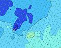 | 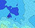 |  | 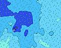 | 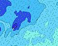 |  | 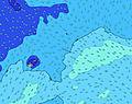 |  | 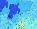 | |||||||||||||||
Wave Height (m) Direction Period (s) | ESE 7 | ESE 8 | W 13 | W 13 | W 13 | ESE 8 | W 14 | W 14 | W 14 | ESE 8 | ESE 8 | W 13 | E 8 | E 8 | E 8 | E 8 | E 8 | E 8 | E 8 | E 8 | E 8 | E 8 | E 7 | E 7 |
Wave Graph | ||||||||||||||||||||||||
0 | 0 | 4 | 3 | 4 | 0 | 4 | 4 | 4 | 0 | 0 | 3 | 551 | 494 | 447 | 401 | 391 | 381 | 371 | 358 | 358 | 319 | 348 | 388 | |
Wind (km/h) | ||||||||||||||||||||||||
Wind State on-shore cross-onshore cross-shore cross-offshore off-shore glassy | cross | cross | cross | cross | cross | cross | cross | cross | cross | cross | cross | cross | cross | cross | cross | cross | cross | cross | cross | cross-on | cross-on | cross-on | cross-on | cross-on |
High Tide | 9:13AM0.91m | 9:48PM0.82m | 10:06AM0.83m | 10:42PM0.78m | 11:01AM0.74m | |||||||||||||||||||
Low Tide | 3:14AM-0.01m | 3:50PM-0.04m | 4:11AM0.05m | 4:43PM0.02m | 5:12AM0.11m | 5:39PM0.09m | ||||||||||||||||||
— | 6:50 | — | — | — | — | — | — | — | 6:50 | — | — | — | — | — | — | — | 6:50 | — | — | — | — | — | — | |
— | — | — | — | — | 6:15 | — | — | — | — | — | — | — | 6:15 | — | — | — | — | — | — | — | 6:15 | — | — | |
mm | 1 | — | — | — | — | — | — | — | — | — | — | — | — | — | — | — | — | — | — | — | — | — | 1 | — |
Temp °C | 25 | 24 | 24 | 24 | 24 | 24 | 24 | 24 | 24 | 24 | 24 | 24 | 24 | 24 | 24 | 24 | 24 | 24 | 25 | 25 | 25 | 25 | 25 | 25 |
Feels °C | 19 | 17 | 18 | 18 | 18 | 17 | 17 | 17 | 18 | 17 | 17 | 18 | 18 | 19 | 19 | 19 | 19 | 19 | 20 | 20 | 21 | 22 | 21 | 21 |
Swell 1 Height (m) Direction Period (s) | SE 17 | SSE 17 | SSE 16 | SE 16 | SE 16 | SE 16 | SSE 15 | SSE 15 | SSE 14 | SSE 14 | SSE 14 | SSE 14 | SSE 14 | SSE 14 | SSE 14 | SSE 14 | SSE 14 | SE 14 | SE 14 | SE 13 | SE 13 | SSE 13 | SSE 13 | SE 13 |
77 | 115 | 103 | 124 | 122 | 118 | 86 | 84 | 82 | 82 | 82 | 81 | 81 | 81 | 81 | 80 | 79 | 51 | 48 | 46 | 45 | 68 | 66 | 42 | |
Swell 2 Height (m) Direction Period (s) | SW 18 | SW 17 | SW 16 | SW 16 | SW 16 | SW 15 | SW 15 | SW 16 | SW 16 | SW 16 | SW 16 | SW 16 | SW 16 | SW 16 | SW 15 | SW 15 | SW 15 | SW 17 | SW 16 | SW 16 | SW 16 | SW 16 | SW 16 | SW 16 |
50 | 73 | 69 | 69 | 69 | 36 | 58 | 64 | 64 | 40 | 39 | 39 | 39 | 38 | 37 | 36 | 36 | 44 | 41 | 67 | 66 | 65 | 64 | 62 | |
Swell 3 Height (m) Direction Period (s) | SW 13 | SW 13 | W 13 | W 13 | W 13 | SW 18 | W 14 | W 14 | W 14 | SW 13 | SW 13 | W 13 | W 13 | W 13 | N 10 | N 10 | N 10 | N 9 | N 9 | N 9 | S 26 | S 24 | S 24 | S 23 |
7 | 7 | 4 | 3 | 4 | 12 | 4 | 4 | 4 | 7 | 7 | 3 | 3 | 3 | 2 | 2 | 2 | 2 | 2 | 2 | 13 | 12 | 11 | 42 | |
Wind waves Height (m) Direction Period (s) | ESE 7 | ESE 8 | ESE 8 | ESE 8 | ESE 8 | ESE 8 | ESE 7 | ESE 7 | ESE 7 | ESE 8 | ESE 8 | E 8 | E 8 | E 8 | E 8 | E 8 | E 8 | E 8 | E 8 | E 8 | E 8 | E 8 | E 7 | E 7 |
471 | 588 | 589 | 542 | 438 | 437 | 468 | 498 | 558 | 574 | 528 | 531 | 551 | 494 | 447 | 401 | 391 | 381 | 371 | 358 | 358 | 319 | 348 | 388 | |
Nearest Offshore or Glassy | ||||||||||||||||||||||||
Distance (km) | 1258 | 1258 | 1264 | 1258 | 1258 | 1258 | 1258 | 1258 | 1258 | 1258 | 1258 | 1258 | 1258 | 2395 | 2181 | 1258 | 1222 | 1222 | 1222 | 1258 | 1269 | 1505 | 1233 | 1206 |
Best forecast wave conditions in Upolu | ||||||||||||||||||||||||
Best forecast wave conditions in Samoa | ||||||||||||||||||||||||
Header Global | ||||||||||||||||||||||||
- Map Icons:
 Break
Break Live Wave Height (m)
 Live Wind Speed (km/h)
 Surf Rating (10 Max)
 Ocean Swells (m)
- Wind Speed (km/h)


FREE! Surf-Forecast.com widget for your website
The surf report / weather widget below is available to embed on third party websites free of charge and provides a summary of our Laulii surf forecast. Simply grab the html code snippet that we provide and paste it into your own site. You can choose your preferred language and metric/imperial units for the surf forecast feed to suit users of your site. Click here to get the code.
 Nearest