

Surf Forecasts:

La Barra surf forecast from 3 Aug 2026:
- Best quality surf: Saturday 8 Aug, 3AM (local time) - 3ft (0.9m), 16s period, SSW swell with offshore winds.
- Most powerful swell: Saturday 8 Aug, 9AM (local time) - 3.5ft (1.0m), 16s period, SSW swell with 487 kJ wave energy.
- Next surfable swell (1★+): Monday 3 Aug, 6AM (local time) - 2.5ft (0.8m), 13s period with SSW swell.
Best Forecast Surf Conditions for La Barra this week:
The surf forecast for La Barra over the next 16 days: The first swell (rated 1 star or higher) is forecast to arrive on Monday (Aug 03) at 6AM. The primary swell is predicted to be 0.8m and 13s period with a secondary swell of 0.4m and 6s. The wind is predicted to be cross-offshore as the swell arrives.
The most powerful waves expected at La Barra in the next 16 days are 1.0m 16s and forecast to arrive on Saturday (Aug 08) at 9AM. Winds are predicted to be glassy at the time the swell arrives. The largest open ocean swell (not directed at the beach) is 0.2m 3s period and expected on Monday (Aug 03) at 6AM.
| Wave Type | Time (CST) & Date | Wave Height & Period |
|---|---|---|
| Next good surf (1 star+) | 6AM (Mon 3rd Aug) | 2.5ft (0.8m) 13s |
| Best Surf | 3AM (Sat 8th Aug) | 3ft (0.9m) 16s |
| Most Powerful | 9AM (Sat 8th Aug) | 3.5ft (1.0m) 16s |
Table - best surf conditions forecast for La Barra over the next 16 days.
The Lowdown
Alright, this is Rusty checkin’ in from the beach. We’ve got a solid couple of weeks ahead here at La Barra, with a real standout window that’s got me stoked.
First up, the water temp is sitting pretty close to average for this time of year, so no surprises there. The real action kicks off straight away. Monday morning, August 3rd, is shaping up as a beauty. We’ve got a clean 3ft SSW groundswell, with a nice long 14-second period, and the wind is absolutely dead calm – glassy as. The wave energy is moderate (246), and it’s delivering some good surf conditions. This is the one to get out for if you can.
The pattern then settles into a bit of a lull through Tuesday and Wednesday mornings, with small, clean waves in the 1ft to 2ft range. The swell energy drops (149 to 167), but the glassy mornings make it worth a paddle for a few fun ones. By Thursday morning, it’s still small but glassy with a 1ft SSW swell.
Then things start to build again. Friday morning, August 7th, sees a jump in energy with a 2ft SSW swell, but it’s that 18-second period that’s the real story – that’s proper groundswell energy (389). It’s glassy, so the morning looks good. Saturday morning, August 8th, is another standout: a 3ft SSW swell, 16-second period, and strong wave energy (610) with glassy conditions. That’s the kind of morning that’ll have you grinning.
The following week keeps the rhythm going. Monday the 10th, Tuesday the 11th, and Wednesday the 12th all have clean, glassy mornings with 2ft to 3ft SSW swell. The energy sits in the moderate range (304 to 349). Thursday the 13th morning is clean with a light offshore wind on a 2ft SSW swell.
Now, for the real highlight of the whole outlook – mark your calendars for Friday morning, August 14th, and Saturday morning, August 15th. Friday’s got a 3ft SSW swell with an 18-second period, glassy as, and very strong wave energy (539). Saturday is even better: 3ft SSW swell, 16-second period, glassy, with cranked-up energy (731). These are the two best sessions of the entire forecast. The water is clean, the swell is solid, and the wind is off. It doesn’t get much better than that.
We finish off with Sunday the 16th and Monday the 17th mornings offering clean, glassy 3ft to 3ft SSW swell, and Tuesday the 18th morning has a glassy 2ft SSW swell to wrap things up.
One thing to keep in mind: La Barra is a river/jetty break, so those long-period groundswells (over 15 seconds) can sometimes make the waves break a bit straight, but with the SSW direction and the jetty structure, it usually handles it well. It’s a fairly consistent spot, so even when it’s small, there’s usually something to ride.
The afternoons, though? Forget it. Almost every afternoon gets chopped up by a cross-onshore wind, so your window is the morning, every time. Get up early, and you’ll be rewarded.
Rusty.
Short Range ForecastLight rain (total 7mm), mostly falling on Mon night. Warm (max 31°C on Mon afternoon, min 25°C on Sun night). Wind will be generally light. | Days 5-7 Weather SummaryLight rain (total 8mm), mostly falling on Thu night. Warm (max 30°C on Thu morning, min 25°C on Thu night). Wind will be generally light. | ||||||||||||||||||
Monday 3 | Tuesday 4 | Wednesday 5 | Thursday 6 | Friday 7 | Saturday 8 | ||||||||||||||
Night | AM | PM | Night | AM | PM | Night | AM | PM | Night | AM | PM | Night | AM | PM | Night | AM | PM | Night | |
Swell Height Map |  |  |  |  | 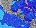 | 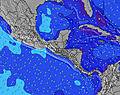 | 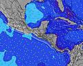 | ||||||||||||
Wave Height (m) Direction Period (s) | SSW 12 | SSW 14 | SSW 13 | SSW 13 | SSW 13 | SW 16 | SSW 12 | SW 14 | SW 15 | S 8 | SSW 14 | SSW 13 | SW 13 | SSW 13 | SSW 18 | SSW 16 | SSW 16 | SSW 16 | SSW 15 |
Wave Graph | |||||||||||||||||||
123 | 217 | 215 | 111 | 95 | 61 | 98 | 58 | 58 | 48 | 76 | 120 | 186 | 178 | 348 | 295 | 487 | 377 | 334 | |
Wind (km/h) | |||||||||||||||||||
Wind State on-shore cross-onshore cross-shore cross-offshore off-shore glassy | off | glassy | cross | off | glassy | cross-on | off | glassy | cross-on | off | glassy | cross-on | cross-off | glassy | cross | off | glassy | cross-on | cross |
High Tide | 5:42AM1.84m | 5:52PM1.69m | 6:20AM1.87m | 6:32PM1.63m | 7:02AM1.88m | 7:17PM1.56m | 7:49AM1.87m | 8:09PM1.50m | 8:44AM1.85m | 9:10PM1.45m | 9:47AM1.84m | 10:19PM1.44m | |||||||
Low Tide | 11:23PM0.23m | 11:52AM0.33m | 11:58PM0.24m | 12:35PM0.34m | 00:37AM0.26m | 1:22PM0.35m | 1:20AM0.29m | 2:15PM0.38m | 2:11AM0.32m | 3:16PM0.39m | 3:11AM0.35m | 4:23PM0.39m | |||||||
— | 5:47 | — | — | 5:47 | — | — | 5:47 | — | — | 5:48 | — | — | 5:48 | — | — | 5:48 | — | — | |
— | — | 6:30 | — | — | 6:30 | — | — | 6:29 | — | — | 6:29 | — | — | 6:28 | — | — | 6:28 | — | |
mm | — | — | — | 4 | — | — | 3 | — | — | 3 | — | — | 4 | — | — | — | — | 1 | 30 |
Temp °C | 28 | 30 | 31 | 28 | 30 | 30 | 28 | 30 | 30 | 28 | 30 | 30 | 26 | 29 | 30 | 27 | 30 | 29 | 27 |
Feels °C | 31 | 32 | 32 | 32 | 33 | 32 | 33 | 32 | 32 | 30 | 32 | 32 | 27 | 31 | 32 | 30 | 31 | 30 | 31 |
Swell 1 Height (m) Direction Period (s) | SSW 12 | SSW 14 | SSW 13 | SSW 13 | S 8 | SSW 10 | S 8 | S 8 | S 8 | S 8 | S 8 | S 8 | S 8 | S 8 | SSE 8 | SSW 16 | SSW 16 | SSW 16 | SSW 15 |
123 | 217 | 215 | 111 | 29 | 58 | 51 | 58 | 58 | 48 | 50 | 80 | 78 | 60 | 165 | 295 | 487 | 377 | 334 | |
Swell 2 Height (m) Direction Period (s) | SE 7 | SE 6 | SSE 7 | SSW 9 | SSW 13 | S 8 | SSW 12 | SSW 12 | SW 12 | SE 7 | SSW 14 | SSW 13 | SW 13 | SSW 13 | SSW 18 | S 8 | SSW 12 | S 8 | SE 7 |
29 | 10 | 17 | 44 | 95 | 33 | 98 | 55 | 34 | 33 | 76 | 120 | 180 | 151 | 348 | 47 | 94 | 36 | 30 | |
Swell 3 Height (m) Direction Period (s) | S 8 | SSE 8 | SSW 16 | S 8 | SSW 8 | SW 16 | SW 9 | SW 14 | SW 15 | SSW 8 | SSW 8 | S 13 | SSW 18 | SSW 18 | SW 13 | SE 7 | S 8 | SSW 12 | S 8 |
10 | 19 | 51 | 33 | 25 | 61 | 39 | 54 | 54 | 26 | 22 | 30 | 186 | 178 | 167 | 30 | 29 | 93 | 34 | |
Wind waves Height (m) Direction Period (s) | WNW 3 | — | — | — | — | — | — | — | — | — | NW 8 | — | — | — | — | — | — | SE 8 | — |
1 | — | — | — | — | — | — | — | — | — | 3 | — | — | — | — | — | — | 15 | — | |
Nearest Offshore or Glassy | |||||||||||||||||||
Distance (km) | 0 | 0 | 503 | 0 | 0 | 470 | 0 | 0 | 484 | 0 | 0 | 552 | 0 | 0 | 498 | 0 | 0 | 392 | 20 |
Best forecast wave conditions in Guatemala - Pacific Coast | |||||||||||||||||||
Best forecast wave conditions in Guatemala | |||||||||||||||||||
Header Global | |||||||||||||||||||
- Map Icons:
 Break
Break Live Wave Height (m)
 Live Wind Speed (km/h)
 Surf Rating (10 Max)
 Ocean Swells (m)
- Wind Speed (km/h)
Latest Updates


FREE! Surf-Forecast.com widget for your website
The surf report / weather widget below is available to embed on third party websites free of charge and provides a summary of our La Barra surf forecast. Simply grab the html code snippet that we provide and paste it into your own site. You can choose your preferred language and metric/imperial units for the surf forecast feed to suit users of your site. Click here to get the code.
Information about the La Barra Surf forecast
The above surf forecast table for La Barra provides essential information for determining whether the surfing conditions will be good over the next 16 days. A general guide to surfing at La Barra can be found by selecting the local surf guide option on the grey menu. Our La Barra surf forecast is unique since it includes wave energy (power) that defines the real feel of the surf rather than just the height or the period. If you surf the same spot (La Barra) regularly then make a mental note of the wave energy from the surf forecast table each time you go. Very soon you may start to choose your surf days based on the wave energy alone combined with our forecast of favourable offshore wind conditions. Our star ratings will help here and of course you will also find the usual wave height and period predictions on our surf forecasts as well as a full break down of the swell components under our advanced users option (to reveal that, click the little Einstein character under the tide times).
Further information to help with frequently asked questions about our surf forecast for La Barra may be found under the help tab on the top menu and also by moving your mouse over the question marks on the surf forecast table itself. Please always bear in mind that the forecast is for near-shore open water and local factors at each surf break influence the actual breaking wave height, such as the beach / reef profile, water depths offshore and shelter.
La Barra is 9 km (6 miles) from San Jose. If you plan a holiday in Guatemala - Pacific Coast, look for hotels and other accommodation in San Jose. San Jose has rooms for a wide range of budgets as well as car hire and transport links.
 Nearest