

Surf Forecasts:

Kata Beach surf forecast from 2 Aug 2026:
- Most powerful swell: Thursday 6 Aug, 10AM (local time) - 10ft (3.0m), 9s period, WSW swell with 1,600 kJ wave energy.
Best Forecast Surf Conditions for Kata Beach this week:
The most powerful waves expected at Kata Beach in the next 16 days are 3.0m 9s and forecast to arrive on Thursday (Aug 06) at 10AM. Winds are predicted to be cross-onshore at the time the swell arrives. The largest open ocean swell (not directed at the beach) is 3.0m 10s period and expected on Thursday (Aug 06) at 1PM.
| Wave Type | Time (+07) & Date | Wave Height & Period |
|---|---|---|
| Next good surf (1 star+) | - | - |
| Best Surf | - | - |
| Most Powerful | 10AM (Thu 6th Aug) | 10ft (3.0m) 9s |
Table - best surf conditions forecast for Kata Beach over the next 16 days.
The Lowdown
Alright folks, Rusty here. Let’s look at what’s cooking for the next couple of weeks.
Honestly, I’ve gotta be straight with you – this is a tough stretch. From now all the way through to the end of the 16-day window, there’s hardly a moment where the stars align for a proper surf. The only spot we’ve got on the radar is Kata Beach, but it’s an inconsistent spot that’s often crowded, and it’s exposed to swell from the SW. The water temp is sitting at 86°F, which is about 1°F above average for this time of year – so it’s a touch warmer than usual, but nothing too wild.
Right from the start, Sunday morning (August 2nd) has a tiny 0.7ft swell from the WSW with a very long 16-second period, but it’s onshore wind and poor surf conditions – not worth paddling out. That same flat, messy pattern carries through Sunday and Monday. The northerly wind options are offshore-friendly for other spots, but not here.
We don’t see any real wave height until Wednesday morning, August 5th, when a 7ft swell from the WSW rolls in with a 9-second period and moderate wave energy (882). But the wind is blowing onshore at 19 mph with risk of thunderstorms, and the surf is rated poor. That’s a no-go for me. By Thursday, August 6th, the swell bumps up to 10ft from the WSW with strong wave energy (1600), but it’s cross-onshore at 22 mph and lumpy. That’s expert territory and honestly, it’s more of a kite-surfing setup than a clean paddle scenario.
After that, the swell collapses back to almost nothing for the rest of the week and into the second week. From August 7th onward, we’re looking at days of flat, onshore wind, and poor conditions. The wind stays strong – often 16–25 mph from the WSW or SW – and the surf is just not there. There’s a tiny blip on Monday, August 17th with a 0.3ft swell from the SW, but it’s cross-onshore and messy.
So, to put it bluntly: there are no good surf options in this 16-day window. Kata Beach is inconsistent at the best of times, and the wind and weather are just not playing ball. This kind of blank run is more normal for the area during this period, so don’t hold your breath. Forecasts can change, but right now, I’d say keep the board in the bag.
Rusty.
Short Range ForecastHeavy rain (total 55mm), heaviest during Tue night. Warm (max 30°C on Mon afternoon, min 27°C on Mon night). Winds increasing (light winds from the SSW on Sun night, fresh winds from the WSW by Tue night). | Days 4-6 Weather SummaryHeavy rain (total 64mm), heaviest during Thu night. Warm (max 28°C on Wed morning, min 27°C on Thu morning). Mainly strong winds. | ||||||||||||||||||||
Sunday 2 | Monday 3 | Tuesday 4 | Wednesday 5 | Thursday 6 | Friday 7 | Saturday 8 | |||||||||||||||
AM | PM | Night | AM | PM | Night | AM | PM | Night | AM | PM | Night | AM | PM | Night | AM | PM | Night | AM | PM | Night | |
Swell Height Map | 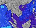 | 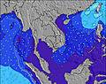 | 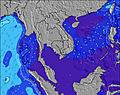 | 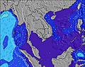 | 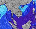 | 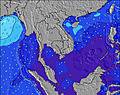 | 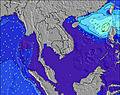 | ||||||||||||||
Wave Height (m) Direction Period (s) | WSW 16 | WSW 15 | WSW 16 | WSW 15 | W 9 | W 9 | W 11 | WSW 10 | WSW 10 | WSW 9 | WSW 9 | WSW 9 | WSW 9 | WSW 10 | W 9 | WSW 16 | SW 16 | W 10 | W 10 | W 10 | W 9 |
Wave Graph | |||||||||||||||||||||
24 | 23 | 24 | 23 | 0 | 0 | 0 | 0 | 0 | 856 | 809 | 0 | 1600 | 0 | 0 | 27 | 10 | 0 | 0 | 0 | 0 | |
Wind (km/h) | |||||||||||||||||||||
Wind State on-shore cross-onshore cross-shore cross-offshore off-shore glassy | on | on | on | cross-on | cross-on | on | on | on | on | on | on | on | cross-on | on | cross-on | on | cross-on | on | on | on | on |
High Tide | 12:14PM2.15m | 00:42AM2.00m | 12:45PM2.06m | 1:16AM1.98m | 1:20PM1.94m | 1:54AM1.93m | 1:59PM1.78m | 2:41AM1.84m | 2:50PM1.60m | 3:43AM1.74m | 4:06PM1.42m | 5:13AM1.68m | 6:04PM1.35m | ||||||||
Low Tide | 6:32PM0.09m | 6:41AM0.29m | 7:02PM0.13m | 7:18AM0.36m | 7:35PM0.22m | 8:01AM0.47m | 8:14PM0.35m | 8:55AM0.60m | 9:04PM0.50m | 10:12AM0.72m | 10:18PM0.65m | 12:04PM0.73m | 00:05AM0.70m | ||||||||
6:18 | — | — | 6:18 | — | — | 6:18 | — | — | 6:18 | — | — | 6:18 | — | — | 6:18 | — | — | 6:18 | — | — | |
— | 6:45 | — | — | 6:45 | — | — | 6:45 | — | — | 6:45 | — | — | 6:45 | — | — | 6:45 | — | — | 6:45 | — | |
mm | 1 | — | 5 | 1 | — | 7 | 10 | 8 | 23 | 11 | 9 | 5 | 2 | 2 | 20 | 3 | 3 | 9 | 3 | 3 | 7 |
Temp °C | 29 | 29 | 29 | 29 | 30 | 29 | 28 | 28 | 28 | 28 | 28 | 28 | 28 | 28 | 27 | 28 | 28 | 28 | 29 | 29 | 28 |
Feels °C | 33 | 31 | 33 | 33 | 33 | 33 | 29 | 28 | 27 | 28 | 28 | 26 | 27 | 27 | 26 | 27 | 26 | 25 | 28 | 29 | 28 |
Swell 1 Height (m) Direction Period (s) | W 8 | W 8 | W 8 | W 7 | W 9 | W 9 | W 11 | WSW 10 | SSE 5 | WSW 16 | SE 5 | — | — | — | — | WSW 16 | SW 16 | — | — | W 10 | SE 4 |
29 | 31 | 18 | 17 | 42 | 76 | 332 | 574 | 6 | 26 | 1 | — | — | — | — | 27 | 10 | — | — | 958 | 1 | |
Swell 2 Height (m) Direction Period (s) | WSW 16 | WSW 15 | WSW 16 | S 4 | SSE 4 | SSE 4 | SE 4 | W 17 | — | — | — | — | — | — | — | SW 16 | — | — | — | W 17 | — |
24 | 23 | 24 | 3 | 2 | 2 | 1 | 6 | — | — | — | — | — | — | — | 11 | — | — | — | 6 | — | |
Swell 3 Height (m) Direction Period (s) | W 8 | — | S 4 | WSW 15 | W 15 | W 15 | W 18 | W 17 | — | — | — | — | — | — | — | — | — | — | — | — | — |
1 | — | 1 | 23 | 4 | 4 | 6 | 6 | — | — | — | — | — | — | — | — | — | — | — | — | — | |
Wind waves Height (m) Direction Period (s) | — | S 4 | — | — | — | — | W 11 | — | WSW 10 | WSW 9 | WSW 9 | WSW 9 | WSW 9 | WSW 10 | W 9 | W 9 | W 9 | W 10 | W 10 | — | W 9 |
— | 1 | — | — | — | — | 116 | — | 627 | 856 | 809 | 860 | 1600 | 1411 | 1064 | 828 | 982 | 1565 | 1346 | — | 693 | |
Nearest Offshore or Glassy | |||||||||||||||||||||
Distance (km) | 1 | 1 | 1 | 103 | 15 | 1 | 19 | 103 | 19 | 640 | 802 | 740 | 1149 | 604 | 604 | 740 | 604 | 604 | 84 | 604 | 19 |
Best forecast wave conditions in Phuket | |||||||||||||||||||||
Best forecast wave conditions in Thailand | |||||||||||||||||||||
Header Global | |||||||||||||||||||||
- Map Icons:
 Break
Break Live Wave Height (m)
 Live Wind Speed (km/h)
 Surf Rating (10 Max)
 Ocean Swells (m)
- Wind Speed (km/h)
Latest Updates


FREE! Surf-Forecast.com widget for your website
The surf report / weather widget below is available to embed on third party websites free of charge and provides a summary of our Kata Beach surf forecast. Simply grab the html code snippet that we provide and paste it into your own site. You can choose your preferred language and metric/imperial units for the surf forecast feed to suit users of your site. Click here to get the code.
Information about the Kata Beach Surf forecast
The above surf forecast table for Kata Beach provides essential information for determining whether the surfing conditions will be good over the next 16 days. A general guide to surfing at Kata Beach can be found by selecting the local surf guide option on the grey menu. Our Kata Beach surf forecast is unique since it includes wave energy (power) that defines the real feel of the surf rather than just the height or the period. If you surf the same spot (Kata Beach) regularly then make a mental note of the wave energy from the surf forecast table each time you go. Very soon you may start to choose your surf days based on the wave energy alone combined with our forecast of favourable offshore wind conditions. Our star ratings will help here and of course you will also find the usual wave height and period predictions on our surf forecasts as well as a full break down of the swell components under our advanced users option (to reveal that, click the little Einstein character under the tide times).
Further information to help with frequently asked questions about our surf forecast for Kata Beach may be found under the help tab on the top menu and also by moving your mouse over the question marks on the surf forecast table itself. Please always bear in mind that the forecast is for near-shore open water and local factors at each surf break influence the actual breaking wave height, such as the beach / reef profile, water depths offshore and shelter.
Kata Beach is 5 km (3 miles) from the city of Ban Chalong. If you plan a holiday in Phuket, look for hotels and other accommodation in Ban Chalong. Ban Chalong has rooms for a wide range of budgets as well as car hire and transport links.
 Nearest