

Surf Forecasts:

How big are the waves at Haapiti today (19 Jun):
- Morning surf: Morning surf (19 Jun, local time) - 6ft (1.8m), 15s period with SSW swell.
- Afternoon surf: Afternoon surf (19 Jun, local time) - 5ft (1.6m), 15s period with SSW swell.
- Evening surf: Evening surf (19 Jun, local time) - 4.5ft (1.3m), 14s period with SSW swell.
The current surf forecast for Haapiti at 1PM is: 1.6m 15s primary swell from a South-southwest direction and 0.6m 7s secondary swell from a South-southeast direction (forecast issued at 07:00am June 19). An open ocean swell of 1.4m 6s is not directed at the surf break. The wind direction is predicted to be cross-offshore.
| Time (-10) & Date | Wave Height | Wave Period |
|---|---|---|
| Morning (19 Jun) | 6ft (1.8m) | 15s |
| Afternoon (19 Jun) | 5ft (1.6m) | 15s |
| Evening (19 Jun) | 4.5ft (1.3m) | 14s |
Table - waves today at Haapiti. (Swell directed towards the surf break)
Updates in hr min s Forecast update imminent
Short Range ForecastLight rain (total 2mm), mostly falling on Sat afternoon. Warm (max 26°C on Fri morning, min 25°C on Fri night). Mainly strong winds. | ||||||||||||||||||||||||
Friday 19 | Saturday 20 | Sunday 21 | Mon 22 | |||||||||||||||||||||
5 AM | 8 AM | 11 AM | 2 PM | 5 PM | 8 PM | 11 PM | 2 AM | 5 AM | 8 AM | 11 AM | 2 PM | 5 PM | 8 PM | 11 PM | 2 AM | 5 AM | 8 AM | 11 AM | 2 PM | 5 PM | 8 PM | 11 PM | 2 AM | |
Swell Height Map | 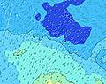 |  |  |  |  |  |  |  |  | 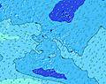 | ||||||||||||||
Wave Height (m) Direction Period (s) | SSW 16 | SSW 16 | SSW 15 | SSW 15 | SSW 14 | SSW 14 | SSW 14 | SSW 14 | SSW 18 | SSW 14 | SSW 16 | SSW 16 | SSW 16 | SSW 15 | SSW 15 | SSW 19 | SSW 18 | SSW 18 | SSW 18 | SSW 17 | SSW 16 | SSW 16 | SSW 16 | SSW 16 |
Wave Graph | ||||||||||||||||||||||||
1785 | 1551 | 1288 | 1059 | 911 | 752 | 642 | 642 | 1015 | 433 | 998 | 986 | 1136 | 1151 | 880 | 970 | 2318 | 2168 | 2432 | 2349 | 2110 | 2033 | 1750 | 1706 | |
Wind (km/h) | ||||||||||||||||||||||||
Wind State on-shore cross-onshore cross-shore cross-offshore off-shore glassy | cross-off | cross-off | cross-off | cross-off | cross-off | cross-off | cross-off | cross-off | cross-off | cross-off | cross-off | cross-off | cross-off | cross-off | cross-off | off | off | off | off | off | off | off | off | off |
High Tide | 2:51AM0.21m | 3:21PM0.24m | 3:27AM0.20m | 4:19PM0.22m | 4:14AM0.19m | 5:47PM0.20m | ||||||||||||||||||
Low Tide | 8:59AM0.07m | 9:48PM0.10m | 9:44AM0.09m | 10:36PM0.12m | 10:40AM0.11m | 11:46PM0.15m | ||||||||||||||||||
6:28 | — | — | — | — | — | — | — | 6:28 | — | — | — | — | — | — | — | 6:28 | — | — | — | — | — | — | 6:28 | |
— | — | — | — | 5:32 | — | — | — | — | — | — | — | 5:32 | — | — | — | — | — | — | — | 5:32 | — | — | 5:32 | |
mm | — | — | — | — | — | — | — | — | — | — | — | — | 1 | 1 | — | — | — | — | — | — | — | — | — | — |
Temp °C | 26 | 26 | 26 | 26 | 26 | 26 | 26 | 26 | 25 | 26 | 26 | 26 | 25 | 26 | 25 | 25 | 25 | 26 | 26 | 26 | 26 | 26 | 26 | 26 |
Feels °C | 24 | 23 | 23 | 24 | 24 | 25 | 24 | 24 | 23 | 25 | 25 | 24 | 21 | 22 | 21 | 21 | 21 | 23 | 23 | 24 | 24 | 23 | 23 | 25 |
Swell 1 Height (m) Direction Period (s) | SSW 16 | SSW 16 | SSW 15 | SSW 15 | SSW 14 | SSW 14 | SSW 14 | SSW 14 | SSW 18 | SSW 14 | SSW 16 | SSW 16 | SSW 16 | SSW 15 | SSW 15 | SSW 15 | SSW 18 | SSW 18 | SSW 18 | SSW 17 | SSW 16 | SSW 16 | SSW 16 | SSW 16 |
1785 | 1551 | 1288 | 1059 | 911 | 752 | 642 | 642 | 1015 | 421 | 998 | 986 | 1136 | 1151 | 880 | 773 | 2318 | 2168 | 2432 | 2349 | 2110 | 2033 | 1750 | 1706 | |
Swell 2 Height (m) Direction Period (s) | SSE 8 | SSE 8 | SE 7 | SSE 7 | SE 7 | SSE 7 | SSE 7 | SSW 18 | SE 7 | SSW 17 | SE 13 | SSE 4 | SE 12 | SE 9 | SSW 19 | SSW 19 | SE 9 | N 9 | N 9 | NW 11 | SE 9 | NNE 8 | SE 9 | SE 10 |
74 | 50 | 56 | 37 | 43 | 36 | 36 | 182 | 25 | 433 | 26 | 4 | 37 | 114 | 539 | 970 | 88 | 7 | 6 | 5 | 51 | 7 | 43 | 58 | |
Swell 3 Height (m) Direction Period (s) | SE 14 | SE 14 | SE 13 | SE 13 | SE 13 | SSW 18 | SSW 18 | SE 7 | SE 13 | SE 13 | NNE 10 | SE 13 | NNE 10 | NNE 10 | SE 8 | SE 8 | NNE 9 | S 9 | ESE 12 | NW 11 | NNE 9 | NW 11 | NNE 9 | NNE 9 |
49 | 46 | 46 | 45 | 44 | 188 | 186 | 26 | 27 | 26 | 10 | 25 | 10 | 10 | 120 | 86 | 8 | 7 | 14 | 5 | 8 | 5 | 8 | 8 | |
Wind waves Height (m) Direction Period (s) | ENE 7 | ENE 7 | ENE 6 | ENE 7 | ENE 7 | ENE 7 | ENE 7 | ENE 7 | ENE 7 | E 7 | E 7 | E 7 | E 6 | E 7 | ENE 7 | ENE 7 | ENE 7 | ENE 7 | E 7 | ENE 8 | ENE 7 | ENE 8 | ENE 7 | ENE 7 |
124 | 173 | 144 | 158 | 141 | 128 | 140 | 149 | 121 | 134 | 111 | 113 | 185 | 342 | 332 | 340 | 295 | 319 | 320 | 273 | 181 | 196 | 181 | 183 | |
Nearest Offshore or Glassy | ||||||||||||||||||||||||
Distance (km) | 3812 | 2602 | 1122 | 1119 | 3486 | 3812 | 3812 | 3812 | 2602 | 2602 | 1119 | 1114 | 1122 | 2602 | 2602 | 2602 | 2602 | 2602 | 2602 | 2602 | 2602 | 1122 | 1116 | 1119 |
Best forecast wave conditions in Moorea | ||||||||||||||||||||||||
Best forecast wave conditions in French Polynesia | ||||||||||||||||||||||||
Header Global | ||||||||||||||||||||||||
- Map Icons:
 Break
Break Live Wave Height (m)
 Live Wind Speed (km/h)
 Surf Rating (10 Max)
 Ocean Swells (m)
- Wind Speed (km/h)


FREE! Surf-Forecast.com widget for your website
The surf report / weather widget below is available to embed on third party websites free of charge and provides a summary of our Haapiti surf forecast. Simply grab the html code snippet that we provide and paste it into your own site. You can choose your preferred language and metric/imperial units for the surf forecast feed to suit users of your site. Click here to get the code.
 Nearest