

Surf Forecasts:

How big are the waves at Walung today (04 Aug):
- Morning surf: Morning surf (04 Aug, local time) - 4.5ft (1.3m), 10s period with WNW swell.
- Afternoon surf: Afternoon surf (04 Aug, local time) - 4.5ft (1.3m), 10s period with WNW swell.
- Evening surf: Evening surf (04 Aug, local time) - 3.5ft (1.1m), 10s period with WNW swell.
The current surf forecast for Walung at 3AM is: 1.0m 13s primary swell from a North-northwest direction and 1.1m 9s secondary swell from a West-northwest direction (forecast issued at 10:00pm August 03). The wind direction is predicted to be cross-onshore.
| Time (+11) & Date | Wave Height | Wave Period |
|---|---|---|
| Morning (04 Aug) | 4.5ft (1.3m) | 10s |
| Afternoon (04 Aug) | 4.5ft (1.3m) | 10s |
| Evening (04 Aug) | 3.5ft (1.1m) | 10s |
Table - waves today at Walung. (Swell directed towards the surf break)
Short Range ForecastLight rain (total 4mm), mostly falling on Tue morning. Warm (max 28°C on Mon night, min 27°C on Tue night). Wind will be generally light. | ||||||||||||||||||
Mon 3 | Tuesday 4 | Wednesday 5 | ||||||||||||||||
8 PM | 11 PM | 2 AM | 5 AM | 8 AM | 11 AM | 2 PM | 5 PM | 8 PM | 11 PM | 2 AM | 5 AM | 8 AM | 11 AM | 2 PM | 5 PM | 8 PM | 11 PM | |
Swell Height Map | 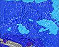 | 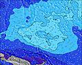 | 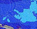 | 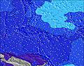 |  |  |  | |||||||||||
Wave Height (m) Direction Period (s) | NNW 12 | NNW 13 | NNW 13 | NNW 13 | NNW 13 | WNW 10 | WNW 10 | WNW 10 | WNW 10 | WNW 9 | WNW 9 | WNW 9 | WNW 9 | WNW 9 | WNW 10 | WNW 10 | WNW 10 | WNW 10 |
Wave Graph | ||||||||||||||||||
212 | 298 | 326 | 384 | 307 | 296 | 308 | 275 | 226 | 217 | 203 | 211 | 216 | 290 | 314 | 347 | 327 | 290 | |
Wind (km/h) | ||||||||||||||||||
Wind State on-shore cross-onshore cross-shore cross-offshore off-shore glassy | cross-on | cross-on | cross-on | cross | cross | cross | cross | cross | cross | cross-off | cross-off | cross-off | cross-off | cross-off | cross-off | cross-off | cross-off | cross-off |
High Tide | 6:02PM1.32m | 6:03AM1.35m | 6:38PM1.30m | 6:37AM1.19m | 7:23PM1.25m | |||||||||||||
Low Tide | 11:58PM0.28m | 12:19PM0.19m | 00:41AM0.37m | 12:50PM0.28m | ||||||||||||||
— | — | — | 6:03 | — | — | — | — | — | — | — | 6:03 | — | — | — | — | — | — | |
— | — | — | — | — | — | — | 6:23 | — | — | — | — | — | — | — | 6:23 | — | — | |
mm | — | — | 1 | 1 | 2 | — | — | — | — | — | — | — | — | — | — | — | — | — |
Temp °C | 28 | 28 | 28 | 28 | 28 | 28 | 28 | 28 | 28 | 28 | 28 | 27 | 27 | 28 | 28 | 28 | 28 | 28 |
Feels °C | 32 | 33 | 32 | 32 | 31 | 30 | 30 | 31 | 31 | 32 | 32 | 30 | 29 | 31 | 30 | 30 | 30 | 31 |
Swell 1 Height (m) Direction Period (s) | WNW 9 | WNW 9 | WNW 9 | WNW 9 | WNW 9 | WNW 10 | WNW 10 | WNW 10 | WNW 10 | WNW 9 | WNW 9 | WNW 9 | WNW 9 | WNW 9 | WNW 10 | WNW 10 | WNW 10 | WNW 10 |
212 | 181 | 190 | 199 | 212 | 296 | 308 | 275 | 226 | 217 | 203 | 211 | 216 | 261 | 314 | 347 | 327 | 290 | |
Swell 2 Height (m) Direction Period (s) | NNW 12 | NNW 13 | NNW 13 | NNW 13 | NNW 13 | NNW 12 | NNW 12 | NNW 12 | NNW 12 | NNW 12 | NNW 11 | NNW 11 | NNW 11 | NNW 13 | NNW 12 | NNW 12 | NNW 12 | NNW 12 |
206 | 298 | 326 | 384 | 307 | 278 | 274 | 230 | 222 | 158 | 148 | 109 | 113 | 290 | 268 | 255 | 255 | 260 | |
Swell 3 Height (m) Direction Period (s) | SW 8 | SW 8 | SSE 9 | SE 9 | SE 9 | SE 9 | SSE 8 | SE 8 | SE 8 | SW 7 | SW 7 | S 10 | S 10 | S 10 | S 10 | S 10 | S 10 | SSE 10 |
57 | 55 | 103 | 81 | 77 | 75 | 64 | 72 | 58 | 28 | 15 | 50 | 51 | 73 | 130 | 127 | 127 | 167 | |
Wind waves Height (m) Direction Period (s) | — | — | — | — | — | — | — | — | — | — | — | — | — | — | — | — | — | — |
— | — | — | — | — | — | — | — | — | — | — | — | — | — | — | — | — | — | |
Nearest Offshore or Glassy | ||||||||||||||||||
Distance (km) | 1607 | 1187 | 1187 | 1187 | 1187 | 1187 | 1187 | 1187 | 1187 | 0 | 0 | 0 | 1187 | 1187 | 1607 | 1187 | 1187 | 1187 |
Best forecast wave conditions in Micronesia - Kosrae | ||||||||||||||||||
Best forecast wave conditions in Micronesia | ||||||||||||||||||
Header Global | ||||||||||||||||||
- Map Icons:
 Break
Break Live Wave Height (m)
 Live Wind Speed (km/h)
 Surf Rating (10 Max)
 Ocean Swells (m)
- Wind Speed (km/h)
Latest Updates


FREE! Surf-Forecast.com widget for your website
The surf report / weather widget below is available to embed on third party websites free of charge and provides a summary of our Walung surf forecast. Simply grab the html code snippet that we provide and paste it into your own site. You can choose your preferred language and metric/imperial units for the surf forecast feed to suit users of your site. Click here to get the code.
 Nearest