

Surf Forecasts:

How big are the waves at Viri Inga O Tuki today (02 Aug):
- Afternoon surf: Afternoon surf (02 Aug, local time) - 5ft (1.6m), 12s period with SW swell.
- Evening surf: Evening surf (02 Aug, local time) - 4.5ft (1.3m), 11s period with SSW swell.
The current surf forecast for Viri Inga O Tuki at 10PM is: 1.3m 11s primary swell from a South-southwest direction and 1.1m 11s secondary swell from a West-southwest direction (forecast issued at 05:00pm August 02). An open ocean swell of 1.4m 5s is not directed at the surf break. The wind direction is predicted to be offshore.
| Time (-06) & Date | Wave Height | Wave Period |
|---|---|---|
| Morning (02 Aug) | - | - |
| Afternoon (02 Aug) | 5ft (1.6m) | 12s |
| Evening (02 Aug) | 4.5ft (1.3m) | 11s |
Table - waves today at Viri Inga O Tuki. (Swell directed towards the surf break)
Short Range ForecastHeavy rain (total 36mm), heaviest during Sun night. Warm (max 21°C on Sun afternoon, min 17°C on Tue morning). Winds increasing (light winds from the S on Mon morning, near gales from the ESE by Wed morning). | |||||||||||||||||||
Sun 2 | Monday 3 | Tuesday 4 | |||||||||||||||||
3 PM | 6 PM | 9 PM | 12 AM | 3 AM | 6 AM | 9 AM | 12 PM | 3 PM | 6 PM | 9 PM | 12 AM | 3 AM | 6 AM | 9 AM | 12 PM | 3 PM | 6 PM | 9 PM | |
Swell Height Map |  | 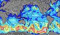 | 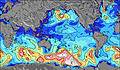 | 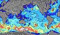 | 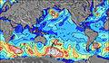 | 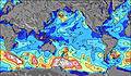 | 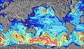 | ||||||||||||
Wave Height (m) Direction Period (s) | SW 12 | SW 11 | SSW 11 | SSW 14 | S 7 | SW 16 | SW 17 | SW 16 | SW 16 | SW 16 | SW 16 | SW 15 | SW 14 | SW 14 | SW 14 | SW 14 | SE 9 | SE 9 | SE 9 |
Wave Graph | |||||||||||||||||||
648 | 512 | 411 | 515 | 1005 | 1318 | 1754 | 3855 | 3668 | 3842 | 3746 | 3086 | 2457 | 2265 | 1977 | 1736 | 1470 | 1373 | 1255 | |
Wind (km/h) | |||||||||||||||||||
Wind State on-shore cross-onshore cross-shore cross-offshore off-shore glassy | cross-off | cross-off | cross-off | cross-off | off | cross-off | cross-on | on | on | on | on | on | on | on | on | on | on | on | on |
High Tide | 8:17PM0.59m | 8:37AM0.57m | 9:10PM0.59m | 9:35AM0.52m | |||||||||||||||
Low Tide | 1:43PM0.19m | 2:09AM0.24m | 2:31PM0.22m | 3:13AM0.26m | 3:31PM0.25m | ||||||||||||||
— | — | — | — | — | 7:56 | — | — | — | — | — | — | — | 7:56 | — | — | — | — | — | |
— | 6:50 | — | — | — | — | — | — | — | 6:51 | — | — | — | — | — | — | — | 6:51 | — | |
mm | 1 | 1 | 3 | 5 | 19 | 1 | — | — | — | — | 1 | 1 | — | — | — | 1 | 1 | — | — |
Temp °C | 21 | 21 | 21 | 20 | 19 | 19 | 19 | 19 | 18 | 18 | 18 | 18 | 18 | 18 | 18 | 17 | 17 | 18 | 18 |
Feels °C | 19 | 16 | 15 | 13 | 13 | 16 | 18 | 14 | 11 | 11 | 11 | 11 | 12 | 12 | 11 | 8 | 8 | 9 | 9 |
Swell 1 Height (m) Direction Period (s) | SW 12 | SW 11 | SSW 11 | SW 11 | NNW 7 | SW 13 | SW 13 | SW 16 | SW 16 | SW 16 | SW 16 | SW 15 | SW 14 | SW 14 | SW 14 | SW 14 | SW 14 | SW 13 | SW 13 |
648 | 512 | 411 | 347 | 259 | 981 | 1164 | 3855 | 3668 | 3842 | 3746 | 3086 | 2457 | 2265 | 1977 | 1736 | 1470 | 1144 | 996 | |
Swell 2 Height (m) Direction Period (s) | W 12 | W 11 | WSW 11 | SSW 14 | SW 13 | SW 16 | SW 17 | NNW 8 | NNW 8 | NNW 7 | NNW 7 | NNW 7 | NNW 7 | N 7 | N 7 | NNE 6 | NNW 6 | NNW 10 | S 14 |
555 | 499 | 314 | 515 | 841 | 1318 | 1754 | 219 | 138 | 125 | 91 | 63 | 48 | 34 | 22 | 16 | 4 | 10 | 60 | |
Swell 3 Height (m) Direction Period (s) | SE 11 | SW 18 | SW 18 | WSW 11 | SSW 16 | NNW 7 | NNW 8 | WSW 11 | N 11 | WSW 11 | WNW 8 | NW 7 | N 10 | N 10 | N 10 | NW 7 | N 10 | S 15 | NNW 10 |
79 | 252 | 323 | 128 | 886 | 243 | 264 | 39 | 20 | 11 | 37 | 26 | 9 | 9 | 8 | 7 | 8 | 17 | 10 | |
Wind waves Height (m) Direction Period (s) | — | NNW 4 | NNW 5 | NNW 6 | S 7 | SSE 8 | SSE 8 | SSE 8 | SSE 8 | SSE 8 | SSE 9 | SE 9 | SE 9 | SE 9 | SE 9 | SE 9 | SE 9 | SE 9 | SE 9 |
— | 14 | 100 | 347 | 1005 | 1023 | 709 | 512 | 1047 | 1108 | 1119 | 966 | 996 | 881 | 995 | 1274 | 1437 | 1373 | 1255 | |
Nearest Offshore or Glassy | |||||||||||||||||||
Distance (km) | 2 | 3637 | 3637 | 3582 | 3637 | 3590 | 4 | 3578 | 3563 | 3578 | 3637 | 3543 | 3543 | 3527 | 3527 | 3563 | 3527 | 3527 | 3527 |
Best forecast wave conditions in Easter Island | |||||||||||||||||||
Best forecast wave conditions in Chile | |||||||||||||||||||
Header Global | |||||||||||||||||||
- Map Icons:
 Break
Break Live Wave Height (m)
 Live Wind Speed (km/h)
 Surf Rating (10 Max)
 Ocean Swells (m)
- Wind Speed (km/h)
Latest Updates


FREE! Surf-Forecast.com widget for your website
The surf report / weather widget below is available to embed on third party websites free of charge and provides a summary of our Viri Inga O Tuki surf forecast. Simply grab the html code snippet that we provide and paste it into your own site. You can choose your preferred language and metric/imperial units for the surf forecast feed to suit users of your site. Click here to get the code.
 Nearest