

Surf Forecasts:

Nirvana Beach surf forecast from 3 Aug 2026:
- Most powerful swell: Saturday 8 Aug, 6PM (local time) - 2.5ft (0.8m), 7s period, WNW swell with 62 kJ wave energy.
Best Forecast Surf Conditions for Nirvana Beach this week:
The most powerful waves expected at Nirvana Beach in the next 16 days are 0.8m 7s and forecast to arrive on Saturday (Aug 08) at 6PM. Winds are predicted to be onshore at the time the swell arrives.
| Wave Type | Time (IDT) & Date | Wave Height & Period |
|---|---|---|
| Next good surf (1 star+) | - | - |
| Best Surf | - | - |
| Most Powerful | 6PM (Sat 8th Aug) | 2.5ft (0.8m) 7s |
Table - best surf conditions forecast for Nirvana Beach over the next 16 days.
The Lowdown
G’day, Rusty here. Let’s be straight with you – Nirvana Beach is not doing us any favours over the next 16 days. The whole stretch from Monday 3 August right through to Tuesday 18 August is a write-off. There’s no standout, no hidden gem, just a long, flat, choppy run. The combined swell energy barely cracks double digits most days, and when it does push a little higher on Friday 14 August afternoon (124 in the metric units), the wind is cross-onshore or onshore, the period is short at 7 seconds, and the whole thing is messy. It’s a beginner spot, but honestly, even a learner would struggle to find a ride worth paddling for.
The water temperature is sitting at 85°F with an anomaly 3°F above the norm, so it’s a touch warmer than usual for this time of year, but that’s about the only interesting thing happening.
The pattern is the same every day: small swell, poor surf conditions, cross-onshore wind, and a score of zero. Tuesday 11 August morning has a brief moment of cleaner wind from the NNE at 3 mph, but the swell is still tiny at 2 ft from the WNW with a 6-second period, so it’s flat and weak. No energy, no shape, no hope.
There is no good surf on offer here. If you’re desperate for a paddle, maybe Monday 10 August morning has the cleanest conditions with that light cross-offshore breeze, but the wave height is 2 ft and the energy is only 33, so it’s more of a float than a surf. The whole 16-day window is a gap of nothing.
Stay patient, mate. It won’t stay like this forever, but for now, leave the board at home.
Rusty.
Short Range ForecastMostly dry. Warm (max 29°C on Mon afternoon, min 24°C on Wed night). Wind will be generally light. | Days 4-6 Weather SummaryMostly dry. Warm (max 28°C on Thu morning, min 25°C on Thu night). Wind will be generally light. | ||||||||||||||||||||
Monday 3 | Tuesday 4 | Wednesday 5 | Thursday 6 | Friday 7 | Saturday 8 | Sunday 9 | |||||||||||||||
AM | PM | Night | AM | PM | Night | AM | PM | Night | AM | PM | Night | AM | PM | Night | AM | PM | Night | AM | PM | Night | |
Swell Height Map | 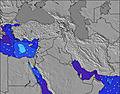 | 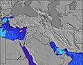 | 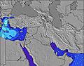 | 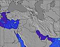 | 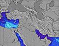 | 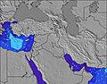 | 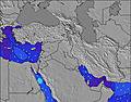 | ||||||||||||||
Wave Height (m) Direction Period (s) | NW 4 | NW 5 | NW 4 | WNW 5 | WNW 5 | WNW 6 | WNW 6 | WNW 7 | WNW 6 | W 6 | W 6 | W 6 | W 6 | W 6 | W 6 | WNW 7 | W 7 | WNW 7 | WNW 6 | WNW 6 | WNW 6 |
Wave Graph | |||||||||||||||||||||
12 | 11 | 9 | 17 | 26 | 29 | 31 | 48 | 32 | 29 | 41 | 27 | 24 | 24 | 19 | 51 | 59 | 60 | 40 | 28 | 21 | |
Wind (km/h) | |||||||||||||||||||||
Wind State on-shore cross-onshore cross-shore cross-offshore off-shore glassy | cross-on | cross-on | cross | on | cross-on | on | cross-on | cross-on | glassy | cross-on | on | cross-on | cross-on | on | cross-on | cross-on | on | cross-on | cross-on | on | cross-off |
High Tide | 1:27PM0.34m | 1:57AM0.33m | 2:05PM0.30m | 2:38AM0.32m | 2:53PM0.26m | 3:34AM0.30m | 4:19PM0.22m | 5:09AM0.29m | 7:13PM0.21m | 7:07AM0.30m | 8:50PM0.24m | 8:25AM0.33m | 9:38PM0.28m | ||||||||
Low Tide | 7:41PM0.06m | 8:05AM0.09m | 8:13PM0.09m | 8:59AM0.11m | 8:53PM0.12m | 10:26AM0.13m | 9:57PM0.15m | 12:49PM0.13m | 00:13AM0.17m | 2:27PM0.09m | 2:03AM0.15m | 3:22PM0.05m | 3:04AM0.12m | ||||||||
5:54 | — | — | 5:54 | — | — | 5:56 | — | — | 5:56 | — | — | 5:56 | — | — | 5:58 | — | — | 5:58 | — | — | |
— | 7:37 | — | — | 7:36 | — | — | 7:35 | — | — | 7:34 | — | — | 7:34 | — | — | 7:32 | — | — | 7:31 | — | |
mm | — | — | — | — | — | — | — | — | — | — | — | — | — | — | — | — | — | — | — | — | — |
Temp °C | 28 | 29 | 27 | 27 | 28 | 27 | 28 | 28 | 27 | 28 | 28 | 27 | 28 | 28 | 27 | 28 | 28 | 27 | 28 | 28 | 27 |
Feels °C | 28 | 29 | 27 | 29 | 29 | 29 | 30 | 30 | 30 | 28 | 29 | 30 | 28 | 29 | 30 | 30 | 29 | 30 | 29 | 29 | 30 |
Swell 1 Height (m) Direction Period (s) | WNW 6 | — | — | WNW 5 | — | WNW 6 | WNW 6 | WNW 7 | WNW 6 | W 6 | — | W 6 | W 6 | — | W 6 | WNW 7 | W 7 | WNW 7 | WNW 6 | — | WNW 6 |
3 | — | — | 17 | — | 29 | 31 | 48 | 32 | 29 | — | 27 | 24 | — | 19 | 51 | 59 | 60 | 40 | — | 21 | |
Swell 2 Height (m) Direction Period (s) | — | — | — | — | — | — | — | — | — | — | — | — | — | — | WNW 8 | — | — | — | — | — | — |
— | — | — | — | — | — | — | — | — | — | — | — | — | — | 12 | — | — | — | — | — | — | |
Swell 3 Height (m) Direction Period (s) | — | — | — | — | — | — | — | — | — | — | — | — | — | — | — | — | — | — | — | — | — |
— | — | — | — | — | — | — | — | — | — | — | — | — | — | — | — | — | — | — | — | — | |
Wind waves Height (m) Direction Period (s) | NW 4 | NW 5 | NW 4 | — | WNW 5 | — | — | — | — | — | W 6 | — | — | W 6 | — | — | — | — | — | WNW 6 | — |
12 | 11 | 9 | — | 26 | — | — | — | — | — | 41 | — | — | 24 | — | — | — | — | — | 28 | — | |
Nearest Offshore or Glassy | |||||||||||||||||||||
Distance (km) | 2228 | 3774 | 3310 | 2228 | 2228 | 2228 | 3369 | 2228 | 150 | 2228 | 2228 | 920 | 2228 | 2228 | 2228 | 2193 | 2723 | 1 | 1 | 3389 | 1552 |
Best forecast wave conditions in North of Tel Aviv | |||||||||||||||||||||
Best forecast wave conditions in Israel | |||||||||||||||||||||
Header Global | |||||||||||||||||||||
- Map Icons:
 Break
Break Live Wave Height (m)
 Live Wind Speed (km/h)
 Surf Rating (10 Max)
 Ocean Swells (m)
- Wind Speed (km/h)
Latest Updates


FREE! Surf-Forecast.com widget for your website
The surf report / weather widget below is available to embed on third party websites free of charge and provides a summary of our Nirvana Beach surf forecast. Simply grab the html code snippet that we provide and paste it into your own site. You can choose your preferred language and metric/imperial units for the surf forecast feed to suit users of your site. Click here to get the code.
Information about the Nirvana Beach Surf forecast
The above surf forecast table for Nirvana Beach provides essential information for determining whether the surfing conditions will be good over the next 16 days. A general guide to surfing at Nirvana Beach can be found by selecting the local surf guide option on the grey menu. Our Nirvana Beach surf forecast is unique since it includes wave energy (power) that defines the real feel of the surf rather than just the height or the period. If you surf the same spot (Nirvana Beach) regularly then make a mental note of the wave energy from the surf forecast table each time you go. Very soon you may start to choose your surf days based on the wave energy alone combined with our forecast of favourable offshore wind conditions. Our star ratings will help here and of course you will also find the usual wave height and period predictions on our surf forecasts as well as a full break down of the swell components under our advanced users option (to reveal that, click the little Einstein character under the tide times).
Further information to help with frequently asked questions about our surf forecast for Nirvana Beach may be found under the help tab on the top menu and also by moving your mouse over the question marks on the surf forecast table itself. Please always bear in mind that the forecast is for near-shore open water and local factors at each surf break influence the actual breaking wave height, such as the beach / reef profile, water depths offshore and shelter.
Nirvana Beach is 4 km (2 miles) from Haifa. If you plan a holiday in North of Tel Aviv, look for hotels and other accommodation in Haifa. Haifa has rooms for a wide range of budgets as well as car hire and transport links.
 Nearest