

Surf Forecasts:

Ngor Lefts surf forecast from 1 Aug 2026:
- Best quality surf: Tuesday 4 Aug, 12PM (local time) - 3ft (0.9m), 6s period, NW swell with cross-offshore winds.
- Most powerful swell: Sunday 2 Aug, 12PM (local time) - 4.5ft (1.3m), 7s period, SW swell with 184 kJ wave energy.
- Next surfable swell (1★+): Tuesday 4 Aug, 12PM (local time) - 3ft (0.9m), 6s period with NW swell.
Best Forecast Surf Conditions for Ngor Lefts this week:
The surf forecast for Ngor Lefts over the next 16 days: The first swell (rated 1 star or higher) is forecast to arrive on Tuesday (Aug 04) at 12PM. The primary swell is predicted to be 0.9m and 6s period. The wind is predicted to be cross-offshore as the swell arrives.
The most powerful waves expected at Ngor Lefts in the next 16 days are 1.3m 7s and forecast to arrive on Sunday (Aug 02) at 12PM. Winds are predicted to be cross-onshore at the time the swell arrives. The largest open ocean swell (not directed at the beach) is 1.3m 7s period and expected on Sunday (Aug 02) at 3AM.
| Wave Type | Time (GMT) & Date | Wave Height & Period |
|---|---|---|
| Next good surf (1 star+) | 12PM (Tue 4th Aug) | 3ft (0.9m) 6s |
| Best Surf | 12PM (Tue 4th Aug) | 3ft (0.9m) 6s |
| Most Powerful | 12PM (Sun 2nd Aug) | 4.5ft (1.3m) 7s |
Table - best surf conditions forecast for Ngor Lefts over the next 16 days.
The Lowdown
Alright mate, Rusty here. Let’s have a look at what’s on the cards for Ngor Lefts.
Right off the bat, I gotta be honest with you—this 16-day stretch is not looking like a classic run. The water’s sitting at 83°F which is about normal for this time of year, so at least a dip will feel good, but the surf is struggling to find its groove for most of the period.
We kick off on Saturday morning, 1st August, with a bit of a stormy vibe—risk of thunderstorms, wind from the south at 12 mph, and a weak 3ft swell from the NNW at a short 8 seconds. The combined energy is low (89), so it’s surfable but very ordinary. Not the kind of thing you’d race down for.
The whole first week is a bit of a write-off, honestly. Sunday and Monday have some size pushing 4ft to 5ft, but the wind is all over the place—cross-on and fresh, making things choppy and lumpy. The swell direction is swinging from the SW and NW, but the period is short (5-7 seconds) and the energy is moderate at best, with values like 244 and 282. The quality is just not there for a good paddle.
Tuesday the 4th and Wednesday the 5th offer a bit of a reprieve with some cleaner conditions—cross-off winds and gentler breezes—but the swell is small, around 3ft to 3ft, and the energy is weak (64 to 129). It’s surfable but you won’t be writing home about it.
We hit a real low point from Thursday the 6th through to Monday the 10th. Swell drops to 2ft-2ft, winds are mostly cross-on or onshore, and the energy is weak (44-92). There’s a brief moment on Saturday morning, 8th August, where it goes glassy—wind from the NW at just 3 mph, 2ft swell, and the energy is 76. It’s clean, but the waves are tiny. You could get a few fun ones if you’re patient, but it’s not pumping.
Now, here’s the one standout worth circling on your calendar. Tuesday afternoon, 11th August. The wind swings to the west at 9 mph, going cross-off, and the swell picks up to 5ft from the NNW with a period of 9 seconds. The combined energy jumps to 307—moderate but solid. The guidance says this spot is exposed to the NW and the optimum direction is NW, so that 5ft from the NNW is right in the sweet spot. The conditions are clean, and the waves should have some shape. This is the best window in the whole forecast. Crowds are possible, but it’s a reef break, so it holds the swell well. Just be aware: 5ft at a reef for advanced surfers only is a good session.
After that, the energy drops away again. Wednesday the 12th through Sunday the 16th sees mostly small swell (2ft-3ft), with periods that are short and weak. The wind is often cross-off or light, so it’s clean but gutless. There’s a little spike on Sunday the 16th afternoon with a long-period 15-second swell from the SW producing 449 energy—that’s a big number, but the wind is cross-on and the swell direction is SW, not the ideal NW. That’s a tease for the reefs, but the conditions just aren’t there.
So, in short: the first week is a bust. The only real hope is that Tuesday afternoon, 11th August. If you can get out then, you’ll be rewarded with a clean, solid 5ft groundswell at Ngor Lefts. The rest of the time, it’s either too small, too windy, or just plain ordinary. Keep an eye on the long-range forecast, because this blank run can’t last forever.
Rusty.
Short Range ForecastLight rain (total 2mm), mostly falling on Sat morning. Warm (max 27°C on Sat morning, min 26°C on Sat afternoon). Mainly fresh winds. | Days 4-6 Weather SummaryMostly dry. Warm (max 27°C on Wed morning, min 26°C on Tue morning). Wind will be generally light. | ||||||||||||||||||||
Saturday 1 | Sunday 2 | Monday 3 | Tuesday 4 | Wednesday 5 | Thursday 6 | Friday 7 | |||||||||||||||
AM | PM | Night | AM | PM | Night | AM | PM | Night | AM | PM | Night | AM | PM | Night | AM | PM | Night | AM | PM | Night | |
Swell Height Map | 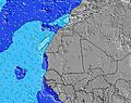 | 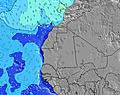 | 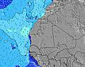 | 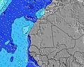 | 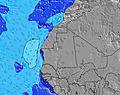 | 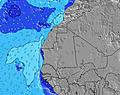 | 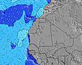 | ||||||||||||||
Wave Height (m) Direction Period (s) | NNW 8 | NNW 8 | NNW 8 | SW 7 | SW 7 | SW 7 | NW 5 | NW 6 | WNW 6 | NNW 7 | NNW 6 | N 7 | N 9 | N 9 | N 8 | N 8 | NNW 8 | N 8 | N 8 | NNW 8 | N 8 |
Wave Graph | |||||||||||||||||||||
89 | 69 | 44 | 160 | 167 | 72 | 74 | 92 | 117 | 88 | 51 | 23 | 83 | 101 | 50 | 35 | 53 | 33 | 30 | 65 | 41 | |
Wind (km/h) | |||||||||||||||||||||
Wind State on-shore cross-onshore cross-shore cross-offshore off-shore glassy | off | cross-off | cross-off | cross-on | cross-on | cross-on | cross-on | cross-on | cross | cross | cross-off | cross-off | cross-off | cross-off | cross | cross-on | cross-on | cross-on | cross-on | cross-on | cross |
High Tide | 10:49AM1.32m | 11:07PM1.12m | 11:20AM1.30m | 11:42PM1.11m | 11:53AM1.26m | 00:18AM1.09m | 12:30PM1.19m | 1:00AM1.05m | 1:13PM1.10m | 1:50AM1.00m | 2:07PM1.01m | 2:55AM0.97m | 3:23PM0.93m | ||||||||
Low Tide | 5:04PM0.11m | 5:01AM0.13m | 5:37PM0.11m | 5:36AM0.16m | 6:11PM0.13m | 6:15AM0.20m | 6:49PM0.16m | 6:59AM0.25m | 7:34PM0.21m | 7:54AM0.30m | 8:29PM0.26m | 9:06AM0.34m | 9:40PM0.30m | ||||||||
6:52 | — | — | 6:52 | — | — | 6:52 | — | — | 6:52 | — | — | 6:52 | — | — | 6:54 | — | — | 6:54 | — | — | |
— | 7:38 | — | — | 7:38 | — | — | 7:37 | — | — | 7:37 | — | — | 7:37 | — | — | 7:37 | — | — | 7:37 | — | |
mm | 2 | — | — | — | — | — | — | — | — | — | — | — | — | — | — | — | — | — | — | — | — |
Temp °C | 27 | 27 | 26 | 27 | 27 | 26 | 26 | 26 | 26 | 26 | 26 | 26 | 27 | 27 | 27 | 26 | 27 | 26 | 26 | 26 | 26 |
Feels °C | 28 | 27 | 28 | 28 | 28 | 26 | 25 | 25 | 26 | 27 | 28 | 27 | 29 | 29 | 30 | 29 | 29 | 27 | 29 | 29 | 28 |
Swell 1 Height (m) Direction Period (s) | NNW 8 | NNW 8 | SSW 7 | SW 7 | SW 7 | SW 7 | SW 7 | SW 7 | N 7 | NNW 7 | NNW 6 | NW 6 | N 9 | N 9 | N 8 | N 8 | NNW 8 | N 8 | N 8 | NNW 8 | N 8 |
89 | 69 | 131 | 160 | 167 | 71 | 36 | 35 | 35 | 88 | 51 | 11 | 83 | 101 | 50 | 35 | 53 | 33 | 30 | 65 | 41 | |
Swell 2 Height (m) Direction Period (s) | SSW 13 | SSW 12 | NNW 8 | SSW 12 | NW 10 | NW 9 | NW 9 | NW 9 | SSW 13 | SSW 12 | SSW 12 | SSW 11 | NW 8 | SSW 11 | SSW 8 | SSW 7 | SSW 7 | S 7 | S 7 | S 7 | SSW 11 |
111 | 103 | 44 | 98 | 48 | 42 | 41 | 40 | 114 | 96 | 96 | 51 | 24 | 47 | 21 | 17 | 18 | 26 | 24 | 23 | 49 | |
Swell 3 Height (m) Direction Period (s) | WSW 5 | SSW 10 | SSW 13 | NNW 7 | SW 12 | SW 12 | SSW 12 | SSW 13 | NW 8 | NW 8 | N 7 | N 7 | SW 11 | NW 6 | NW 6 | NW 11 | SSW 10 | SW 13 | SSW 12 | SSW 12 | SSW 6 |
15 | 10 | 106 | 29 | 72 | 72 | 52 | 68 | 25 | 25 | 8 | 23 | 31 | 14 | 11 | 19 | 19 | 42 | 57 | 56 | 13 | |
Wind waves Height (m) Direction Period (s) | S 6 | SSW 7 | — | — | NNW 7 | NW 4 | NW 5 | NW 6 | WNW 6 | WSW 5 | WSW 5 | WSW 5 | WSW 5 | SW 5 | — | — | W 5 | NW 2 | NW 3 | WNW 3 | W 3 |
30 | 70 | — | — | 15 | 39 | 74 | 92 | 117 | 39 | 32 | 19 | 19 | 14 | — | — | 2 | 1 | 4 | 2 | 3 | |
Nearest Offshore or Glassy | |||||||||||||||||||||
Distance (km) | 0 | 625 | 612 | 612 | 612 | 612 | 613 | 644 | 646 | 646 | 612 | 612 | 612 | 0 | 612 | 614 | 612 | 613 | 2 | 2 | 612 |
Best forecast wave conditions in Senegal | |||||||||||||||||||||
Best forecast wave conditions in Senegal | |||||||||||||||||||||
Header Global | |||||||||||||||||||||
- Map Icons:
 Break
Break Live Wave Height (m)
 Live Wind Speed (km/h)
 Surf Rating (10 Max)
 Ocean Swells (m)
- Wind Speed (km/h)
Latest Updates


FREE! Surf-Forecast.com widget for your website
The surf report / weather widget below is available to embed on third party websites free of charge and provides a summary of our Ngor Lefts surf forecast. Simply grab the html code snippet that we provide and paste it into your own site. You can choose your preferred language and metric/imperial units for the surf forecast feed to suit users of your site. Click here to get the code.
Information about the Ngor Lefts Surf forecast
The above surf forecast table for Ngor Lefts provides essential information for determining whether the surfing conditions will be good over the next 16 days. A general guide to surfing at Ngor Lefts can be found by selecting the local surf guide option on the grey menu. Our Ngor Lefts surf forecast is unique since it includes wave energy (power) that defines the real feel of the surf rather than just the height or the period. If you surf the same spot (Ngor Lefts) regularly then make a mental note of the wave energy from the surf forecast table each time you go. Very soon you may start to choose your surf days based on the wave energy alone combined with our forecast of favourable offshore wind conditions. Our star ratings will help here and of course you will also find the usual wave height and period predictions on our surf forecasts as well as a full break down of the swell components under our advanced users option (to reveal that, click the little Einstein character under the tide times).
Further information to help with frequently asked questions about our surf forecast for Ngor Lefts may be found under the help tab on the top menu and also by moving your mouse over the question marks on the surf forecast table itself. Please always bear in mind that the forecast is for near-shore open water and local factors at each surf break influence the actual breaking wave height, such as the beach / reef profile, water depths offshore and shelter.
Ngor Lefts is 6 km (4 miles) from the very large city of Dakar. If you plan a holiday in Senegal, look for hotels and other accommodation in Dakar. Dakar has rooms for a wide range of budgets as well as cheap car hire and transport links.
 Nearest