
Surf Forecasts:

Covelong Point surf forecast from 5 Jul 2026:
- Best quality surf: Saturday 11 Jul, 11AM (local time) - 2ft (0.6m), 7s period, SSE swell with offshore winds.
- Most powerful swell: Wednesday 8 Jul, 11PM (local time) - 6ft (1.8m), 6s period, S swell with 253 kJ wave energy.
- Next surfable swell (1★+): Saturday 11 Jul, 11AM (local time) - 2ft (0.6m), 7s period with SSE swell.
Best Forecast Surf Conditions for Covelong Point this week:
The surf forecast for Covelong Point over the next 16 days: The first swell (rated 1 star or higher) is forecast to arrive on Saturday (Jul 11) at 11AM. The primary swell is predicted to be 0.7m and 6s period with a secondary swell of 0.6m and 7s. The wind is predicted to be offshore as the swell arrives.
The most powerful waves expected at Covelong Point in the next 16 days are 1.8m 6s and forecast to arrive on Wednesday (Jul 08) at 11PM. Winds are predicted to be cross-offshore at the time the swell arrives. The largest open ocean swell (not directed at the beach) is 1.1m 6s period and expected on Sunday (Jul 12) at 2AM.
| Wave Type | Time (IST) & Date | Wave Height & Period |
|---|---|---|
| Next good surf (1 star+) | 11AM (Sat 11th Jul) | 2ft (0.6m) 7s |
| Best Surf | 11AM (Sat 11th Jul) | 2ft (0.6m) 7s |
| Most Powerful | 11PM (Wed 8th Jul) | 6ft (1.8m) 6s |
Table - best surf conditions forecast for Covelong Point over the next 16 days.
Updates in hr min s Forecast update imminent
Alright, let’s switch to feet and Fahrenheit for you non-metric crew.
Right, Rusty here again. Looking at Covelong Point for the next couple of weeks, and I won’t sugarcoat it – it’s a bleak outlook.
From Sunday the 5th through to Tuesday the 14th, it’s mostly a dead zone. Tiny surf, messy wind, and poor conditions day after day. Water temp is 85°, right about average for this time of year, so that’s no excuse.
There’s a small window on Saturday morning the 11th: about 2ft from the SE with a 6-second period, and a light offshore from the West cleaning it up. The combined energy is weak (88), so it’s not gonna have much punch, but it’s the cleanest you’ll see in over a week. You might get some knee-high runners if you’re lucky. Crowds are possible, so don’t expect solitude.
Then Thursday morning the 16th offers another early chance: 2ft from the SE, period 7 seconds, with a moderate offshore from the WNW. Again, combined energy is weak (88), but it’s tidy and you won’t be fighting a bumpy surface.
The only real change comes Monday afternoon the 20th, when we see a longer-period 9-second swell from the SSE at 3ft, and the energy hits moderate (141). But the wind swings cross-onshore from the SSE, and that makes it lumpy and choppy. The longer period would normally mean better waves, but with that wind, it’s just a tease.
No true standout sessions here, folks. If you’re really keen, aim for the 11th or 16th early mornings. Otherwise, this is a stretch where patience is the only game in town.
Rusty.
Short Range ForecastMostly dry. Warm (max 36°C on Sun afternoon, min 29°C on Sun night). Mainly fresh winds. | Days 5-7 Weather SummaryMostly dry. Warm (max 35°C on Wed afternoon, min 29°C on Wed night). Mainly fresh winds. | ||||||||||||||||||||
Sun 5 | Monday 6 | Tuesday 7 | Wednesday 8 | Thursday 9 | Friday 10 | Saturday 11 | |||||||||||||||
PM | Night | AM | PM | Night | AM | PM | Night | AM | PM | Night | AM | PM | Night | AM | PM | Night | AM | PM | Night | AM | |
Swell Height Map | 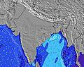 | 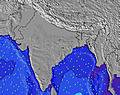 | 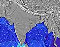 | 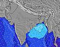 | 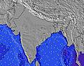 | 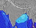 | 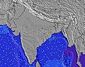 | 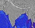 | |||||||||||||
Wave Height (m) Direction Period (s) | S 5 | SE 7 | SSE 6 | S 5 | SSE 6 | SSE 6 | S 5 | SSE 6 | SSE 6 | SSE 5 | SSE 6 | SSE 6 | SSE 5 | S 5 | SSE 6 | SSE 5 | S 6 | SSE 7 | SSE 6 | SSE 6 | SSE 6 |
Wave Graph | |||||||||||||||||||||
36 | 65 | 33 | 35 | 69 | 25 | 66 | 74 | 17 | 51 | 88 | 21 | 20 | 83 | 32 | 33 | 193 | 42 | 31 | 109 | 26 | |
Wind (km/h) | |||||||||||||||||||||
Wind State on-shore cross-onshore cross-shore cross-offshore off-shore glassy | cross-off | off | cross-off | cross | cross-off | cross-off | cross-on | cross-off | cross-off | cross-on | off | cross-off | cross-on | cross-off | off | cross-on | cross-off | off | cross-on | cross-off | off |
High Tide | 11:56PM0.81m | 11:59AM0.96m | 00:48AM0.81m | 12:40PM0.91m | 1:48AM0.83m | 1:31PM0.85m | 2:58AM0.85m | 2:35PM0.80m | 4:12AM0.89m | 3:52PM0.77m | 5:23AM0.96m | 5:13PM0.78m | 6:26AM1.03m | ||||||||
Low Tide | 5:54PM0.19m | 5:42AM0.28m | 6:33PM0.18m | 6:33AM0.33m | 7:18PM0.17m | 7:35AM0.38m | 8:13PM0.17m | 8:53AM0.42m | 9:16PM0.16m | 10:20AM0.41m | 10:26PM0.15m | 11:41AM0.36m | 11:34PM0.12m | 12:48PM0.29m | |||||||
— | — | 5:48 | — | — | 5:48 | — | — | 5:48 | — | — | 5:48 | — | — | 5:48 | — | — | 5:48 | — | — | 5:48 | |
6:38 | — | — | 6:38 | — | — | 6:38 | — | — | 6:38 | — | — | 6:38 | — | — | 6:38 | — | — | 6:38 | — | 6:38 | |
mm | — | — | — | — | — | — | — | — | — | — | — | — | — | — | — | — | — | — | — | — | — |
Temp °C | 36 | 35 | 33 | 35 | 33 | 34 | 34 | 33 | 34 | 35 | 33 | 34 | 34 | 30 | 34 | 34 | 30 | 35 | 35 | 32 | 36 |
Feels °C | 33 | 31 | 32 | 33 | 32 | 31 | 33 | 32 | 32 | 34 | 33 | 32 | 34 | 31 | 32 | 34 | 31 | 34 | 36 | 31 | 33 |
Swell 1 Height (m) Direction Period (s) | SE 10 | SE 7 | SSE 6 | SE 10 | SSE 6 | SSE 6 | SE 10 | SSE 6 | SSE 6 | SE 9 | SSE 6 | SSE 6 | SSE 5 | SSE 5 | SSE 6 | SE 9 | SSE 6 | SE 6 | SE 8 | SSE 6 | SSE 6 |
16 | 65 | 33 | 14 | 69 | 25 | 16 | 74 | 17 | 14 | 88 | 21 | 20 | 40 | 32 | 13 | 91 | 42 | 11 | 109 | 26 | |
Swell 2 Height (m) Direction Period (s) | S 21 | SE 10 | SE 10 | — | SE 12 | SE 10 | — | SE 11 | SE 10 | — | SE 10 | ESE 10 | SE 9 | SE 9 | SE 9 | — | E 13 | SSE 7 | — | S 16 | SE 11 |
8 | 4 | 15 | — | 5 | 16 | — | 4 | 14 | — | 4 | 9 | 14 | 14 | 14 | — | 3 | 36 | — | 5 | 4 | |
Swell 3 Height (m) Direction Period (s) | — | — | E 18 | — | — | — | — | — | — | — | S 18 | S 18 | S 18 | — | — | — | — | SSE 10 | — | — | S 16 |
— | — | 6 | — | — | — | — | — | — | — | 6 | 6 | 6 | — | — | — | — | 10 | — | — | 5 | |
Wind waves Height (m) Direction Period (s) | S 5 | W 3 | WSW 3 | S 5 | WSW 3 | WSW 3 | S 5 | WSW 3 | WSW 3 | SSE 5 | — | WSW 2 | — | S 5 | — | SSE 5 | S 6 | W 3 | SSE 6 | SW 6 | WSW 3 |
36 | 6 | 7 | 35 | 2 | 4 | 66 | 2 | 1 | 51 | — | 1 | — | 83 | — | 33 | 193 | 1 | 31 | 82 | 2 | |
Nearest Offshore or Glassy | |||||||||||||||||||||
Distance (km) | 677 | 101 | 684 | 1406 | 101 | 677 | 1406 | 101 | 101 | 707 | 20 | 546 | 677 | 531 | 101 | 1201 | 531 | 0 | 531 | 531 | 655 |
Best forecast wave conditions in Tamil Nadu | |||||||||||||||||||||
Best forecast wave conditions in India | |||||||||||||||||||||
Header Global | |||||||||||||||||||||
- Map Icons:
 Break
Break Live Wave Height (m)
 Live Wind Speed (km/h)
 Surf Rating (10 Max)
 Ocean Swells (m)
- Wind Speed (km/h)


FREE! Surf-Forecast.com widget for your website
The surf report / weather widget below is available to embed on third party websites free of charge and provides a summary of our Covelong Point surf forecast. Simply grab the html code snippet that we provide and paste it into your own site. You can choose your preferred language and metric/imperial units for the surf forecast feed to suit users of your site. Click here to get the code.
Information about the Covelong Point Surf forecast
The above surf forecast table for Covelong Point provides essential information for determining whether the surfing conditions will be good over the next 16 days. A general guide to surfing at Covelong Point can be found by selecting the local surf guide option on the grey menu. Our Covelong Point surf forecast is unique since it includes wave energy (power) that defines the real feel of the surf rather than just the height or the period. If you surf the same spot (Covelong Point) regularly then make a mental note of the wave energy from the surf forecast table each time you go. Very soon you may start to choose your surf days based on the wave energy alone combined with our forecast of favourable offshore wind conditions. Our star ratings will help here and of course you will also find the usual wave height and period predictions on our surf forecasts as well as a full break down of the swell components under our advanced users option (to reveal that, click the little Einstein character under the tide times).
Further information to help with frequently asked questions about our surf forecast for Covelong Point may be found under the help tab on the top menu and also by moving your mouse over the question marks on the surf forecast table itself. Please always bear in mind that the forecast is for near-shore open water and local factors at each surf break influence the actual breaking wave height, such as the beach / reef profile, water depths offshore and shelter.
Covelong Point is 20 km (12 miles) from Perungudi. If you plan a holiday in Tamil Nadu, look for hotels and other accommodation in Perungudi. Perungudi has rooms for a wide range of budgets as well as car hire and transport links.
 Nearest