


Surf Forecasts:

How big are the waves at Cotton Tree today (15 Nov):
- Afternoon surf: Afternoon surf (15 Nov, local time) - 1.5ft (0.4m), 12s period with SSW swell.
- Evening surf: Evening surf (15 Nov, local time) - 1ft (0.3m), 18s period with SSW swell.
The current surf forecast for Cotton Tree at 12AM is: 0.4m 13s primary swell from a South-southwest direction and 0.6m 8s secondary swell from a South direction (forecast issued at 05:00pm November 14). The wind direction is predicted to be glassy.
| Time (GMT) & Date | Wave Height | Wave Period |
|---|---|---|
| Morning (15 Nov) | - | - |
| Afternoon (15 Nov) | 1.5ft (0.4m) | 12s |
| Evening (15 Nov) | 1ft (0.3m) | 18s |
Table - waves today at Cotton Tree. (Swell directed towards the surf break)
Short Range ForecastLight rain (total 7mm), mostly falling on Sat night. Warm (max 28°C on Sat afternoon, min 26°C on Mon night). Wind will be generally light. | ||||||||||||||||||||||
Sat 14 | Sunday 15 | Monday 16 | Tue 17 | |||||||||||||||||||
3 PM | 6 PM | 9 PM | 12 AM | 3 AM | 6 AM | 9 AM | 12 PM | 3 PM | 6 PM | 9 PM | 12 AM | 3 AM | 6 AM | 9 AM | 12 PM | 3 PM | 6 PM | 9 PM | 12 AM | 3 AM | 6 AM | |
Swell Height Map | 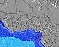 | 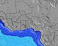 | 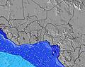 | 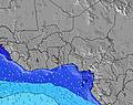 |  |  |  |  | ||||||||||||||
Wave Height (m) Direction Period (s) | SSW 12 | SSW 18 | SSW 18 | SSW 13 | SSW 13 | SSW 12 | SSW 12 | SSW 16 | SSW 16 | SSW 16 | SW 16 | SSW 16 | SSW 16 | SSW 16 | SSW 15 | SSW 15 | SSW 15 | SSW 15 | SSW 15 | SSW 15 | SSW 15 | SSW 16 |
Wave Graph  | ||||||||||||||||||||||
 kJ | 61 | 62 | 64 | 65 | 64 | 89 | 79 | 103 | 103 | 102 | 77 | 99 | 98 | 95 | 91 | 88 | 125 | 123 | 123 | 172 | 181 | 193 |
Wind (km/h) | ||||||||||||||||||||||
Wind State on-shore cross-onshore cross-shore cross-offshore off-shore glassy | on | cross-on | on | glassy | glassy | glassy | glassy | on | on | on | on | on | on | on | on | on | on | on | on | on | on | on |
High Tide | 10:06PM1.07m | 9:58AM0.86m | 11:00PM1.04m | 10:58AM0.82m | 00:00AM1.03m | |||||||||||||||||
Low Tide | 3:20PM0.28m | 4:14AM0.46m | 4:03PM0.35m | 5:11AM0.51m | 4:53PM0.42m | |||||||||||||||||
 |  |  |  | | | | |  | | | | | | | | | | |  | | | |
 | — | — | — | — | — | 6:35 | — | — | — | — | — | — | — | 6:35 | — | — | — | — | — | — | — | 6:35 |
 | — | 6:23 | — | — | — | — | — | — | — | 6:23 | — | — | — | — | — | — | — | 6:23 | — | — | — | 6:23 |
mm | — | — | — | 1 | 1 | — | — | — | 1 | — | 1 | — | — | — | 1 | 1 | — | — | — | — | — | 1 |
Temp °C | 28 | 28 | 28 | 27 | 27 | 27 | 27 | 28 | 28 | 28 | 28 | 28 | 27 | 27 | 27 | 27 | 28 | 28 | 27 | 27 | 27 | 26 |
Feels °C | 29 | 30 | 31 | 31 | 32 | 32 | 32 | 32 | 32 | 30 | 30 | 31 | 30 | 31 | 30 | 30 | 31 | 32 | 30 | 30 | 30 | 29 |
Swell 1 Height (m) Direction Period (s) | SSW 12 | S 8 | SSW 13 | S 8 | S 8 | S 7 | S 7 | SSW 12 | SSW 12 | SSW 12 | SSW 12 | SSW 11 | SSW 11 | SSW 11 | SSW 11 | SSW 11 | SSW 10 | SSW 10 | SSW 15 | SSW 15 | SSW 15 | SSW 16 |
| kJ | 61 | 42 | 64 | 40 | 41 | 28 | 27 | 79 | 79 | 79 | 77 | 68 | 65 | 65 | 64 | 64 | 63 | 58 | 123 | 172 | 181 | 193 |
Swell 2 Height (m) Direction Period (s) | SSW 18 | SSW 12 | SSW 18 | SSW 13 | SSW 13 | SSW 12 | SSW 12 | S 7 | S 7 | S 7 | S 7 | S 7 | S 7 | S 7 | SSW 15 | SSW 15 | SSW 15 | SSW 15 | SSW 10 | SSW 10 | SSW 10 | SSW 10 |
| kJ | 32 | 61 | 62 | 65 | 64 | 89 | 79 | 26 | 26 | 24 | 24 | 24 | 24 | 24 | 91 | 88 | 125 | 123 | 57 | 38 | 38 | 38 |
Swell 3 Height (m) Direction Period (s) | W 12 | SSW 18 | W 12 | SSW 18 | SSW 18 | SSW 17 | SSW 16 | SSW 16 | SSW 16 | SSW 16 | SW 16 | SSW 16 | SSW 16 | SSW 16 | S 7 | S 7 | SSE 7 | SSE 7 | SSE 8 | SSE 8 | SSE 8 | SSE 8 |
| kJ | 3 | 62 | 3 | 31 | 31 | 29 | 52 | 103 | 103 | 102 | 66 | 99 | 98 | 95 | 24 | 24 | 15 | 15 | 22 | 22 | 22 | 22 |
Wind waves Height (m) Direction Period (s) | S 8 | — | S 8 | — | — | — | — | — | — | — | — | — | — | — | — | — | — | — | — | — | — | — |
| kJ | 29 | — | 40 | — | — | — | — | — | — | — | — | — | — | — | — | — | — | — | — | — | — | — |
Nearest Offshore or Glassy | ||||||||||||||||||||||
Distance (km) | 79 | 79 | 79 | 0 | 0 | 0 | 0 | 79 | 79 | 1034 | 1034 | 286 | 1034 | 79 | 79 | 79 | 79 | 79 | 79 | 79 | 1034 | 79 |
Best forecast wave conditions in Liberia | ||||||||||||||||||||||
Best forecast wave conditions in Liberia | ||||||||||||||||||||||
Header Global | ||||||||||||||||||||||
- Map Icons:
 Break
 Live Wave Height (m)
 Live Wind Speed (km/h)
 Surf Rating (10 Max)
 Ocean Swells (m)
- Wind Speed (km/h)

Never miss your swells again.
Built by surfers, trusted by millions for over 20 years. The Wavefinder in our app makes it even easier to find where the best waves are breaking. Follow the yellow stars along your coast and get there first.


Scan the QR code to open the Surf‑Forecast app


FREE! Surf-Forecast.com widget for your website
The surf report / weather widget below is available to embed on third party websites free of charge and provides a summary of our Cotton Tree surf forecast. Simply grab the html code snippet that we provide and paste it into your own site. You can choose your preferred language and metric/imperial units for the surf forecast feed to suit users of your site. Click here to get the code.

 Nearest