

Surf Forecasts:

Cocles surf forecast from 1 Aug 2026:
- Best quality surf: Saturday 1 Aug, 4AM (local time) - 7ft (2.2m), 10s period, ENE swell with cross-offshore winds.
- Most powerful swell: Saturday 1 Aug, 4AM (local time) - 7ft (2.2m), 10s period, ENE swell with 1,022 kJ wave energy.
- Next surfable swell (1★+): Saturday 1 Aug, 4AM (local time) - 7ft (2.2m), 10s period with ENE swell.
Best Forecast Surf Conditions for Cocles this week:
The surf forecast for Cocles over the next 16 days: The first swell (rated 1 star or higher) is forecast to arrive on Saturday (Aug 01) at 4AM. The primary swell is predicted to be 2.2m and 10s period. The wind is predicted to be cross-offshore as the swell arrives.
The most powerful waves expected at Cocles in the next 16 days are 2.2m 10s and forecast to arrive on Saturday (Aug 01) at 4AM. Winds are predicted to be cross-offshore at the time the swell arrives.
| Wave Type | Time (EST) & Date | Wave Height & Period |
|---|---|---|
| Next good surf (1 star+) | 4AM (Sat 1st Aug) | 7ft (2.2m) 10s |
| Best Surf | 4AM (Sat 1st Aug) | 7ft (2.2m) 10s |
| Most Powerful | 4AM (Sat 1st Aug) | 7ft (2.2m) 10s |
Table - best surf conditions forecast for Cocles over the next 16 days.
The Lowdown
Alright folks, Rusty here. Let’s take a look at what’s shaping up for Cocles. We’ve got a solid 16-day window, but the first few days are a bit of a write-off, so we’ll be waiting for things to clean up.
The opening stretch from Friday the 31st right through the weekend and into early next week is pretty messy. The swell is there, between 4 ft and 7 ft, and the energy is moderate (with values between 193 and 890), but the wind is a problem. It’s mostly cross-onshore, and the forecast is calling for marginal to poor conditions. Not worth paddling out for. There’s a long gap here with no real recommendation until the middle of the week.
Things start to turn around on Wednesday the 5th of August. The morning session is looking promising. We’ve got a 5 ft swell from the ENE, period of 9 seconds, and a light cross-offshore breeze from the WSW. That’s clean. The combined energy is a moderate 378. It’s not huge, but it’ll be fun. The water temperature is sitting at 84°F, which is almost bang on average for this time of year, so no thermal shock there.
The real standout, the one you want to circle on the calendar, is Monday the 10th of August. Early morning, the wind goes glassy, absolutely dead calm. Swell is a solid 7 ft from the ENE, with a 10-second period. The energy jumps up to a strong 873. This is the best quality we’ll see across the whole run. The wave direction is a perfect match for the break’s optimum. For a beach and reef setup like Cocles, that glassy morning is going to be a treat. Just keep in mind, this is a fairly consistent spot, but it can get a crowd, so be early.
The weekend of the 9th and 10th also has some decent size, with 7 ft to 8 ft swell, but the wind is a little more cross-onshore, so the Monday morning remains the pick. The second week after that is a bit of a mixed bag. The swell hangs around the 6 ft to 7 ft mark, but the wind is often cross-onshore or onshore. It’s not terrible, but it’s not the same as that glassy Monday. The energy stays moderate to strong (values between 563 and 772), but the conditions are just average.
For any beginners, those days with swell over 5 ft, especially the 7 ft and 8 ft days, might be a bit much. The 5 ft days on the 5th and 6th would be a better bet for you.
So, for the best surfs of the outlook: Wednesday morning, the 5th of August, for a clean, fun wave, and the absolute standout is the glassy Monday morning, the 10th of August.
Rusty.
Short Range ForecastHeavy rain (total 20mm), heaviest during Fri afternoon. Warm (max 29°C on Sat morning, min 25°C on Sat night). Wind will be generally light. | Days 5-7 Weather SummaryHeavy rain (total 40mm), heaviest during Wed night. Warm (max 29°C on Mon afternoon, min 25°C on Wed night). Wind will be generally light. | |||||||||||||||||||
Fri 31 | Saturday 1 | Sunday 2 | Monday 3 | Tuesday 4 | Wednesday 5 | Thursday 6 | ||||||||||||||
PM | Night | AM | PM | Night | AM | PM | Night | AM | PM | Night | AM | PM | Night | AM | PM | Night | AM | PM | Night | |
Swell Height Map |  |  |  | 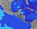 | 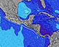 | 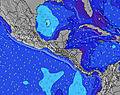 | 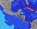 | |||||||||||||
Wave Height (m) Direction Period (s) | ENE 9 | ENE 10 | ENE 10 | ENE 10 | ENE 9 | ENE 9 | NE 9 | NE 8 | ENE 9 | ENE 8 | ENE 9 | ENE 9 | ENE 9 | ENE 9 | ENE 9 | ENE 9 | NE 9 | ENE 9 | NE 9 | NE 9 |
Wave Graph | ||||||||||||||||||||
497 | 983 | 890 | 670 | 508 | 378 | 323 | 227 | 202 | 193 | 207 | 270 | 370 | 354 | 378 | 362 | 380 | 441 | 563 | 626 | |
Wind (km/h) | ||||||||||||||||||||
Wind State on-shore cross-onshore cross-shore cross-offshore off-shore glassy | cross-on | cross | cross-on | on | cross | cross-on | cross-on | cross-off | cross-on | on | cross | cross | cross-on | cross | cross-off | cross-on | cross-off | glassy | on | glassy |
High Tide | 4:31PM0.27m | 2:30AM0.38m | 4:40PM0.31m | 3:16AM0.35m | 4:51PM0.35m | 4:02AM0.31m | 5:06PM0.39m | 4:50AM0.27m | 5:30PM0.42m | 5:40AM0.23m | 6:02PM0.46m | 6:35AM0.19m | 6:42PM0.49m | |||||||
Low Tide | 7:14PM0.26m | 9:57AM0.14m | 9:29PM0.25m | 10:10AM0.15m | 10:59PM0.22m | 10:25AM0.16m | 00:02AM0.18m | 10:41AM0.16m | 00:56AM0.13m | 11:00AM0.15m | 1:47AM0.09m | 11:23AM0.14m | 2:39AM0.06m | |||||||
— | — | 6:20 | — | — | 6:20 | — | — | 6:20 | — | — | 6:20 | — | — | 6:20 | — | — | 6:20 | — | — | |
6:52 | — | — | 6:52 | — | — | 6:52 | — | — | 6:52 | — | — | 6:52 | — | — | 6:52 | — | — | 6:52 | — | |
mm | 6 | 6 | 1 | 1 | 2 | — | — | 2 | 2 | 1 | 8 | 3 | 7 | 3 | 2 | 1 | 12 | 3 | 7 | 10 |
Temp °C | 28 | 27 | 29 | 29 | 26 | 28 | 28 | 27 | 29 | 29 | 27 | 29 | 28 | 26 | 27 | 27 | 26 | 27 | 27 | 25 |
Feels °C | 32 | 31 | 32 | 32 | 29 | 31 | 30 | 31 | 32 | 32 | 31 | 31 | 30 | 29 | 30 | 31 | 31 | 31 | 30 | 30 |
Swell 1 Height (m) Direction Period (s) | ENE 9 | ENE 10 | ENE 10 | ENE 10 | ENE 9 | ENE 9 | NE 9 | NE 8 | ENE 9 | ENE 8 | ENE 9 | ENE 9 | ENE 9 | ENE 9 | ENE 9 | ENE 9 | NE 9 | ENE 9 | NE 9 | NE 9 |
497 | 983 | 890 | 670 | 508 | 378 | 323 | 227 | 202 | 193 | 207 | 270 | 370 | 354 | 378 | 362 | 380 | 441 | 563 | 626 | |
Swell 2 Height (m) Direction Period (s) | — | — | — | — | — | — | — | — | — | — | — | — | — | — | — | — | — | — | — | — |
— | — | — | — | — | — | — | — | — | — | — | — | — | — | — | — | — | — | — | — | |
Swell 3 Height (m) Direction Period (s) | — | — | — | — | — | — | — | — | — | — | — | — | — | — | — | — | — | — | — | — |
— | — | — | — | — | — | — | — | — | — | — | — | — | — | — | — | — | — | — | — | |
Wind waves Height (m) Direction Period (s) | — | — | — | — | — | — | — | — | — | — | — | — | — | — | — | — | — | — | — | — |
— | — | — | — | — | — | — | — | — | — | — | — | — | — | — | — | — | — | — | — | |
Nearest Offshore or Glassy | ||||||||||||||||||||
Distance (km) | 80 | 19 | 30 | 30 | 5 | 30 | 30 | 0 | 19 | 30 | 5 | 30 | 30 | 5 | 0 | 30 | 0 | 0 | 80 | 0 |
Best forecast wave conditions in Limon | ||||||||||||||||||||
Best forecast wave conditions in Costa Rica | ||||||||||||||||||||
Header Global | ||||||||||||||||||||
- Map Icons:
 Break
Break Live Wave Height (m)
 Live Wind Speed (km/h)
 Surf Rating (10 Max)
 Ocean Swells (m)
- Wind Speed (km/h)
Latest Updates


FREE! Surf-Forecast.com widget for your website
The surf report / weather widget below is available to embed on third party websites free of charge and provides a summary of our Cocles surf forecast. Simply grab the html code snippet that we provide and paste it into your own site. You can choose your preferred language and metric/imperial units for the surf forecast feed to suit users of your site. Click here to get the code.
Information about the Cocles Surf forecast
The above surf forecast table for Cocles provides essential information for determining whether the surfing conditions will be good over the next 16 days. A general guide to surfing at Cocles can be found by selecting the local surf guide option on the grey menu. Our Cocles surf forecast is unique since it includes wave energy (power) that defines the real feel of the surf rather than just the height or the period. If you surf the same spot (Cocles) regularly then make a mental note of the wave energy from the surf forecast table each time you go. Very soon you may start to choose your surf days based on the wave energy alone combined with our forecast of favourable offshore wind conditions. Our star ratings will help here and of course you will also find the usual wave height and period predictions on our surf forecasts as well as a full break down of the swell components under our advanced users option (to reveal that, click the little Einstein character under the tide times).
Further information to help with frequently asked questions about our surf forecast for Cocles may be found under the help tab on the top menu and also by moving your mouse over the question marks on the surf forecast table itself. Please always bear in mind that the forecast is for near-shore open water and local factors at each surf break influence the actual breaking wave height, such as the beach / reef profile, water depths offshore and shelter.
Cocles is 35 km (22 miles) from the city of Changuinola. If you plan a holiday in Limon, look for hotels and other accommodation in Changuinola. Changuinola has rooms for a wide range of budgets as well as car hire and transport links.
 Nearest