

Surf Forecasts:

How big are the waves at Axim today (03 Aug):
- Morning surf: Morning surf (03 Aug, local time) - 4.5ft (1.3m), 6s period with S swell.
- Afternoon surf: Afternoon surf (03 Aug, local time) - 2.5ft (0.7m), 13s period with SSW swell.
- Evening surf: Evening surf (03 Aug, local time) - 2.5ft (0.7m), 12s period with SSW swell.
The current surf forecast for Axim at 1AM is: 1.4m 6s primary swell from a South-southwest direction and 0.5m 15s secondary swell from a South-southwest direction, 0.5m 11s secondary swell from a South direction (forecast issued at 05:00pm August 02). The wind direction is predicted to be onshore.
| Time (GMT) & Date | Wave Height | Wave Period |
|---|---|---|
| Morning (03 Aug) | 4.5ft (1.3m) | 6s |
| Afternoon (03 Aug) | 2.5ft (0.7m) | 13s |
| Evening (03 Aug) | 2.5ft (0.7m) | 12s |
Table - waves today at Axim. (Swell directed towards the surf break)
Short Range ForecastLight rain (total 6mm), mostly falling on Sun afternoon. Warm (max 26°C on Tue morning, min 23°C on Sun night). Wind will be generally light. | |||||||||||||||||||
Sun 2 | Monday 3 | Tuesday 4 | |||||||||||||||||
3 PM | 6 PM | 9 PM | 12 AM | 3 AM | 6 AM | 9 AM | 12 PM | 3 PM | 6 PM | 9 PM | 12 AM | 3 AM | 6 AM | 9 AM | 12 PM | 3 PM | 6 PM | 9 PM | |
Swell Height Map | 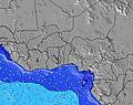 | 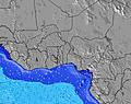 | 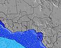 | 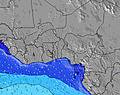 | 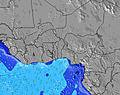 | 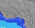 | 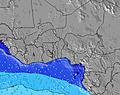 | ||||||||||||
Wave Height (m) Direction Period (s) | S 12 | SSW 6 | SSW 6 | SSW 6 | SSW 14 | S 6 | S 6 | S 6 | SSW 13 | SSW 13 | SSW 12 | SSW 12 | SSW 12 | SSW 12 | SSW 12 | SSW 12 | SSW 12 | S 9 | S 9 |
Wave Graph | |||||||||||||||||||
134 | 125 | 131 | 135 | 215 | 139 | 139 | 137 | 181 | 176 | 157 | 115 | 115 | 113 | 111 | 109 | 106 | 78 | 99 | |
Wind (km/h) | |||||||||||||||||||
Wind State on-shore cross-onshore cross-shore cross-offshore off-shore glassy | on | on | on | on | on | on | cross-on | cross-on | cross-on | cross-on | cross-on | cross-on | on | cross-on | on | on | on | on | on |
High Tide | 6:16PM1.19m | 6:55AM1.35m | 6:57PM1.14m | 7:32AM1.33m | 7:45PM1.06m | ||||||||||||||
Low Tide | 12:26PM0.36m | 00:24AM0.18m | 1:07PM0.34m | 1:00AM0.24m | 1:54PM0.34m | ||||||||||||||
— | — | — | — | — | 6:05 | — | — | — | — | — | — | — | 6:05 | — | — | — | — | — | |
— | 6:24 | — | — | — | — | — | — | — | 6:23 | — | — | — | — | — | — | — | 6:23 | — | |
mm | 1 | — | 1 | 1 | 1 | 1 | — | 1 | — | — | — | — | — | — | — | — | — | — | — |
Temp °C | 25 | 24 | 24 | 24 | 24 | 23 | 24 | 25 | 25 | 24 | 23 | 23 | 23 | 24 | 25 | 26 | 26 | 25 | 24 |
Feels °C | 26 | 25 | 25 | 25 | 26 | 25 | 25 | 26 | 26 | 26 | 26 | 26 | 26 | 26 | 27 | 26 | 26 | 25 | 25 |
Swell 1 Height (m) Direction Period (s) | S 12 | S 11 | S 12 | SSW 15 | SSW 6 | S 6 | S 6 | S 6 | SSW 13 | S 6 | S 6 | S 6 | S 6 | S 6 | SSE 6 | S 6 | S 9 | S 9 | S 9 |
134 | 125 | 98 | 121 | 139 | 139 | 139 | 135 | 181 | 94 | 89 | 71 | 66 | 64 | 56 | 43 | 78 | 78 | 99 | |
Swell 2 Height (m) Direction Period (s) | SSW 16 | SSW 15 | SSW 15 | S 11 | SSW 14 | S 13 | SSW 13 | SSW 13 | S 10 | SSW 13 | SSW 12 | SSW 12 | SSW 12 | SSW 12 | SSW 12 | SSW 12 | SSW 12 | SSW 11 | SSW 11 |
48 | 72 | 121 | 66 | 215 | 92 | 139 | 137 | 50 | 176 | 157 | 115 | 115 | 113 | 111 | 109 | 106 | 71 | 70 | |
Swell 3 Height (m) Direction Period (s) | SSW 16 | SSE 10 | SSE 10 | SSE 10 | SSE 10 | SSE 10 | SSE 10 | S 10 | SSE 10 | SSE 10 | S 10 | S 10 | WSW 5 | S 16 | WSW 5 | WSW 5 | ESE 6 | S 15 | S 15 |
49 | 34 | 34 | 34 | 34 | 33 | 32 | 51 | 31 | 32 | 48 | 47 | 10 | 5 | 5 | 5 | 4 | 4 | 17 | |
Wind waves Height (m) Direction Period (s) | SSW 6 | SSW 6 | SSW 6 | SSW 6 | — | — | — | — | S 6 | — | — | — | — | — | — | — | WSW 5 | WSW 5 | WSW 5 |
97 | 117 | 131 | 135 | — | — | — | — | 115 | — | — | — | — | — | — | — | 5 | 5 | 5 | |
Nearest Offshore or Glassy | |||||||||||||||||||
Distance (km) | 2603 | 2602 | 2291 | 2213 | 3 | 3 | 3 | 2580 | 3 | 3 | 3 | 3 | 3 | 3 | 3 | 3 | 2581 | 2581 | 962 |
Best forecast wave conditions in Ghana - Gold Coast | |||||||||||||||||||
Best forecast wave conditions in Ghana | |||||||||||||||||||
Header Global | |||||||||||||||||||
- Map Icons:
 Break
Break Live Wave Height (m)
 Live Wind Speed (km/h)
 Surf Rating (10 Max)
 Ocean Swells (m)
- Wind Speed (km/h)
Latest Updates


FREE! Surf-Forecast.com widget for your website
The surf report / weather widget below is available to embed on third party websites free of charge and provides a summary of our Axim surf forecast. Simply grab the html code snippet that we provide and paste it into your own site. You can choose your preferred language and metric/imperial units for the surf forecast feed to suit users of your site. Click here to get the code.
 Nearest