

Surf Forecasts:

Anse Bertrand surf forecast from 3 Aug 2026:
- Most powerful swell: Thursday 6 Aug, 8PM (local time) - 3.5ft (1.1m), 6s period, ENE swell with 92 kJ wave energy.
Best Forecast Surf Conditions for Anse Bertrand this week:
The most powerful waves expected at Anse Bertrand in the next 16 days are 1.1m 6s and forecast to arrive on Thursday (Aug 06) at 8PM. Winds are predicted to be cross-offshore at the time the swell arrives. The largest open ocean swell (not directed at the beach) is 1.6m 6s period and expected on Saturday (Aug 08) at 8AM.
| Wave Type | Time (AST) & Date | Wave Height & Period |
|---|---|---|
| Next good surf (1 star+) | - | - |
| Best Surf | - | - |
| Most Powerful | 8PM (Thu 6th Aug) | 3.5ft (1.1m) 6s |
Table - best surf conditions forecast for Anse Bertrand over the next 16 days.
The Lowdown
Yo, what’s up? Rusty here.
Alright, straight up, we’ve got a rough stretch ahead for this region. The next 16 days are looking lean – really lean. For the entire forecast period, there’s just no good surf to recommend. We’ve got a long, flat run with nothing but poor surf conditions day after day.
Looking at the whole picture, the only named break is Anse Bertrand. It’s a beginner-friendly, exposed spot that’s inconsistent and only occasionally breaks, so this kind of blank run isn’t totally out of the ordinary for here. The swell is tiny, the wind is almost always a moderate to fresh breeze from the east, and it’s coming in as cross or cross-off shore. That combo just isn’t giving us anything rideable.
The wave energy is basically zero for the first week. There’s a slight bump on Thursday the 6th of August afternoon, with 3ft of weak, short-period easterly swell, but even then, the data says “poor surf conditions.” Later, on the 11th (Tuesday) and 12th (Wednesday), we see some 3ft to 4ft swell, but the period is only 6 seconds, which is weak, wind-affected slop. And the wind is still a cross-shore mess.
There’s no standout, no morning glass-off, no proper swell direction matching what the break wants. The water temp is about average for this time of year, nothing unusual there.
So, for the next two and a half weeks? Save the wax. There’s nothing worth paddling out for.
Rusty out.
Short Range ForecastSome drizzle, heaviest during Tue afternoon. Warm (max 28°C on Sun night, min 26°C on Mon night). Mainly fresh winds. | Days 5-7 Weather SummaryMostly dry. Warm (max 28°C on Thu morning, min 26°C on Wed night). Mainly fresh winds. | ||||||||||||||||||
Monday 3 | Tuesday 4 | Wednesday 5 | Thursday 6 | Friday 7 | Saturday 8 | ||||||||||||||
Night | AM | PM | Night | AM | PM | Night | AM | PM | Night | AM | PM | Night | AM | PM | Night | AM | PM | Night | |
Swell Height Map |  |  |  |  | 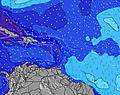 | 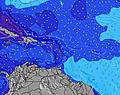 | 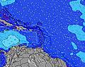 | ||||||||||||
Wave Height (m) Direction Period (s) | N 11 | N 11 | N 10 | N 10 | N 10 | NE 6 | ENE 6 | N 12 | NNE 8 | NE 7 | NE 11 | E 6 | E 5 | NE 7 | NE 7 | NNE 9 | NE 9 | NE 9 | NNE 8 |
Wave Graph | |||||||||||||||||||
2 | 2 | 2 | 2 | 2 | 34 | 0 | 3 | 7 | 33 | 4 | 60 | 71 | 27 | 18 | 16 | 20 | 20 | 26 | |
Wind (km/h) | |||||||||||||||||||
Wind State on-shore cross-onshore cross-shore cross-offshore off-shore glassy | cross-off | cross-off | cross | cross-off | cross | cross-off | cross-off | cross-off | cross-off | cross-off | cross-off | cross-off | cross | cross | cross-off | cross | cross | cross | cross |
High Tide | 6:13AM0.30m | 6:48PM0.35m | 7:23AM0.27m | 7:09PM0.35m | 9:41AM0.23m | 7:38PM0.36m | 8:19PM0.37m | 9:15PM0.37m | 10:32PM0.38m | ||||||||||
Low Tide | 00:52AM0.22m | 12:17PM0.19m | 2:01AM0.18m | 12:15PM0.22m | 3:16AM0.15m | 10:42AM0.23m | 4:33AM0.10m | 5:46AM0.06m | 6:51AM0.03m | ||||||||||
— | 5:47 | — | — | 5:47 | — | — | 5:47 | — | — | 5:47 | — | — | 5:48 | — | — | 5:48 | — | — | |
6:37 | — | 6:37 | — | — | 6:36 | — | — | 6:36 | — | — | 6:35 | — | — | 6:35 | — | — | 6:34 | — | |
mm | — | — | — | — | — | 1 | — | — | — | — | — | — | — | — | — | — | — | — | — |
Temp °C | 28 | 28 | 28 | 27 | 27 | 28 | 27 | 28 | 28 | 27 | 28 | 27 | 26 | 27 | 27 | 27 | 27 | 28 | 27 |
Feels °C | 27 | 27 | 28 | 28 | 28 | 30 | 29 | 29 | 28 | 28 | 28 | 26 | 26 | 25 | 25 | 26 | 26 | 27 | 27 |
Swell 1 Height (m) Direction Period (s) | N 11 | N 11 | N 10 | N 10 | E 7 | NE 6 | ENE 6 | E 11 | E 10 | NE 7 | ENE 9 | NE 7 | NE 7 | NE 7 | NE 7 | NNE 9 | NE 9 | NE 9 | NNE 8 |
2 | 2 | 2 | 2 | 59 | 34 | 37 | 9 | 18 | 33 | 16 | 19 | 19 | 27 | 18 | 16 | 20 | 20 | 26 | |
Swell 2 Height (m) Direction Period (s) | — | — | — | N 10 | N 10 | E 7 | ESE 7 | N 12 | NNE 8 | ENE 9 | SE 9 | ENE 9 | NNE 10 | NNE 10 | NNE 9 | NNE 9 | E 12 | E 12 | NE 12 |
— | — | — | 2 | 2 | 24 | 15 | 3 | 7 | 29 | 3 | 15 | 18 | 9 | 17 | 8 | 3 | 3 | 6 | |
Swell 3 Height (m) Direction Period (s) | — | — | — | — | E 11 | E 12 | E 11 | E 10 | SE 8 | N 11 | NE 11 | NNE 10 | ESE 9 | NNE 10 | ESE 8 | ENE 8 | — | — | E 12 |
— | — | — | — | 2 | 3 | 2 | 2 | 2 | 2 | 4 | 10 | 9 | 18 | 7 | 6 | — | — | 3 | |
Wind waves Height (m) Direction Period (s) | E 7 | E 7 | E 7 | E 7 | — | — | ESE 3 | ENE 7 | E 6 | E 4 | ENE 6 | E 6 | E 5 | E 6 | E 6 | ENE 6 | ENE 6 | E 6 | ENE 6 |
176 | 142 | 117 | 92 | — | — | 2 | 73 | 51 | 17 | 68 | 60 | 71 | 88 | 91 | 129 | 160 | 143 | 119 | |
Nearest Offshore or Glassy | |||||||||||||||||||
Distance (km) | 548 | 398 | 6 | 398 | 492 | 595 | 211 | 211 | 211 | 211 | 211 | 880 | 525 | 399 | 492 | 492 | 880 | 211 | 548 |
Best forecast wave conditions in Guadeloupe - Grande Terre | |||||||||||||||||||
Best forecast wave conditions in Guadeloupe | |||||||||||||||||||
Header Global | |||||||||||||||||||
- Map Icons:
 Break
Break Live Wave Height (m)
 Live Wind Speed (km/h)
 Surf Rating (10 Max)
 Ocean Swells (m)
- Wind Speed (km/h)
Latest Updates


FREE! Surf-Forecast.com widget for your website
The surf report / weather widget below is available to embed on third party websites free of charge and provides a summary of our Anse Bertrand surf forecast. Simply grab the html code snippet that we provide and paste it into your own site. You can choose your preferred language and metric/imperial units for the surf forecast feed to suit users of your site. Click here to get the code.
Information about the Anse Bertrand Surf forecast
The above surf forecast table for Anse Bertrand provides essential information for determining whether the surfing conditions will be good over the next 16 days. A general guide to surfing at Anse Bertrand can be found by selecting the local surf guide option on the grey menu. Our Anse Bertrand surf forecast is unique since it includes wave energy (power) that defines the real feel of the surf rather than just the height or the period. If you surf the same spot (Anse Bertrand) regularly then make a mental note of the wave energy from the surf forecast table each time you go. Very soon you may start to choose your surf days based on the wave energy alone combined with our forecast of favourable offshore wind conditions. Our star ratings will help here and of course you will also find the usual wave height and period predictions on our surf forecasts as well as a full break down of the swell components under our advanced users option (to reveal that, click the little Einstein character under the tide times).
Further information to help with frequently asked questions about our surf forecast for Anse Bertrand may be found under the help tab on the top menu and also by moving your mouse over the question marks on the surf forecast table itself. Please always bear in mind that the forecast is for near-shore open water and local factors at each surf break influence the actual breaking wave height, such as the beach / reef profile, water depths offshore and shelter.
Anse Bertrand is 23 km (14 miles) from Les Abymes. If you plan a holiday in Guadeloupe - Grande Terre, look for hotels and other accommodation in Les Abymes. Les Abymes has rooms for a wide range of budgets as well as car hire and transport links.
 Nearest