

Surf Forecasts:

Acre (Mifalim) or Ako surf forecast from 3 Aug 2026:
- Most powerful swell: Sunday 9 Aug, 3AM (local time) - 2.5ft (0.7m), 7s period, WNW swell with 48 kJ wave energy.
Best Forecast Surf Conditions for Acre (Mifalim) or Ako this week:
The most powerful waves expected at Acre (Mifalim) or Ako in the next 16 days are 0.7m 7s and forecast to arrive on Sunday (Aug 09) at 3AM. Winds are predicted to be onshore at the time the swell arrives.
| Wave Type | Time (IDT) & Date | Wave Height & Period |
|---|---|---|
| Next good surf (1 star+) | - | - |
| Best Surf | - | - |
| Most Powerful | 3AM (Sun 9th Aug) | 2.5ft (0.7m) 7s |
Table - best surf conditions forecast for Acre (Mifalim) or Ako over the next 16 days.
The Lowdown
Alright folks, Rusty here. Let’s take a look at what’s cooking at Acre (Mifalim) or Ako for the next couple of weeks. I gotta be straight with you – this stretch is looking pretty flat and uninspiring.
Right off the bat, we’ve got a long spell of poor surf conditions. From Monday the 3rd of August right through to the 18th, there’s not a single wave worth paddling for. The swell is tiny, barely pushing 2 ft to 3 ft, and it’s coming from the west and northwest. The period is short too, mostly 5 to 7 seconds – that’s weak windswill, not any real grunt. The combined swell energy barely gets into double digits, and most of the time it’s under 50 (weak energy). That’s just not gonna get a surfboard planing.
The wind is the other killer. It’s cross-on or onshore most days, with moderate breezes making the surface choppy. There is one morning – Monday the 10th of August – where it goes glassy with a northerly breeze and calm conditions, but with only 2 ft of weak swell, it’s still a flat, poor surf situation. The water temperature is around 85°F, which is a touch warmer than normal for this time of year – so at least you won’t freeze while you’re staring at the ocean.
To be honest, for a river break that’s exposed to the west swell, this is just a dead run. The setup looks more interesting for kite surfing than paddle surfing if there’s any breeze, but for us wave riders, there’s nothing on the table. The forecast is for consistently small, weak, and choppy conditions, so don’t bother waxing up. This is one of those tough windows where the ocean just ain’t cooperating.
Hang in there. Forecasts can change, but right now, it’s a flat spell that seems to be sticking around.
Rusty
Short Range ForecastMostly dry. Warm (max 30°C on Mon afternoon, min 25°C on Mon night). Wind will be generally light. | Days 5-7 Weather SummaryMostly dry. Warm (max 29°C on Thu afternoon, min 24°C on Thu night). Wind will be generally light. | |||||||||||||||||||
Mon 3 | Tuesday 4 | Wednesday 5 | Thursday 6 | Friday 7 | Saturday 8 | Sunday 9 | ||||||||||||||
PM | Night | AM | PM | Night | AM | PM | Night | AM | PM | Night | AM | PM | Night | AM | PM | Night | AM | PM | Night | |
Swell Height Map | 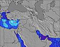 | 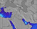 | 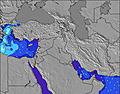 | 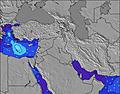 | 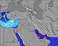 | 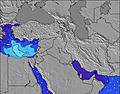 | 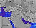 | |||||||||||||
Wave Height (m) Direction Period (s) | NW 5 | WNW 4 | WNW 5 | WNW 5 | WNW 6 | WNW 6 | WNW 7 | WNW 6 | W 6 | W 7 | W 6 | W 6 | W 6 | W 6 | W 7 | W 7 | WNW 7 | WNW 6 | WNW 6 | W 6 |
Wave Graph | ||||||||||||||||||||
11 | 7 | 15 | 22 | 21 | 22 | 35 | 23 | 20 | 33 | 27 | 18 | 26 | 25 | 36 | 45 | 48 | 44 | 30 | 17 | |
Wind (km/h) | ||||||||||||||||||||
Wind State on-shore cross-onshore cross-shore cross-offshore off-shore glassy | cross-on | cross | on | cross-on | cross-on | on | on | glassy | cross-on | on | glassy | cross-on | on | on | cross-on | on | on | cross-on | on | cross-off |
High Tide | 1:57AM0.33m | 2:05PM0.30m | 2:38AM0.32m | 2:53PM0.26m | 3:34AM0.30m | 4:19PM0.22m | 5:08AM0.29m | 7:13PM0.21m | 7:07AM0.30m | 8:50PM0.24m | 8:25AM0.33m | 9:38PM0.28m | ||||||||
Low Tide | 7:41PM0.06m | 8:05AM0.09m | 8:13PM0.08m | 8:59AM0.11m | 8:53PM0.12m | 10:26AM0.13m | 9:57PM0.15m | 12:49PM0.13m | 00:13AM0.17m | 2:27PM0.09m | 2:02AM0.15m | 3:22PM0.05m | 3:04AM0.12m | |||||||
— | — | 5:54 | — | — | 5:54 | — | — | 5:56 | — | — | 5:56 | — | — | 5:56 | — | — | 5:58 | — | — | |
7:37 | — | — | 7:36 | — | — | 7:35 | — | — | 7:34 | — | — | 7:32 | — | — | 7:31 | — | — | 7:30 | — | |
mm | — | — | — | — | — | — | — | — | — | — | — | — | — | — | — | — | — | — | — | — |
Temp °C | 30 | 27 | 29 | 29 | 26 | 29 | 29 | 26 | 29 | 29 | 26 | 28 | 29 | 27 | 29 | 29 | 27 | 29 | 29 | 27 |
Feels °C | 29 | 28 | 30 | 30 | 28 | 31 | 30 | 29 | 30 | 30 | 29 | 28 | 30 | 31 | 30 | 30 | 31 | 30 | 30 | 30 |
Swell 1 Height (m) Direction Period (s) | — | WNW 4 | WNW 5 | WNW 5 | WNW 6 | WNW 6 | WNW 7 | WNW 6 | W 6 | W 7 | W 6 | W 6 | W 6 | W 6 | W 7 | W 7 | WNW 7 | WNW 6 | WNW 6 | W 6 |
— | 7 | 15 | 22 | 21 | 22 | 35 | 23 | 20 | 33 | 27 | 18 | 26 | 25 | 36 | 45 | 48 | 44 | 30 | 17 | |
Swell 2 Height (m) Direction Period (s) | — | — | — | — | — | — | — | — | — | — | — | — | — | — | — | — | — | — | — | — |
— | — | — | — | — | — | — | — | — | — | — | — | — | — | — | — | — | — | — | — | |
Swell 3 Height (m) Direction Period (s) | — | — | — | — | — | — | — | — | — | — | — | — | — | — | — | — | — | — | — | — |
— | — | — | — | — | — | — | — | — | — | — | — | — | — | — | — | — | — | — | — | |
Wind waves Height (m) Direction Period (s) | NW 5 | — | — | — | — | — | — | — | — | — | — | — | — | — | — | — | — | — | — | — |
11 | — | — | — | — | — | — | — | — | — | — | — | — | — | — | — | — | — | — | — | |
Nearest Offshore or Glassy | ||||||||||||||||||||
Distance (km) | 3761 | 3305 | 2219 | 3462 | 2219 | 3373 | 2219 | 323 | 2219 | 2219 | 2219 | 2219 | 2219 | 2113 | 2113 | 2504 | 128 | 17 | 3578 | 511 |
Best forecast wave conditions in North of Tel Aviv | ||||||||||||||||||||
Best forecast wave conditions in Israel | ||||||||||||||||||||
Header Global | ||||||||||||||||||||
- Map Icons:
 Break
Break Live Wave Height (m)
 Live Wind Speed (km/h)
 Surf Rating (10 Max)
 Ocean Swells (m)
- Wind Speed (km/h)
Latest Updates


FREE! Surf-Forecast.com widget for your website
The surf report / weather widget below is available to embed on third party websites free of charge and provides a summary of our Acre (Mifalim) or Ako surf forecast. Simply grab the html code snippet that we provide and paste it into your own site. You can choose your preferred language and metric/imperial units for the surf forecast feed to suit users of your site. Click here to get the code.
Information about the Acre (Mifalim) or Ako Surf forecast
The above surf forecast table for Acre (Mifalim) or Ako provides essential information for determining whether the surfing conditions will be good over the next 16 days. A general guide to surfing at Acre (Mifalim) or Ako can be found by selecting the local surf guide option on the grey menu. Our Acre (Mifalim) or Ako surf forecast is unique since it includes wave energy (power) that defines the real feel of the surf rather than just the height or the period. If you surf the same spot (Acre (Mifalim) or Ako) regularly then make a mental note of the wave energy from the surf forecast table each time you go. Very soon you may start to choose your surf days based on the wave energy alone combined with our forecast of favourable offshore wind conditions. Our star ratings will help here and of course you will also find the usual wave height and period predictions on our surf forecasts as well as a full break down of the swell components under our advanced users option (to reveal that, click the little Einstein character under the tide times).
Further information to help with frequently asked questions about our surf forecast for Acre (Mifalim) or Ako may be found under the help tab on the top menu and also by moving your mouse over the question marks on the surf forecast table itself. Please always bear in mind that the forecast is for near-shore open water and local factors at each surf break influence the actual breaking wave height, such as the beach / reef profile, water depths offshore and shelter.
Are you planning a holiday in North of Tel Aviv? If you are looking for accommodation near Acre (Mifalim) or Ako, camping, hotels and holiday cottages in North of Tel Aviv, consider staying in `Akko which is 2 km (1 miles) away. Other places in and around North of Tel Aviv where you can find information about places to rent, and car hire include Qiryat Yam which is 6 km (4 miles) away, Judeida, Qiryat Motzkin and Qiryat Bialik.
 Nearest